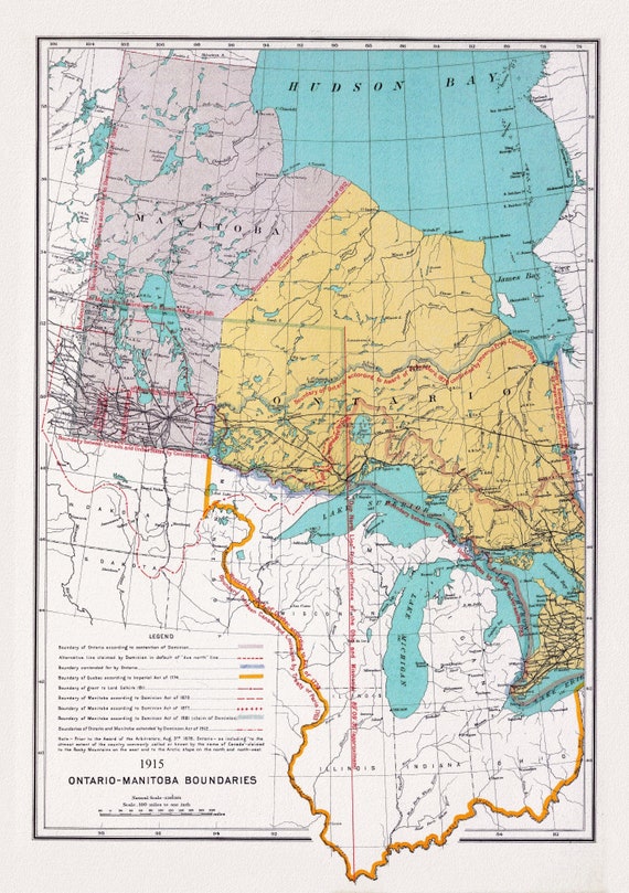
 Canada. Department of Interior, Ontario, Manitoba Boundary, 1915, map on heavy cotton canvas, 22x27" approx.
$45.20
Canada. Department of Interior, Ontario, Manitoba Boundary, 1915, map on heavy cotton canvas, 22x27" approx.
$45.20
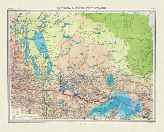 Bartholomew, Manitoba & North-West Ontario, 1922, map on heavy cotton canvas, 22x27" approx.
$45.20
Bartholomew, Manitoba & North-West Ontario, 1922, map on heavy cotton canvas, 22x27" approx.
$45.20
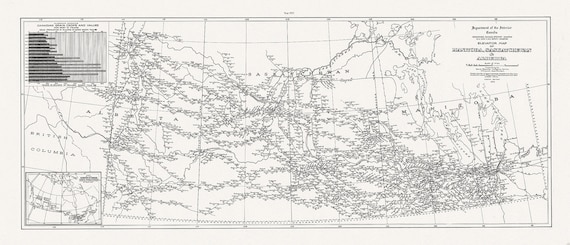 An Elevator map of Manitoba, Saskatchewan & Alberta, 1923,on heavy cotton canvas, 15x36" approx.
$48.97
An Elevator map of Manitoba, Saskatchewan & Alberta, 1923,on heavy cotton canvas, 15x36" approx.
$48.97
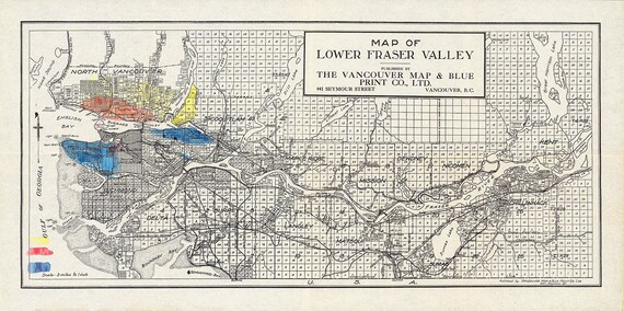 Lower Fraser Valley, Topping auth., 1910, map on heavy cotton canvas, 50 x 70cm, 20 x 25" approx.
$45.20
Lower Fraser Valley, Topping auth., 1910, map on heavy cotton canvas, 50 x 70cm, 20 x 25" approx.
$45.20
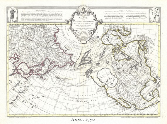 The Northern Hemisphere, 1750, Buache, , map on heavy cotton canvas, 50 x 70cm, 20 x 25" approx.
$45.20
The Northern Hemisphere, 1750, Buache, , map on heavy cotton canvas, 50 x 70cm, 20 x 25" approx.
$45.20
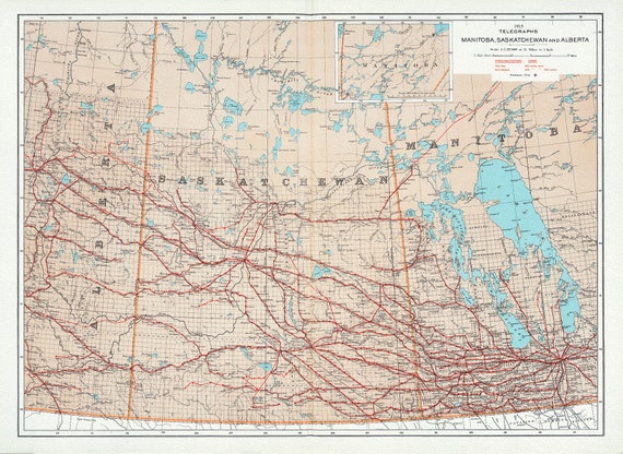 Canada Department of the Interior, Telegraphs, Manitoba, Saskatchewan and Alberta, 1915, map on heavy cotton canvas, 22x27" approx.
$45.20
Canada Department of the Interior, Telegraphs, Manitoba, Saskatchewan and Alberta, 1915, map on heavy cotton canvas, 22x27" approx.
$45.20
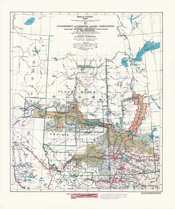 Northern Alberta land districts comprising agencies of Peace River, Grande Prairie, Edmonton showing homestead entry, 1919, canvas, 22x27"
$45.20
Northern Alberta land districts comprising agencies of Peace River, Grande Prairie, Edmonton showing homestead entry, 1919, canvas, 22x27"
$45.20
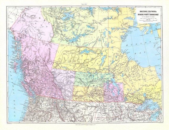
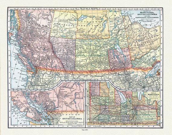 Appleton, Map of Manitoba, British Columbia and the Northwest Territories, 1891 , map on heavy cotton canvas, 22x27" approx.
$45.20
Appleton, Map of Manitoba, British Columbia and the Northwest Territories, 1891 , map on heavy cotton canvas, 22x27" approx.
$45.20
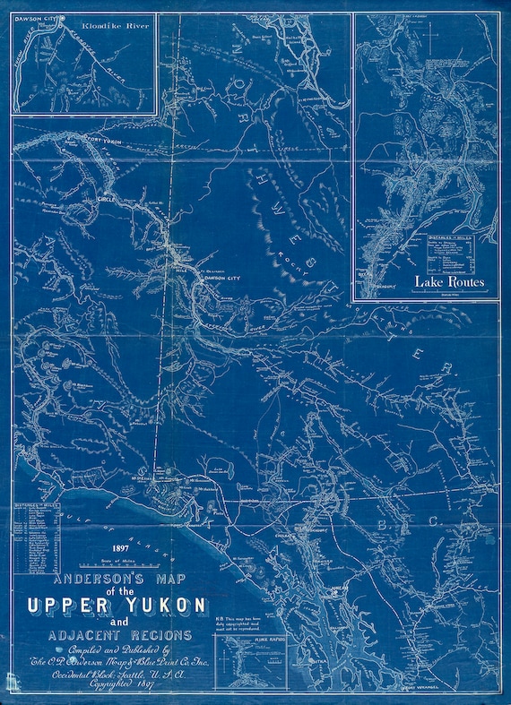 Anderson's map of the Upper Yukon and adjacent regions, 1897, Cyanotype map on durable cotton canvas, 50 x 70 cm, 20 x 25" approx.
$45.20
Anderson's map of the Upper Yukon and adjacent regions, 1897, Cyanotype map on durable cotton canvas, 50 x 70 cm, 20 x 25" approx.
$45.20
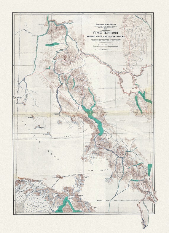 Yukon Territory, 1905, map on durable cotton canvas, 50 x 70 cm, 20 x 25" approx.
$45.20
Yukon Territory, 1905, map on durable cotton canvas, 50 x 70 cm, 20 x 25" approx.
$45.20
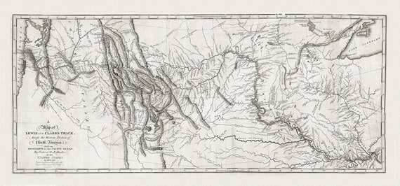 Lewis and Clark's track, across the western portion of North America in 1804, 5 & 6, , map on heavy cotton canvas, 22x27" approx.
$45.20
Lewis and Clark's track, across the western portion of North America in 1804, 5 & 6, , map on heavy cotton canvas, 22x27" approx.
$45.20
 Stanford, British Columbia, North West Territory, 1901 , map on heavy cotton canvas, 22x27" approx.
$45.20
Stanford, British Columbia, North West Territory, 1901 , map on heavy cotton canvas, 22x27" approx.
$45.20
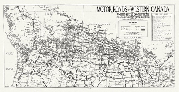 Motor roads in Western Canada and United States connections leading to Calgary & Canadian Rockies, 1929
$45.20
Motor roads in Western Canada and United States connections leading to Calgary & Canadian Rockies, 1929
$45.20
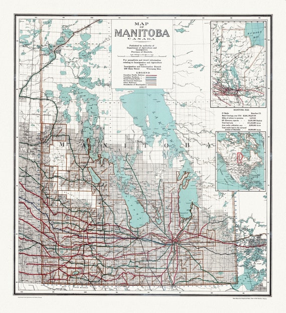 Map of Manitoba Canada, 1917, map on heavy cotton canvas, 22x27" approx.
$45.20
Map of Manitoba Canada, 1917, map on heavy cotton canvas, 22x27" approx.
$45.20
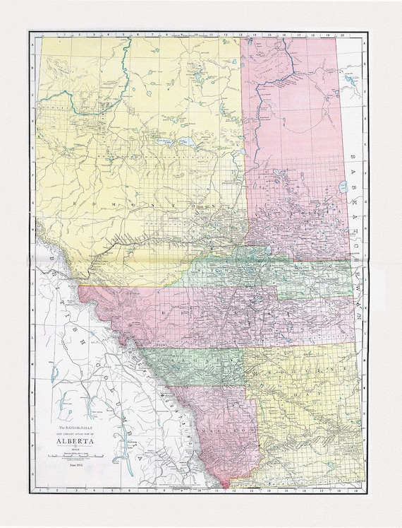 Alberta, Rand McNally and Company, 1912, map on heavy cotton canvas, 20x27" approx.
$45.20
Alberta, Rand McNally and Company, 1912, map on heavy cotton canvas, 20x27" approx.
$45.20
 Geological Map of Northern Alberta, Assiniboia and Saskatchewan, Northwest Territory, Tyrrell , 1887, map on cotton canvas, 20x27" approx.
$45.20
Geological Map of Northern Alberta, Assiniboia and Saskatchewan, Northwest Territory, Tyrrell , 1887, map on cotton canvas, 20x27" approx.
$45.20
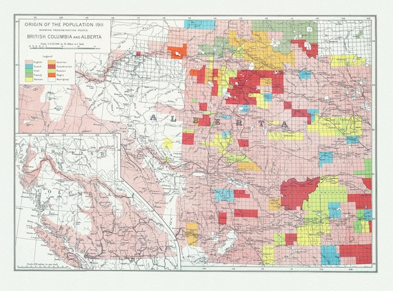 British Columbia and Alberta, Canada Department of the Interior et Chalifour-Origin of the population,1915 , map on cotton canvas, 20x27"
$45.20
British Columbia and Alberta, Canada Department of the Interior et Chalifour-Origin of the population,1915 , map on cotton canvas, 20x27"
$45.20
 Edmonton, auth. Chalifour, 1915, map on heavy cotton canvas, 20x27" approx.
$45.20
Edmonton, auth. Chalifour, 1915, map on heavy cotton canvas, 20x27" approx.
$45.20
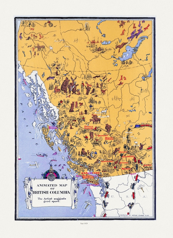 An Animated Map of British Columbia, 1929, on heavy cotton canvas, 22x27"approx.
$45.20
An Animated Map of British Columbia, 1929, on heavy cotton canvas, 22x27"approx.
$45.20
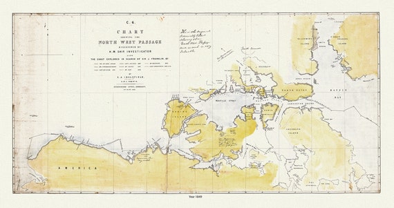 Chart Shewing the North West Passage discovered by H.M. Ship Investigator also the search of Franklin by Sir Jas. Ross, 1848 & 49
$45.20
Chart Shewing the North West Passage discovered by H.M. Ship Investigator also the search of Franklin by Sir Jas. Ross, 1848 & 49
$45.20