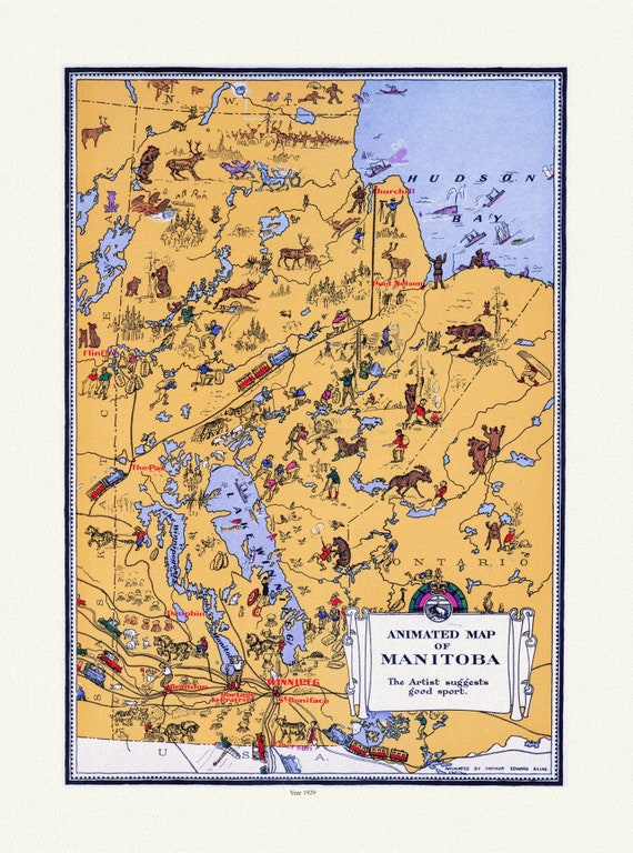
 An Animated Map of Manitoba, 1929, on heavy cotton canvas, 22x27" approx.
$45.20
An Animated Map of Manitoba, 1929, on heavy cotton canvas, 22x27" approx.
$45.20
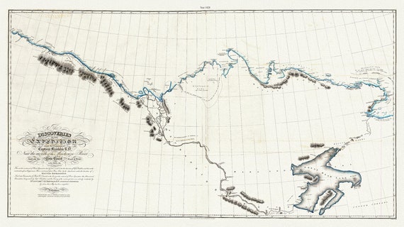 Discoveries of the expedition under the command of Captain Franklin R.N. near the mouth of the Mackenzie River, 1828 map, 20 x 36" approx.
$45.20
Discoveries of the expedition under the command of Captain Franklin R.N. near the mouth of the Mackenzie River, 1828 map, 20 x 36" approx.
$45.20
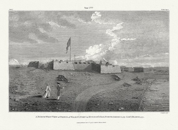 A north west view of Prince of Wales's Fort in Hudson's Bay, North America, Saml. Hearne auth., 1777, .50 x 70 cm, 20 x 25" approx.
$45.20
A north west view of Prince of Wales's Fort in Hudson's Bay, North America, Saml. Hearne auth., 1777, .50 x 70 cm, 20 x 25" approx.
$45.20
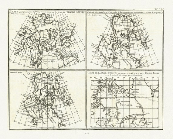
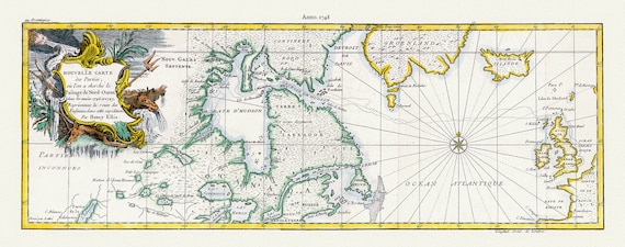 Nouvelle carte des parties, oul'on a cherche le passage de nord-ouest dans les anneees 1746 et 1747, Ellis auth 20x50" approx.
$64.03
Nouvelle carte des parties, oul'on a cherche le passage de nord-ouest dans les anneees 1746 et 1747, Ellis auth 20x50" approx.
$64.03
 Outline to shew the Connected Discoveries of Captains Ross, Parry & Franklin, in the years 1818, 19, 20 and 21.20x35, 20 x 25" approx.
$45.20
Outline to shew the Connected Discoveries of Captains Ross, Parry & Franklin, in the years 1818, 19, 20 and 21.20x35, 20 x 25" approx.
$45.20
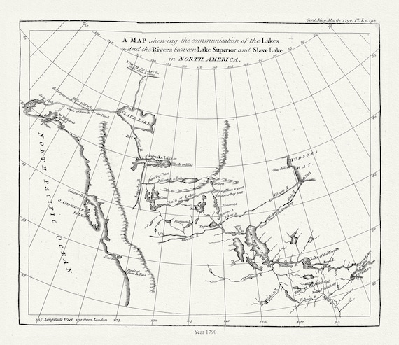 The communication of the lakes and the rivers between Lake Superior and Slave Lake in North America,1790, Pond auth.20x25" approx
$45.20
The communication of the lakes and the rivers between Lake Superior and Slave Lake in North America,1790, Pond auth.20x25" approx
$45.20
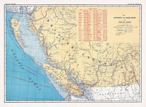 Canada Department of the Interior, Lighthouses and sailing routes on Pacific Coast, 1915, map on heavy cotton canvas, 22x27" approx.
$45.20
Canada Department of the Interior, Lighthouses and sailing routes on Pacific Coast, 1915, map on heavy cotton canvas, 22x27" approx.
$45.20
 Canada Department of the Interior, West sheet. Geological Map of the Dominion of Canada, 1915, map on heavy cotton canvas, 22x27" approx.
$45.20
Canada Department of the Interior, West sheet. Geological Map of the Dominion of Canada, 1915, map on heavy cotton canvas, 22x27" approx.
$45.20
 Rand, McNally & Co., North West Territories, 1891, map on heavy cotton canvas, 22x27" approx.
$45.20
Rand, McNally & Co., North West Territories, 1891, map on heavy cotton canvas, 22x27" approx.
$45.20
 A map of part of the continent of North America, to the Pacific and between latitude 35 and 52 North, 1830, map on canvas, 22x27"
$45.20
A map of part of the continent of North America, to the Pacific and between latitude 35 and 52 North, 1830, map on canvas, 22x27"
$45.20
 Map of the North West Territory illustrating the British and United States boundary line, , 1872-3-4, map on cotton canvas, 22x27" approx.
$45.20
Map of the North West Territory illustrating the British and United States boundary line, , 1872-3-4, map on cotton canvas, 22x27" approx.
$45.20
 Meriwether Lewis, A Map showing the Mississippi, the Missouri above Kansas, Lakes Michigan, Superior, and Winnipeg, 1803, canvas, 22x27"
$45.20
Meriwether Lewis, A Map showing the Mississippi, the Missouri above Kansas, Lakes Michigan, Superior, and Winnipeg, 1803, canvas, 22x27"
$45.20
 Septemtrionaliora Americae a Groenlandia, per Freta Davidis et Hudson, de Straet Davis end Straet Hudson tot Terra Neuf, 1765, 22x27" canvas
$45.20
Septemtrionaliora Americae a Groenlandia, per Freta Davidis et Hudson, de Straet Davis end Straet Hudson tot Terra Neuf, 1765, 22x27" canvas
$45.20
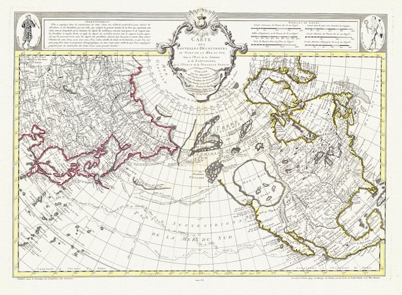
 Vaugondy et Diderot, Mapping of the Northwest Passage, 1772, map on heavy cotton canvas, 22x27" approx.
$45.20
Vaugondy et Diderot, Mapping of the Northwest Passage, 1772, map on heavy cotton canvas, 22x27" approx.
$45.20
 Chart containing part of the Icy Sea, Greenland, Islands about Baffins Bay and Hudsons Bay, 1776 , map on heavy cotton canvas, 22x27" approx
$45.20
Chart containing part of the Icy Sea, Greenland, Islands about Baffins Bay and Hudsons Bay, 1776 , map on heavy cotton canvas, 22x27" approx
$45.20
 Buache et Delisle, Carte Des Nouvelles Decouvertes Au Nord de la Mer de Sud, 1752, map on heavy cotton canvas, 22x27" approx.
$45.20
Buache et Delisle, Carte Des Nouvelles Decouvertes Au Nord de la Mer de Sud, 1752, map on heavy cotton canvas, 22x27" approx.
$45.20
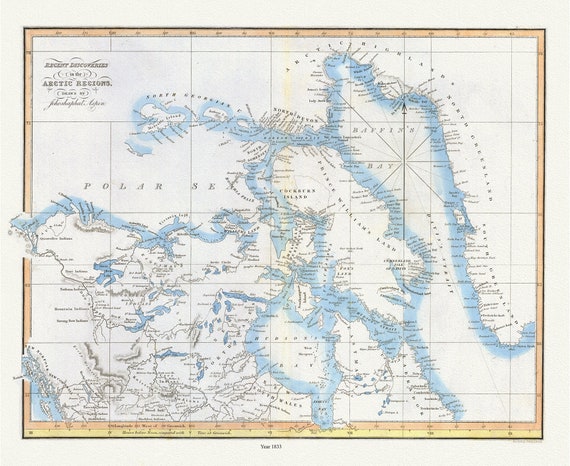 Recent discoveries in the Arctic Regions, 1833, Aspen auth. , map on durable cotton canvas, 50 x 70 cm, 20 x 25" approx.
$45.20
Recent discoveries in the Arctic Regions, 1833, Aspen auth. , map on durable cotton canvas, 50 x 70 cm, 20 x 25" approx.
$45.20
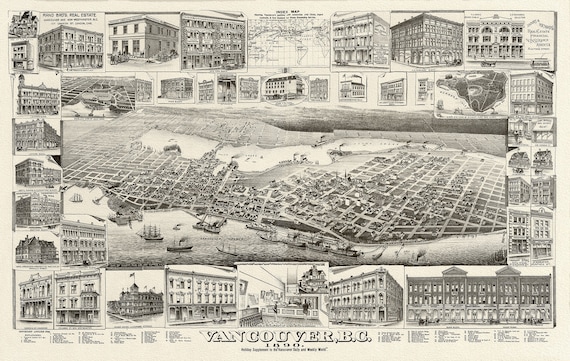 Birdseye View of Vancouver, British Columbia, 1890, on heavy canvas, 22x27"
$45.20
Birdseye View of Vancouver, British Columbia, 1890, on heavy canvas, 22x27"
$45.20
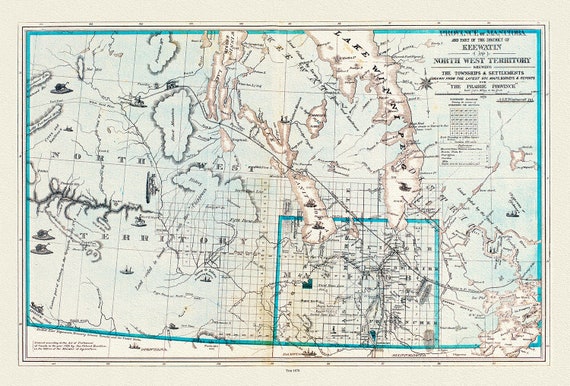 Province of Manitoba District of Keewatin, 1878, , map on heavy cotton canvas, 22x27" approx.
$45.20
Province of Manitoba District of Keewatin, 1878, , map on heavy cotton canvas, 22x27" approx.
$45.20
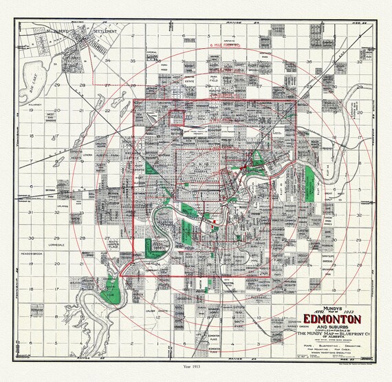 Edmonton and suburbs, 1913, Mundy auth. , map on durable cotton canvas, 50 x 70 cm or 20x25" approx.
$45.20
Edmonton and suburbs, 1913, Mundy auth. , map on durable cotton canvas, 50 x 70 cm or 20x25" approx.
$45.20