 Discoveries in the Arctic Sea up to MDCCCLIV (1854), map on durable cotton canvas, 50 x 70 cm, 20 x 25" approx.
$45.20
Discoveries in the Arctic Sea up to MDCCCLIV (1854), map on durable cotton canvas, 50 x 70 cm, 20 x 25" approx.
$45.20
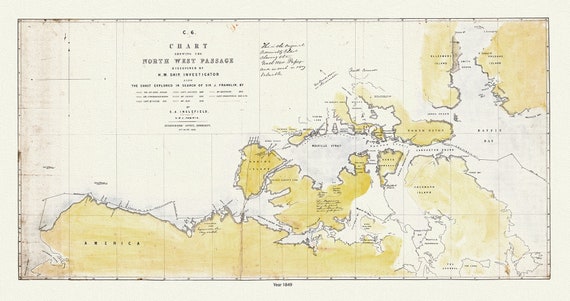 A Chart Shewing the North West Passage discovered by H.M. Ship Investigator also the coast explored in search of Sir J. Franklin , 20x25"
$45.20
A Chart Shewing the North West Passage discovered by H.M. Ship Investigator also the coast explored in search of Sir J. Franklin , 20x25"
$45.20
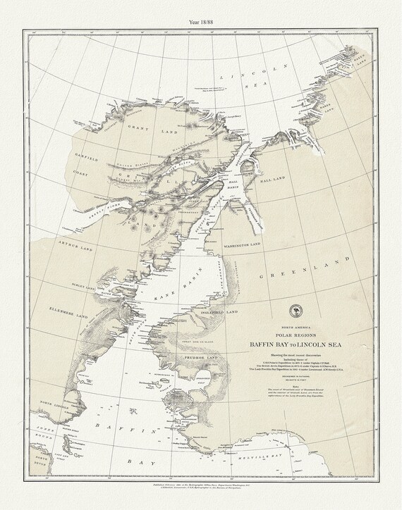 North America polar regions Baffin Bay to E Lincoln Sea, showing the most recent discoveries, 20x25"
$45.20
North America polar regions Baffin Bay to E Lincoln Sea, showing the most recent discoveries, 20x25"
$45.20
 Septemtrionaliora Americae a Groenlandia, per Freta Davidis et Hudson, ad Terram Novam, 1765, cotton canvas, 50 x 70 cm, 20 x 25" approx.
$45.20
Septemtrionaliora Americae a Groenlandia, per Freta Davidis et Hudson, ad Terram Novam, 1765, cotton canvas, 50 x 70 cm, 20 x 25" approx.
$45.20
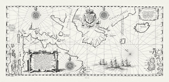
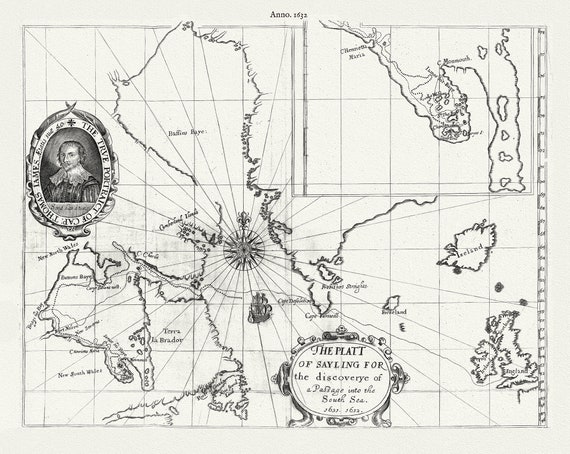 The Platt of sayling for the discoverye of a Passage into the South Sea, 1631 & 1632
$45.20
The Platt of sayling for the discoverye of a Passage into the South Sea, 1631 & 1632
$45.20
 Tabula nautica, qua repraesentantur orae maritimae meatus, ac freta, noviter a IHudsono Anglo,1624, Gerardi auth., 21x36"
$45.20
Tabula nautica, qua repraesentantur orae maritimae meatus, ac freta, noviter a IHudsono Anglo,1624, Gerardi auth., 21x36"
$45.20
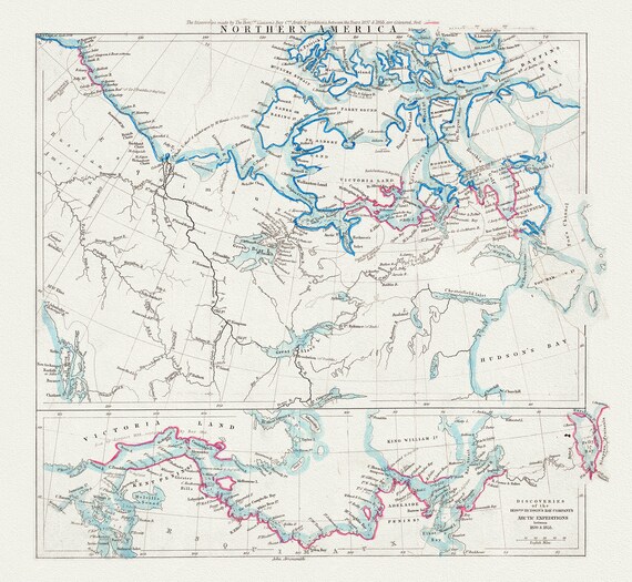
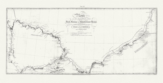 Route of the Expedition from York Factory to Cumberland House. and the Summer & Winter tracks from thence to Isle a La Crosse,1819-20,.21x36
$45.20
Route of the Expedition from York Factory to Cumberland House. and the Summer & Winter tracks from thence to Isle a La Crosse,1819-20,.21x36
$45.20
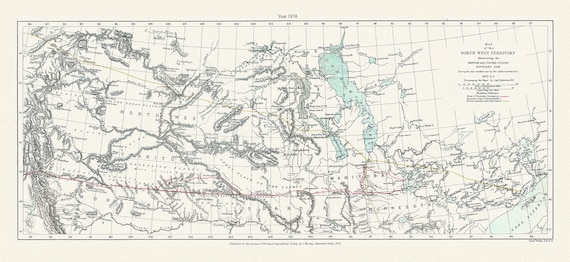 North West Territory illustrating the British and US boundary line. Surveyed by the Joint Commission, 1872-3-4.1876, map 21x36"
$45.20
North West Territory illustrating the British and US boundary line. Surveyed by the Joint Commission, 1872-3-4.1876, map 21x36"
$45.20
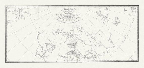 General Chart shewing the track of H. M. Ships Fury and Hecla, on a Voyage for the Discovery of a North West Passage, 1821 -22 -23. 21 x 36"
$101.70
General Chart shewing the track of H. M. Ships Fury and Hecla, on a Voyage for the Discovery of a North West Passage, 1821 -22 -23. 21 x 36"
$101.70
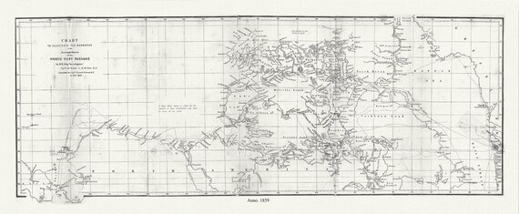 Chart to Illustrate the Narrative of the Accomplishment of the North West Passage by H.M. Ship 'Investigator', 1859, 20 x 34" approx.
$101.70
Chart to Illustrate the Narrative of the Accomplishment of the North West Passage by H.M. Ship 'Investigator', 1859, 20 x 34" approx.
$101.70
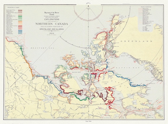 Explorations in Northern Canada and adjacent portions of Greenland and Alaska, 1904 Ver. II , cotton canvas, 50 x 70 cm, 20 x 25" approx.
$45.20
Explorations in Northern Canada and adjacent portions of Greenland and Alaska, 1904 Ver. II , cotton canvas, 50 x 70 cm, 20 x 25" approx.
$45.20
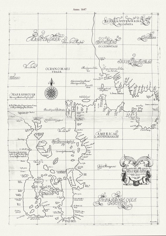 Carta particolare dello istreto e mare iscoperto de Hen. Hudson Ingilese nel 1611 , 1647, Dudley auth., canvas, 50 x 70 cm, 20 x 25" approx.
$45.20
Carta particolare dello istreto e mare iscoperto de Hen. Hudson Ingilese nel 1611 , 1647, Dudley auth., canvas, 50 x 70 cm, 20 x 25" approx.
$45.20
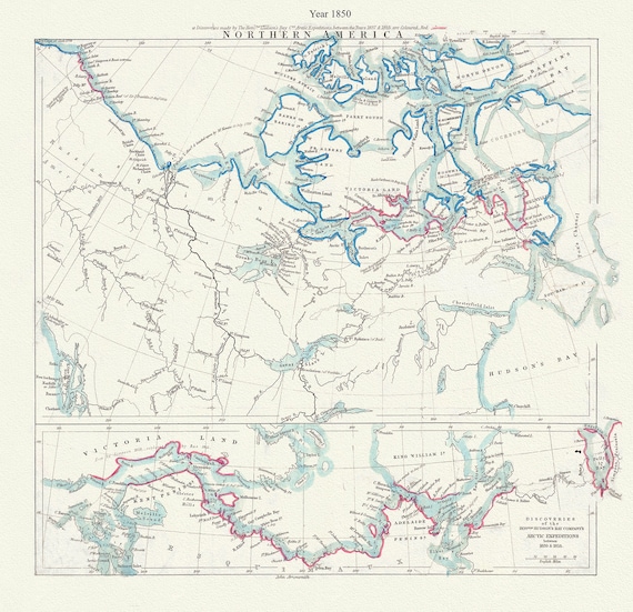 Arctic Expeditions in Northern America, 1850, Arrowsmith auth.
$45.20
Arctic Expeditions in Northern America, 1850, Arrowsmith auth.
$45.20
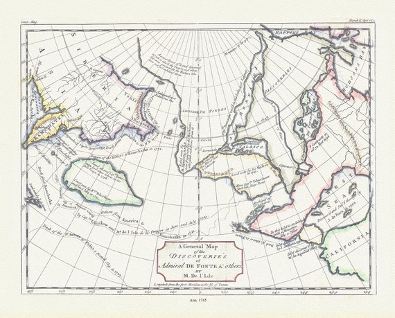 General map of the discoveries of Admiral de Fonte & others, Delisle auth., 1745 , on durable cotton canvas, 50 x 70 cm, 20 x 25" approx.
$45.20
General map of the discoveries of Admiral de Fonte & others, Delisle auth., 1745 , on durable cotton canvas, 50 x 70 cm, 20 x 25" approx.
$45.20
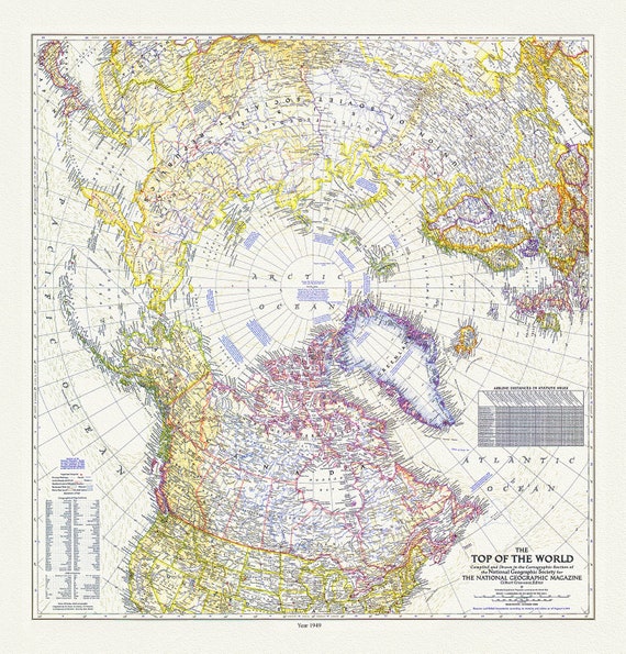 The Top of the World, National Geographic Society, 1949 , map on heavy cotton canvas, 50 x 70 cm, 20 x 25" approx.
$45.20
The Top of the World, National Geographic Society, 1949 , map on heavy cotton canvas, 50 x 70 cm, 20 x 25" approx.
$45.20
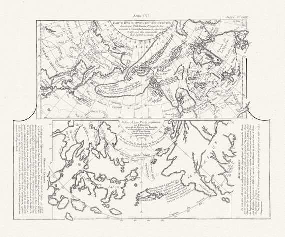 Map of new discoveries in the Arctic,1777, Vaugondy auth. map on durable cotton canvas, 50 x 70 cm, 20 x 25" approx.
$45.20
Map of new discoveries in the Arctic,1777, Vaugondy auth. map on durable cotton canvas, 50 x 70 cm, 20 x 25" approx.
$45.20
 Northern America, Arrowsmith auth., 1855, map on durable cotton canvas, 50 x 70 cm, 20 x 25" approx.
$45.20
Northern America, Arrowsmith auth., 1855, map on durable cotton canvas, 50 x 70 cm, 20 x 25" approx.
$45.20
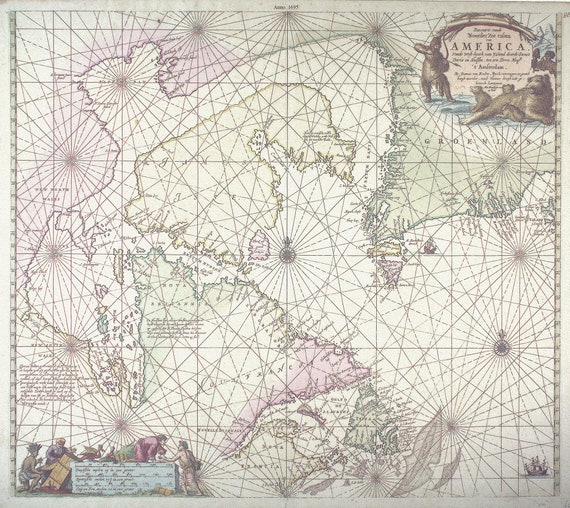 Keulen, Johannes van, 1654-1715. Pas-Kaart, vande zee-kusten van Terra Nova, 1695, , 50 x 70 cm or 20x25" approx.
$45.20
Keulen, Johannes van, 1654-1715. Pas-Kaart, vande zee-kusten van Terra Nova, 1695, , 50 x 70 cm or 20x25" approx.
$45.20
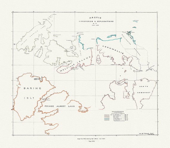 Arctic discoveries and explorations up to July 1853, (1910)
$45.20
Arctic discoveries and explorations up to July 1853, (1910)
$45.20
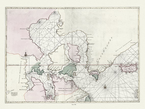 Carte particulière de l'Amerique septentrionale ou sont compris le destroit de Davids, le destroit de Hudson, Mortier auth.,1700, 20x25"
$45.20
Carte particulière de l'Amerique septentrionale ou sont compris le destroit de Davids, le destroit de Hudson, Mortier auth.,1700, 20x25"
$45.20