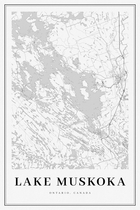
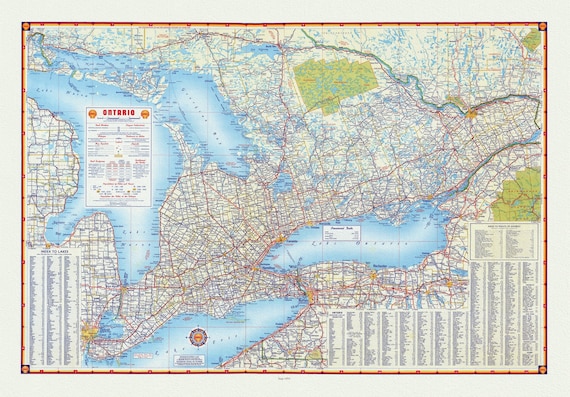
 Ontario, Lake Muskoka, A Modern Map
$41.36
Ontario, Lake Muskoka, A Modern Map
$41.36
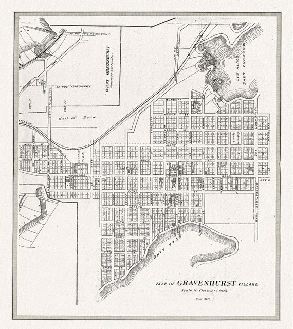 Gravenhurst Village, Muskoka, 1893 , map on durable cotton canvas, 50 x 70 cm or 20x25" approx.
$41.36
Gravenhurst Village, Muskoka, 1893 , map on durable cotton canvas, 50 x 70 cm or 20x25" approx.
$41.36
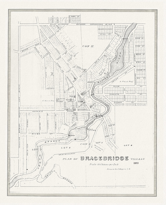 Bracebridge, Muskoka Region, 1893, map on durable cotton canvas, 50 x 70 cm or 20x25" approx.
$41.36
Bracebridge, Muskoka Region, 1893, map on durable cotton canvas, 50 x 70 cm or 20x25" approx.
$41.36
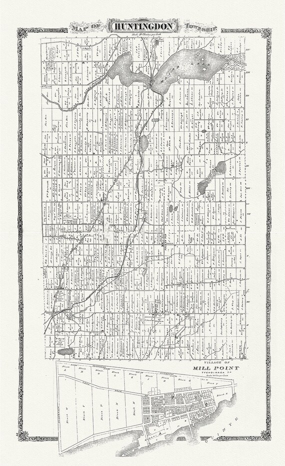 Huntington Township, Hastings County, Ontario, 1880, map on heavy cotton canvas, 45 x 65 cm, 18 x 24" approx.
$41.36
Huntington Township, Hastings County, Ontario, 1880, map on heavy cotton canvas, 45 x 65 cm, 18 x 24" approx.
$41.36
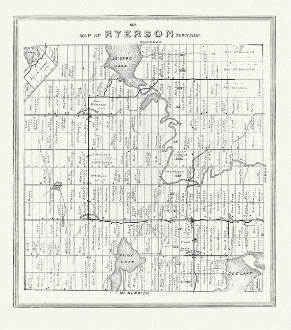 Muskoka-Haliburton, Ryerson Township, 1893, map on heavy cotton canvas, 20 x 25" approx.
$41.36
Muskoka-Haliburton, Ryerson Township, 1893, map on heavy cotton canvas, 20 x 25" approx.
$41.36
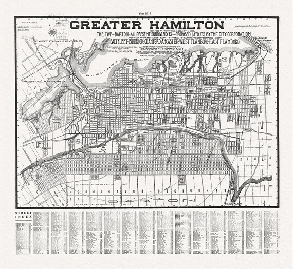 Hamilton, Ontario, 1913, map on heavy cotton canvas, 50 x 70 cm, 20 x 25" approx.
$41.36
Hamilton, Ontario, 1913, map on heavy cotton canvas, 50 x 70 cm, 20 x 25" approx.
$41.36
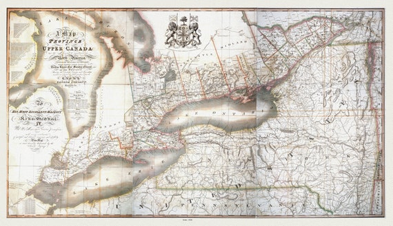 Map of the province of Upper Canada and the adjacent territories in North America, 1826 , map on heavy cotton canvas, 22x27" approx.
$41.36
Map of the province of Upper Canada and the adjacent territories in North America, 1826 , map on heavy cotton canvas, 22x27" approx.
$41.36
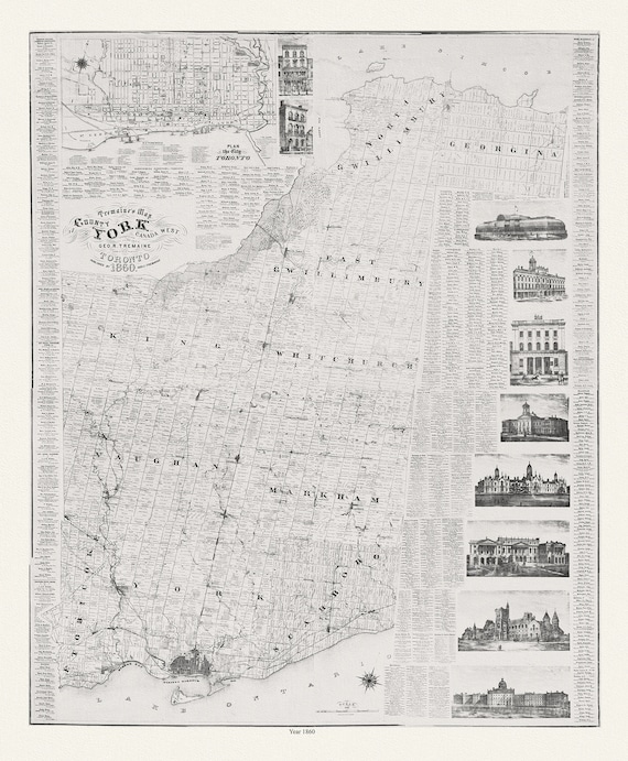 York County: Tremaine's Map of the County of York, Canada West, 1860, map on heavy cotton canvas, 22x27" approx.
$41.36
York County: Tremaine's Map of the County of York, Canada West, 1860, map on heavy cotton canvas, 22x27" approx.
$41.36
 Shell Oil Company of Canada, Road Map of Ontario, 1955, map on heavy cotton canvas, 22x27" approx.
$41.36
Shell Oil Company of Canada, Road Map of Ontario, 1955, map on heavy cotton canvas, 22x27" approx.
$41.36
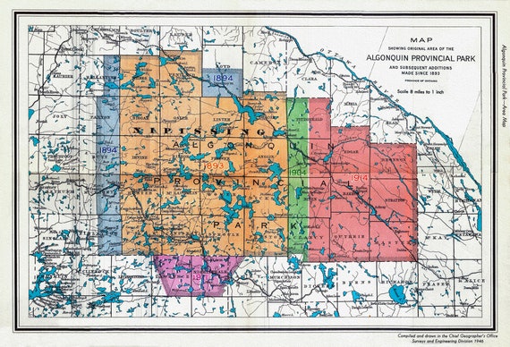 1946 Map of Algonquin Park, Showing Subsequent Additions since 1893, map on heavy cotton canvas, 22x27" approx.
$41.36
1946 Map of Algonquin Park, Showing Subsequent Additions since 1893, map on heavy cotton canvas, 22x27" approx.
$41.36
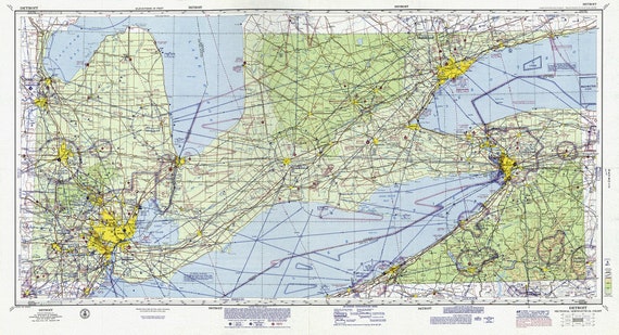 Aeronautical Chart, Ontario, South Western Section, 1970, map on heavy cotton canvas, 20 x 27" approx.
$41.36
Aeronautical Chart, Ontario, South Western Section, 1970, map on heavy cotton canvas, 20 x 27" approx.
$41.36
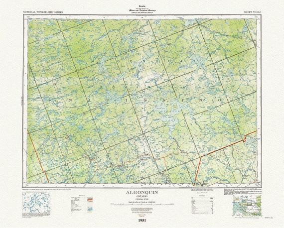 Historic Algonquin Park Map, National Topographic Series, Algonquin, 1951 , map on heavy cotton canvas, 45 x 65 cm, 18 x 24" approx.
$41.36
Historic Algonquin Park Map, National Topographic Series, Algonquin, 1951 , map on heavy cotton canvas, 45 x 65 cm, 18 x 24" approx.
$41.36
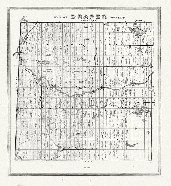 Muskoka-Haliburton, Draper Township, 1893, map on heavy cotton canvas, 20 x 25" approx.
$41.36
Muskoka-Haliburton, Draper Township, 1893, map on heavy cotton canvas, 20 x 25" approx.
$41.36
 Historic Algonquin Park Map, Lands and Forrests, 1921, map on heavy cotton canvas, 20 x 25" approx.
$41.36
Historic Algonquin Park Map, Lands and Forrests, 1921, map on heavy cotton canvas, 20 x 25" approx.
$41.36
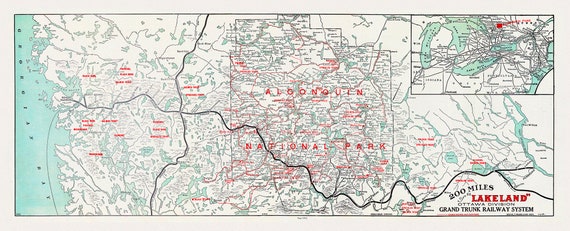 Historic Algonquin Park Map, Grand Trunk Railway, 1912, map on heavy cotton canvas, 22x27" approx.
$41.36
Historic Algonquin Park Map, Grand Trunk Railway, 1912, map on heavy cotton canvas, 22x27" approx.
$41.36
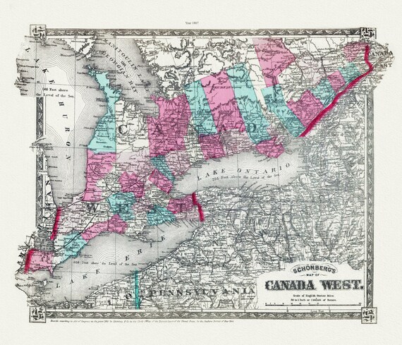 Schonberg's Map of Canada West, 1867 , map on heavy cotton canvas, 22x27" approx.
$41.36
Schonberg's Map of Canada West, 1867 , map on heavy cotton canvas, 22x27" approx.
$41.36
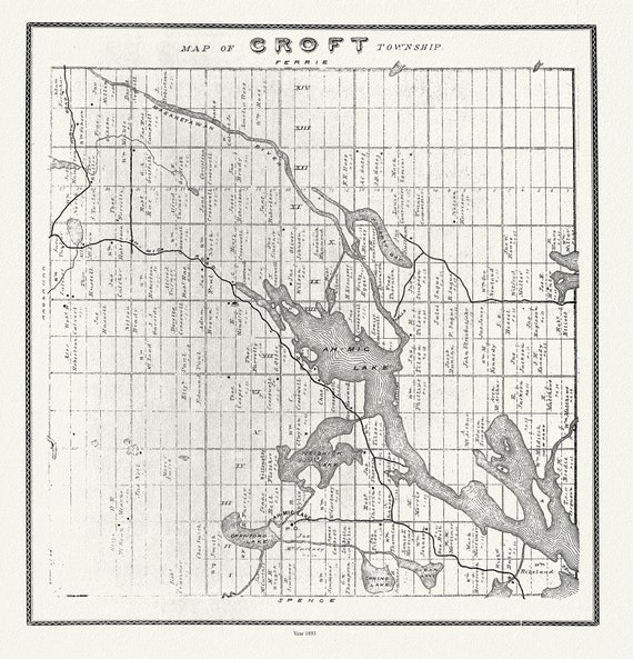 Muskoka-Haliburton, Croft Township, 1893 , map on heavy cotton canvas, 20 x 25" approx.
$41.36
Muskoka-Haliburton, Croft Township, 1893 , map on heavy cotton canvas, 20 x 25" approx.
$41.36
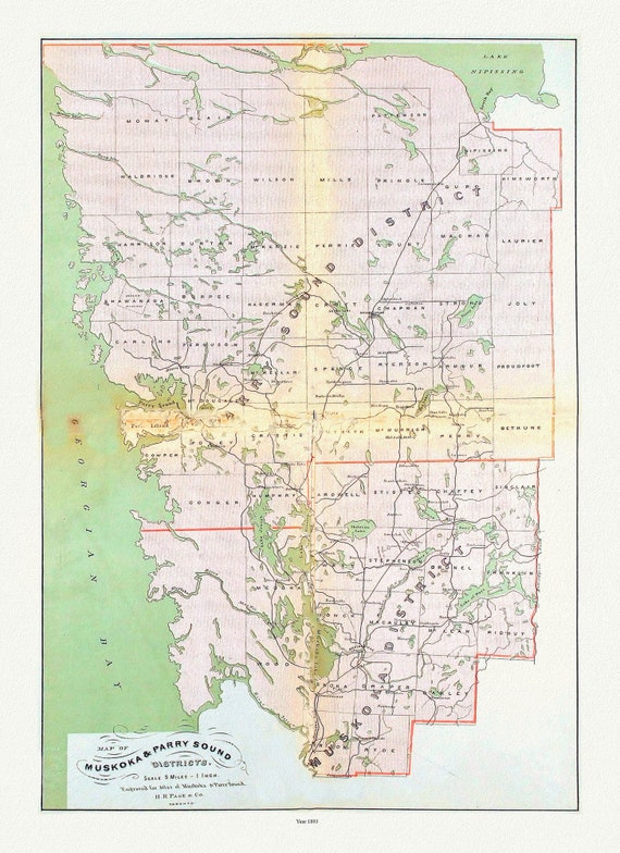 Muskoka & Parry Sound District, 1893 , map on heavy cotton canvas, 20 x 25" approx.
$41.36
Muskoka & Parry Sound District, 1893 , map on heavy cotton canvas, 20 x 25" approx.
$41.36
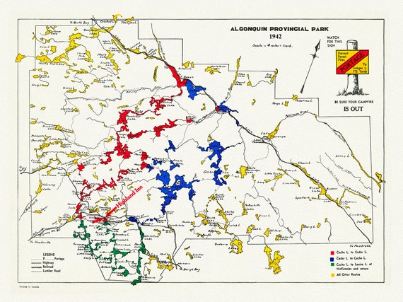 Historic Algonquin Park Map , Highland Inn, 1942, map on heavy cotton canvas, 20 x 25" approx.
$41.36
Historic Algonquin Park Map , Highland Inn, 1942, map on heavy cotton canvas, 20 x 25" approx.
$41.36
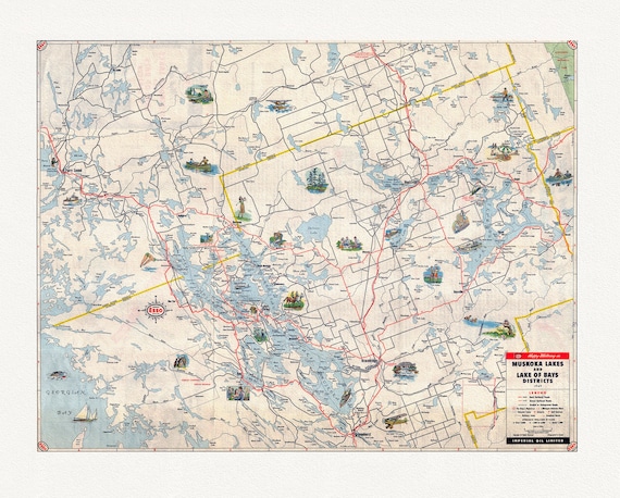 Happy motoring in Muskoka Lakes and Lake of Bays Districts, Ontario, 1949
$41.36
Happy motoring in Muskoka Lakes and Lake of Bays Districts, Ontario, 1949
$41.36