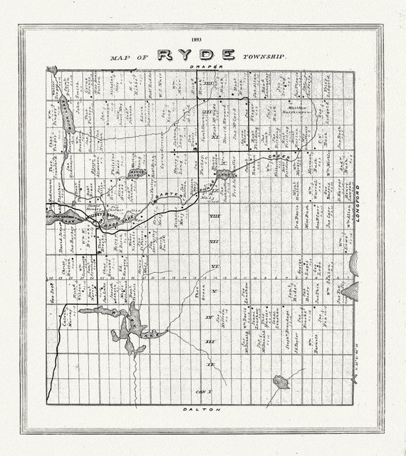
 Muskoka-Haliburton, Ryde Township, 1893, map on heavy cotton canvas, 20 x 25" approx.
$41.36
Muskoka-Haliburton, Ryde Township, 1893, map on heavy cotton canvas, 20 x 25" approx.
$41.36
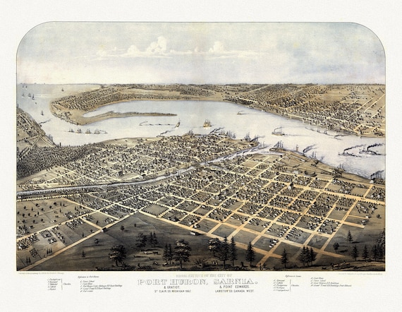 View of the City of Port Huron, Sarnia & Gratiot, Michigan, Point Edwards, Lambton Co., Canada West, 1867, canvas, 22x27"
$41.36
View of the City of Port Huron, Sarnia & Gratiot, Michigan, Point Edwards, Lambton Co., Canada West, 1867, canvas, 22x27"
$41.36
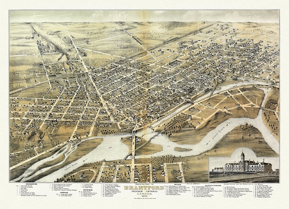 Bird's eye view of Brantford, Province of Ontario, Canada, 1875, map on heavy cotton canvas, 22x27" approx.
$41.36
Bird's eye view of Brantford, Province of Ontario, Canada, 1875, map on heavy cotton canvas, 22x27" approx.
$41.36
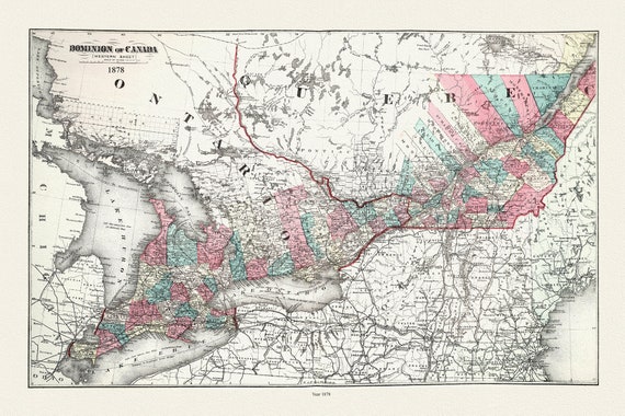 Ontario and Quebec, Dominion of Canada, 1878, map on durable cotton canvas, 50 x 85 cm, 20 x 29" approx.
$41.36
Ontario and Quebec, Dominion of Canada, 1878, map on durable cotton canvas, 50 x 85 cm, 20 x 29" approx.
$41.36
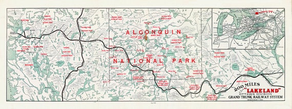 Algonquin: Grand Trunk Railway, Historic Algonquin Park Map, 1905, map on heavy cotton canvas, 22x27" approx.
$41.36
Algonquin: Grand Trunk Railway, Historic Algonquin Park Map, 1905, map on heavy cotton canvas, 22x27" approx.
$41.36
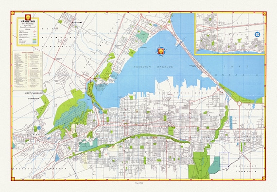 Hamilton and surrounding area, showing waterways, streets, railways, and an index, 1966, map on heavy cotton canvas, 20 x 25" approx.
$41.36
Hamilton and surrounding area, showing waterways, streets, railways, and an index, 1966, map on heavy cotton canvas, 20 x 25" approx.
$41.36
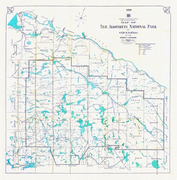 Historic Algonquin Park Map, Lands, Forests, Mines, 1919, map on heavy cotton canvas, 20 x 25" approx.
$41.36
Historic Algonquin Park Map, Lands, Forests, Mines, 1919, map on heavy cotton canvas, 20 x 25" approx.
$41.36
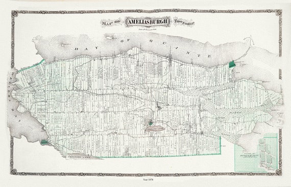 Ameliasburgh Township, Ont., 1878 , map on durable cotton canvas, 50 x 70 cm, 20 x 25" approx.
$41.36
Ameliasburgh Township, Ont., 1878 , map on durable cotton canvas, 50 x 70 cm, 20 x 25" approx.
$41.36
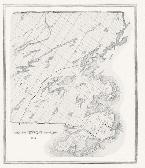 Muskoka-Haliburton, Wood Township, 1893 , map on heavy cotton canvas, 20 x 25" approx.
$41.36
Muskoka-Haliburton, Wood Township, 1893 , map on heavy cotton canvas, 20 x 25" approx.
$41.36
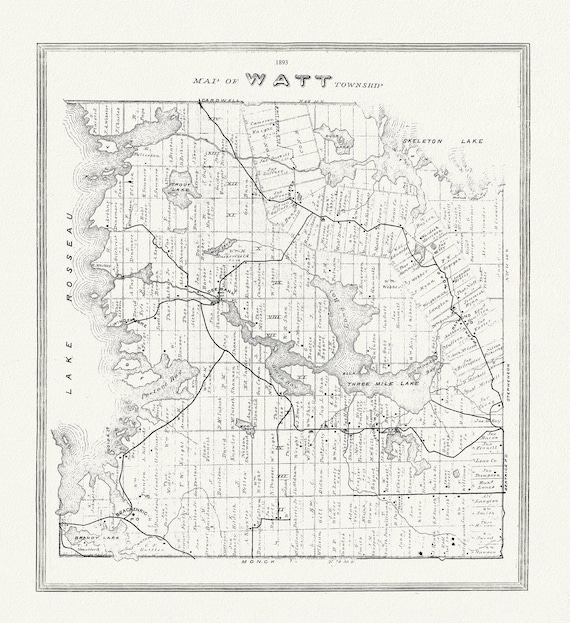 Muskoka-Haliburton, Watt Township, 1893 , map on heavy cotton canvas, 20 x 25" approx.
$41.36
Muskoka-Haliburton, Watt Township, 1893 , map on heavy cotton canvas, 20 x 25" approx.
$41.36
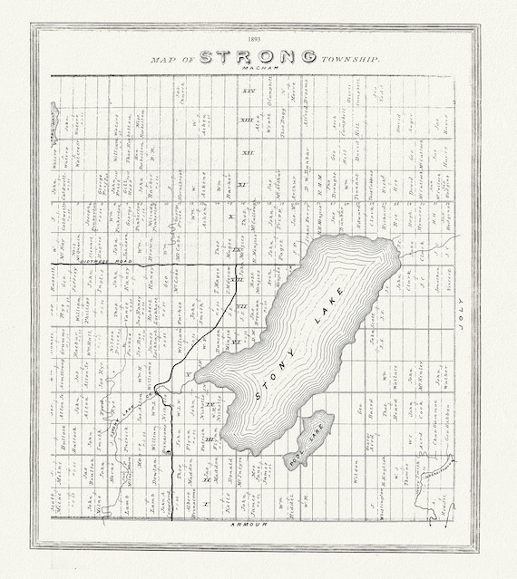 Muskoka-Haliburton, Strong Township, 1893, map on heavy cotton canvas, 20 x 25" approx.
$41.36
Muskoka-Haliburton, Strong Township, 1893, map on heavy cotton canvas, 20 x 25" approx.
$41.36
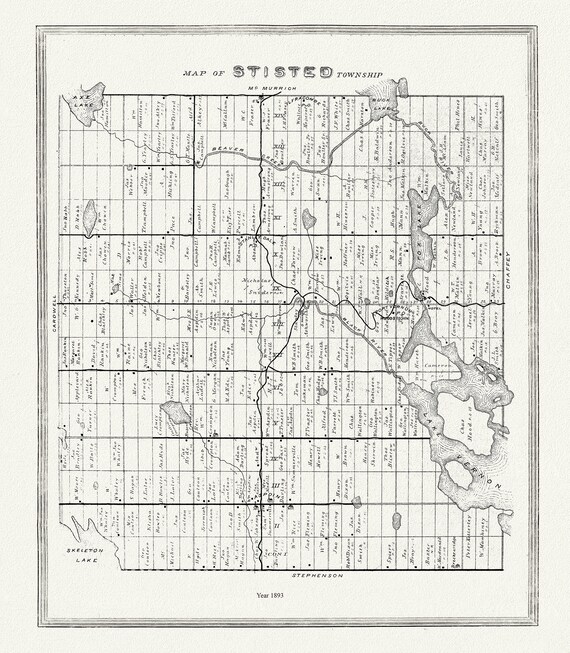 Muskoka-Haliburton, Stisted Township, 1893 , map on heavy cotton canvas, 20 x 25" approx.
$41.36
Muskoka-Haliburton, Stisted Township, 1893 , map on heavy cotton canvas, 20 x 25" approx.
$41.36
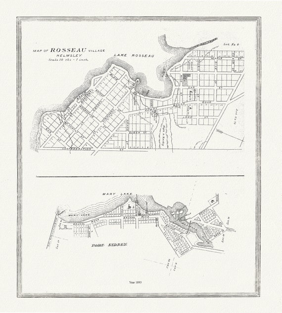 Muskoka-Haliburton, Rosseau Village & Port Sydney, 1893, map on heavy cotton canvas, 20 x 25" approx.
$41.36
Muskoka-Haliburton, Rosseau Village & Port Sydney, 1893, map on heavy cotton canvas, 20 x 25" approx.
$41.36
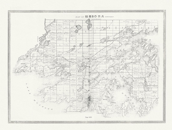 Muskoka-Haliburton, Medora Township, 1893, map on heavy cotton canvas, 20 x 25" approx.
$41.36
Muskoka-Haliburton, Medora Township, 1893, map on heavy cotton canvas, 20 x 25" approx.
$41.36
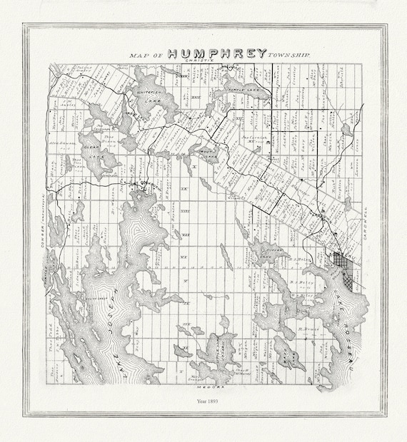 Muskoka-Haliburton, Humphrey Township, 1893 , map on heavy cotton canvas, 20 x 25" approx.
$41.36
Muskoka-Haliburton, Humphrey Township, 1893 , map on heavy cotton canvas, 20 x 25" approx.
$41.36
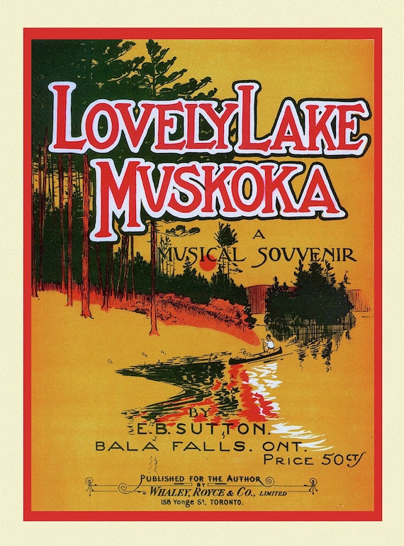 Lovely Lake Muskoka, A Musical Souvenir, travel poster on heavy cotton canvas, 50 x 70 cm, 20 x 25" approx.
$41.36
Lovely Lake Muskoka, A Musical Souvenir, travel poster on heavy cotton canvas, 50 x 70 cm, 20 x 25" approx.
$41.36
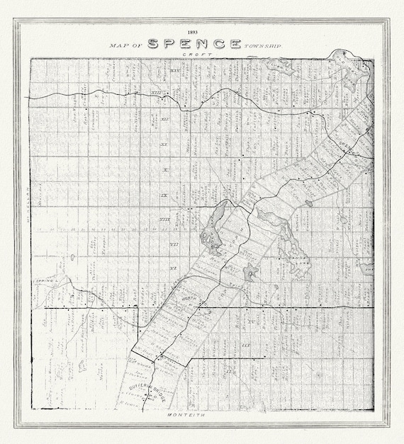 Muskoka-Haliburton, Spence Township, 1893, map on heavy cotton canvas, 20 x 25" approx.
$41.36
Muskoka-Haliburton, Spence Township, 1893, map on heavy cotton canvas, 20 x 25" approx.
$41.36
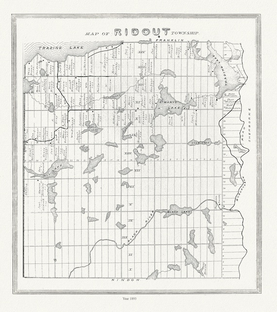 Muskoka-Haliburton, Ridout Township,1893
$41.36
Muskoka-Haliburton, Ridout Township,1893
$41.36
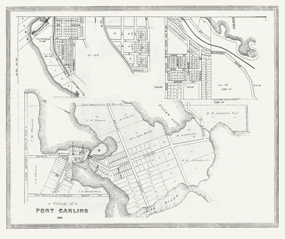 Muskoka-Haliburton, Port Carling, 1893 , map on heavy cotton canvas, 20 x 25" approx.
$41.36
Muskoka-Haliburton, Port Carling, 1893 , map on heavy cotton canvas, 20 x 25" approx.
$41.36
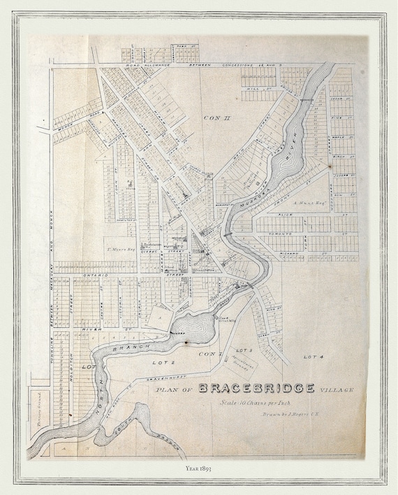 Muskoka-Haliburton, Plan of Bracebridge Village, 1893 , map on heavy cotton canvas, 20 x 25" approx.
$41.36
Muskoka-Haliburton, Plan of Bracebridge Village, 1893 , map on heavy cotton canvas, 20 x 25" approx.
$41.36