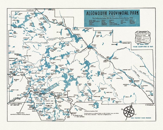
 Historic Algonquin Park Map & Highland Inn, 1944, map on heavy cotton canvas, 22x27" approx.
$41.36
Historic Algonquin Park Map & Highland Inn, 1944, map on heavy cotton canvas, 22x27" approx.
$41.36
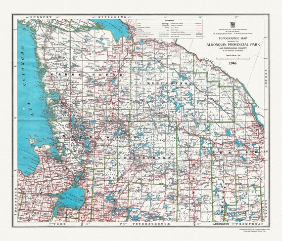 Historic Algonquin Park Map & Surrounding Area, Algonquin Story, 1946 , map on heavy cotton canvas, 20x27" approx.
$41.36
Historic Algonquin Park Map & Surrounding Area, Algonquin Story, 1946 , map on heavy cotton canvas, 20x27" approx.
$41.36
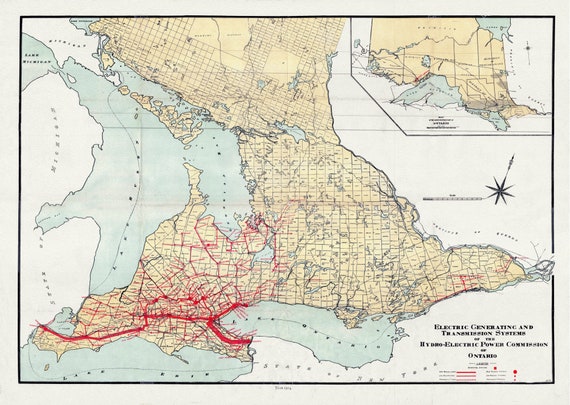 The Electric Generating and Transmission Systems of the Hydro, Electric Power Commission of Ontario, 1914 , map on canvas, 22x27" approx.
$41.36
The Electric Generating and Transmission Systems of the Hydro, Electric Power Commission of Ontario, 1914 , map on canvas, 22x27" approx.
$41.36
 Town of Picton in Prince Edward County, Tremaine auth.,1863 , map on heavy cotton canvas, 45 x 65 cm, 18 x 24" approx.
$41.36
Town of Picton in Prince Edward County, Tremaine auth.,1863 , map on heavy cotton canvas, 45 x 65 cm, 18 x 24" approx.
$41.36
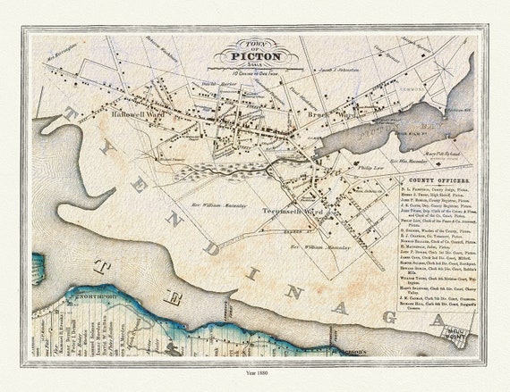
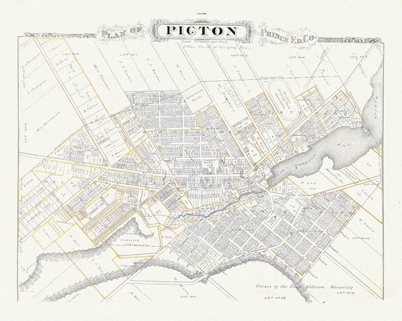 Plan of Picton, Prince Edward County, Ontario, 1880, map on heavy cotton canvas, 45 x 65 cm, 18 x 24" approx.
$41.36
Plan of Picton, Prince Edward County, Ontario, 1880, map on heavy cotton canvas, 45 x 65 cm, 18 x 24" approx.
$41.36
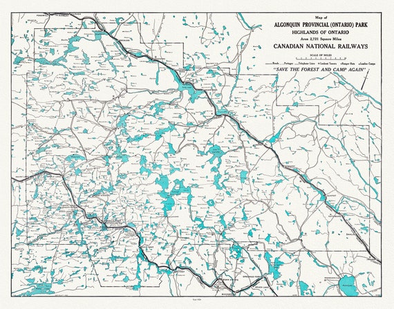 Historic Algonquin Park, Canadian National Railways, 1926, map on heavy cotton canvas, 22x27" approx.
$41.36
Historic Algonquin Park, Canadian National Railways, 1926, map on heavy cotton canvas, 22x27" approx.
$41.36
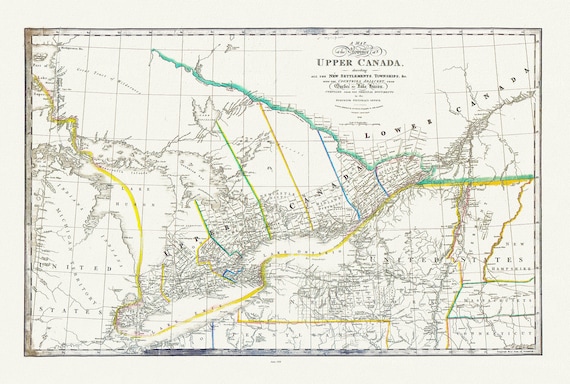 Ontario: Upper Canada describing new settlements, townships, countries from Quebec to Lake Huron, Wyld auth., 1838 ,canvas, 20 x 25" approx.
$41.36
Ontario: Upper Canada describing new settlements, townships, countries from Quebec to Lake Huron, Wyld auth., 1838 ,canvas, 20 x 25" approx.
$41.36
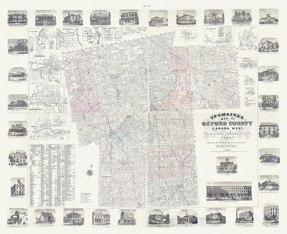 Oxford County, Canada West, 1857 , map on durable cotton canvas, 50 x 70 cm, 20 x 25" approx.
$41.36
Oxford County, Canada West, 1857 , map on durable cotton canvas, 50 x 70 cm, 20 x 25" approx.
$41.36
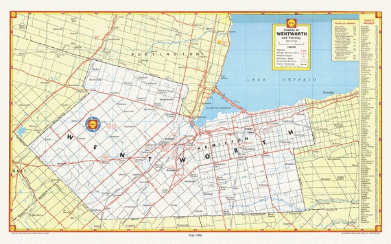 City of Hamilton, County of Wentworth and vicinity, with an index for points of interest, 1966 , map on cotton canvas, 20 x 25" approx.
$41.36
City of Hamilton, County of Wentworth and vicinity, with an index for points of interest, 1966 , map on cotton canvas, 20 x 25" approx.
$41.36
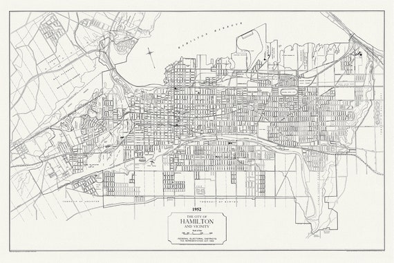 The City of Hamilton and Vicinity, federal electoral districts, The Representation Act, 1952 , map on heavy cotton canvas, 20 x 25" approx.
$41.36
The City of Hamilton and Vicinity, federal electoral districts, The Representation Act, 1952 , map on heavy cotton canvas, 20 x 25" approx.
$41.36
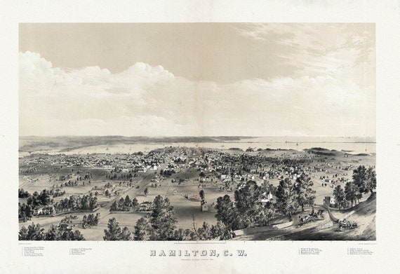 Hamilton, Ontario, Canada West, 1859 , map on heavy cotton canvas, 50 x 70 cm, 20 x 25" approx.
$41.36
Hamilton, Ontario, Canada West, 1859 , map on heavy cotton canvas, 50 x 70 cm, 20 x 25" approx.
$41.36
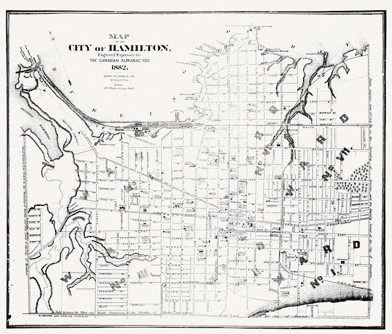 Hamilton, Ontario, 1882, map on heavy cotton canvas, 50 x 70cm, 20 x 25" approx.
$41.36
Hamilton, Ontario, 1882, map on heavy cotton canvas, 50 x 70cm, 20 x 25" approx.
$41.36
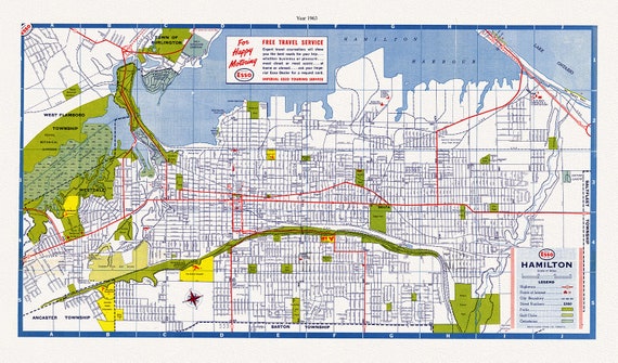 Hamilton, Ontario, 1963, map on heavy cotton canvas, 50 x 70 cm, 20 x 25" approx.
$41.36
Hamilton, Ontario, 1963, map on heavy cotton canvas, 50 x 70 cm, 20 x 25" approx.
$41.36
 Aeronautical Chart, Ontario, South Western Section, 1952 , map on heavy cotton canvas, 20 x 27" approx.
$41.36
Aeronautical Chart, Ontario, South Western Section, 1952 , map on heavy cotton canvas, 20 x 27" approx.
$41.36
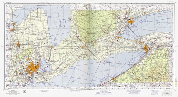 Aeronautical Chart, Ontario, South Western Section, 1960 , map on heavy cotton canvas, 20 x 27" approx.
$41.36
Aeronautical Chart, Ontario, South Western Section, 1960 , map on heavy cotton canvas, 20 x 27" approx.
$41.36
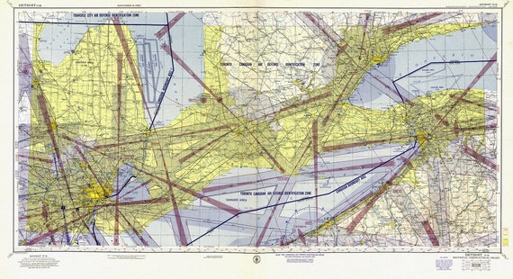
 Aeronautical Chart, Ontario, South Eastern Section, 1952 , map on heavy cotton canvas, 20 x 27" approx.
$41.36
Aeronautical Chart, Ontario, South Eastern Section, 1952 , map on heavy cotton canvas, 20 x 27" approx.
$41.36
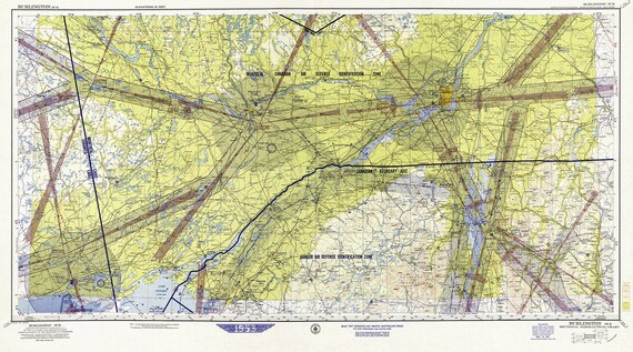
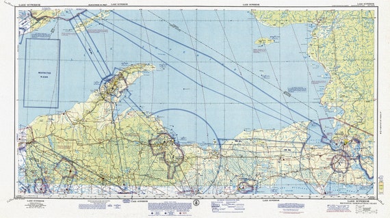 Aeronautical Chart, Ontario, Lake Superior Section, 1970, map on heavy cotton canvas, 20 x 27" approx.
$41.36
Aeronautical Chart, Ontario, Lake Superior Section, 1970, map on heavy cotton canvas, 20 x 27" approx.
$41.36
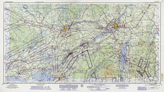 Aeronautical Chart, Ontario, South Eastern Section, 1962 , map on heavy cotton canvas, 20 x 27" approx.
$41.36
Aeronautical Chart, Ontario, South Eastern Section, 1962 , map on heavy cotton canvas, 20 x 27" approx.
$41.36
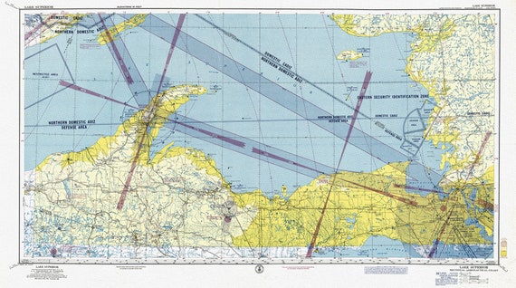 Aeronautical Chart, Ontario, Lake Superior Section, 1960, map on heavy cotton canvas, 20 x 27" approx.
$41.36
Aeronautical Chart, Ontario, Lake Superior Section, 1960, map on heavy cotton canvas, 20 x 27" approx.
$41.36
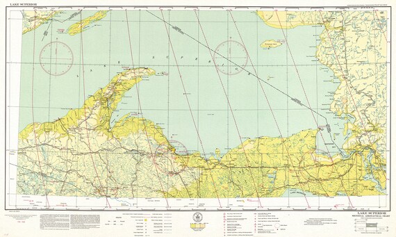 Aeronautical Chart, Ontario, Lake Superior Section, 1931 , map on heavy cotton canvas, 20 x 27" approx.
$41.36
Aeronautical Chart, Ontario, Lake Superior Section, 1931 , map on heavy cotton canvas, 20 x 27" approx.
$41.36