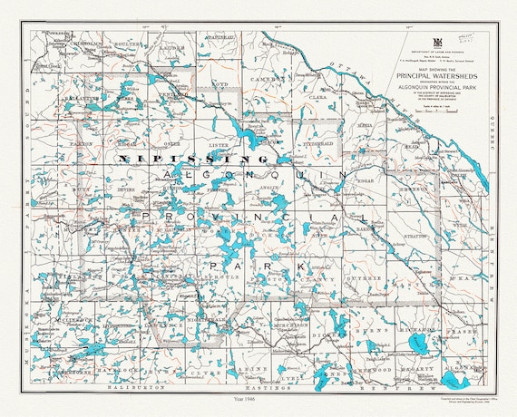
 Algonquin Provincial Park, Principal Watersheds, 1946 , map on heavy cotton canvas, 45 x 65 cm, 18 x 24" approx.
$41.36
Algonquin Provincial Park, Principal Watersheds, 1946 , map on heavy cotton canvas, 45 x 65 cm, 18 x 24" approx.
$41.36
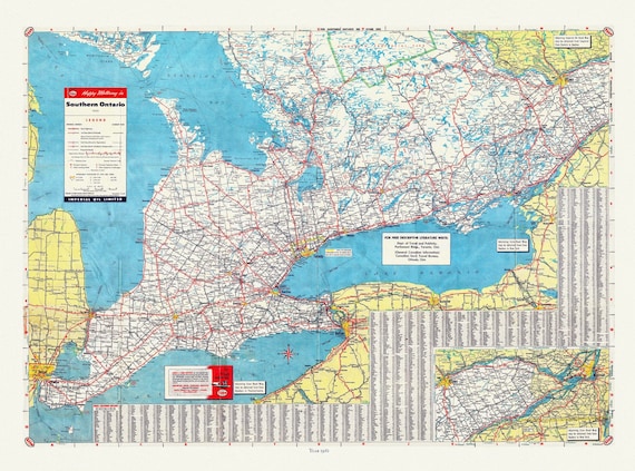 Road Map of Southern Ontario, 1955 , map on heavy cotton canvas, 22x27" approx.
$41.36
Road Map of Southern Ontario, 1955 , map on heavy cotton canvas, 22x27" approx.
$41.36
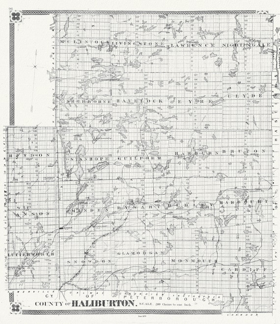 Historic Algonquin Park Map, Haliburton County, 1879, map on heavy cotton canvas, 20 x 25" approx.
$45.12
Historic Algonquin Park Map, Haliburton County, 1879, map on heavy cotton canvas, 20 x 25" approx.
$45.12
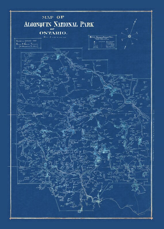 Historic Algonquin Park Map, auth. Arthur Brown, 1925 Cyanotype , map on heavy cotton canvas, 20x27" approx.
$41.36
Historic Algonquin Park Map, auth. Arthur Brown, 1925 Cyanotype , map on heavy cotton canvas, 20x27" approx.
$41.36
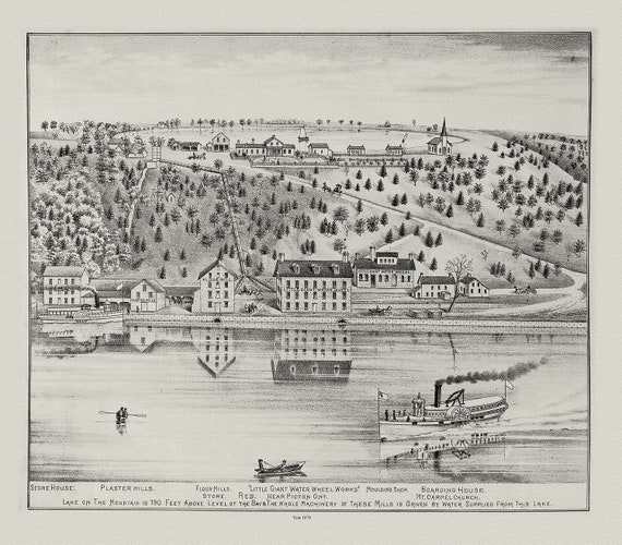 Glenora & Lake on the Mountain, Picton, Prince Edward County, 1878, map on heavy cotton canvas, 45 x 65 cm, 18 x 24" approx.
$41.36
Glenora & Lake on the Mountain, Picton, Prince Edward County, 1878, map on heavy cotton canvas, 45 x 65 cm, 18 x 24" approx.
$41.36
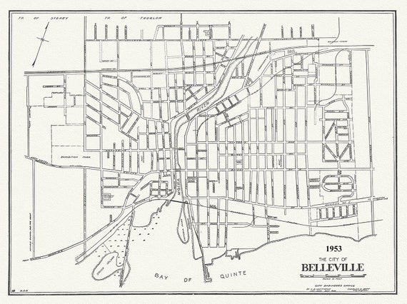 The City of Belleville, Hastings County, Ontario, 1953
$41.36
The City of Belleville, Hastings County, Ontario, 1953
$41.36
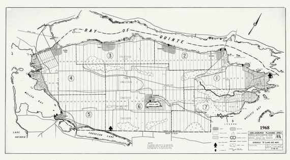 Prince Edward County, Ameliasburgh planning area, 1968, map on heavy cotton canvas, 45 x 65 cm, 18 x 24" approx.
$41.36
Prince Edward County, Ameliasburgh planning area, 1968, map on heavy cotton canvas, 45 x 65 cm, 18 x 24" approx.
$41.36
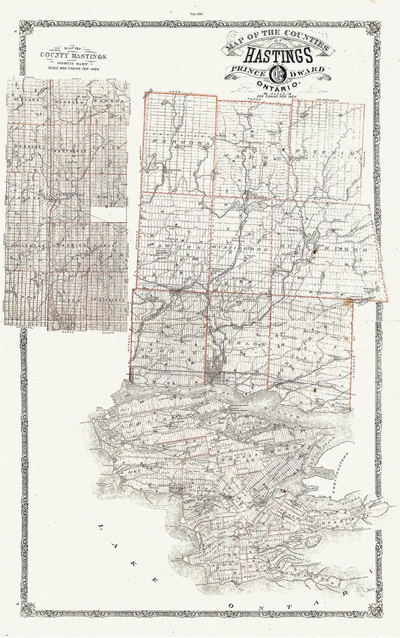 Map of Hastings County, Ontario, 1880 , map on heavy cotton canvas, 45 x 65 cm, 18 x 24" approx.
$41.36
Map of Hastings County, Ontario, 1880 , map on heavy cotton canvas, 45 x 65 cm, 18 x 24" approx.
$41.36
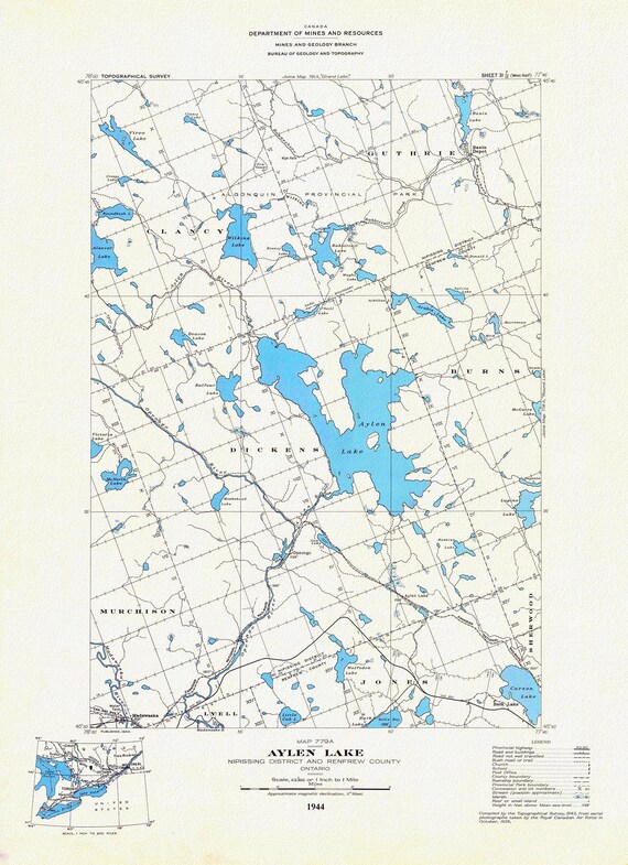 Historic Algonquin Park Map, Aylen Lake, National Topographic Series, 1944, map on heavy cotton canvas, 20 x 25" approx.
$41.36
Historic Algonquin Park Map, Aylen Lake, National Topographic Series, 1944, map on heavy cotton canvas, 20 x 25" approx.
$41.36
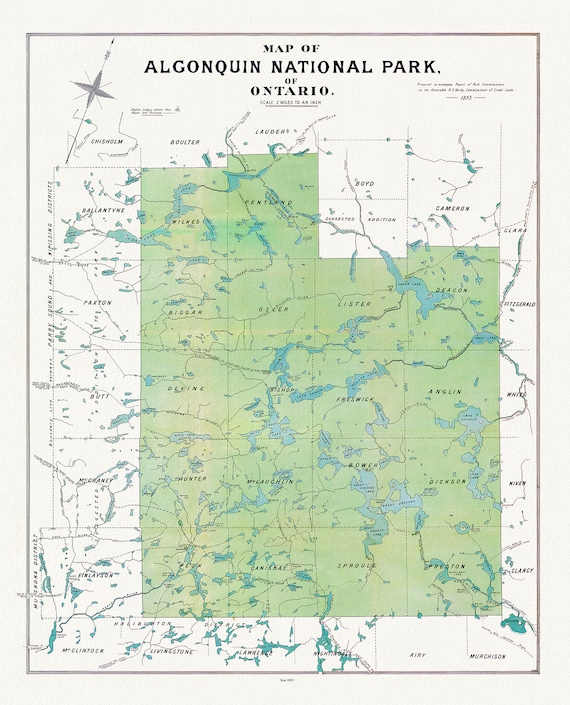 Historic Algonquin Park Map, Algonquin Park Commission, 1893, map on heavy cotton canvas, 20x27" approx.
$41.36
Historic Algonquin Park Map, Algonquin Park Commission, 1893, map on heavy cotton canvas, 20x27" approx.
$41.36
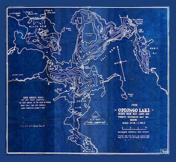 Historic Algonquin Park Map, Depth Map, Opeongo Lake, 1958 Cyanotype , map on heavy cotton canvas, 20x27" approx
$41.36
Historic Algonquin Park Map, Depth Map, Opeongo Lake, 1958 Cyanotype , map on heavy cotton canvas, 20x27" approx
$41.36
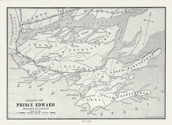 Prince Edward County, Ontario, Gage's county atlas, 1886, map on durable cotton canvas, 50 x 70 cm, 20 x 25" approx.
$41.36
Prince Edward County, Ontario, Gage's county atlas, 1886, map on durable cotton canvas, 50 x 70 cm, 20 x 25" approx.
$41.36
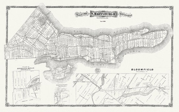 Map of Marysburgh Township, Prince Edward County, 1880 , map on heavy cotton canvas, 45 x 65 cm, 18 x 24" approx.
$41.36
Map of Marysburgh Township, Prince Edward County, 1880 , map on heavy cotton canvas, 45 x 65 cm, 18 x 24" approx.
$41.36
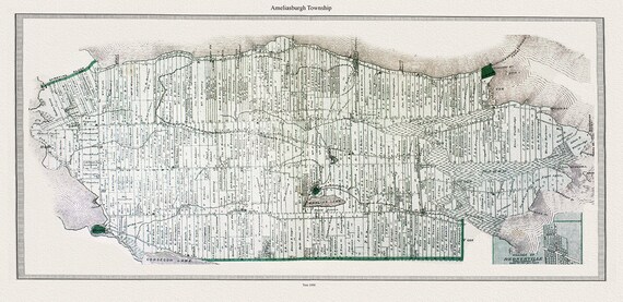 Map of Ameliasburgh Township, in Prince Edward County, 1880, map on heavy cotton canvas, 45 x 65 cm, 18 x 24" approx.
$41.36
Map of Ameliasburgh Township, in Prince Edward County, 1880, map on heavy cotton canvas, 45 x 65 cm, 18 x 24" approx.
$41.36
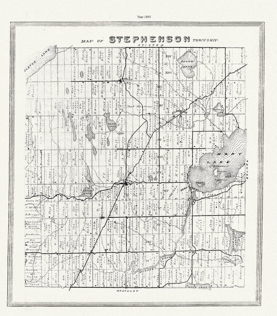 Muskoka-Haliburton, Stephenson Township, 1893 , map on heavy cotton canvas, 20 x 25" approx.
$41.36
Muskoka-Haliburton, Stephenson Township, 1893 , map on heavy cotton canvas, 20 x 25" approx.
$41.36
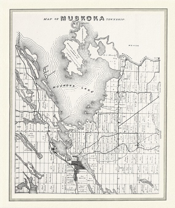 Muskoka Township, 1893, map on heavy cotton canvas, 22x27" approx.
$41.36
Muskoka Township, 1893, map on heavy cotton canvas, 22x27" approx.
$41.36
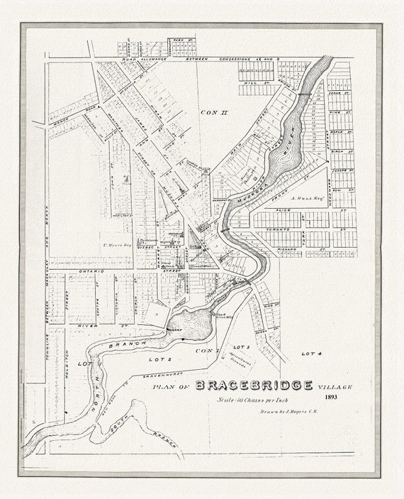 Bracebridge, Muskoka Region, 1893, map on heavy cotton canvas, 22x27" approx.
$41.36
Bracebridge, Muskoka Region, 1893, map on heavy cotton canvas, 22x27" approx.
$41.36
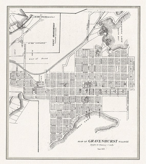 Gravenhurst Village, Muskoka, 1893,map on heavy cotton canvas, 22x27" approx.
$41.36
Gravenhurst Village, Muskoka, 1893,map on heavy cotton canvas, 22x27" approx.
$41.36
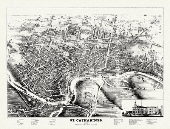 St. Catharines, Ont., A birdseye View, 1878, map on durable cotton canvas, 50 x 70 cm, 20 x 25" approx.
$41.36
St. Catharines, Ont., A birdseye View, 1878, map on durable cotton canvas, 50 x 70 cm, 20 x 25" approx.
$41.36
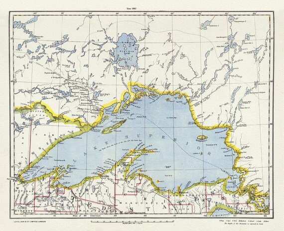 Letts, North Shore, Lake Superior, Canada,1883, Map on heavy cotton canvas, 22x27" approx.
$41.36
Letts, North Shore, Lake Superior, Canada,1883, Map on heavy cotton canvas, 22x27" approx.
$41.36