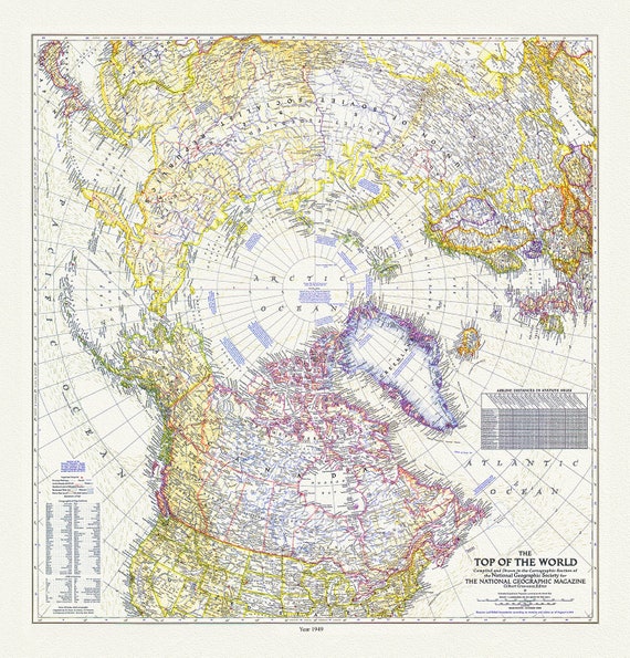
 The Top of the World, National Geographic Society, 1949 , map on heavy cotton canvas, 50 x 70 cm, 20 x 25" approx.
$45.54
The Top of the World, National Geographic Society, 1949 , map on heavy cotton canvas, 50 x 70 cm, 20 x 25" approx.
$45.54
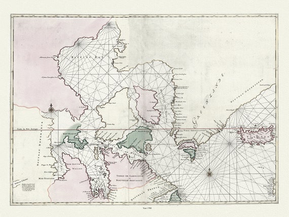
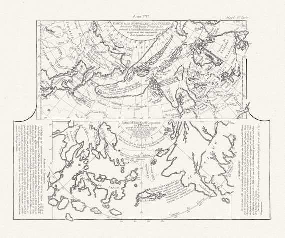 Map of new discoveries in the Arctic,1777, Vaugondy auth. map on durable cotton canvas, 50 x 70 cm, 20 x 25" approx.
$45.54
Map of new discoveries in the Arctic,1777, Vaugondy auth. map on durable cotton canvas, 50 x 70 cm, 20 x 25" approx.
$45.54
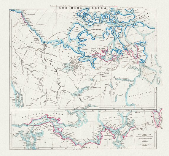 Northern America, Arrowsmith auth., 1855, map on durable cotton canvas, 50 x 70 cm, 20 x 25" approx.
$45.54
Northern America, Arrowsmith auth., 1855, map on durable cotton canvas, 50 x 70 cm, 20 x 25" approx.
$45.54
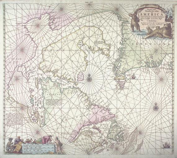 Keulen, Johannes van, 1654-1715. Pas-Kaart, vande zee-kusten van Terra Nova, 1695, , 50 x 70 cm or 20x25" approx.
$45.54
Keulen, Johannes van, 1654-1715. Pas-Kaart, vande zee-kusten van Terra Nova, 1695, , 50 x 70 cm or 20x25" approx.
$45.54
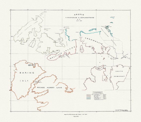 Arctic discoveries and explorations up to July 1853, (1910)
$45.54
Arctic discoveries and explorations up to July 1853, (1910)
$45.54
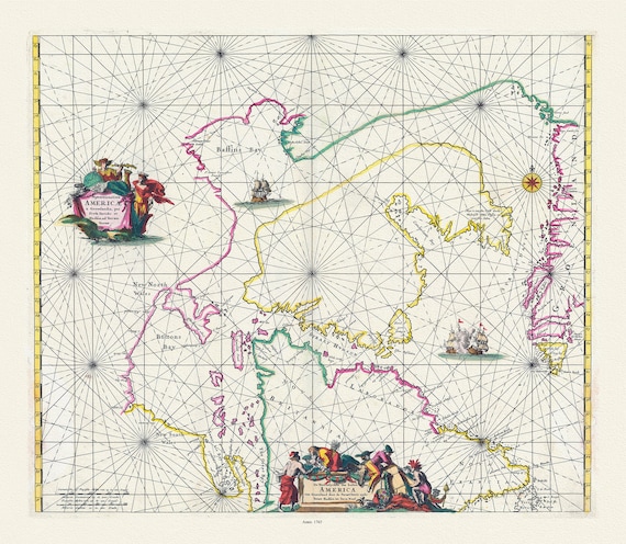
 Carte particulière de l'Amerique septentrionale ou sont compris le destroit de Davids, le destroit de Hudson, Mortier auth.,1700, 20x25"
$45.54
Carte particulière de l'Amerique septentrionale ou sont compris le destroit de Davids, le destroit de Hudson, Mortier auth.,1700, 20x25"
$45.54
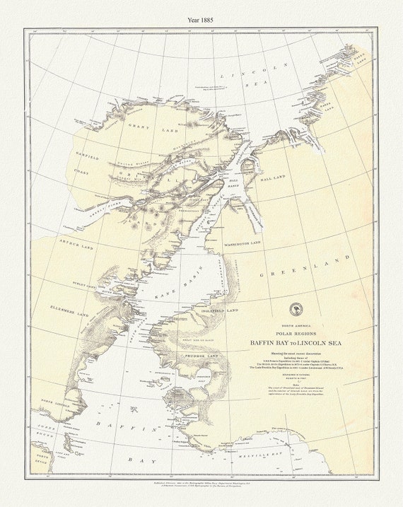 Polar Regions, Baffin Bay to Lincoln Sea, 1885 , map on durable cotton canvas, 50 x 70 cm, 20 x 25" approx.
$45.54
Polar Regions, Baffin Bay to Lincoln Sea, 1885 , map on durable cotton canvas, 50 x 70 cm, 20 x 25" approx.
$45.54
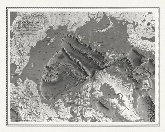 Arctic Ocean Floor, National Geographic, 1971 , map on heavy cotton canvas, 50 x 70cm, 20 x 25" approx.
$45.54
Arctic Ocean Floor, National Geographic, 1971 , map on heavy cotton canvas, 50 x 70cm, 20 x 25" approx.
$45.54
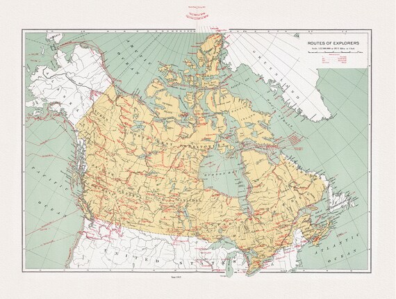 Canada, Routes of explorers, Chalifour (auth.), 1915, map on heavy cotton canvas, 20 x 25" approx.
$45.54
Canada, Routes of explorers, Chalifour (auth.), 1915, map on heavy cotton canvas, 20 x 25" approx.
$45.54
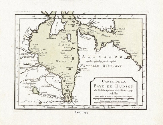 Carte de la Bye de Hudson, Bellin auth., 1744, map on heavy cotton canvas, 50 x 70 cm, 20 x 25" approx.
$45.54
Carte de la Bye de Hudson, Bellin auth., 1744, map on heavy cotton canvas, 50 x 70 cm, 20 x 25" approx.
$45.54
 Sketch of North America shewing the proposed route of Capt. Back, 1833, map on heavy cotton canvas, 50 x 70 cm, 20 x 25" approx.
$45.54
Sketch of North America shewing the proposed route of Capt. Back, 1833, map on heavy cotton canvas, 50 x 70 cm, 20 x 25" approx.
$45.54
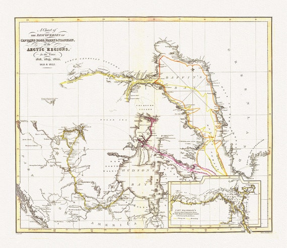 The Discoveries in the Arctic Regions by Ross et Franklin, 1818-1822, map on heavy cotton canvas, 50 x 70 cm, 20 x 25" approx.
$45.54
The Discoveries in the Arctic Regions by Ross et Franklin, 1818-1822, map on heavy cotton canvas, 50 x 70 cm, 20 x 25" approx.
$45.54
 Jacques Nicolas Bellin, Canada, Pacific North West, 1764
$45.54
Jacques Nicolas Bellin, Canada, Pacific North West, 1764
$45.54
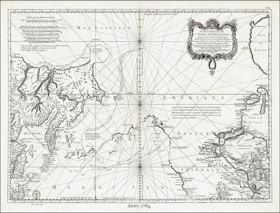
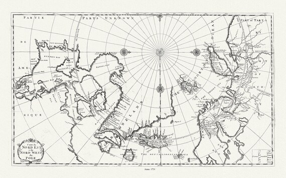 Carte du nord est & du nord west du Pole, 1735, Bernard auth., map on heavy cotton canvas, 50 x 70 cm, 20 x 25" approx.
$45.54
Carte du nord est & du nord west du Pole, 1735, Bernard auth., map on heavy cotton canvas, 50 x 70 cm, 20 x 25" approx.
$45.54
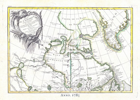 Canada North, Rigobert Bonne auth., 1783, map on heavy cotton canvas, 50 x 70 cm, 20 x 25" approx.
$45.54
Canada North, Rigobert Bonne auth., 1783, map on heavy cotton canvas, 50 x 70 cm, 20 x 25" approx.
$45.54
 Septemtrionaliora Americae a Groenlandia, per Davidis et Hudson, Witt auth., 1765, map on heavy cotton canvas, 50 x 70 cm, 20 x 25" approx.
$45.54
Septemtrionaliora Americae a Groenlandia, per Davidis et Hudson, Witt auth., 1765, map on heavy cotton canvas, 50 x 70 cm, 20 x 25" approx.
$45.54
 Bellin, Carte de la Bye de Hudson, 1744 Ver. II, map on heavy cotton canvas, 50 x 70 cm, 20 x 25" approx.
$45.54
Bellin, Carte de la Bye de Hudson, 1744 Ver. II, map on heavy cotton canvas, 50 x 70 cm, 20 x 25" approx.
$45.54
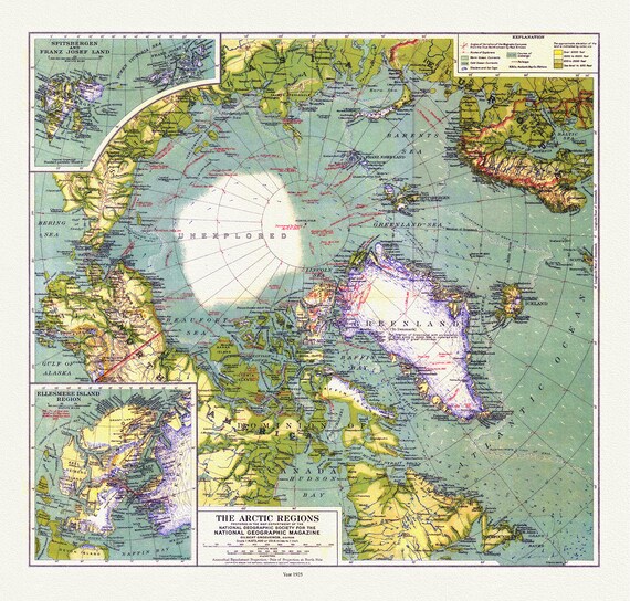 Arctic Regions, National Geographic, 1925, map on heavy cotton canvas, 50 x 70 cm, 20 x 25" approx.
$45.54
Arctic Regions, National Geographic, 1925, map on heavy cotton canvas, 50 x 70 cm, 20 x 25" approx.
$45.54
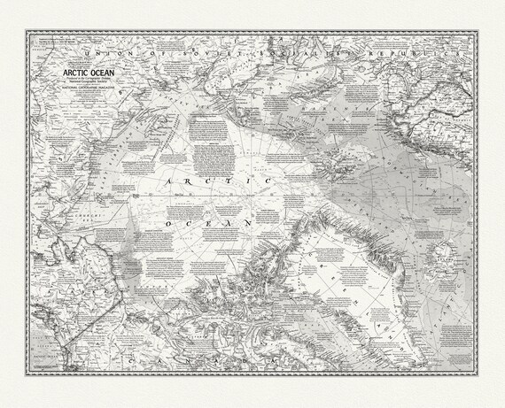 Arctic Ocean, National Geographic, 1971, map on heavy cotton canvas, 50 x 70 cm, 20 x 25" approx.
$45.54
Arctic Ocean, National Geographic, 1971, map on heavy cotton canvas, 50 x 70 cm, 20 x 25" approx.
$45.54
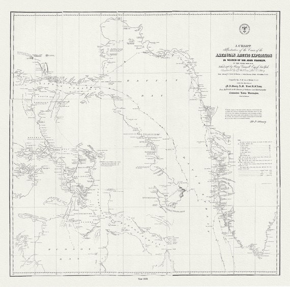 The Franklin Expedition, 1850, map on durable cotton canvas, 50 x 70 cm, 20 x 25" approx.
$45.54
The Franklin Expedition, 1850, map on durable cotton canvas, 50 x 70 cm, 20 x 25" approx.
$45.54