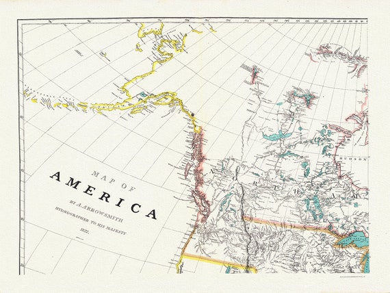
 Arrowsmith's America (North West portion), 1824 , map on heavy cotton canvas, 22x27" approx.
$45.20
Arrowsmith's America (North West portion), 1824 , map on heavy cotton canvas, 22x27" approx.
$45.20
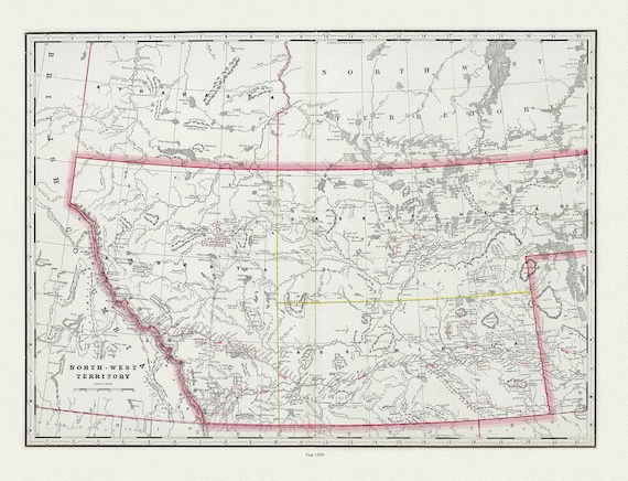 Cram, George Franklin, The North-West Territory, 1889, map on heavy cotton canvas, 22x27" approx.
$45.20
Cram, George Franklin, The North-West Territory, 1889, map on heavy cotton canvas, 22x27" approx.
$45.20
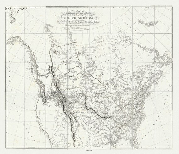 Arrowsmith, New Discoveries in the Interior Parts of North America, 1814, map on heavy cotton canvas, 22x27" approx.
$45.20
Arrowsmith, New Discoveries in the Interior Parts of North America, 1814, map on heavy cotton canvas, 22x27" approx.
$45.20
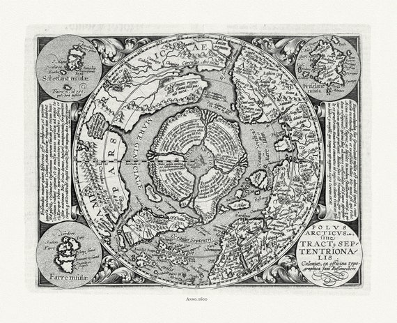 Polus Arcticus, 1600, ,map on heavy cotton canvas, 22x27" approx.
$45.20
Polus Arcticus, 1600, ,map on heavy cotton canvas, 22x27" approx.
$45.20
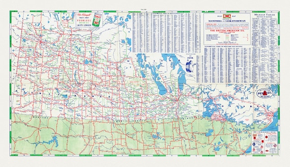 Road Map of the Provinces of Manitoba and Saskatchewan, 1940 Sheet 2
$45.20
Road Map of the Provinces of Manitoba and Saskatchewan, 1940 Sheet 2
$45.20
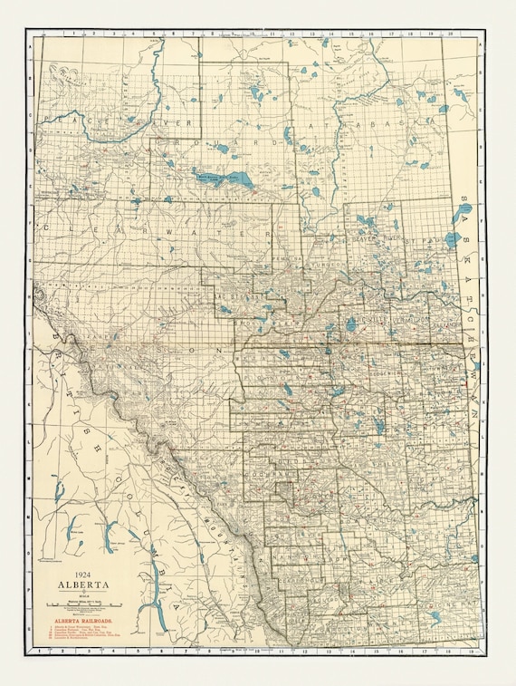 Rand McNally & Company, Commercial Atlas, Alberta, 1924 V. II , map on heavy cotton canvas, 22x27" approx.
$45.20
Rand McNally & Company, Commercial Atlas, Alberta, 1924 V. II , map on heavy cotton canvas, 22x27" approx.
$45.20
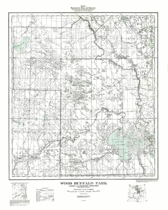 Wood Buffalo Park, Alberta and Northwest Territories, 1947
$45.20
Wood Buffalo Park, Alberta and Northwest Territories, 1947
$45.20
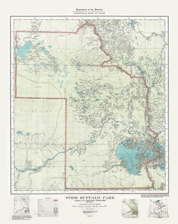 Wood Buffalo Park, Alberta and Northwest Territories, 1931 , map on heavy cotton canvas, 22x27" approx.
$45.20
Wood Buffalo Park, Alberta and Northwest Territories, 1931 , map on heavy cotton canvas, 22x27" approx.
$45.20
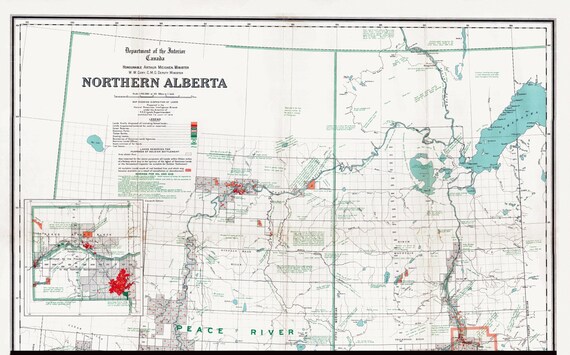 Northern Alberta, map showing disposition of lands, 1918 , map on heavy cotton canvas, 22x27" approx.
$45.20
Northern Alberta, map showing disposition of lands, 1918 , map on heavy cotton canvas, 22x27" approx.
$45.20
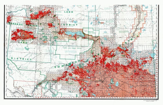 Northern Alberta, map showing disposition of lands, 1918 South Sheet, map on heavy cotton canvas, 22x27" approx.
$45.20
Northern Alberta, map showing disposition of lands, 1918 South Sheet, map on heavy cotton canvas, 22x27" approx.
$45.20
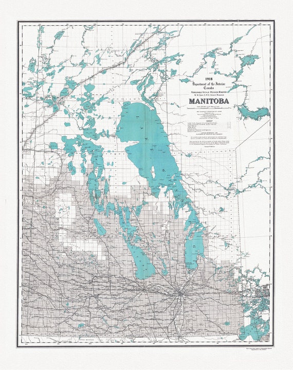 Manitoba, map showing disposition of lands, 1918 , map on heavy cotton canvas, 22x27" approx.
$45.20
Manitoba, map showing disposition of lands, 1918 , map on heavy cotton canvas, 22x27" approx.
$45.20
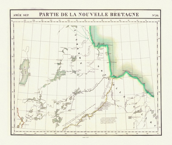 Vandermaelen, Partie, Nouvelle Bretagne (Manitoba), 1827 , map on heavy cotton canvas, 22x27" approx.
$45.20
Vandermaelen, Partie, Nouvelle Bretagne (Manitoba), 1827 , map on heavy cotton canvas, 22x27" approx.
$45.20
 Stanford, Manitoba, 1904 , map on heavy cotton canvas, 22x27" approx.
$45.20
Stanford, Manitoba, 1904 , map on heavy cotton canvas, 22x27" approx.
$45.20
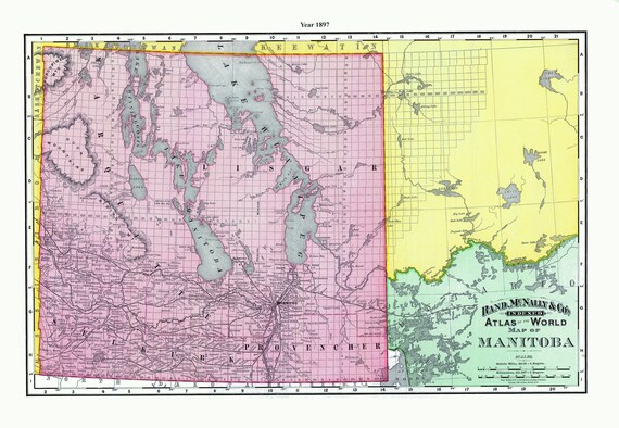 Rand McNally and Company, Manitoba, 1897 , map on heavy cotton canvas, 22x27" approx.
$45.20
Rand McNally and Company, Manitoba, 1897 , map on heavy cotton canvas, 22x27" approx.
$45.20
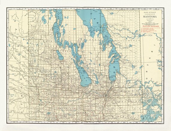 Rand McNally & Company, Commercial Atlas, Manitoba, 1924 , map on heavy cotton canvas, 22x27" approx.
$45.20
Rand McNally & Company, Commercial Atlas, Manitoba, 1924 , map on heavy cotton canvas, 22x27" approx.
$45.20
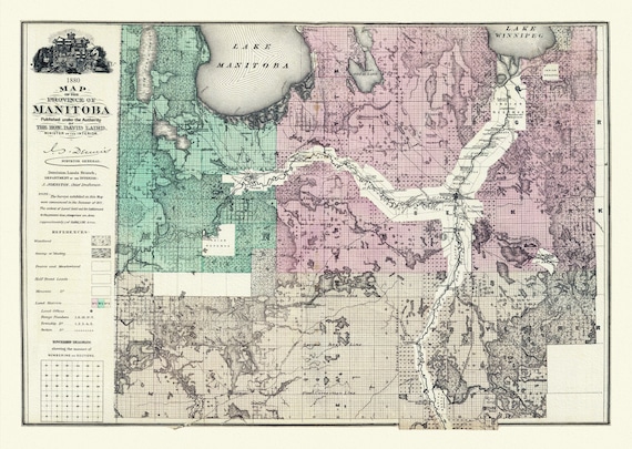 Meacham et Allan, Province of Manitoba, 1880, map on heavy cotton canvas, 22x27" approx.
$45.20
Meacham et Allan, Province of Manitoba, 1880, map on heavy cotton canvas, 22x27" approx.
$45.20
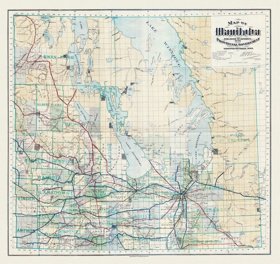 Map of Manitoba published by the authority of the Provincial Government, 1903, map on heavy cotton canvas, 22x27" approx.
$45.20
Map of Manitoba published by the authority of the Provincial Government, 1903, map on heavy cotton canvas, 22x27" approx.
$45.20
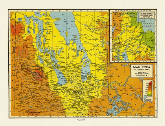 Manitoba, 1947 , map on heavy cotton canvas, 22x27" approx.
$45.20
Manitoba, 1947 , map on heavy cotton canvas, 22x27" approx.
$45.20
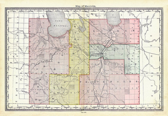 Hardesty, Map of Manitoba, 1881, map on heavy cotton canvas, 22x27" approx.
$45.20
Hardesty, Map of Manitoba, 1881, map on heavy cotton canvas, 22x27" approx.
$45.20
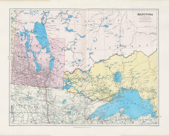
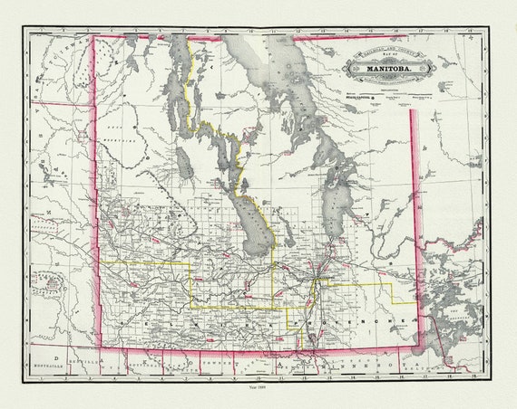 Cram, Manitoba, 1889, map on heavy cotton canvas, 22x27" approx.
$45.20
Cram, Manitoba, 1889, map on heavy cotton canvas, 22x27" approx.
$45.20