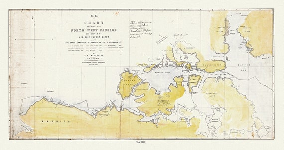
 A Chart Shewing the North West Passage discovered by H.M. Ship Investigator the coast explored in search of Franklin, 1848 & 41 Ver. II
$45.20
A Chart Shewing the North West Passage discovered by H.M. Ship Investigator the coast explored in search of Franklin, 1848 & 41 Ver. II
$45.20
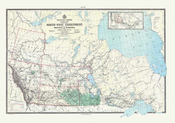 General map of part of the North-West Territories including the province of Manitoba shewing Dominion land surveys to 1882, 20 x 25" approx.
$45.20
General map of part of the North-West Territories including the province of Manitoba shewing Dominion land surveys to 1882, 20 x 25" approx.
$45.20
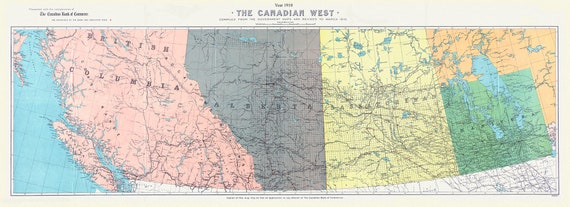 The Canadian west, 1910, map on durable cotton canvas,21x40"" approx.
$101.70
The Canadian west, 1910, map on durable cotton canvas,21x40"" approx.
$101.70
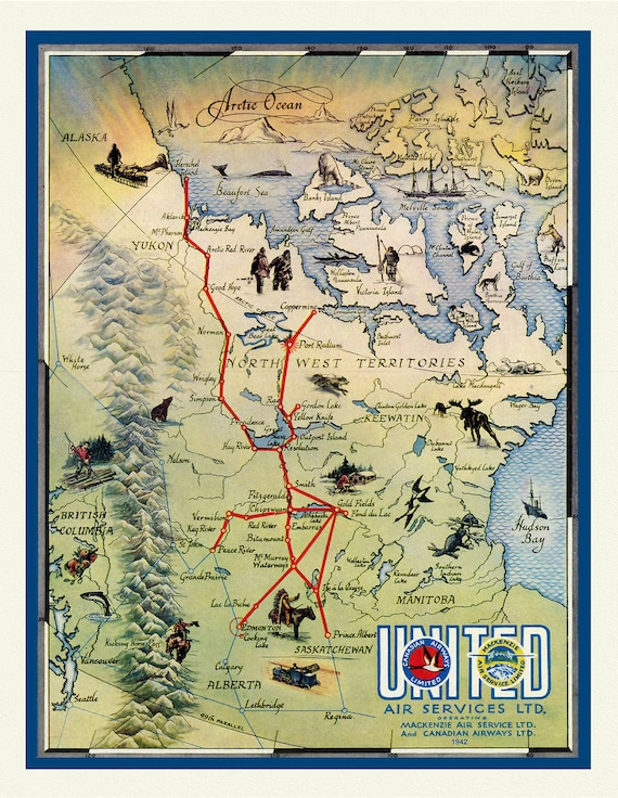 North West Territories (NWT), United Air Services Ltd, 1942 , vintage print on canvas, 50 x 70 cm, 20 x 25" approx.
$45.20
North West Territories (NWT), United Air Services Ltd, 1942 , vintage print on canvas, 50 x 70 cm, 20 x 25" approx.
$45.20
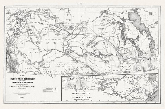 North West Territory and Manitoba, 1880, CPR, map on durable cotton canvas, 50 x 70 cm, 20 x 25" approx.
$45.20
North West Territory and Manitoba, 1880, CPR, map on durable cotton canvas, 50 x 70 cm, 20 x 25" approx.
$45.20
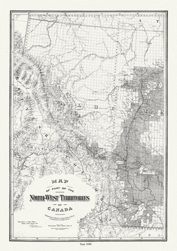 Map of Western Alberta, formerly N.W.T., 1898, map on durable cotton canvas, 50 x 70 cm or 20x25" approx.
$45.20
Map of Western Alberta, formerly N.W.T., 1898, map on durable cotton canvas, 50 x 70 cm or 20x25" approx.
$45.20
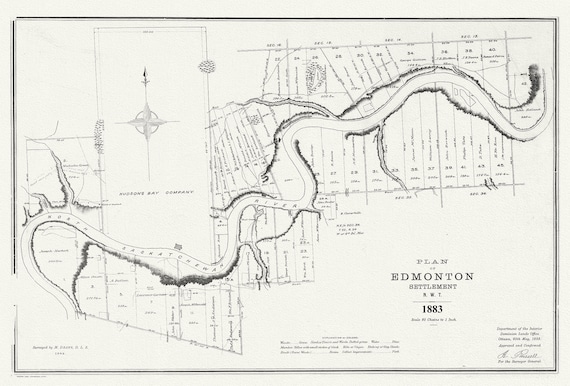 E Plan of Edmonton settlement, N.W.T., 1883, map on durable cotton canvas, 50 x 70 cm or 20x25" approx.
$45.20
E Plan of Edmonton settlement, N.W.T., 1883, map on durable cotton canvas, 50 x 70 cm or 20x25" approx.
$45.20
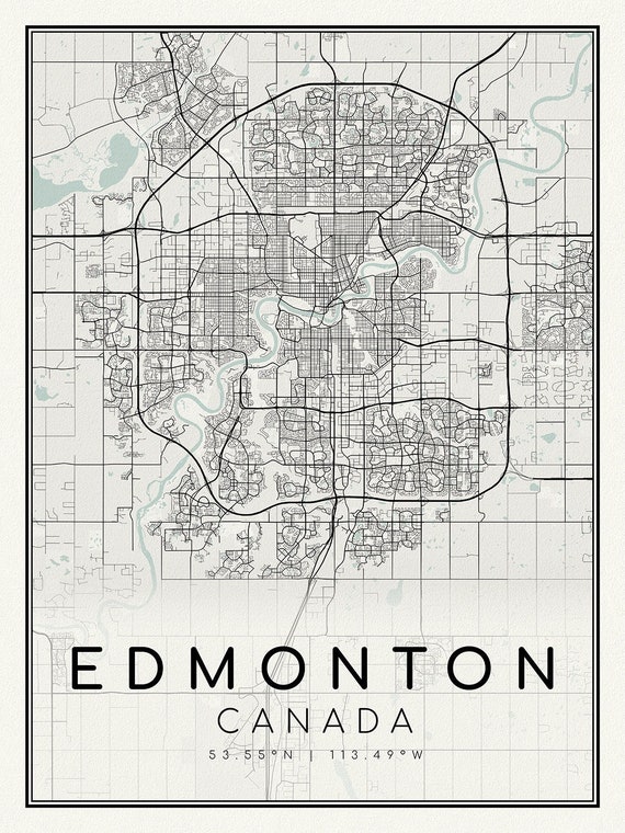 Edmonton, A Modern Map, on durable cotton canvas, 50 x 70 cm, 20 x 25" approx.
$45.20
Edmonton, A Modern Map, on durable cotton canvas, 50 x 70 cm, 20 x 25" approx.
$45.20
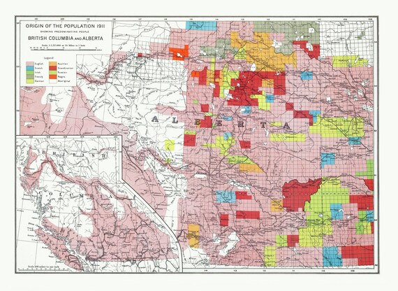 Department of the Interior, Origin of the Population for 1911 British Columbia and Alberta, issued 1915 ,heavy cotton canvas, 22x27" approx.
$45.20
Department of the Interior, Origin of the Population for 1911 British Columbia and Alberta, issued 1915 ,heavy cotton canvas, 22x27" approx.
$45.20
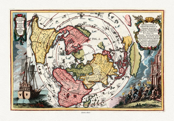 Navis Dicta duce Magellane Prima Circuvecia per Orbem, Terrarum Orbis, 1607 (Polar Arctic),map on heavy cotton canvas, 22x27" approx.
$45.20
Navis Dicta duce Magellane Prima Circuvecia per Orbem, Terrarum Orbis, 1607 (Polar Arctic),map on heavy cotton canvas, 22x27" approx.
$45.20
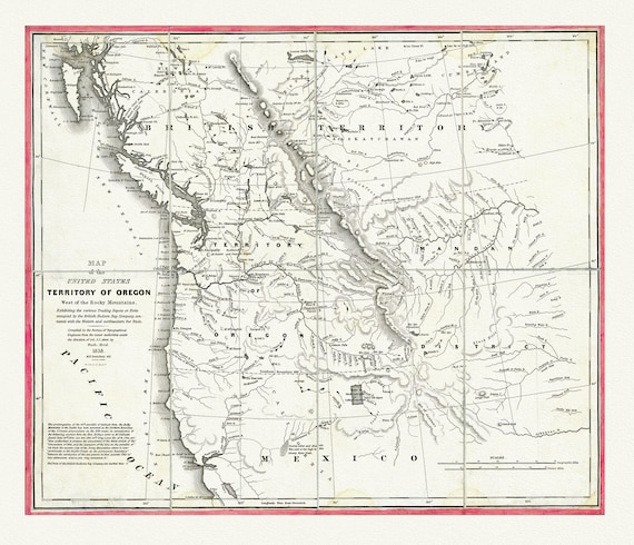 Map of the United States, Territory of Oregon, west of the Rocky Mountains, connected with fur trade, 1838, canvas map 20x25"
$45.20
Map of the United States, Territory of Oregon, west of the Rocky Mountains, connected with fur trade, 1838, canvas map 20x25"
$45.20
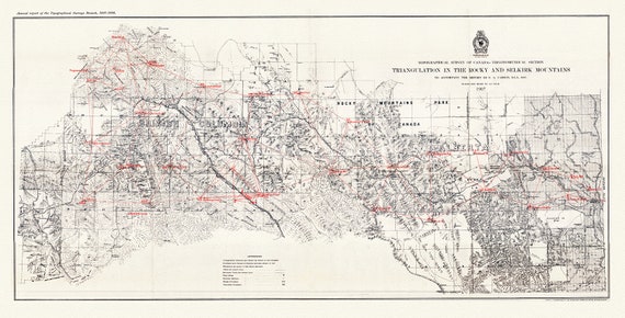 Triangulation in the Rocky and Selkirk Mountains, 1907, map on heavy cotton canvas, 50 x 70cm, 20 x 25" approx.
$45.20
Triangulation in the Rocky and Selkirk Mountains, 1907, map on heavy cotton canvas, 50 x 70cm, 20 x 25" approx.
$45.20
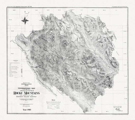 Topographical map of part of the main range of the Rocky Mountains adjacent to the Canadian Pacific Railway, 1903, Canvas 20 x 25" approx.
$45.20
Topographical map of part of the main range of the Rocky Mountains adjacent to the Canadian Pacific Railway, 1903, Canvas 20 x 25" approx.
$45.20
 Southern British Columbia, A Modern Map, Ver. I, map on heavy cotton canvas, 50 x 70cm, 20 x 25" approx.
$45.20
Southern British Columbia, A Modern Map, Ver. I, map on heavy cotton canvas, 50 x 70cm, 20 x 25" approx.
$45.20
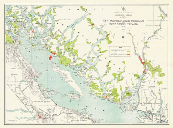 Portions of New Westminster District and Vancouver Island, 1912 , map on heavy cotton canvas, 50 x 70cm, 20 x 25" approx.
$45.20
Portions of New Westminster District and Vancouver Island, 1912 , map on heavy cotton canvas, 50 x 70cm, 20 x 25" approx.
$45.20
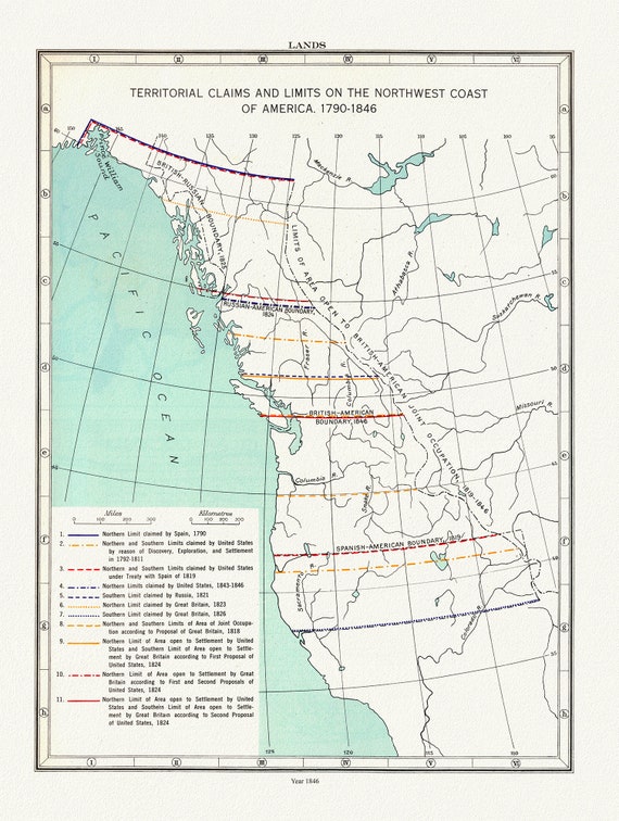 Northwest Coast Lands, Territorial Claims, Paulin et Wright auths., 1790 - 1846, map on heavy cotton canvas, 50 x 70cm, 20 x 25" approx.
$45.20
Northwest Coast Lands, Territorial Claims, Paulin et Wright auths., 1790 - 1846, map on heavy cotton canvas, 50 x 70cm, 20 x 25" approx.
$45.20
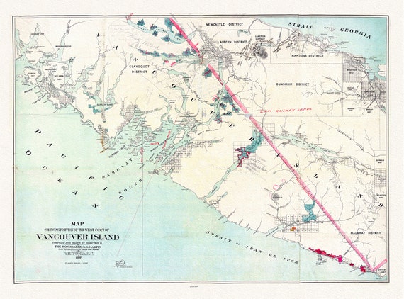 Map shewing portion of the west coast of Vancouver Island, G. B. Martin ,auth., 1897 , map on heavy cotton canvas, 20 x 25" approx.
$45.20
Map shewing portion of the west coast of Vancouver Island, G. B. Martin ,auth., 1897 , map on heavy cotton canvas, 20 x 25" approx.
$45.20
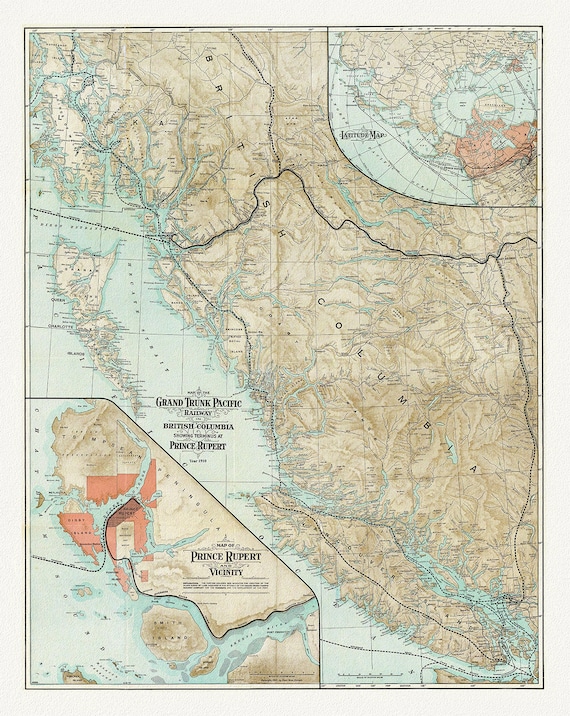 Map Of The Grand Trunk Pacific Railway In British Columbia, 1910, map on heavy cotton canvas, 20 x 30" or 50 x 75cm. approx.
$45.20
Map Of The Grand Trunk Pacific Railway In British Columbia, 1910, map on heavy cotton canvas, 20 x 30" or 50 x 75cm. approx.
$45.20
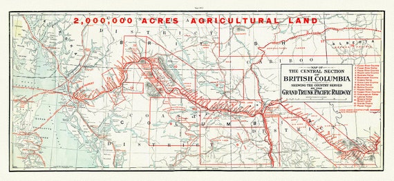 Central section of British Columbia shewing the county served by the Grand Trunk Pacific Railway, 1911 , map on canvas, 20 x 30", approx.
$45.20
Central section of British Columbia shewing the county served by the Grand Trunk Pacific Railway, 1911 , map on canvas, 20 x 30", approx.
$45.20
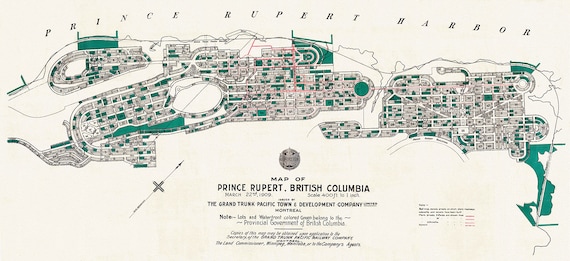 Prince Rupert Harbour, 1909 Ver. II, map on heavy cotton canvas, 50 x 70cm, 20 x 25" approx.
$45.20
Prince Rupert Harbour, 1909 Ver. II, map on heavy cotton canvas, 50 x 70cm, 20 x 25" approx.
$45.20