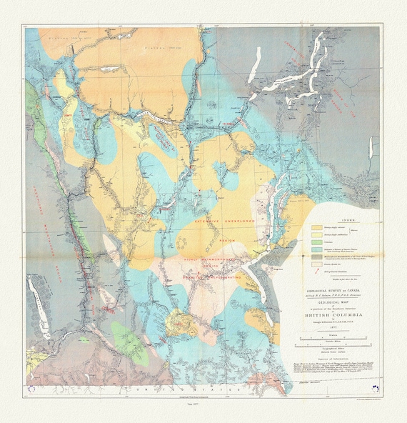
 Geological map of a portion of the Southern Interior of British Columbia, George Dawson ,1877, map on cotton canvas, 20 x 25" approx.
$45.20
Geological map of a portion of the Southern Interior of British Columbia, George Dawson ,1877, map on cotton canvas, 20 x 25" approx.
$45.20
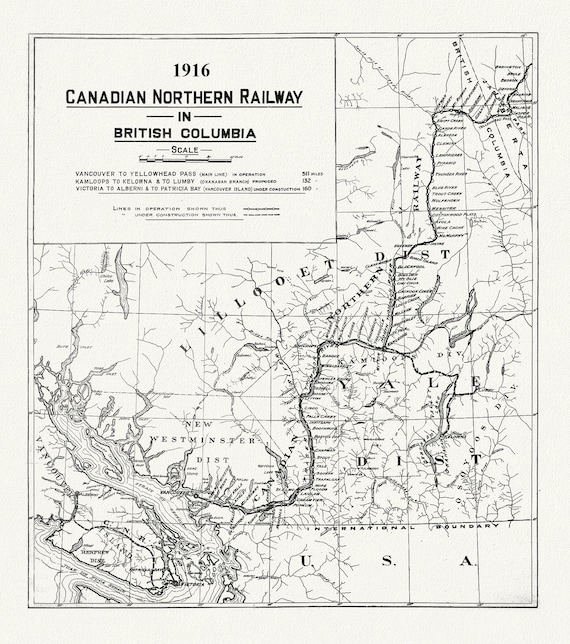 Canadian Northern Railway in British Columbia, 1916 , map on heavy cotton canvas, 50 x 70cm, 20 x 25" approx.
$45.20
Canadian Northern Railway in British Columbia, 1916 , map on heavy cotton canvas, 50 x 70cm, 20 x 25" approx.
$45.20
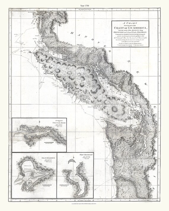 Part of the coast of N.W. America , with tracks of His Majesty's sloop Discovery and armed tender Chatham, 1798, canvas map, 20x25" approx.
$45.20
Part of the coast of N.W. America , with tracks of His Majesty's sloop Discovery and armed tender Chatham, 1798, canvas map, 20x25" approx.
$45.20
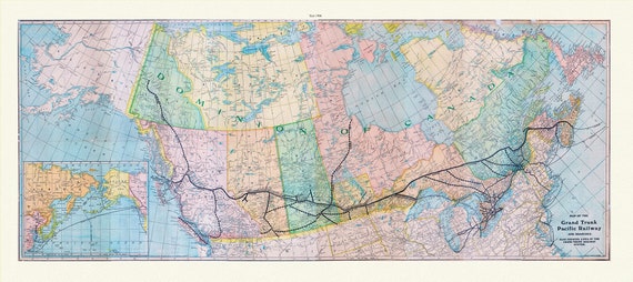 Map of the Grand Trunk Pacific Railway and branches, also showing lines of the Grand Trunk Railway System, 1906, on heavy canvas, 22x27"
$45.20
Map of the Grand Trunk Pacific Railway and branches, also showing lines of the Grand Trunk Railway System, 1906, on heavy canvas, 22x27"
$45.20
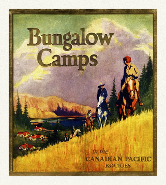 Bungalow Camps in The Canadian Rockies , reprinted vintage poster on heavy cotton canvas, 50 x 70 cm, 20 x 25" approx.
$45.20
Bungalow Camps in The Canadian Rockies , reprinted vintage poster on heavy cotton canvas, 50 x 70 cm, 20 x 25" approx.
$45.20
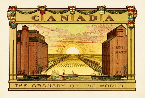 Canada, The Granary of the World
$45.20
Canada, The Granary of the World
$45.20
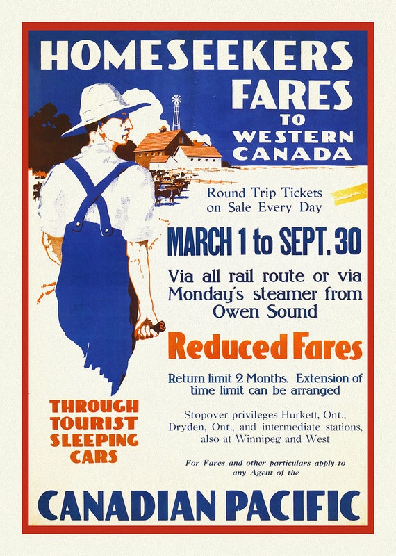 Canadian Pacific, Homeseeker Fares to Western Canada, 1910, reprinted vintage poster on heavy cotton canvas, 50 x 70 cm, 20 x 25" approx.
$45.20
Canadian Pacific, Homeseeker Fares to Western Canada, 1910, reprinted vintage poster on heavy cotton canvas, 50 x 70 cm, 20 x 25" approx.
$45.20
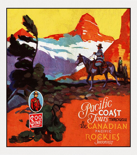 Pacific Coast Tours through the Canadian Rockies, 1927
$45.20
Pacific Coast Tours through the Canadian Rockies, 1927
$45.20
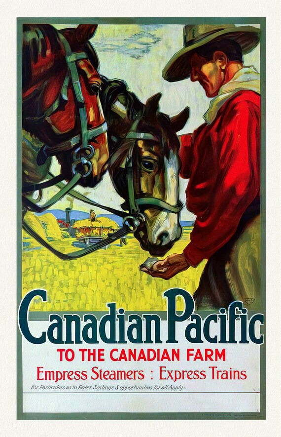 Canadian Pacific to the Canadian Farm , reprinted vintage poster on heavy cotton canvas, 50 x 70 cm, 20 x 25" approx.
$45.20
Canadian Pacific to the Canadian Farm , reprinted vintage poster on heavy cotton canvas, 50 x 70 cm, 20 x 25" approx.
$45.20
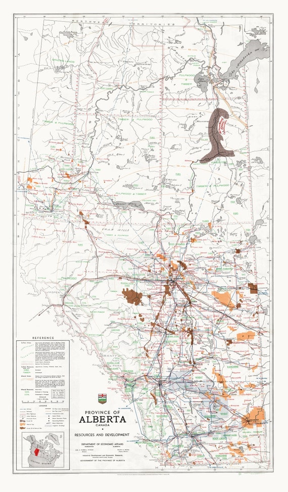 Province of Alberta, Canada resources and development, 1958 , map on heavy cotton canvas, 22x27" approx.
$45.20
Province of Alberta, Canada resources and development, 1958 , map on heavy cotton canvas, 22x27" approx.
$45.20
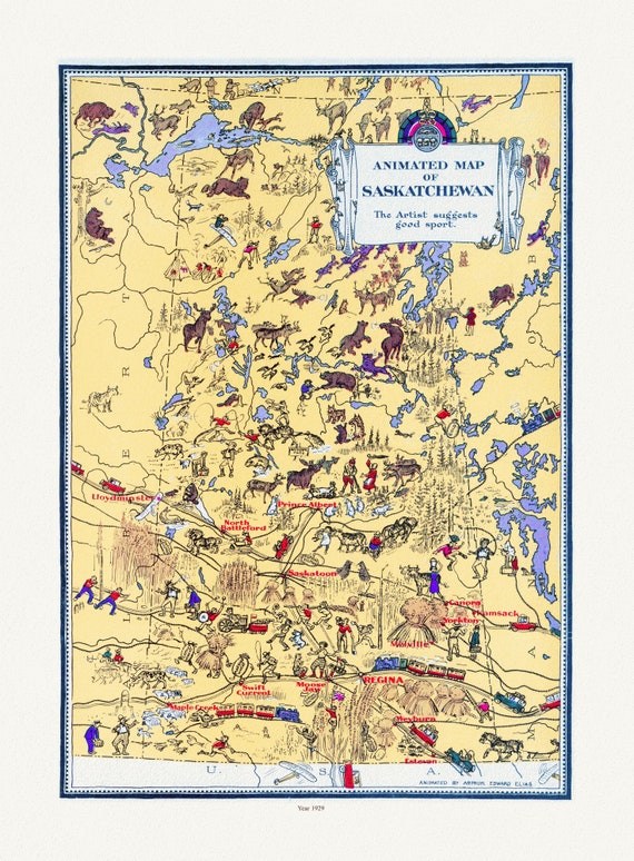 An Animated Map of Saskatchewan, 1929, on heavy cotton canvas, 22x27" approx.
$45.20
An Animated Map of Saskatchewan, 1929, on heavy cotton canvas, 22x27" approx.
$45.20
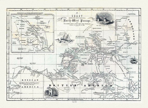 Morse et Colby, Chart Showing the Recent Search for the North-West Passage, 1856 , map on heavy cotton canvas, 22x27" approx.
$45.20
Morse et Colby, Chart Showing the Recent Search for the North-West Passage, 1856 , map on heavy cotton canvas, 22x27" approx.
$45.20
 Johnson, Western Canada, 1912 , map on heavy cotton canvas, 22x27" approx.
$45.20
Johnson, Western Canada, 1912 , map on heavy cotton canvas, 22x27" approx.
$45.20
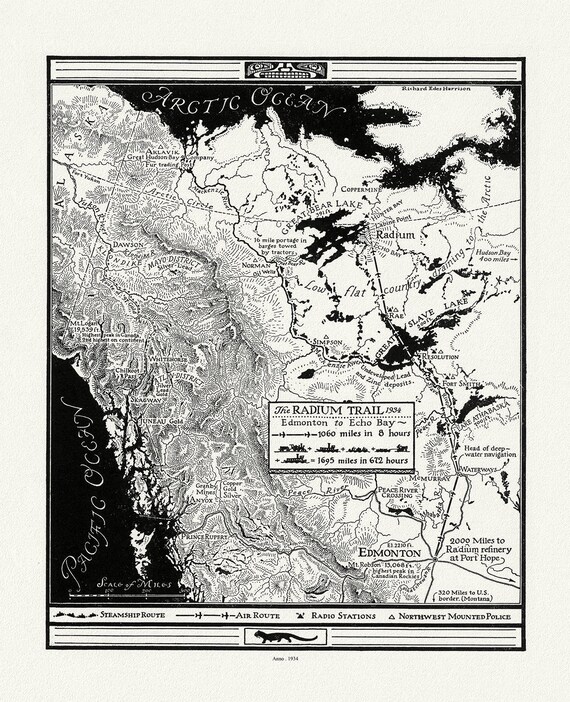 Harrison, The Radium Trail, 1934 , map on heavy cotton canvas, 22x27" approx.
$45.20
Harrison, The Radium Trail, 1934 , map on heavy cotton canvas, 22x27" approx.
$45.20
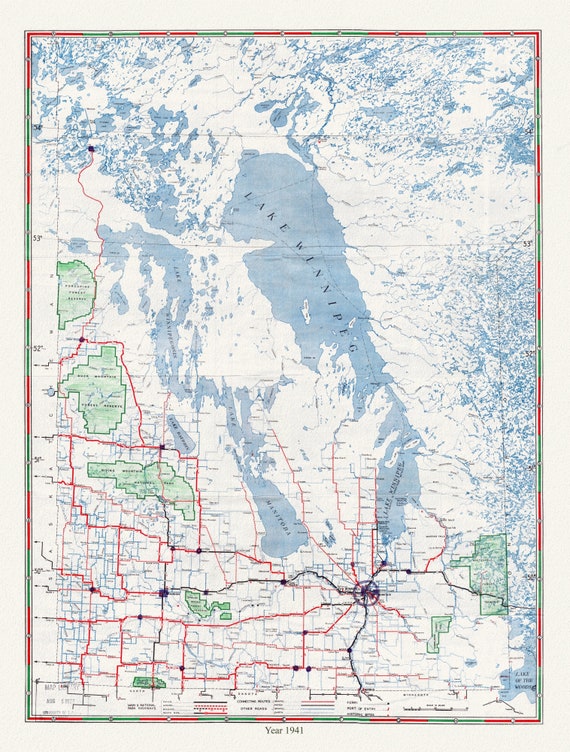 Manitoba Official Highway Map, 1941 , map on heavy cotton canvas, 22x27" approx.
$45.20
Manitoba Official Highway Map, 1941 , map on heavy cotton canvas, 22x27" approx.
$45.20
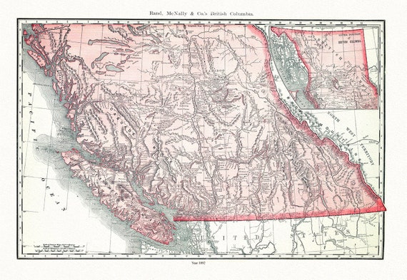 Rand, McNally & Co., British Columbia, 1892, map on heavy cotton canvas, 22x27" approx.
$45.20
Rand, McNally & Co., British Columbia, 1892, map on heavy cotton canvas, 22x27" approx.
$45.20
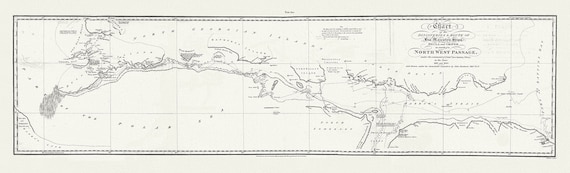 Chart of the Discoveries & Route of his Majesty's Ships Hecla and Griper in search of a North West Passage, 1821 20x66"
$101.70
Chart of the Discoveries & Route of his Majesty's Ships Hecla and Griper in search of a North West Passage, 1821 20x66"
$101.70
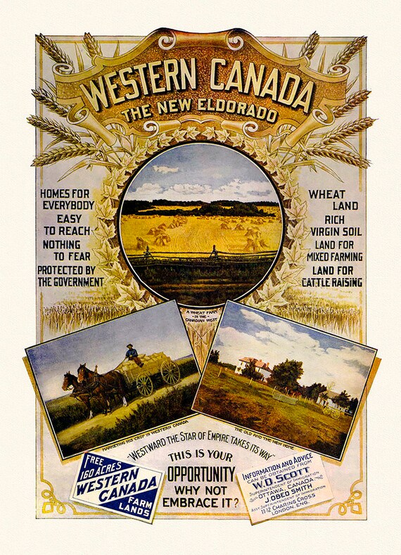 Western Canada, The New Eldorado, vintage poster on heavy cotton canvas, 22x27" approx.
$45.20
Western Canada, The New Eldorado, vintage poster on heavy cotton canvas, 22x27" approx.
$45.20
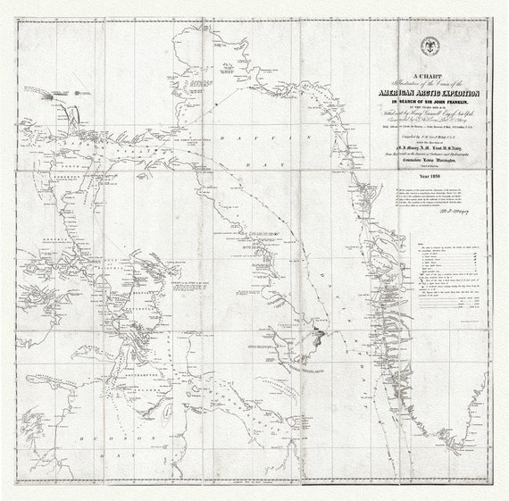 Arctic Expedition in Search of Sir John Franklin, 1850 Ver.2 , map on heavy cotton canvas, 22x27" approx.
$45.20
Arctic Expedition in Search of Sir John Franklin, 1850 Ver.2 , map on heavy cotton canvas, 22x27" approx.
$45.20
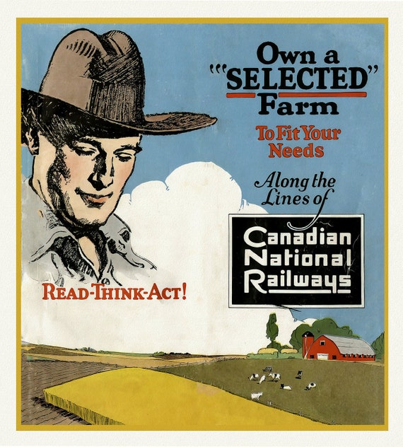 Own a Selected Farm, Canadian National Railways, vintage poster on heavy cotton canvas, 50 x 70 cm, 20 x 25" approx.
$45.20
Own a Selected Farm, Canadian National Railways, vintage poster on heavy cotton canvas, 50 x 70 cm, 20 x 25" approx.
$45.20