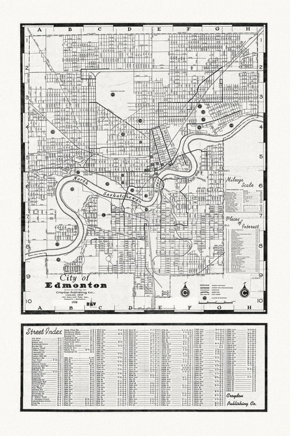
 City of Edmonton, 1950, map on heavy cotton canvas, 20x27" approx.
$45.20
City of Edmonton, 1950, map on heavy cotton canvas, 20x27" approx.
$45.20
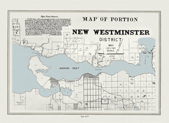 Vancouver, New Westminster District, 1877, map on heavy cotton canvas, 45 x 65 cm, 18 x 24" approx.
$45.20
Vancouver, New Westminster District, 1877, map on heavy cotton canvas, 45 x 65 cm, 18 x 24" approx.
$45.20
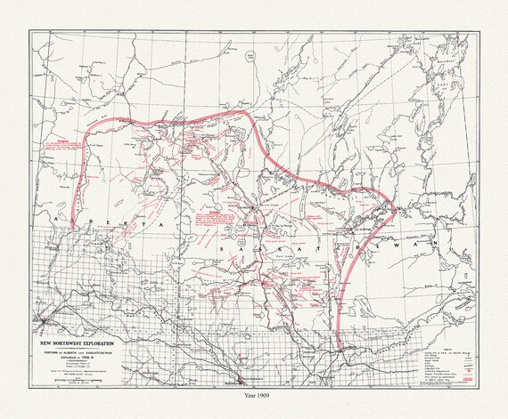 New Northwest Exploration, in Portions of Alberta and Saskatchewan, 1909 , map on durable cotton canvas, 50 x 70 cm, 20 x 25" approx.
$45.20
New Northwest Exploration, in Portions of Alberta and Saskatchewan, 1909 , map on durable cotton canvas, 50 x 70 cm, 20 x 25" approx.
$45.20
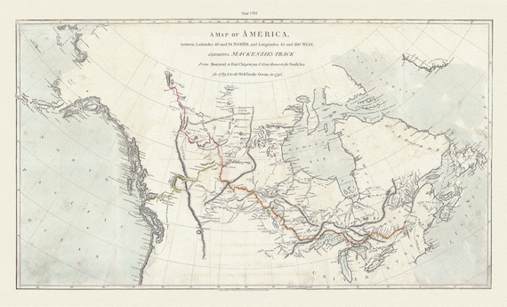 Mackenzie's Track, between latitudes 40 and 70 north, and longitudes 45 and 180 west, 1793 , map on canvas, 50 x 70 cm, 20 x 25" approx.
$45.20
Mackenzie's Track, between latitudes 40 and 70 north, and longitudes 45 and 180 west, 1793 , map on canvas, 50 x 70 cm, 20 x 25" approx.
$45.20
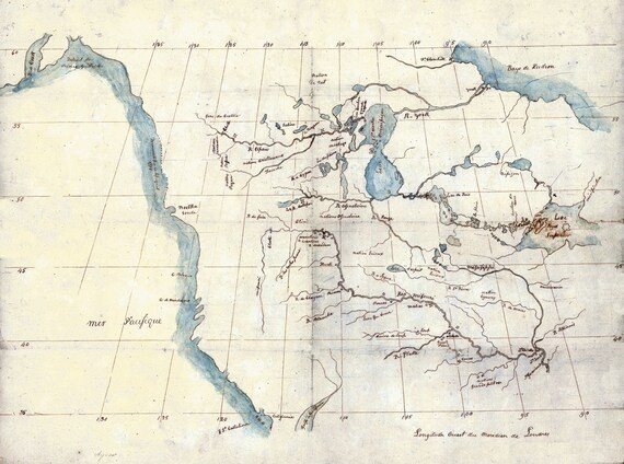 North America from the Mississippi River to the Pacific, between the 35th and 60th parallels, 1790 , on heavy cotton canvas, 22x27" approx.
$45.20
North America from the Mississippi River to the Pacific, between the 35th and 60th parallels, 1790 , on heavy cotton canvas, 22x27" approx.
$45.20
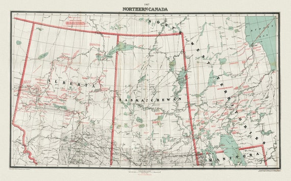 Northern Canada, 1907, map on heavy cotton canvas, 22x27" approx.
$45.20
Northern Canada, 1907, map on heavy cotton canvas, 22x27" approx.
$45.20
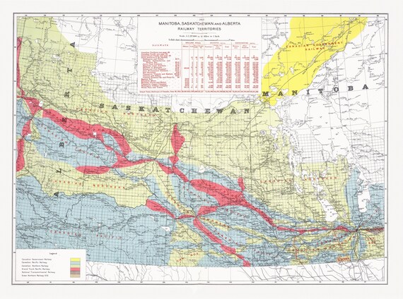 Canada Department of the Interior, Manitoba, Saskatchewan and Alberta railway territories, 1915, map on heavy cotton canvas, 22x27" approx.
$45.20
Canada Department of the Interior, Manitoba, Saskatchewan and Alberta railway territories, 1915, map on heavy cotton canvas, 22x27" approx.
$45.20
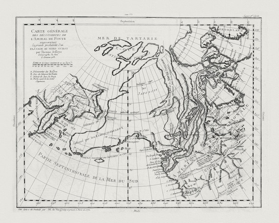 Vaugondy, Carte Générale des Découvertes de l'Amiral de Fonte (Northwest Passage), 1772, map on heavy cotton canvas, 22x27" approx.
$45.20
Vaugondy, Carte Générale des Découvertes de l'Amiral de Fonte (Northwest Passage), 1772, map on heavy cotton canvas, 22x27" approx.
$45.20
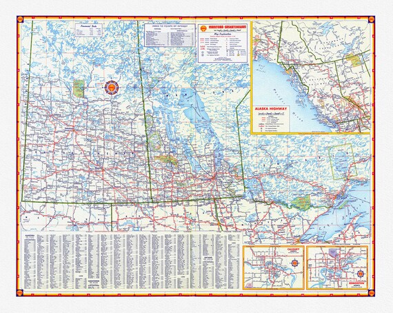 Shell Oil Company-Manitoba, Saskatchewan, Alaska Highway, Calgary, Edmonton, 1956, map on heavy cotton canvas, 22x27" approx.
$45.20
Shell Oil Company-Manitoba, Saskatchewan, Alaska Highway, Calgary, Edmonton, 1956, map on heavy cotton canvas, 22x27" approx.
$45.20
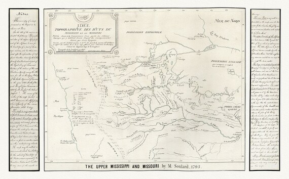 Kohl et Soulard, The Upper Mississippi and Missouri, 1795, map on heavy cotton canvas, 22x27" approx
$45.20
Kohl et Soulard, The Upper Mississippi and Missouri, 1795, map on heavy cotton canvas, 22x27" approx
$45.20
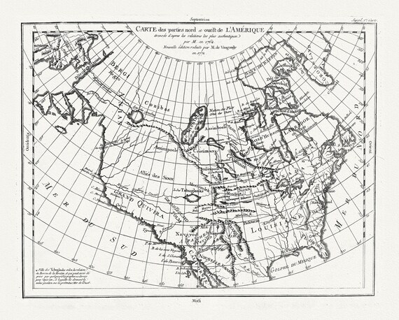 Vaugondy et Diderot, Carte des parties nord et ouest de L'Amerique, 1772 , map on heavy cotton canvas, 22x27" approx.
$45.20
Vaugondy et Diderot, Carte des parties nord et ouest de L'Amerique, 1772 , map on heavy cotton canvas, 22x27" approx.
$45.20
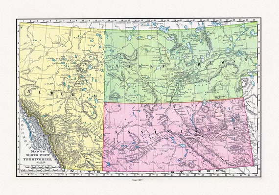 Rand McNally and Company, Alberta, Saskatchewan, 1897, map on heavy cotton canvas, 22x27" approx.
$45.20
Rand McNally and Company, Alberta, Saskatchewan, 1897, map on heavy cotton canvas, 22x27" approx.
$45.20
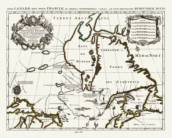 Jaillot, Le Canada ou Partie De La Nouvelle France Dans l'Amerique Septentrionale, 1696 , map on heavy cotton canvas, 22x27" approx.
$45.20
Jaillot, Le Canada ou Partie De La Nouvelle France Dans l'Amerique Septentrionale, 1696 , map on heavy cotton canvas, 22x27" approx.
$45.20
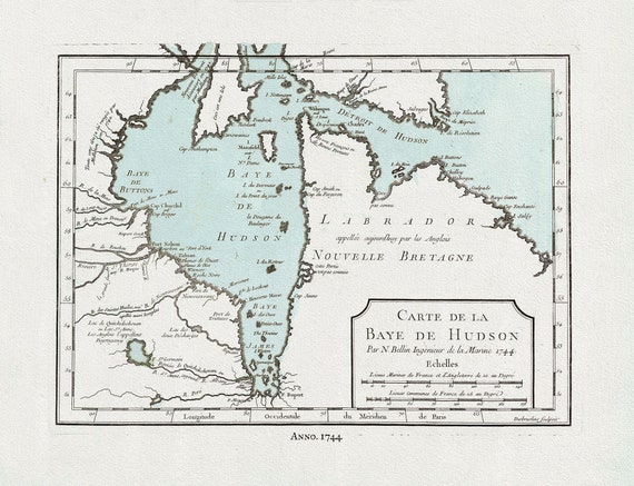 Bellin, Carte de la Bye de Hudson, 1744 Ver. II, map on heavy cotton canvas, 22x27" approx.
$45.20
Bellin, Carte de la Bye de Hudson, 1744 Ver. II, map on heavy cotton canvas, 22x27" approx.
$45.20
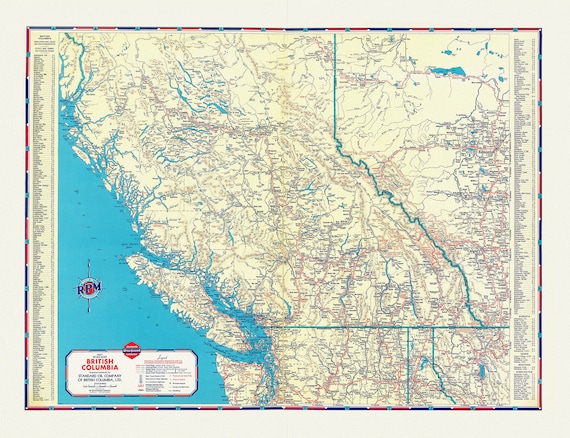 A Road Map of British Columbia, 1937
$45.20
A Road Map of British Columbia, 1937
$45.20