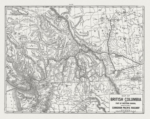
 Map of British Columbia and part of Western Canada,, Canadian Pacific Railways, 1890, map on cotton canvas, 50 x 70cm, 20 x 25" approx.
$37.67
Map of British Columbia and part of Western Canada,, Canadian Pacific Railways, 1890, map on cotton canvas, 50 x 70cm, 20 x 25" approx.
$37.67
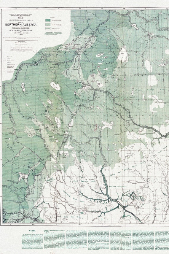 Northern Alberta, Map showing wooded and prairie tracts, etc.,by J.B. Tyrrell, 1884 , map on heavy cotton canvas, 20x27" approx.
$45.20
Northern Alberta, Map showing wooded and prairie tracts, etc.,by J.B. Tyrrell, 1884 , map on heavy cotton canvas, 20x27" approx.
$45.20
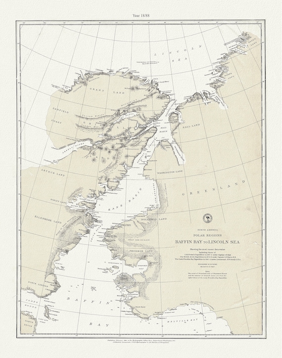 North America polar regions Baffin Bay to Lincoln Sea, showing the most recent discoveries and British Arctic Expedition in 1875-6.,1885
$45.20
North America polar regions Baffin Bay to Lincoln Sea, showing the most recent discoveries and British Arctic Expedition in 1875-6.,1885
$45.20
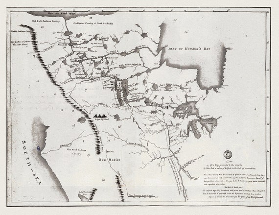
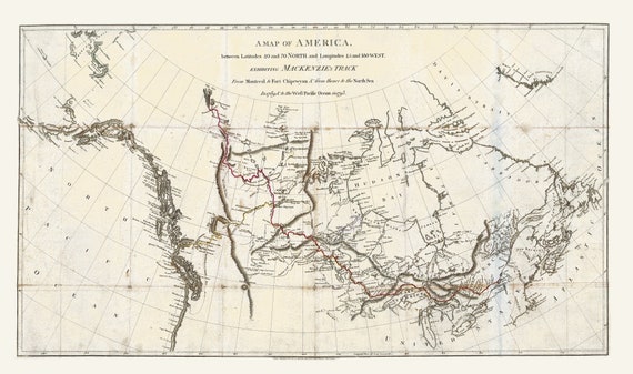 Mackenzie's Track from Montreal to Fort Chipewyan, 1793, map on heavy cotton canvas, 22x27" approx.
$45.20
Mackenzie's Track from Montreal to Fort Chipewyan, 1793, map on heavy cotton canvas, 22x27" approx.
$45.20
 Map of the Grand Trunk Pacific Railway, also showing lines of the Grand Trunk Railway System, 1906 Western Section, 22x27" cotton canvas
$45.20
Map of the Grand Trunk Pacific Railway, also showing lines of the Grand Trunk Railway System, 1906 Western Section, 22x27" cotton canvas
$45.20
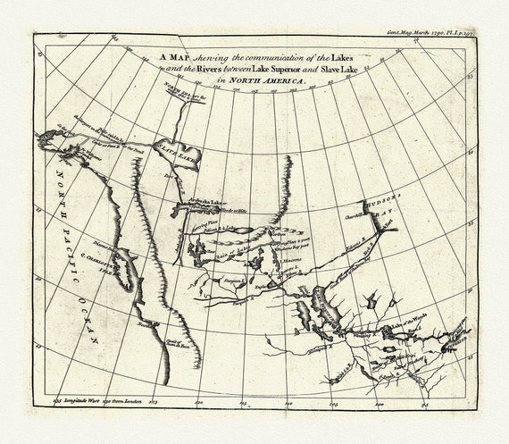
 A map shewing the communication of the lakes and the rivers between Lake Superior and Slave Lake in North America, 1785 on canvas, 22x27"
$45.20
A map shewing the communication of the lakes and the rivers between Lake Superior and Slave Lake in North America, 1785 on canvas, 22x27"
$45.20
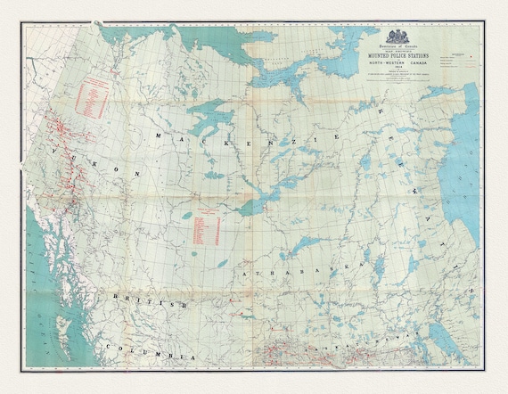 Map showing Mounted Police stations in North-Western Canada, 1904 , map on heavy cotton canvas, 22x27" approx.
$45.20
Map showing Mounted Police stations in North-Western Canada, 1904 , map on heavy cotton canvas, 22x27" approx.
$45.20
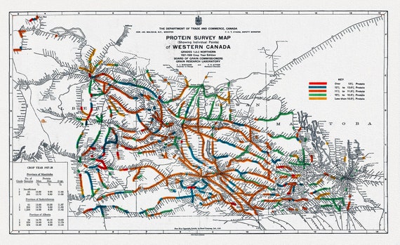 Map of Western Canada showing the protein content of red spring wheat, 1928, map on heavy cotton canvas, 22x27" approx.
$45.20
Map of Western Canada showing the protein content of red spring wheat, 1928, map on heavy cotton canvas, 22x27" approx.
$45.20
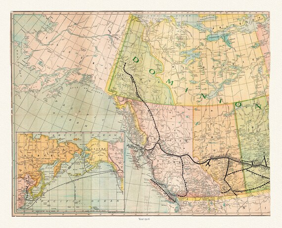
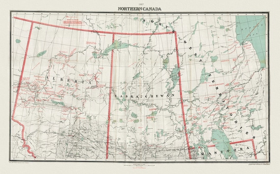 Northern Canada, 1907, map on heavy cotton canvas, 22x27" approx.
$45.20
Northern Canada, 1907, map on heavy cotton canvas, 22x27" approx.
$45.20
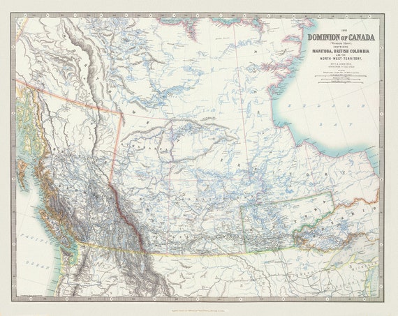 Johnston, Western Canada, 1893, map on heavy cotton canvas, 22x27" approx.
$45.20
Johnston, Western Canada, 1893, map on heavy cotton canvas, 22x27" approx.
$45.20
 A map shewing the communication of the lakes and rivers between Lake Superior and Slave Lake in N. America, 1790, on canvas, 22x27" approx.
$45.20
A map shewing the communication of the lakes and rivers between Lake Superior and Slave Lake in N. America, 1790, on canvas, 22x27" approx.
$45.20
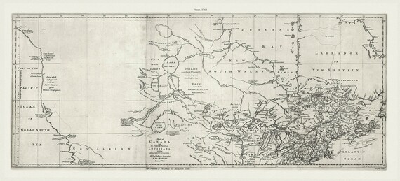 Jefferys, A map of Canada and the north part of Louisiana with the adjacent countrys, 1768 Ver. 2, on heavy cotton canvas, 22x27" approx.
$45.20
Jefferys, A map of Canada and the north part of Louisiana with the adjacent countrys, 1768 Ver. 2, on heavy cotton canvas, 22x27" approx.
$45.20
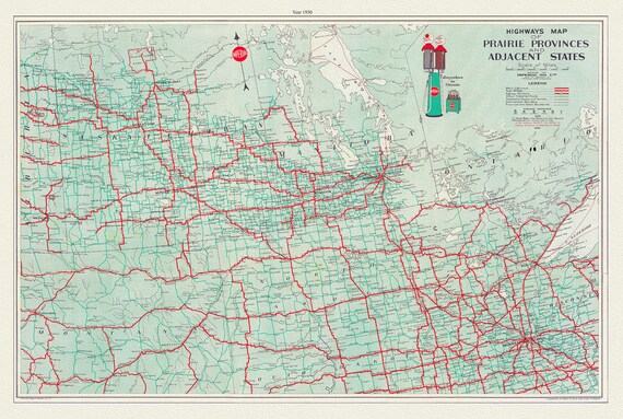 Highways Map of Prairie Provinces and Adjacent States, 1930, map on heavy cotton canvas, 22x27" approx.
$45.20
Highways Map of Prairie Provinces and Adjacent States, 1930, map on heavy cotton canvas, 22x27" approx.
$45.20
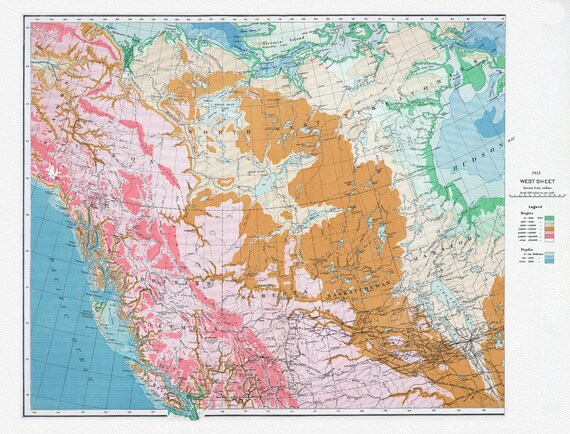 Canada Department of the Interior, West sheet, Physical map of the Dominion of Canada, 1915 , map on heavy cotton canvas, 22x27" approx.
$45.20
Canada Department of the Interior, West sheet, Physical map of the Dominion of Canada, 1915 , map on heavy cotton canvas, 22x27" approx.
$45.20
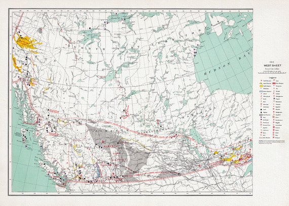 Canada Department of the Interior, West sheet. Mineral map of the Dominion of Canada, 1915, map on heavy cotton canvas, 22x27" approx.
$45.20
Canada Department of the Interior, West sheet. Mineral map of the Dominion of Canada, 1915, map on heavy cotton canvas, 22x27" approx.
$45.20
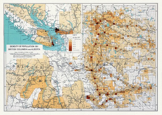 Canada Department of the Interior, Density of population 1911, British Columbia and Alberta, 1915, on heavy cotton canvas, 22x27" approx.
$45.20
Canada Department of the Interior, Density of population 1911, British Columbia and Alberta, 1915, on heavy cotton canvas, 22x27" approx.
$45.20
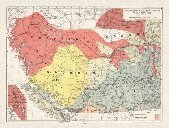 Canada Department of the Interior, Alberta, British Columbia and Yukon Railway Territories, 1915, on heavy cotton canvas, 22x27" approx.
$45.20
Canada Department of the Interior, Alberta, British Columbia and Yukon Railway Territories, 1915, on heavy cotton canvas, 22x27" approx.
$45.20
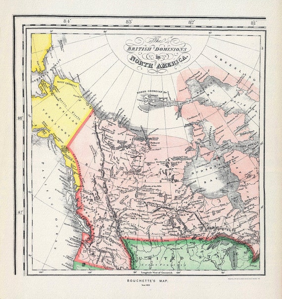 Bouchette's British Dominions in North America (portion), 1831
$45.20
Bouchette's British Dominions in North America (portion), 1831
$45.20
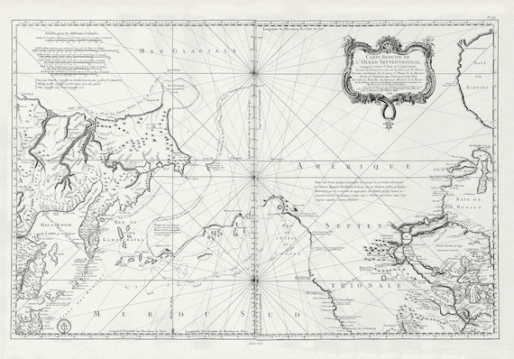 Bellin, L'hydrographie françoise, Pacific NorthWest, 1766, map on heavy cotton canvas, 22x27" approx.
$45.20
Bellin, L'hydrographie françoise, Pacific NorthWest, 1766, map on heavy cotton canvas, 22x27" approx.
$45.20
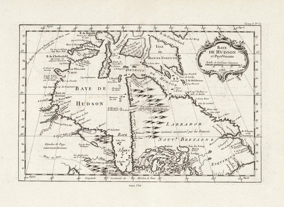 Bellin, Baye De Hudson et Pays Voisins, 1764 , map on heavy cotton canvas, 22x27" approx.
$45.20
Bellin, Baye De Hudson et Pays Voisins, 1764 , map on heavy cotton canvas, 22x27" approx.
$45.20