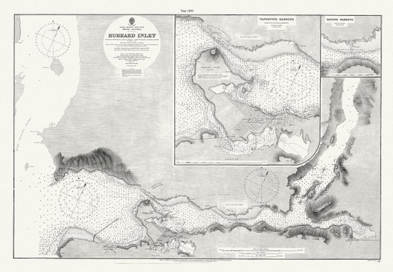
 Vancouver, Burrard Inlet, 1893, map on heavy cotton canvas, 45 x 65 cm, 18 x 24" approx.
$45.20
Vancouver, Burrard Inlet, 1893, map on heavy cotton canvas, 45 x 65 cm, 18 x 24" approx.
$45.20
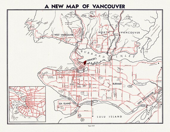 Vancouver, A New Map, by Spencer's, 1941, map on heavy cotton canvas, 45 x 65 cm, 18 x 24" approx.
$45.20
Vancouver, A New Map, by Spencer's, 1941, map on heavy cotton canvas, 45 x 65 cm, 18 x 24" approx.
$45.20
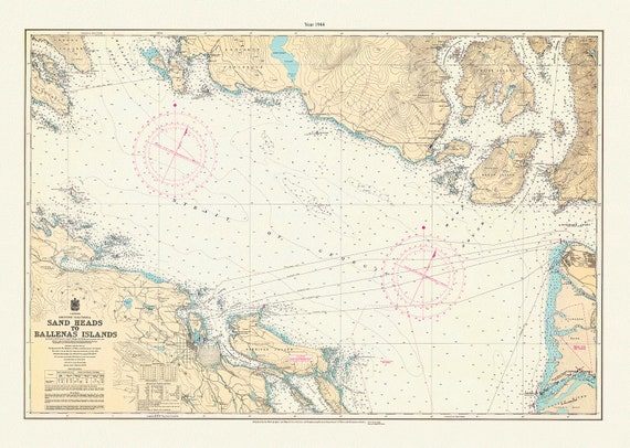 Vancouver Island, Sand Heads to Ballenas Islands, 1944, map on heavy cotton canvas, 45 x 65 cm, 18 x 24" approx.
$45.20
Vancouver Island, Sand Heads to Ballenas Islands, 1944, map on heavy cotton canvas, 45 x 65 cm, 18 x 24" approx.
$45.20
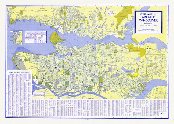 Greater Vancouver, A Wall Map, 1960 , map on heavy cotton canvas, 45 x 65 cm, 18 x 24" approx.
$45.20
Greater Vancouver, A Wall Map, 1960 , map on heavy cotton canvas, 45 x 65 cm, 18 x 24" approx.
$45.20
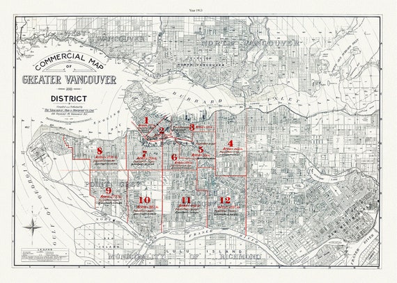 Greater Vancouver, A Commercial Map, 1913, map on heavy cotton canvas, 45 x 65 cm, 18 x 24" approx.
$45.20
Greater Vancouver, A Commercial Map, 1913, map on heavy cotton canvas, 45 x 65 cm, 18 x 24" approx.
$45.20
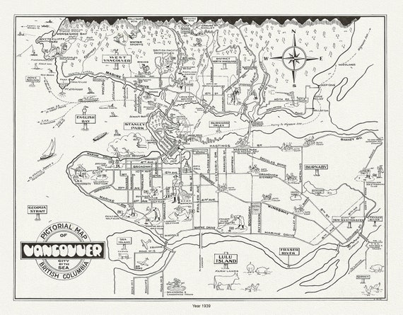 Vancouver, City by the Sea, A Pictorial Map, 1939 , on heavy cotton canvas, 45 x 65 cm, 18 x 24" approx.
$45.20
Vancouver, City by the Sea, A Pictorial Map, 1939 , on heavy cotton canvas, 45 x 65 cm, 18 x 24" approx.
$45.20
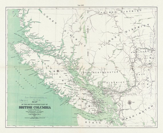 Map of the south-western part of British Columbia, Vernon, 1892, map on durable cotton canvas, 50 x 70 cm, 20 x 25" approx.
$45.20
Map of the south-western part of British Columbia, Vernon, 1892, map on durable cotton canvas, 50 x 70 cm, 20 x 25" approx.
$45.20
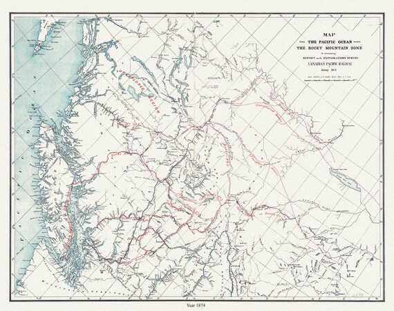 Map from the Pacific Ocean across the Rocky Mountain zone to accompany report on the exploratory survey.CPR.1874, 20x25" approx.
$45.20
Map from the Pacific Ocean across the Rocky Mountain zone to accompany report on the exploratory survey.CPR.1874, 20x25" approx.
$45.20
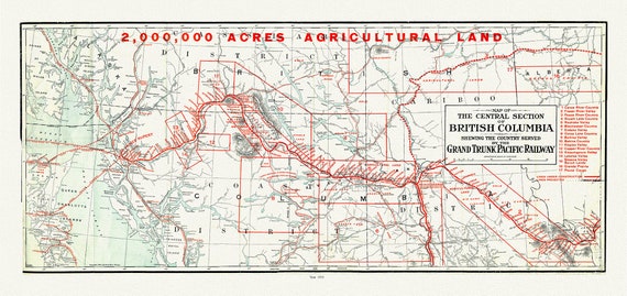 Map of the central section of British Columbia shewing the county served by the Grand Trunk Pacific Railway, 1911, 20 x 25" approx.
$45.20
Map of the central section of British Columbia shewing the county served by the Grand Trunk Pacific Railway, 1911, 20 x 25" approx.
$45.20
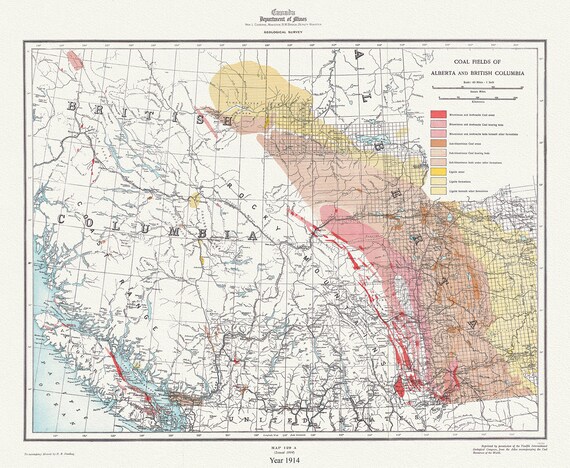 Coal fields of Alberta and British Columbia, 1914, map on durable cotton canvas, 50 x 70 cm, 20 x 25" approx.
$45.20
Coal fields of Alberta and British Columbia, 1914, map on durable cotton canvas, 50 x 70 cm, 20 x 25" approx.
$45.20
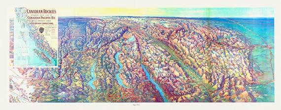 Canadian Rockies showing main line of Canadian Pacific Ry. with branch lines & steamship connections, 1915, map on canvas, 20 x 25" approx.
$45.20
Canadian Rockies showing main line of Canadian Pacific Ry. with branch lines & steamship connections, 1915, map on canvas, 20 x 25" approx.
$45.20
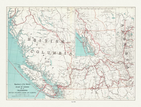 British Columbia, Yukon and Alberta, Telegraphs, 1906, map on durable cotton canvas, 50 x 70 cm, 20 x 25" approx.
$45.20
British Columbia, Yukon and Alberta, Telegraphs, 1906, map on durable cotton canvas, 50 x 70 cm, 20 x 25" approx.
$45.20
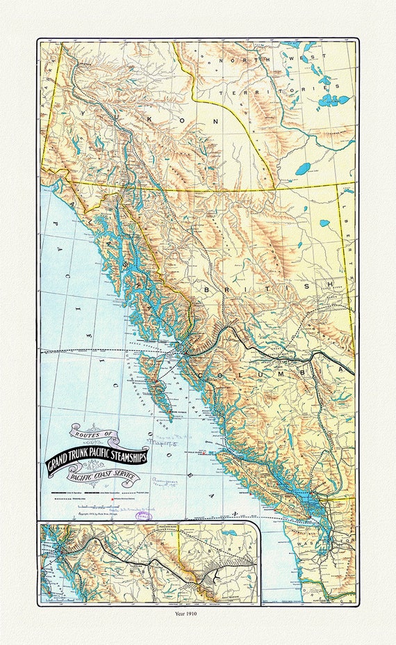 Routes of Grand Trunk Pacific Steamships Pacific coast service, Poole Bros. auths., 1910, map on durable cotton canvas, 20 x 25" approx.
$45.20
Routes of Grand Trunk Pacific Steamships Pacific coast service, Poole Bros. auths., 1910, map on durable cotton canvas, 20 x 25" approx.
$45.20
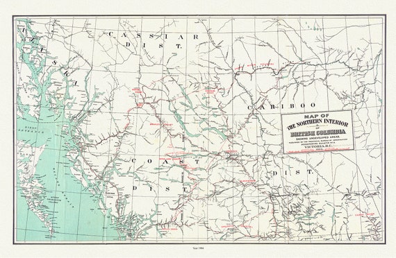 Map of the northern interior of British Columbia shewing undeveloped areas, 1904, map on durable cotton canvas, 50 x 70 cm, 20 x 25" approx.
$45.20
Map of the northern interior of British Columbia shewing undeveloped areas, 1904, map on durable cotton canvas, 50 x 70 cm, 20 x 25" approx.
$45.20
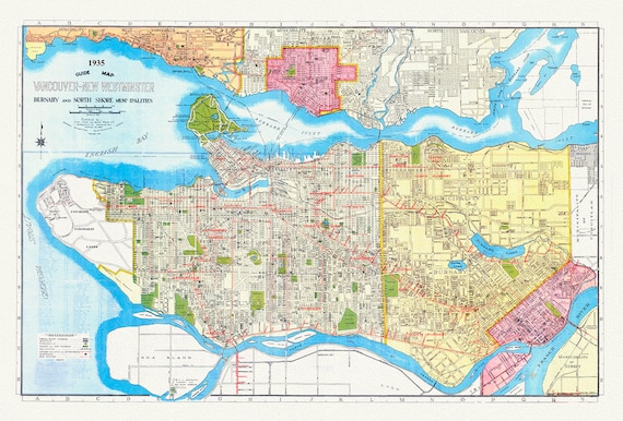 Vancouver, New Westminster, Burnaby and North Shore municipalities. A Guide map, 1935, on heavy cotton canvas, 45 x 65 cm, 18 x 24" approx.
$45.20
Vancouver, New Westminster, Burnaby and North Shore municipalities. A Guide map, 1935, on heavy cotton canvas, 45 x 65 cm, 18 x 24" approx.
$45.20
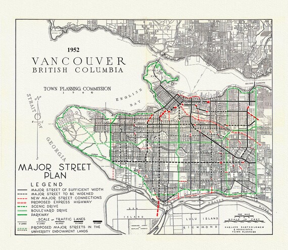 Vancouver, Major Street Plan, 1952 , map on heavy cotton canvas, 45 x 65 cm, 18 x 24" approx.
$45.20
Vancouver, Major Street Plan, 1952 , map on heavy cotton canvas, 45 x 65 cm, 18 x 24" approx.
$45.20
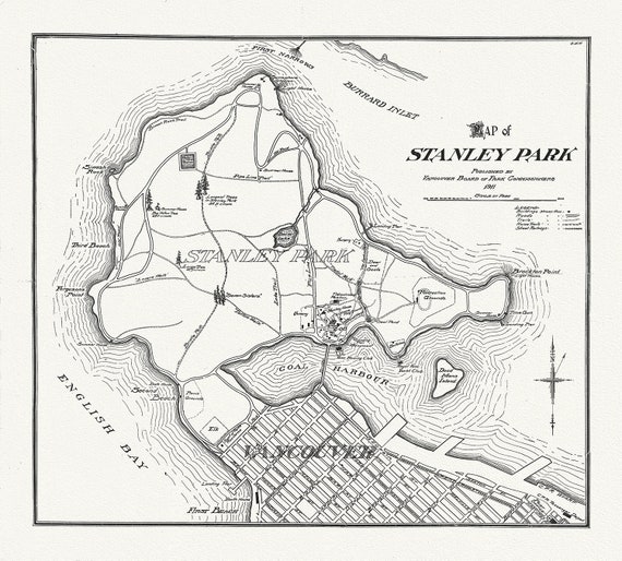 Vancouver, Map of Stanley Park, 1916, map on heavy cotton canvas, 45 x 65 cm, 18 x 24" approx.
$45.20
Vancouver, Map of Stanley Park, 1916, map on heavy cotton canvas, 45 x 65 cm, 18 x 24" approx.
$45.20
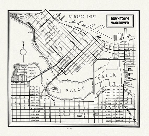 Vancouver, Downtown, 1958 , map on heavy cotton canvas, 45 x 65 cm, 18 x 24" approx.
$45.20
Vancouver, Downtown, 1958 , map on heavy cotton canvas, 45 x 65 cm, 18 x 24" approx.
$45.20
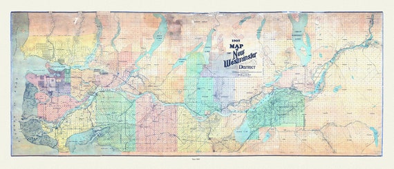 Map of New Westminster District, 1905 , map on heavy cotton canvas, 45 x 65 cm, 18 x 24" approx.
$45.20
Map of New Westminster District, 1905 , map on heavy cotton canvas, 45 x 65 cm, 18 x 24" approx.
$45.20
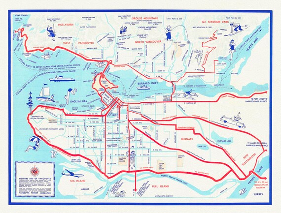 Vancouver, A Tourist Map of the City , map on heavy cotton canvas, 45 x 65 cm, 18 x 24" approx.
$45.20
Vancouver, A Tourist Map of the City , map on heavy cotton canvas, 45 x 65 cm, 18 x 24" approx.
$45.20