 Rand McNally & Company, Commercial Atlas, Newfoundland, 1924, Printed on Heavy Natural Cotton Canvas, approx. 20x24"
$41.72
Rand McNally & Company, Commercial Atlas, Newfoundland, 1924, Printed on Heavy Natural Cotton Canvas, approx. 20x24"
$41.72
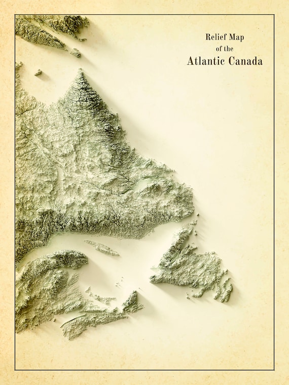 Relief Map of Atlantic Canada, 1924 Ver. IV , map on heavy cotton canvas, 50 x 70 cm, 20 x 25" approx.
$45.52
Relief Map of Atlantic Canada, 1924 Ver. IV , map on heavy cotton canvas, 50 x 70 cm, 20 x 25" approx.
$45.52
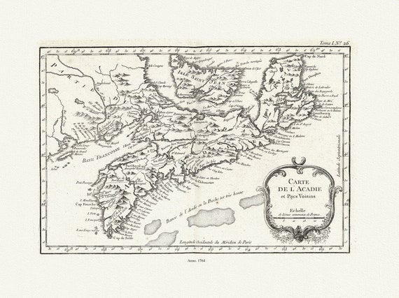 Bellin, Carte De L'Acadie et Pays Voisins, 1764 Ver. II , map on durable cotton canvas, 50 x 70 cm, 20 x 25" approx.
$45.52
Bellin, Carte De L'Acadie et Pays Voisins, 1764 Ver. II , map on durable cotton canvas, 50 x 70 cm, 20 x 25" approx.
$45.52
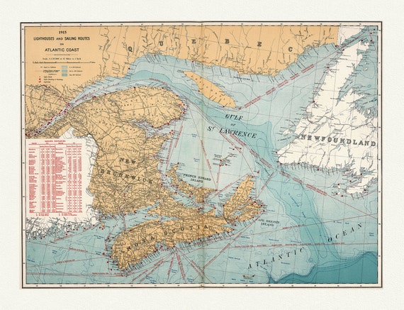 Canada Department of the Interior: Lighthouses and sailing routes on Atlantic coast, 1915 , map on heavy cotton canvas, 20 x 25" approx.
$45.52
Canada Department of the Interior: Lighthouses and sailing routes on Atlantic coast, 1915 , map on heavy cotton canvas, 20 x 25" approx.
$45.52
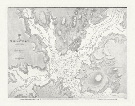 Nautical Chart, Prince Edward Island, Charlottetown Harbour, 1861 , map on heavy cotton canvas, 20 x 25" approx.
$45.52
Nautical Chart, Prince Edward Island, Charlottetown Harbour, 1861 , map on heavy cotton canvas, 20 x 25" approx.
$45.52
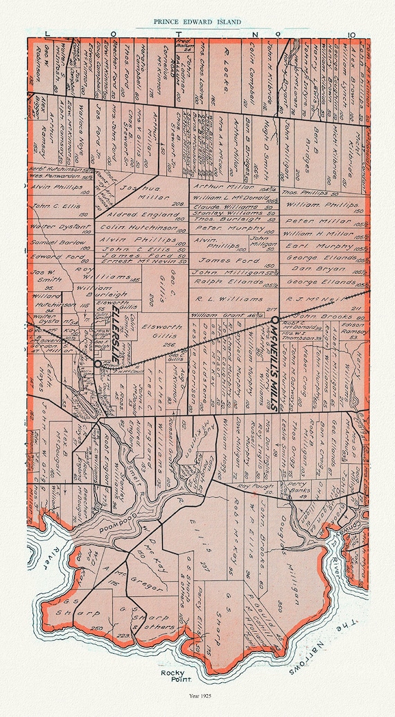 PEI: Map 12, Prince County, Prince Edward Island, 1925 , vintage map reprinted on durable cotton canvas, 50 x 70 cm or 20x25" approx.
$45.52
PEI: Map 12, Prince County, Prince Edward Island, 1925 , vintage map reprinted on durable cotton canvas, 50 x 70 cm or 20x25" approx.
$45.52
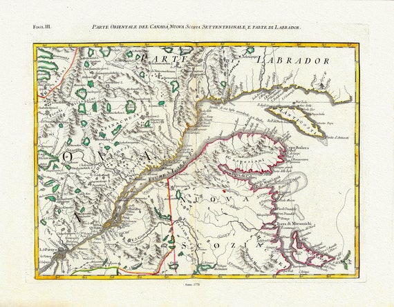 Mitchell, Rayanal et Zatta,Parte Orientale del Canada, Nuova Scozia Settentrionale, e Parte di Labrador, 1778, on canvas, 22x27"
$45.52
Mitchell, Rayanal et Zatta,Parte Orientale del Canada, Nuova Scozia Settentrionale, e Parte di Labrador, 1778, on canvas, 22x27"
$45.52
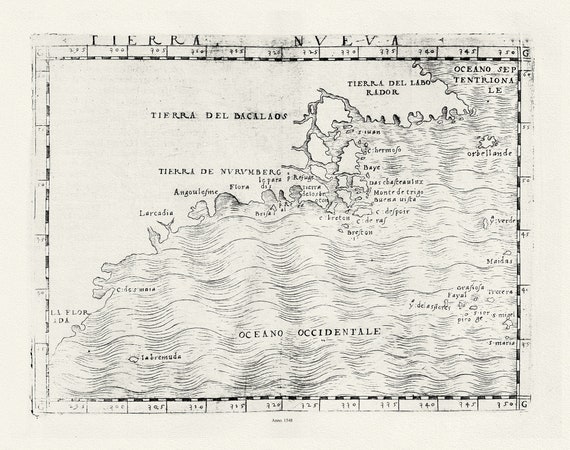 Ptolemy, Gastaldi et Mattioli, Tierra Nueva, 1548 , map on heavy cotton canvas, 22x27" approx.
$45.52
Ptolemy, Gastaldi et Mattioli, Tierra Nueva, 1548 , map on heavy cotton canvas, 22x27" approx.
$45.52
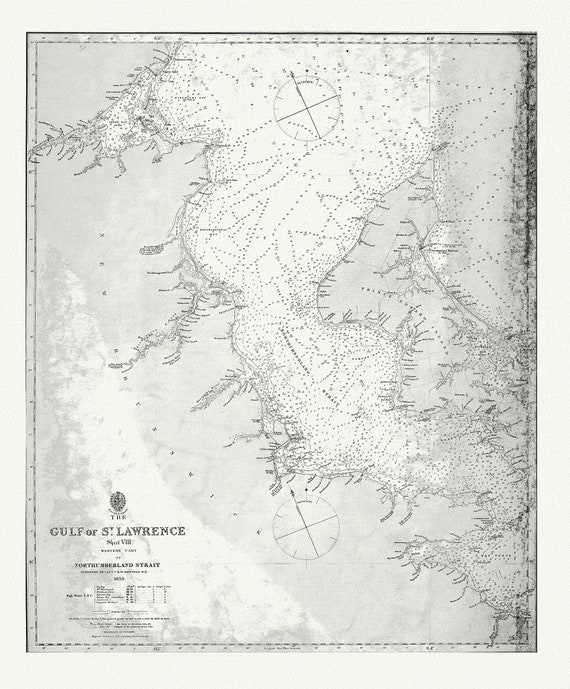 Nautical Chart, The Gulf of St. Lawrence, Western Part of Northumberland Strait, 1839, map on heavy cotton canvas, 20 x 25" approx.
$45.52
Nautical Chart, The Gulf of St. Lawrence, Western Part of Northumberland Strait, 1839, map on heavy cotton canvas, 20 x 25" approx.
$45.52
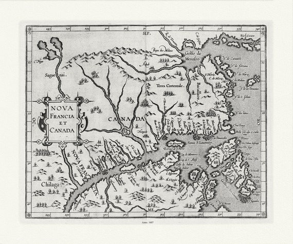 Wytfliet, Corneille, Nova Francia et Canada, 1607 , map on heavy cotton canvas, 22x27" approx.
$45.52
Wytfliet, Corneille, Nova Francia et Canada, 1607 , map on heavy cotton canvas, 22x27" approx.
$45.52
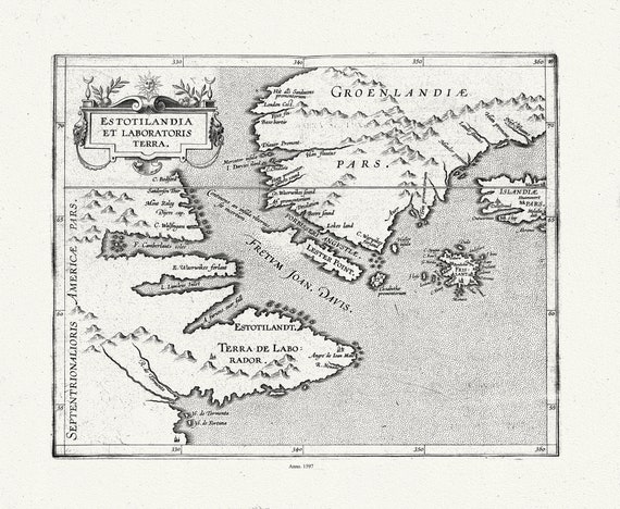 Wytfliet, Corneille, Estotilandia et Laboratoris Terra, ( East Coast Canada), 1597, map on heavy cotton canvas, 22x27" approx.
$45.52
Wytfliet, Corneille, Estotilandia et Laboratoris Terra, ( East Coast Canada), 1597, map on heavy cotton canvas, 22x27" approx.
$45.52
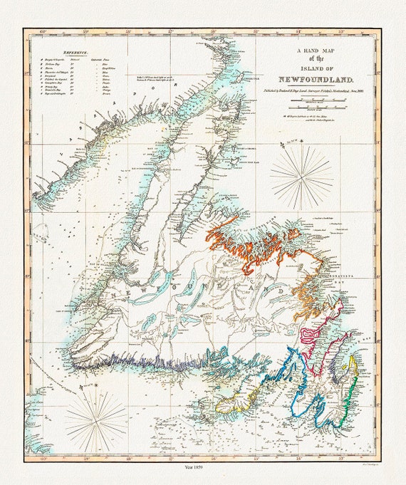 A Hand Map of the Island of Newfoundland, Findlay auth.,1859 , map on heavy cotton canvas, 45 x 65 cm, 18 x 24" approx.
$45.52
A Hand Map of the Island of Newfoundland, Findlay auth.,1859 , map on heavy cotton canvas, 45 x 65 cm, 18 x 24" approx.
$45.52
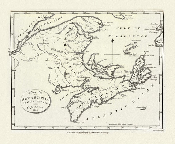 A New Map of Nova Scotia, New Brunswick and Cape Breton, 1794, on heavy cotton canvas, approx. 18x27"
$45.52
A New Map of Nova Scotia, New Brunswick and Cape Breton, 1794, on heavy cotton canvas, approx. 18x27"
$45.52
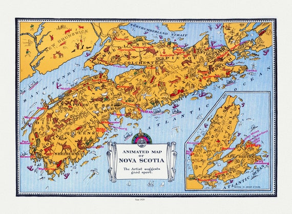 An Animated Map of Nova Scotia, 1929, on heavy cotton canvas, 22x27" approx.
$45.52
An Animated Map of Nova Scotia, 1929, on heavy cotton canvas, 22x27" approx.
$45.52
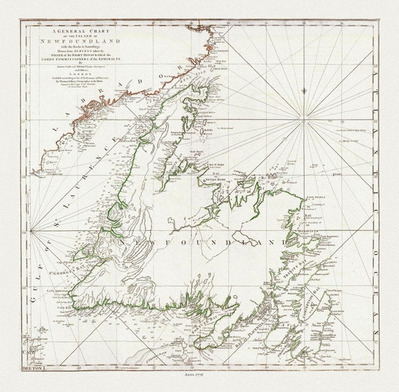 A General Chart Of The Island Of Newfoundland, 1776, Author: Jefferys, on heavy cotton canvas, 20x24" approx.
$41.72
A General Chart Of The Island Of Newfoundland, 1776, Author: Jefferys, on heavy cotton canvas, 20x24" approx.
$41.72
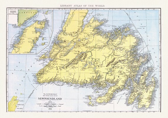 Newfoundland,1912, Rand McNally and Company
$45.52
Newfoundland,1912, Rand McNally and Company
$45.52
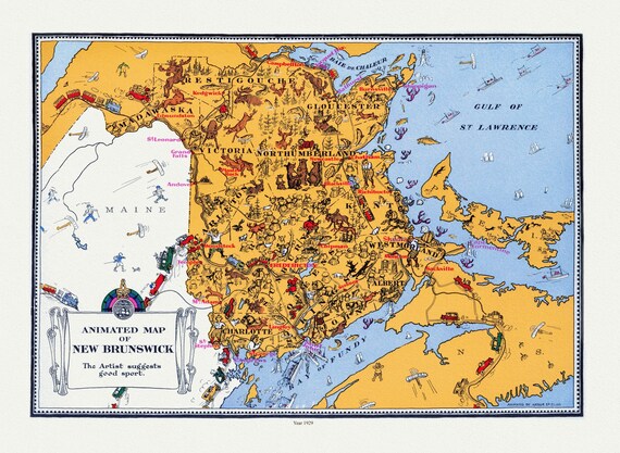 An Animated Map of New Brunswick, 1929, on heavy cotton canvas, 22x27" approx.
$45.52
An Animated Map of New Brunswick, 1929, on heavy cotton canvas, 22x27" approx.
$45.52
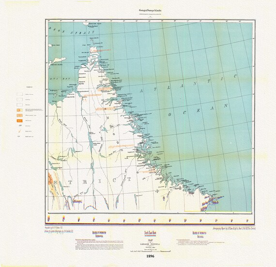 Labrador Peninsula, NE Sheet, 1896, map on heavy cotton canvas, 45 x 65 cm, 18 x 24" approx.
$45.52
Labrador Peninsula, NE Sheet, 1896, map on heavy cotton canvas, 45 x 65 cm, 18 x 24" approx.
$45.52
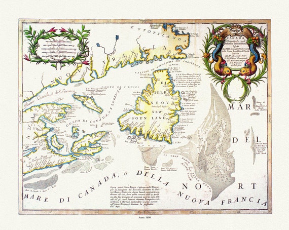 Coronelli, Canada Orientale Nell' America Settentrionale, 1690, map on heavy cotton canvas, 22x27" approx.
$45.52
Coronelli, Canada Orientale Nell' America Settentrionale, 1690, map on heavy cotton canvas, 22x27" approx.
$45.52
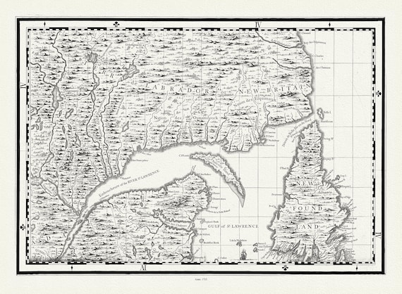 Part of a Map of the British Empire in America, Popple auth., 1733E, map on heavy cotton canvas, 50 x 70 cm, 20 x 25" approx.
$45.52
Part of a Map of the British Empire in America, Popple auth., 1733E, map on heavy cotton canvas, 50 x 70 cm, 20 x 25" approx.
$45.52