 William Faden, A Plan of the island of St. John, 1777, Map on Heavy Canvas, approx. 20x24"
$45.52
William Faden, A Plan of the island of St. John, 1777, Map on Heavy Canvas, approx. 20x24"
$45.52
 Zatta, Zuiliani, Novelli et Pitteri, Le isole di Terra Nuova e Capo Breton, 1778, Map of Newfoundland on heavy canvas, 20x24" approx.
$45.52
Zatta, Zuiliani, Novelli et Pitteri, Le isole di Terra Nuova e Capo Breton, 1778, Map of Newfoundland on heavy canvas, 20x24" approx.
$45.52
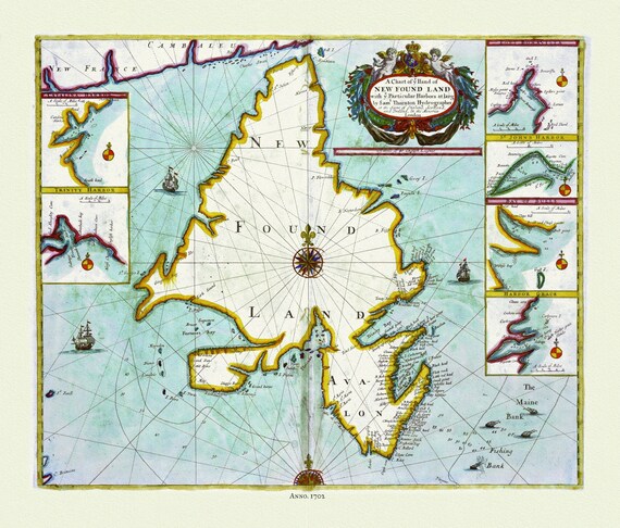 Thornton, A chart NEW FOUND LAND with particular harbors , 1702 , Approx. 20x24", on heavy canvas
$45.52
Thornton, A chart NEW FOUND LAND with particular harbors , 1702 , Approx. 20x24", on heavy canvas
$45.52
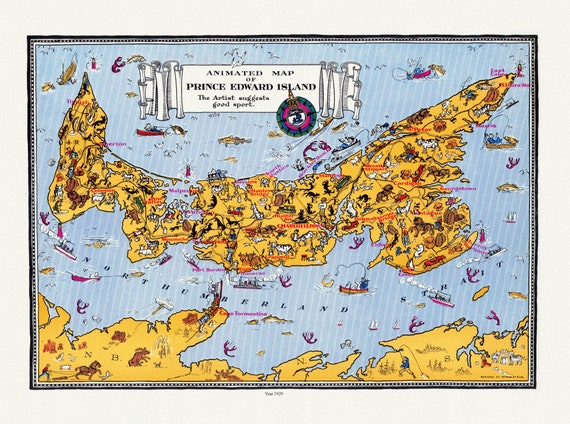 An Animated Map of Prince Edward Island, 1929, on heavy cotton canvas, 22x27" approx.
$45.52
An Animated Map of Prince Edward Island, 1929, on heavy cotton canvas, 22x27" approx.
$45.52
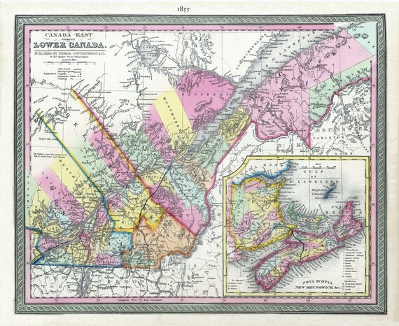 Lower Canada, 1855, Mitchell auth., map on heavy cotton canvas, 50 x 70cm, 20 x 25" approx.
$45.52
Lower Canada, 1855, Mitchell auth., map on heavy cotton canvas, 50 x 70cm, 20 x 25" approx.
$45.52
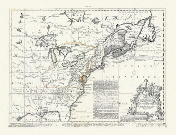
 Part of North America,containing Canada, the north parts of New England and New York, with Nova Scotia and Newfoundland,1777, canvas, 20x25"
$45.52
Part of North America,containing Canada, the north parts of New England and New York, with Nova Scotia and Newfoundland,1777, canvas, 20x25"
$45.52
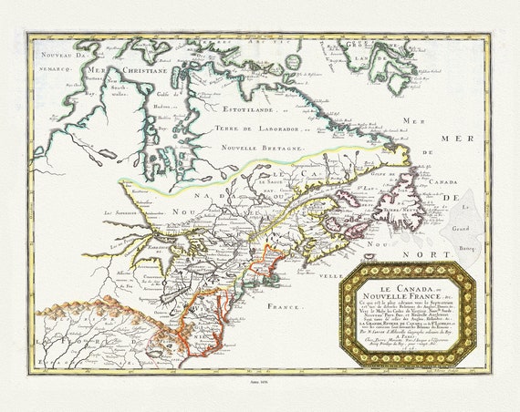
 Nova Francia et Canada, 1597, , map on heavy cotton canvas, 50 x 70cm, 20 x 27" approx.
$45.52
Nova Francia et Canada, 1597, , map on heavy cotton canvas, 50 x 70cm, 20 x 27" approx.
$45.52
 Mappa dell' America Settentrionale et i paesi e che hanno dato motivo alla guerra presente fra la Francia e l'Inghilterra, 1758, Bellin,
$45.52
Mappa dell' America Settentrionale et i paesi e che hanno dato motivo alla guerra presente fra la Francia e l'Inghilterra, 1758, Bellin,
$45.52
 E Newfoundland, 1898 , map on heavy cotton canvas, 45 x 65 cm, 18 x 24" approx.
$45.52
E Newfoundland, 1898 , map on heavy cotton canvas, 45 x 65 cm, 18 x 24" approx.
$45.52
 Nouvelle France, qui de diverses Relations des Anglois, Danois. Vers le Midy les Costes de Virginie, Nouvlle Suede, Nouveau Pays Bas, 1656,
$45.52
Nouvelle France, qui de diverses Relations des Anglois, Danois. Vers le Midy les Costes de Virginie, Nouvlle Suede, Nouveau Pays Bas, 1656,
$45.52
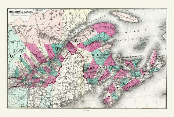 Dominion of Canada. Eastern Sheet. 1878, map on heavy cotton canvas, 50x70cm (20 x 25") approx.
$45.52
Dominion of Canada. Eastern Sheet. 1878, map on heavy cotton canvas, 50x70cm (20 x 25") approx.
$45.52
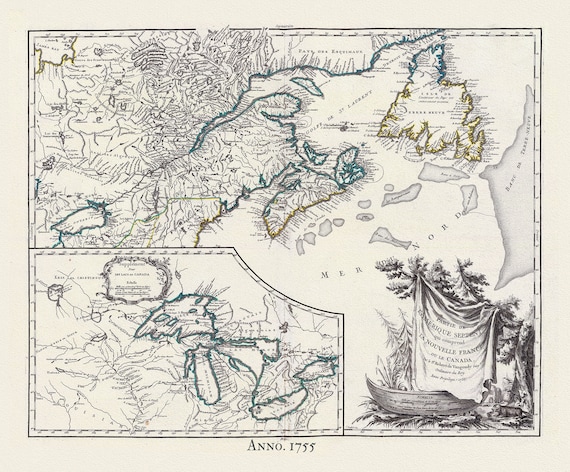 Canada, Nouvelles France,1755, Vaugondy auth., map on heavy cotton canvas, 50x70cm (20 x 25") approx.
$45.52
Canada, Nouvelles France,1755, Vaugondy auth., map on heavy cotton canvas, 50x70cm (20 x 25") approx.
$45.52
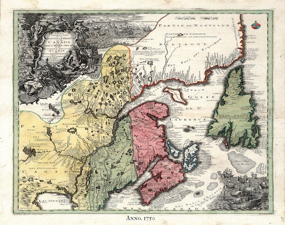 Canada, Nouvelles France, 1720, Seutter auth., map on heavy cotton canvas, 50x70cm (20 x 25") approx.
$45.52
Canada, Nouvelles France, 1720, Seutter auth., map on heavy cotton canvas, 50x70cm (20 x 25") approx.
$45.52
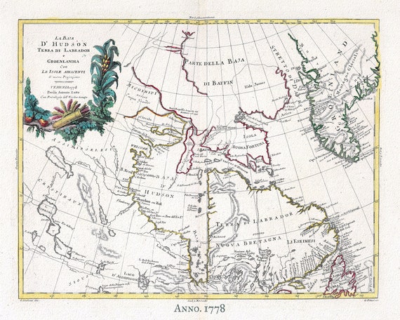 Canada, Labrador & Greenland, 1778 ,Zatta auth. , map on heavy cotton canvas, 50x70cm (20 x 25") approx.
$45.52
Canada, Labrador & Greenland, 1778 ,Zatta auth. , map on heavy cotton canvas, 50x70cm (20 x 25") approx.
$45.52
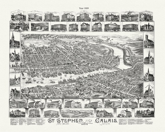 St. Stephen, New Brunswick and Calais, Maine, A Birdseye View, 1889, map on durable cotton canvas, 50 x 70 cm, 20 x 25" approx.
$45.52
St. Stephen, New Brunswick and Calais, Maine, A Birdseye View, 1889, map on durable cotton canvas, 50 x 70 cm, 20 x 25" approx.
$45.52
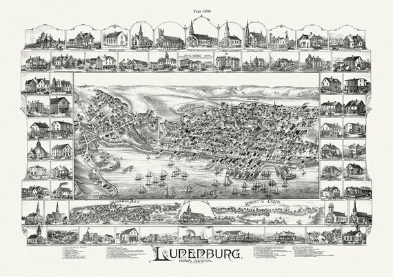 Lunenburg, Nova Scotia, A Bird's Eye View, 1890 , map on durable cotton canvas, 50 x 70 cm, 20 x 25" approx.
$45.52
Lunenburg, Nova Scotia, A Bird's Eye View, 1890 , map on durable cotton canvas, 50 x 70 cm, 20 x 25" approx.
$45.52
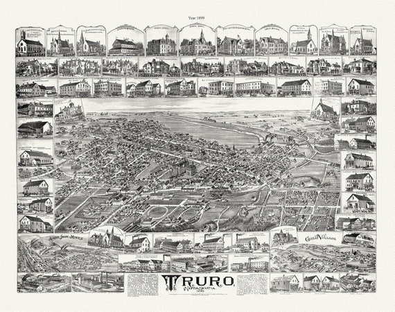 Truro, Nova Scotia, A Birdseye View, 1889 , vintage print on canvas, 50 x 70 cm, 20 x 25" approx.
$45.52
Truro, Nova Scotia, A Birdseye View, 1889 , vintage print on canvas, 50 x 70 cm, 20 x 25" approx.
$45.52
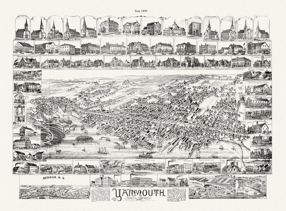 Yarmouth, Nova Scotia, A Bird's Eye View, 1889 , map on durable cotton canvas, 50 x 70 cm, 20 x 25" approx.
$45.52
Yarmouth, Nova Scotia, A Bird's Eye View, 1889 , map on durable cotton canvas, 50 x 70 cm, 20 x 25" approx.
$45.52
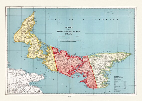 Province of Prince Edward Island, Canada, 1925, vintage map reprinted on durable cotton canvas, 50 x 70 cm or 20x25" approx.
$45.52
Province of Prince Edward Island, Canada, 1925, vintage map reprinted on durable cotton canvas, 50 x 70 cm or 20x25" approx.
$45.52
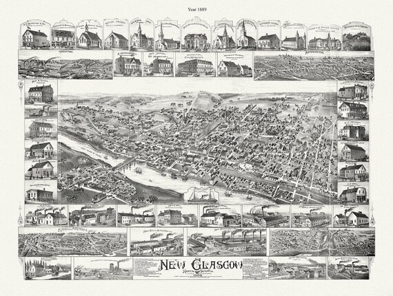 New Glasgow, Nova Scotia, 1889 , map on durable cotton canvas, 50 x 70 cm, 20 x 25" approx.
$45.52
New Glasgow, Nova Scotia, 1889 , map on durable cotton canvas, 50 x 70 cm, 20 x 25" approx.
$45.52