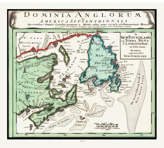
 Atlantic Canada, Bellin auth., 1745 , map on heavy cotton canvas, 50 x 70cm, 20 x 25" approx.
$45.52
Atlantic Canada, Bellin auth., 1745 , map on heavy cotton canvas, 50 x 70cm, 20 x 25" approx.
$45.52
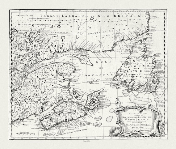 A new & accurate map of Newfoundland, Cape Breton, St. John and Anticosta, with Nova Scotia, Canada, 1752 , on canvas, 20 x 25" approx.
$45.52
A new & accurate map of Newfoundland, Cape Breton, St. John and Anticosta, with Nova Scotia, Canada, 1752 , on canvas, 20 x 25" approx.
$45.52
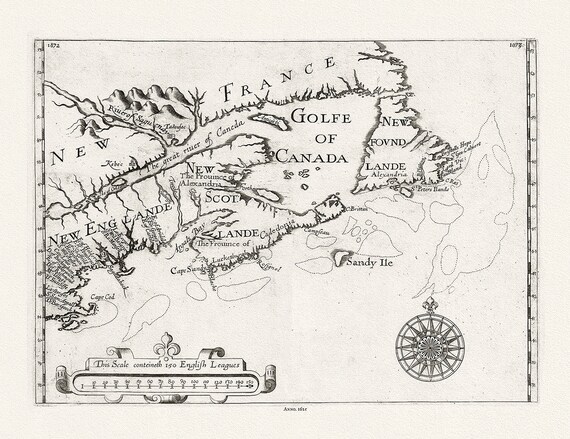 New England, Canada, Nova Scotia, Newfoundland, Alexander auth., 1625 Ver. B, map on heavy cotton canvas, 50 x 70 cm, 20 x 25" approx.
$45.52
New England, Canada, Nova Scotia, Newfoundland, Alexander auth., 1625 Ver. B, map on heavy cotton canvas, 50 x 70 cm, 20 x 25" approx.
$45.52
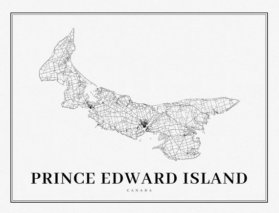 PEI: Prince Edward Island, A Modern Map
$45.52
PEI: Prince Edward Island, A Modern Map
$45.52
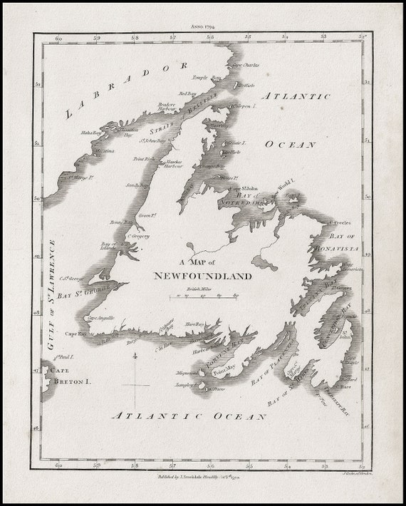 A Map of Newfoundland, Stockdale auth., 1794, map on heavy cotton canvas, 50 x 70 cm, 20 x 25" approx.
$45.52
A Map of Newfoundland, Stockdale auth., 1794, map on heavy cotton canvas, 50 x 70 cm, 20 x 25" approx.
$45.52
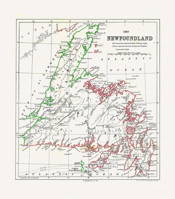 Newfoundland: A Comparison of British and French Fishing rights, Johnston auth., 1885 ,on heavy cotton canvas, 50 x 70 cm, 20 x 25" approx.
$45.52
Newfoundland: A Comparison of British and French Fishing rights, Johnston auth., 1885 ,on heavy cotton canvas, 50 x 70 cm, 20 x 25" approx.
$45.52
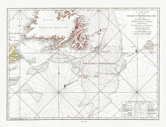 Jefferys, A Chart Of The Banks Of Newfoundland, 1776 , map on heavy cotton canvas, 50 x 70 cm, 20 x 25" approx.
$45.52
Jefferys, A Chart Of The Banks Of Newfoundland, 1776 , map on heavy cotton canvas, 50 x 70 cm, 20 x 25" approx.
$45.52
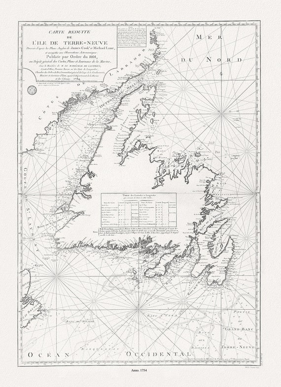 Isle de Terre-Neuve, Lane et Cook, 1784 , map on heavy cotton canvas, 50 x 70 cm, 20 x 25" approx.
$45.52
Isle de Terre-Neuve, Lane et Cook, 1784 , map on heavy cotton canvas, 50 x 70 cm, 20 x 25" approx.
$45.52
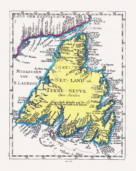 Newfoundland: Insel Neu Land od. Terre Neuve olirn Avalon, 1762 , map on heavy cotton canvas, 50 x 70 cm, 20 x 25" approx.
$45.52
Newfoundland: Insel Neu Land od. Terre Neuve olirn Avalon, 1762 , map on heavy cotton canvas, 50 x 70 cm, 20 x 25" approx.
$45.52
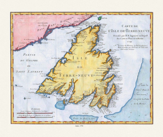 Carte de l'Isle de Terre-Neuve, Bellin auth.,1744 , map on heavy cotton canvas, 50 x 70 cm, 20 x 25" approx.
$45.52
Carte de l'Isle de Terre-Neuve, Bellin auth.,1744 , map on heavy cotton canvas, 50 x 70 cm, 20 x 25" approx.
$45.52
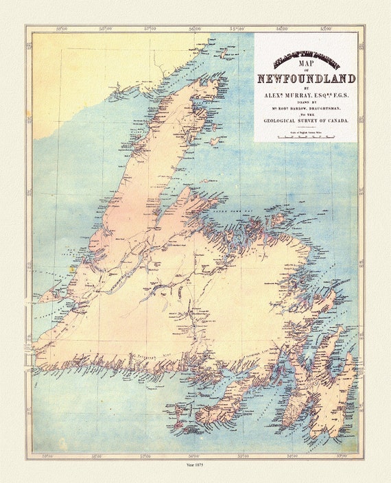 Atlas of the Dominion map of Newfoundland, Murray auth., 1875, map on heavy cotton canvas, 50 x 70 cm, 20 x 25" approx.
$45.52
Atlas of the Dominion map of Newfoundland, Murray auth., 1875, map on heavy cotton canvas, 50 x 70 cm, 20 x 25" approx.
$45.52
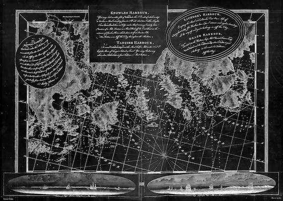 Des Barres, The Sea Coast of Nova Scotia-Keppel Harbor, Knowles Harbor, Tangier Harbor, etc.-1777 , map,canvas, 50 x 70 cm, 20 x 25" approx.
$45.52
Des Barres, The Sea Coast of Nova Scotia-Keppel Harbor, Knowles Harbor, Tangier Harbor, etc.-1777 , map,canvas, 50 x 70 cm, 20 x 25" approx.
$45.52
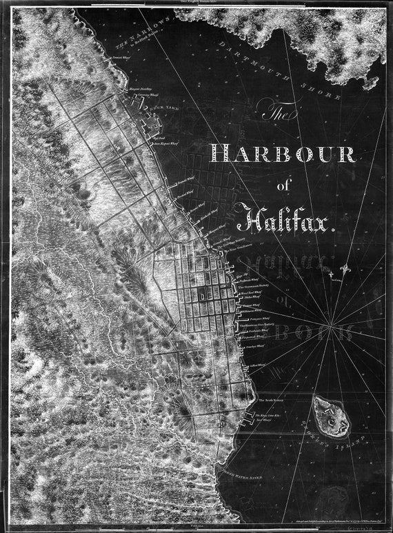 Des Barres, The Sea Coast of Nova Scotia-Harbor of Halifax-1777 , map on durable cotton canvas, 50 x 70 cm, 20 x 25" approx.
$45.52
Des Barres, The Sea Coast of Nova Scotia-Harbor of Halifax-1777 , map on durable cotton canvas, 50 x 70 cm, 20 x 25" approx.
$45.52
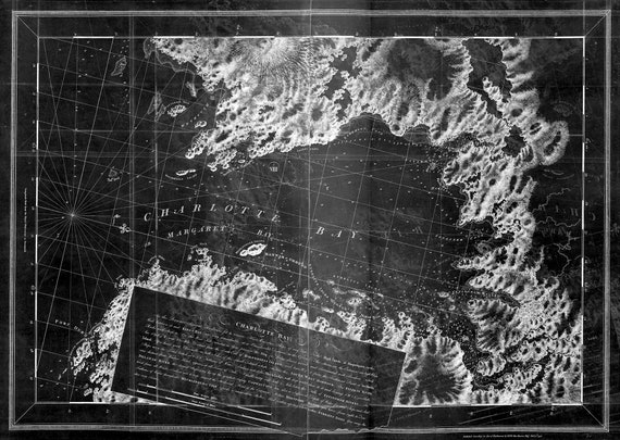 Des Barres, The Sea Coast of Nova Scotia-Charlotte Bay-1777, map on durable cotton canvas, 50 x 70 cm, 20 x 25" approx.
$45.52
Des Barres, The Sea Coast of Nova Scotia-Charlotte Bay-1777, map on durable cotton canvas, 50 x 70 cm, 20 x 25" approx.
$45.52
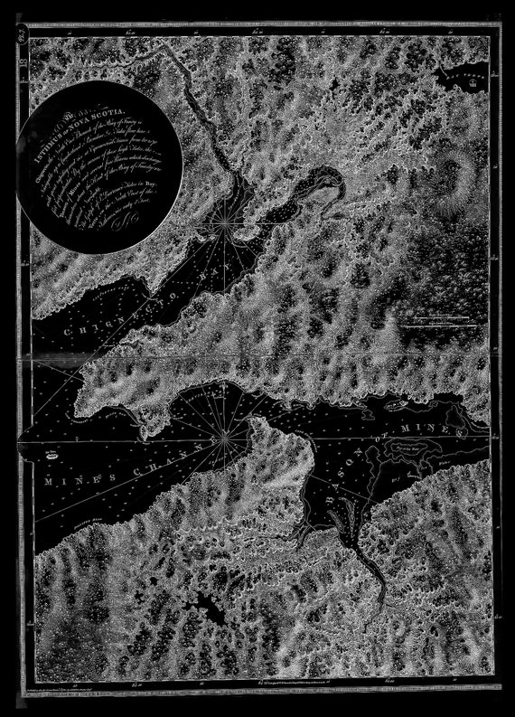
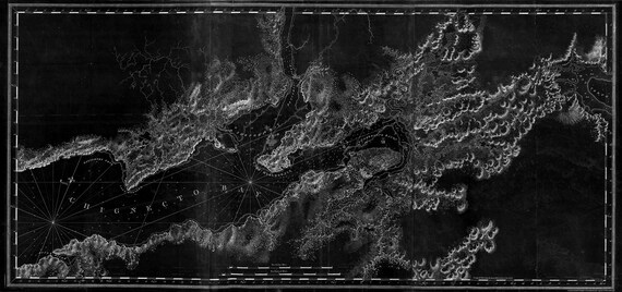 Des Barres, The Sea Coast of Nova Scotia-Chignecto Bay-1777, map on durable cotton canvas, 50 x 70 cm, 20 x 25" approx.
$45.52
Des Barres, The Sea Coast of Nova Scotia-Chignecto Bay-1777, map on durable cotton canvas, 50 x 70 cm, 20 x 25" approx.
$45.52
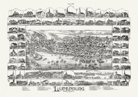 Lunenburg, Nova Scotia, A Bird's Eye View, 1890 , map on durable cotton canvas, 50 x 70 cm, 20 x 25" approx.
$45.52
Lunenburg, Nova Scotia, A Bird's Eye View, 1890 , map on durable cotton canvas, 50 x 70 cm, 20 x 25" approx.
$45.52
 The isthmus of Nova Scotia.Halifax.1780 Ver. BWI , map on durable cotton canvas, 50 x 70 cm, 20 x 25" approx.
$45.52
The isthmus of Nova Scotia.Halifax.1780 Ver. BWI , map on durable cotton canvas, 50 x 70 cm, 20 x 25" approx.
$45.52
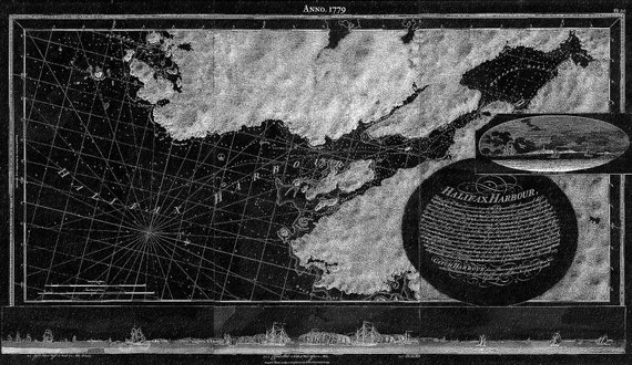 Des Barres, Halifax Harbour, 1779 Ver. BWI , map on durable cotton canvas, 50 x 70 cm, 20 x 25" approx.
$45.52
Des Barres, Halifax Harbour, 1779 Ver. BWI , map on durable cotton canvas, 50 x 70 cm, 20 x 25" approx.
$45.52
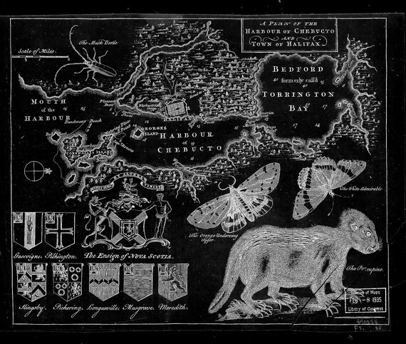 A plan of the harbour of Chebucto and town of Halifax.1750 Ver. BW! , map on durable cotton canvas, 50 x 70 cm, 20 x 25" approx.
$45.52
A plan of the harbour of Chebucto and town of Halifax.1750 Ver. BW! , map on durable cotton canvas, 50 x 70 cm, 20 x 25" approx.
$45.52
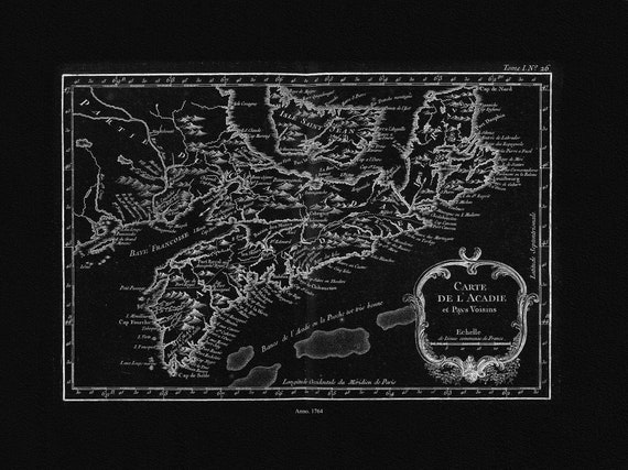 Bellin, Carte De L'Acadie et Pays Voisins, 1764 Ver. IIBWI, map on durable cotton canvas, 50 x 70 cm, 20 x 25" approx.
$45.52
Bellin, Carte De L'Acadie et Pays Voisins, 1764 Ver. IIBWI, map on durable cotton canvas, 50 x 70 cm, 20 x 25" approx.
$45.52