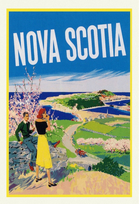
 Nova Scotia, Vintage Travel Poster , vintage print on canvas, 50 x 70 cm, 20 x 25" approx.
$45.52
Nova Scotia, Vintage Travel Poster , vintage print on canvas, 50 x 70 cm, 20 x 25" approx.
$45.52
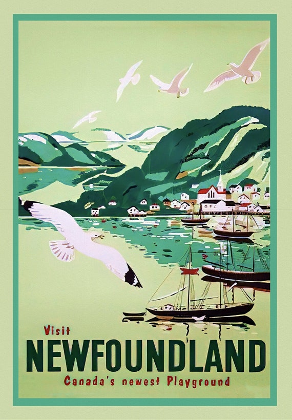
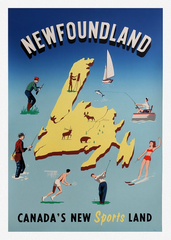 Newfoundland, Canadas New Sports Land, vintage print on canvas, 50 x 70 cm, 20 x 25" approx.
$45.52
Newfoundland, Canadas New Sports Land, vintage print on canvas, 50 x 70 cm, 20 x 25" approx.
$45.52
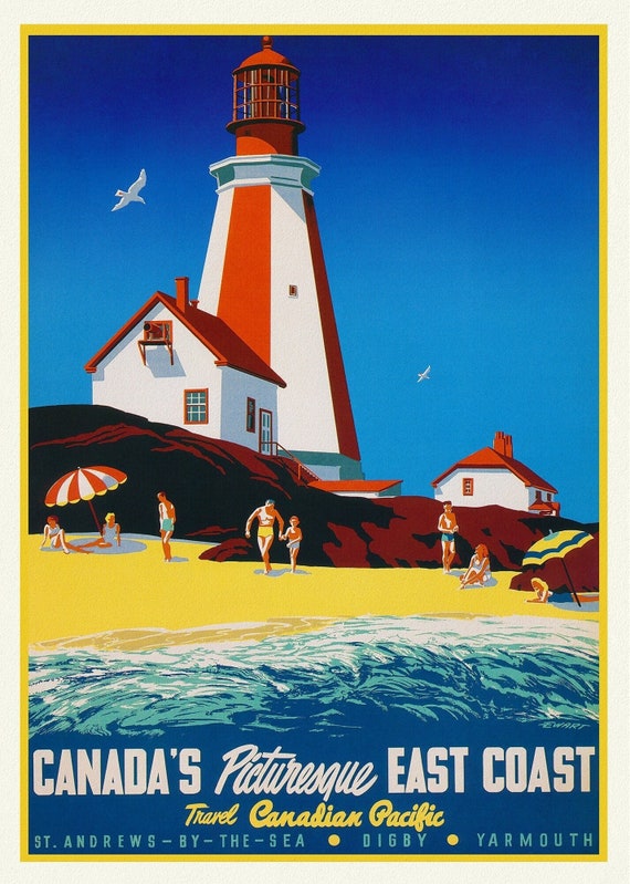 Canada's Picturesque East Coast, Travel Canadian Pacific, vintage print on canvas, 50 x 70 cm, 20 x 25" approx.
$45.52
Canada's Picturesque East Coast, Travel Canadian Pacific, vintage print on canvas, 50 x 70 cm, 20 x 25" approx.
$45.52
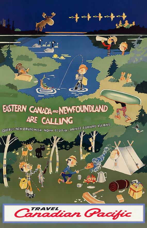 Eastern Canada is Calling, Travel Canadian Pacific, vintage print on canvas, 50 x 70 cm, 20 x 25" approx.
$45.52
Eastern Canada is Calling, Travel Canadian Pacific, vintage print on canvas, 50 x 70 cm, 20 x 25" approx.
$45.52
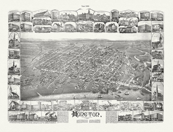 Moncton, New Brunswick, A Birds's Eye View, 1888, map on durable cotton canvas, 50 x 70 cm, 20 x 25" approx.
$45.52
Moncton, New Brunswick, A Birds's Eye View, 1888, map on durable cotton canvas, 50 x 70 cm, 20 x 25" approx.
$45.52
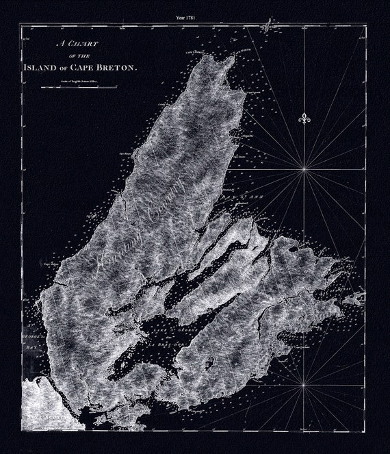 A chart of the island of Cape Breton.1781, Des Barres auth. Ver. BWI , map on durable cotton canvas, 50 x 70 cm, 20 x 25" approx.
$45.52
A chart of the island of Cape Breton.1781, Des Barres auth. Ver. BWI , map on durable cotton canvas, 50 x 70 cm, 20 x 25" approx.
$45.52
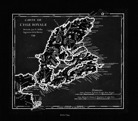 Bellin, Carte de L'isle Royalee, 1744 Ver. BWI, map on durable cotton canvas, 50 x 70 cm, 20 x 25" approx.
$45.52
Bellin, Carte de L'isle Royalee, 1744 Ver. BWI, map on durable cotton canvas, 50 x 70 cm, 20 x 25" approx.
$45.52
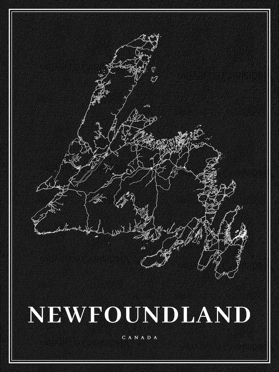 Newfoundland, A Modern Map Ver. Inv., map on durable cotton canvas, 50 x 70 cm, 20 x 25" approx.
$45.52
Newfoundland, A Modern Map Ver. Inv., map on durable cotton canvas, 50 x 70 cm, 20 x 25" approx.
$45.52
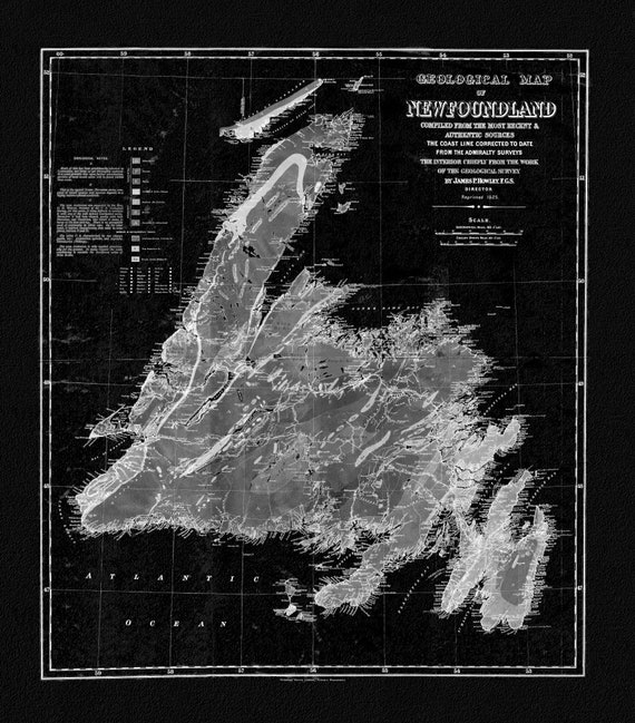 Geological Map of Newfoundland, 1921 Ver. BWI, vintage print on canvas, 50 x 70 cm, 20 x 25" approx.
$45.52
Geological Map of Newfoundland, 1921 Ver. BWI, vintage print on canvas, 50 x 70 cm, 20 x 25" approx.
$45.52
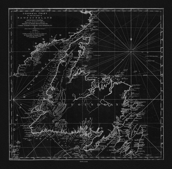 Jefferys, A General Chart Of The Island Of Newfoundland, 1776 Ver. BWI , map on durable cotton canvas, 50 x 70 cm, 20 x 25" approx.
$45.52
Jefferys, A General Chart Of The Island Of Newfoundland, 1776 Ver. BWI , map on durable cotton canvas, 50 x 70 cm, 20 x 25" approx.
$45.52
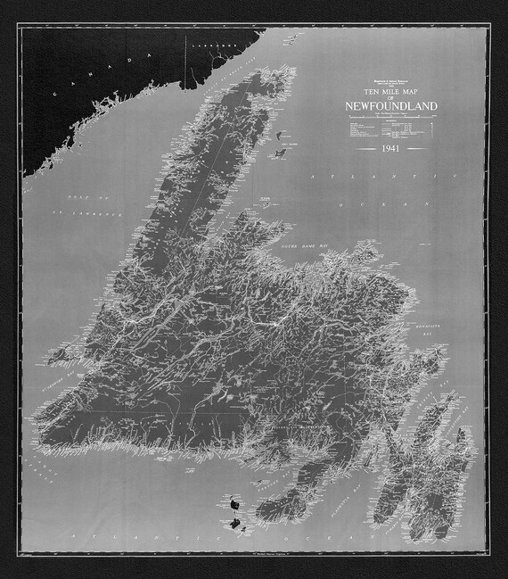 A Ten Mile Map of Newfoundland, 1941 Ver. BWI , map on durable cotton canvas, 50 x 70 cm, 20 x 25" approx.
$45.52
A Ten Mile Map of Newfoundland, 1941 Ver. BWI , map on durable cotton canvas, 50 x 70 cm, 20 x 25" approx.
$45.52
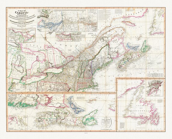 Purdy et Whittle, A Map Of Cabotia, Canada, 1814, map on heavy cotton canvas, 22x27" approx.
$45.52
Purdy et Whittle, A Map Of Cabotia, Canada, 1814, map on heavy cotton canvas, 22x27" approx.
$45.52
 Newfoundland and Labrador Tourist Development Office, 1960 , map on heavy cotton canvas, 50 x 70 cm, 20 x 25" approx.
$45.52
Newfoundland and Labrador Tourist Development Office, 1960 , map on heavy cotton canvas, 50 x 70 cm, 20 x 25" approx.
$45.52
 Visit Newfoundland Canada, 1965, vintage print on canvas, 50 x 70 cm, 20 x 25" approx.
$45.52
Visit Newfoundland Canada, 1965, vintage print on canvas, 50 x 70 cm, 20 x 25" approx.
$45.52
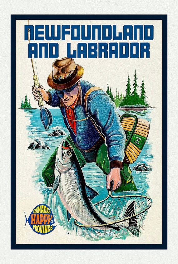 Newfoundland and Labrador, Canada's Happy Province, Ver. I , vintage print on canvas, 50 x 70 cm, 20 x 25" approx.
$45.52
Newfoundland and Labrador, Canada's Happy Province, Ver. I , vintage print on canvas, 50 x 70 cm, 20 x 25" approx.
$45.52
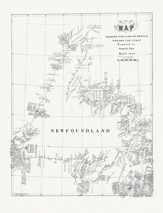 Newfoundland, A handrawn Map showing position of shipwrecks around the coast, R.White auth., 1904, on canvas, 45 x 65 cm, 18 x 24" approx.
$45.52
Newfoundland, A handrawn Map showing position of shipwrecks around the coast, R.White auth., 1904, on canvas, 45 x 65 cm, 18 x 24" approx.
$45.52
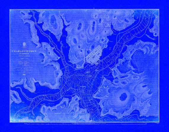 Nautical Chart, Prince Edward Island, Charlottetown Harbour, 1861 Cyanotype , map on durable cotton canvas, 50 x 70 cm, 20 x 25" approx.
$45.52
Nautical Chart, Prince Edward Island, Charlottetown Harbour, 1861 Cyanotype , map on durable cotton canvas, 50 x 70 cm, 20 x 25" approx.
$45.52
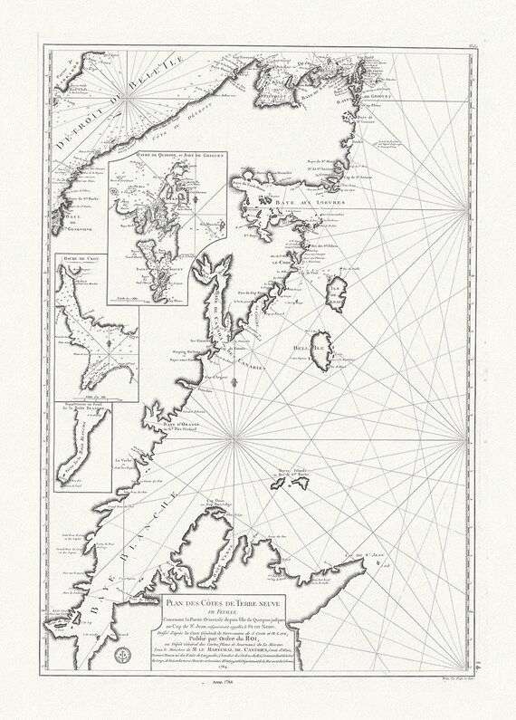 Plan des cotes de Terre-Neuve VII, 1784, Cook et Lane auths. map on durable cotton canvas, 50 x 70 cm, 20 x 25" approx.
$45.52
Plan des cotes de Terre-Neuve VII, 1784, Cook et Lane auths. map on durable cotton canvas, 50 x 70 cm, 20 x 25" approx.
$45.52
 Newfoundland, 1814, Purdie auth., map on durable cotton canvas, 50 x 70 cm, 20 x 25" approx.
$45.52
Newfoundland, 1814, Purdie auth., map on durable cotton canvas, 50 x 70 cm, 20 x 25" approx.
$45.52
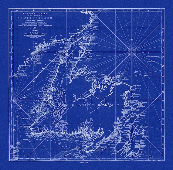 A General Chart Of The Island Of Newfoundland, 1776,Jefferys, auth., Cyanotype, map on durable cotton canvas, 50 x 70 cm, 20 x 25" approx.
$45.52
A General Chart Of The Island Of Newfoundland, 1776,Jefferys, auth., Cyanotype, map on durable cotton canvas, 50 x 70 cm, 20 x 25" approx.
$45.52