
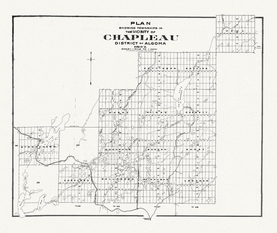
 Chapleau District, Algoma, 1907, map on heavy cotton canvas, 50 x 70cm, 20 x 25" approx.
$41.63
Chapleau District, Algoma, 1907, map on heavy cotton canvas, 50 x 70cm, 20 x 25" approx.
$41.63
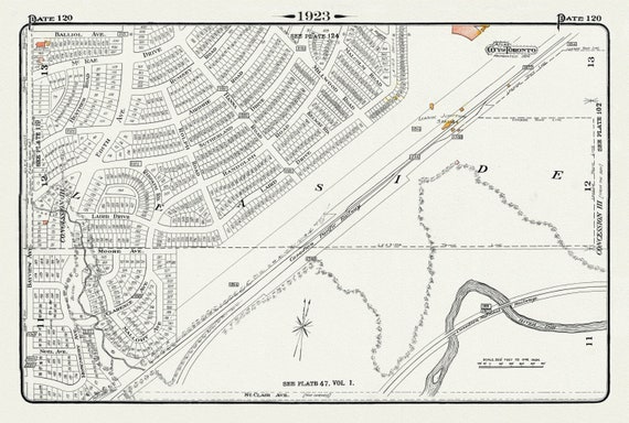 Plate 120, Toronto Uptown East, Leaside Station Junction, 1923, Map on heavy cotton canvas, 18x27in. approx.
$41.63
Plate 120, Toronto Uptown East, Leaside Station Junction, 1923, Map on heavy cotton canvas, 18x27in. approx.
$41.63
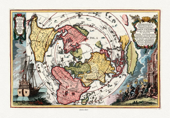 Navis Dicta duce Magellane Prima Circuvecia per Orbem, Terrarum Orbis, 1607 (Polar Arctic),map on heavy cotton canvas, 22x27" approx.
$41.63
Navis Dicta duce Magellane Prima Circuvecia per Orbem, Terrarum Orbis, 1607 (Polar Arctic),map on heavy cotton canvas, 22x27" approx.
$41.63
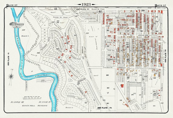 Plate 57, Toronto West, High Park West, South Kingsway & Swansea, 1923, Map on heavy cotton canvas, 18x27in. approx.
$41.63
Plate 57, Toronto West, High Park West, South Kingsway & Swansea, 1923, Map on heavy cotton canvas, 18x27in. approx.
$41.63
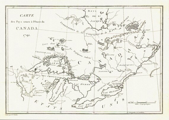 Carte des Pays situes a l'Ouest du Canada, Long auth.,1791, travel poster on durable cotton canvas, 50 x 70 cm, 20 x 25" approx.
$41.63
Carte des Pays situes a l'Ouest du Canada, Long auth.,1791, travel poster on durable cotton canvas, 50 x 70 cm, 20 x 25" approx.
$41.63
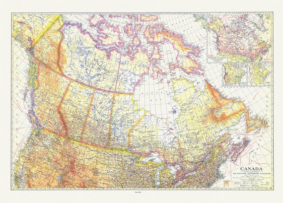 Canada , National Geographic, 1936, vintage map reprinted on durable cotton canvas, 50 x 70 cm or 20x25" approx.
$41.63
Canada , National Geographic, 1936, vintage map reprinted on durable cotton canvas, 50 x 70 cm or 20x25" approx.
$41.63
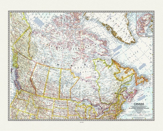 Canada, National Geographic, 1961 , vintage map reprinted on durable cotton canvas, 50 x 70 cm or 20x25" approx.
$41.63
Canada, National Geographic, 1961 , vintage map reprinted on durable cotton canvas, 50 x 70 cm or 20x25" approx.
$41.63
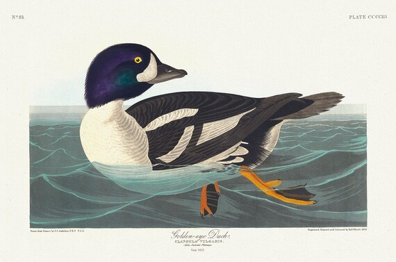 Golden-eye duck. Ciangula vulgaris. summer plumage. c.1 v.4 plate 403, 1836 Audobon auth. , print on canvas, 50 x 70 cm, 20 x 25" approx.
$41.63
Golden-eye duck. Ciangula vulgaris. summer plumage. c.1 v.4 plate 403, 1836 Audobon auth. , print on canvas, 50 x 70 cm, 20 x 25" approx.
$41.63
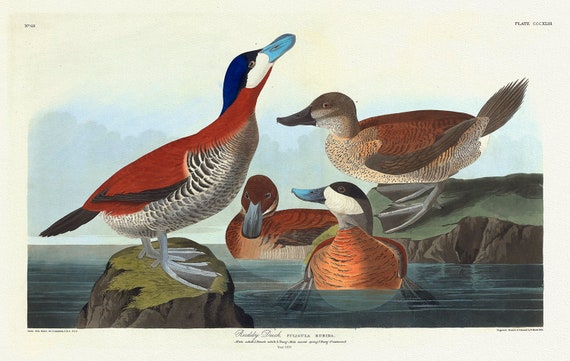 Ruddy duck Fuligula rubida. c.1 v.4 plate 343, 1836 Audobon auth. , vintage nature print on canvas, 50 x 70 cm, 20 x 25" approx.
$41.63
Ruddy duck Fuligula rubida. c.1 v.4 plate 343, 1836 Audobon auth. , vintage nature print on canvas, 50 x 70 cm, 20 x 25" approx.
$41.63
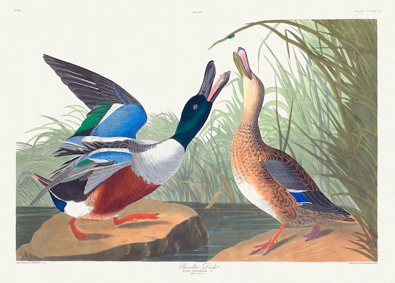 Shoveller duck .Anas clypeata. c.1 v.4 plate 327, 1836 Audobon auth., vintage nature print on canvas, 50 x 70 cm, 20 x 25" approx.
$41.63
Shoveller duck .Anas clypeata. c.1 v.4 plate 327, 1836 Audobon auth., vintage nature print on canvas, 50 x 70 cm, 20 x 25" approx.
$41.63
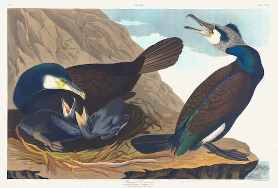 Common cormorant.Phalacrocorax carbo, Dumont. plate 266, 1836 Audobon auth. , vintage print on canvas, 50 x 70 cm, 20 x 25" approx.
$41.63
Common cormorant.Phalacrocorax carbo, Dumont. plate 266, 1836 Audobon auth. , vintage print on canvas, 50 x 70 cm, 20 x 25" approx.
$41.63
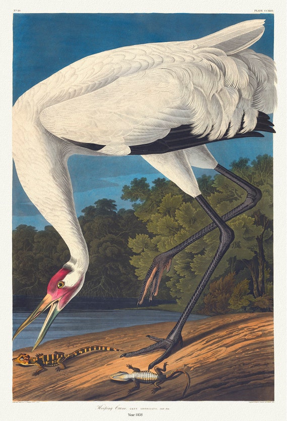 Hooping crane. Grus Americana. c.1 v.3 plate 226, 1836 Audobon auth. , vintage nature print on canvas, 50 x 70 cm, 20 x 25" approx.
$41.63
Hooping crane. Grus Americana. c.1 v.3 plate 226, 1836 Audobon auth. , vintage nature print on canvas, 50 x 70 cm, 20 x 25" approx.
$41.63
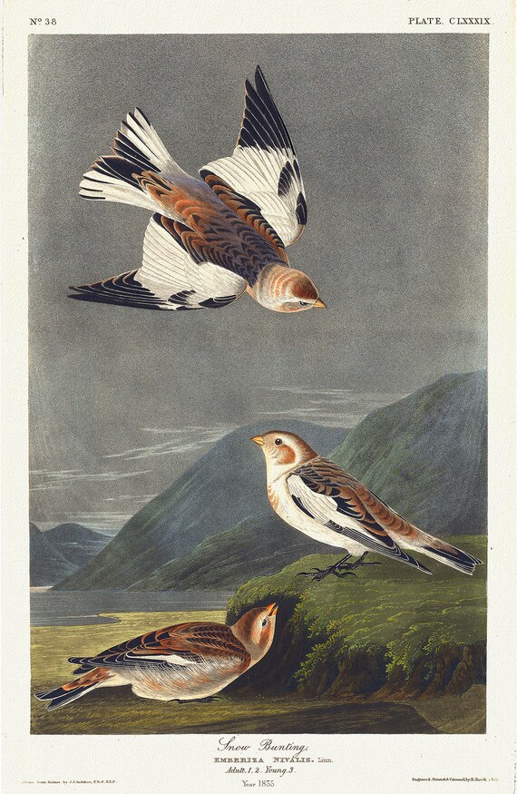 Snow bunting. Emberiza nivalis, Linn.. c.1 v.2 plate 189, vintage nature print on canvas, 50 x 70 cm, 20 x 25" approx.
$41.63
Snow bunting. Emberiza nivalis, Linn.. c.1 v.2 plate 189, vintage nature print on canvas, 50 x 70 cm, 20 x 25" approx.
$41.63
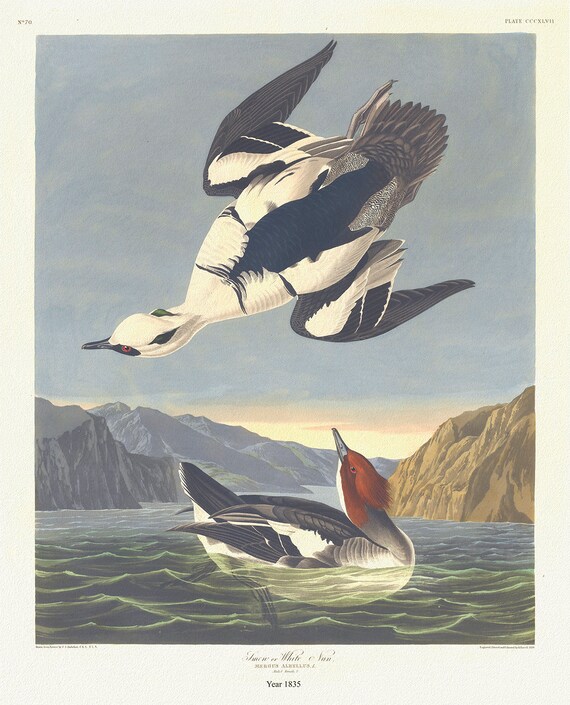 Smew or white nun. Mergus albellus,. c.1 v.4 plate 347, 1836 Audobon auth., vintage print on canvas, 50 x 70 cm, 20 x 25" approx.
$41.63
Smew or white nun. Mergus albellus,. c.1 v.4 plate 347, 1836 Audobon auth., vintage print on canvas, 50 x 70 cm, 20 x 25" approx.
$41.63
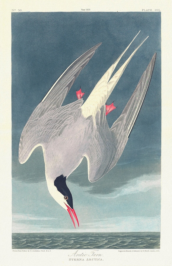 Arctic tern. Sterna arctica. c.1 v.3 plate 250, , 1836 Audobon auth. ,wildlife print on durable cotton canvas, 50 x 70 cm, 20 x 25" approx.
$41.63
Arctic tern. Sterna arctica. c.1 v.3 plate 250, , 1836 Audobon auth. ,wildlife print on durable cotton canvas, 50 x 70 cm, 20 x 25" approx.
$41.63
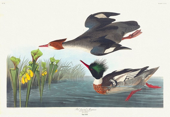 Red-breasted merganser. Mergus serrator, sarracenia flava., 1836 Audobon auth. , v nature print on canvas, 50 x 70 cm, 20 x 25" approx.
$41.63
Red-breasted merganser. Mergus serrator, sarracenia flava., 1836 Audobon auth. , v nature print on canvas, 50 x 70 cm, 20 x 25" approx.
$41.63
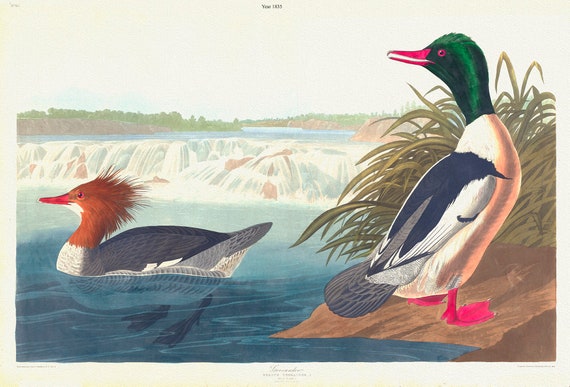 Goosander. Mergus merganser, L. Male, 1. Female, 2.. c.1 v.4 plate 331, 1836 Audobon auth., print on canvas, 50 x 70 cm, 20 x 25" approx
$41.63
Goosander. Mergus merganser, L. Male, 1. Female, 2.. c.1 v.4 plate 331, 1836 Audobon auth., print on canvas, 50 x 70 cm, 20 x 25" approx
$41.63
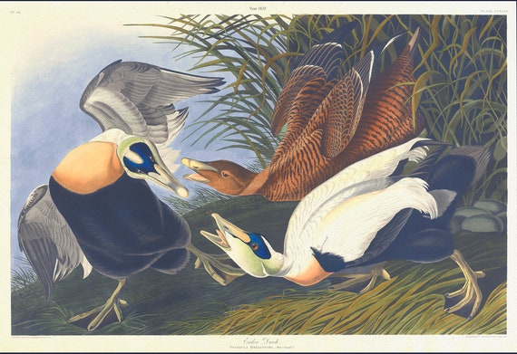 Eider duck. Fuligula mollissima. plate 246, 1836 Audobon auth., vi print on durable cotton canvas, 50 x 70 cm, 20 x 25" approx.
$41.63
Eider duck. Fuligula mollissima. plate 246, 1836 Audobon auth., vi print on durable cotton canvas, 50 x 70 cm, 20 x 25" approx.
$41.63
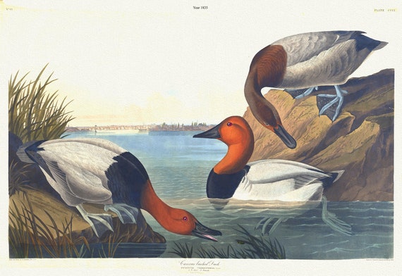 Canvas backed duck. Fuligula vallisneria., 1836 Audobon auth., vintage print on durable cotton canvas, 50 x 70 cm, 20 x 25" approx.
$41.63
Canvas backed duck. Fuligula vallisneria., 1836 Audobon auth., vintage print on durable cotton canvas, 50 x 70 cm, 20 x 25" approx.
$41.63
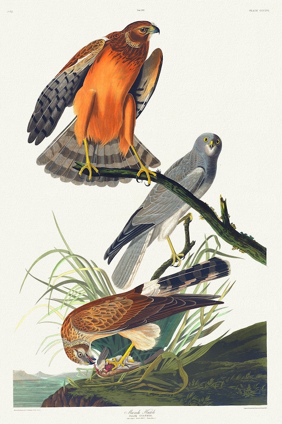 Marsh hawk.Falco cyaneus. Male adult, 1. Female adult, 2. Young male, 3. c.1 v.4 plate 356, 1836 Audobon auth.
$41.63
Marsh hawk.Falco cyaneus. Male adult, 1. Female adult, 2. Young male, 3. c.1 v.4 plate 356, 1836 Audobon auth.
$41.63