
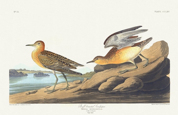
 J.J. Audobon, Buff breasted sandpiper. Tringa rufescens, Viell, 1835 , vintage nature print on canvas, 50 x 70 cm, 20 x 25" approx.
$41.63
J.J. Audobon, Buff breasted sandpiper. Tringa rufescens, Viell, 1835 , vintage nature print on canvas, 50 x 70 cm, 20 x 25" approx.
$41.63
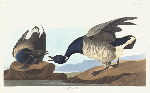 J.J. Audobon, Brant goose. Anser bernicla. 1. Male. 2. Female, 1835, vintage nature print on canvas, 50 x 70 cm, 20 x 25" approx.
$41.63
J.J. Audobon, Brant goose. Anser bernicla. 1. Male. 2. Female, 1835, vintage nature print on canvas, 50 x 70 cm, 20 x 25" approx.
$41.63
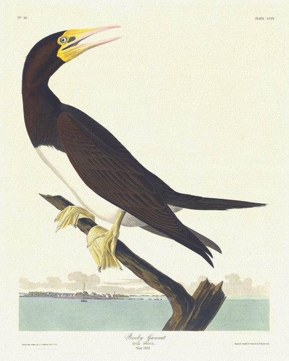 J.J. Audobon, Booby gannet. Sula fusca, 1835 , vintage nature print on canvas, 50 x 70 cm, 20 x 25" approx.
$41.63
J.J. Audobon, Booby gannet. Sula fusca, 1835 , vintage nature print on canvas, 50 x 70 cm, 20 x 25" approx.
$41.63
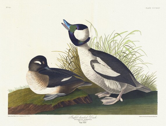 J.J. Audobon, Buffet-headed duck. Fuligula albeola, 1835, vintage nature print on canvas, 50 x 70 cm, 20 x 25" approx.
$41.63
J.J. Audobon, Buffet-headed duck. Fuligula albeola, 1835, vintage nature print on canvas, 50 x 70 cm, 20 x 25" approx.
$41.63
 J.J. Audobon, Blue-winged teal .Anas discors, L. Male, 1. Female, 1835, vintage nature print on canvas, 50 x 70 cm, 20 x 25" approx.
$41.63
J.J. Audobon, Blue-winged teal .Anas discors, L. Male, 1. Female, 1835, vintage nature print on canvas, 50 x 70 cm, 20 x 25" approx.
$41.63
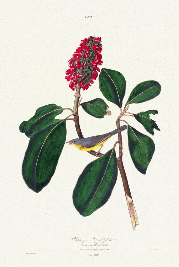 J.J. Audobon, Bonaparte fly catcher. Muscicapa Bonapartii. Plant seed pod Magnolia grandiflora, 1835 ,canvas, 50 x 70 cm, 20 x 25" approx.
$41.63
J.J. Audobon, Bonaparte fly catcher. Muscicapa Bonapartii. Plant seed pod Magnolia grandiflora, 1835 ,canvas, 50 x 70 cm, 20 x 25" approx.
$41.63
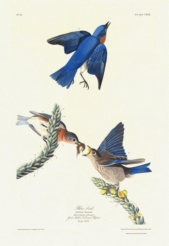 J.J. Audobon, Blue-bird Sylvia sialis. 1835, vintage nature print on canvas, 50 x 70 cm, 20 x 25" approx.
$41.63
J.J. Audobon, Blue-bird Sylvia sialis. 1835, vintage nature print on canvas, 50 x 70 cm, 20 x 25" approx.
$41.63
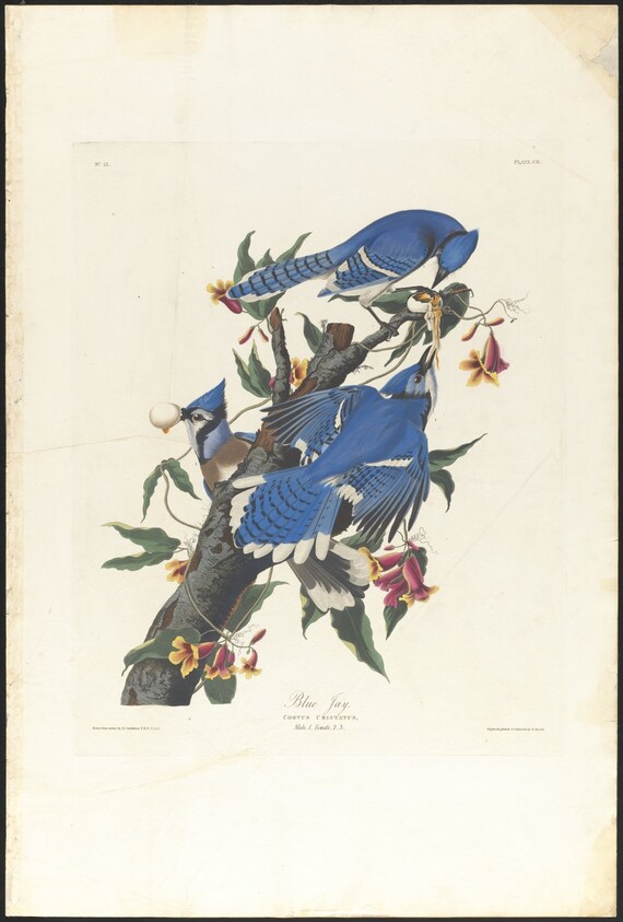 J.J. Audobon, Blue jay .Corvus cristatus, 1835, vintage nature print on canvas, 50 x 70 cm, 20 x 25" approx.
$41.63
J.J. Audobon, Blue jay .Corvus cristatus, 1835, vintage nature print on canvas, 50 x 70 cm, 20 x 25" approx.
$41.63
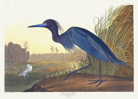 J.J. Audobon, Blue crane or heron. Ardea cœrulea, 1835, vintage nature print on canvas, 50 x 70 cm, 20 x 25" approx.
$41.63
J.J. Audobon, Blue crane or heron. Ardea cœrulea, 1835, vintage nature print on canvas, 50 x 70 cm, 20 x 25" approx.
$41.63
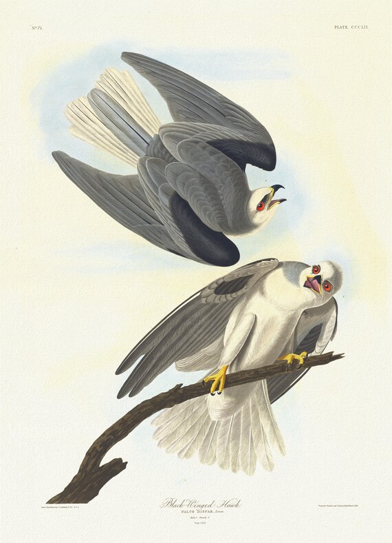 J.J. Audobon, Black-winged hawk.Falco dispar, Temm. Male, 1. Female, 2. plate 352, 1835 , on canvas, 50 x 70 cm, 20 x 25" approx.
$41.63
J.J. Audobon, Black-winged hawk.Falco dispar, Temm. Male, 1. Female, 2. plate 352, 1835 , on canvas, 50 x 70 cm, 20 x 25" approx.
$41.63
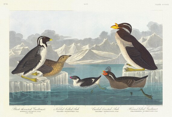 J.J. Audobon, Black-throated guillemot. Nobbed-billed auk. Curled-crested auk. Horned-billed guillemo, 1835, 20x25"
$41.63
J.J. Audobon, Black-throated guillemot. Nobbed-billed auk. Curled-crested auk. Horned-billed guillemo, 1835, 20x25"
$41.63
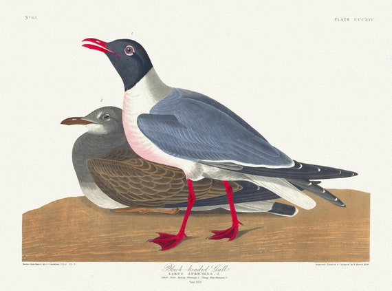 J.J. Audobon, Black-headed gull. Larus atricilla, L. Adult male spring plumage, 1. Young first autumn, 1835, 50 x 70 cm, 20 x 25" approx.
$41.63
J.J. Audobon, Black-headed gull. Larus atricilla, L. Adult male spring plumage, 1. Young first autumn, 1835, 50 x 70 cm, 20 x 25" approx.
$41.63
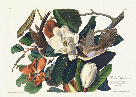 J.J. Audobon, Black-billed cuckoo Male, 1. F, 2. Coccyzus erythrophthalmus. Plant, magnolia grandiflora. 1835, 50 x 70 cm, 20 x 25" approx.
$41.63
J.J. Audobon, Black-billed cuckoo Male, 1. F, 2. Coccyzus erythrophthalmus. Plant, magnolia grandiflora. 1835, 50 x 70 cm, 20 x 25" approx.
$41.63
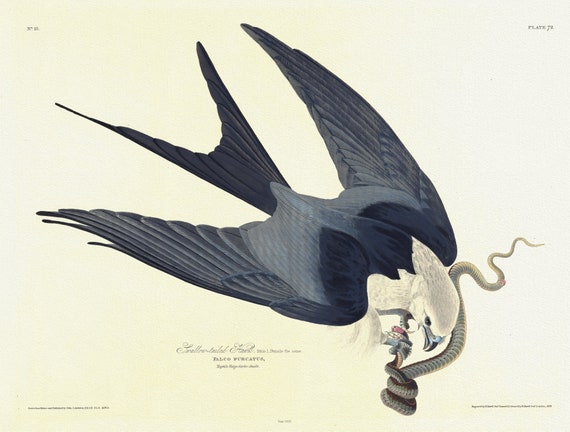 J.J. Audobon, Swallow-tailed hawk. Male, 1. Female the same. Falco furcatus. with garter snake, 1835 canvas, 50 x 70 cm, 20 x 25" approx.
$41.63
J.J. Audobon, Swallow-tailed hawk. Male, 1. Female the same. Falco furcatus. with garter snake, 1835 canvas, 50 x 70 cm, 20 x 25" approx.
$41.63
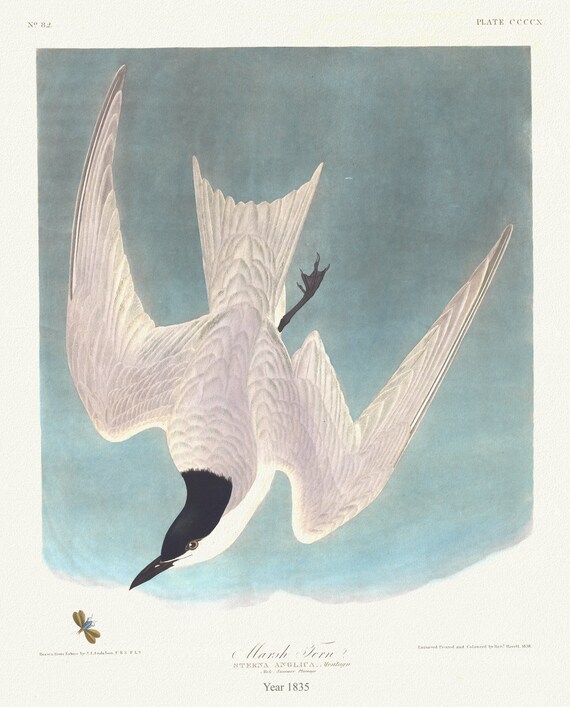 J.J. Audobon, Marsh tern Sterna anglica, Montagu. Male summer plumage.1835, canvas, 50 x 70 cm, 20 x 25" approx.
$41.63
J.J. Audobon, Marsh tern Sterna anglica, Montagu. Male summer plumage.1835, canvas, 50 x 70 cm, 20 x 25" approx.
$41.63
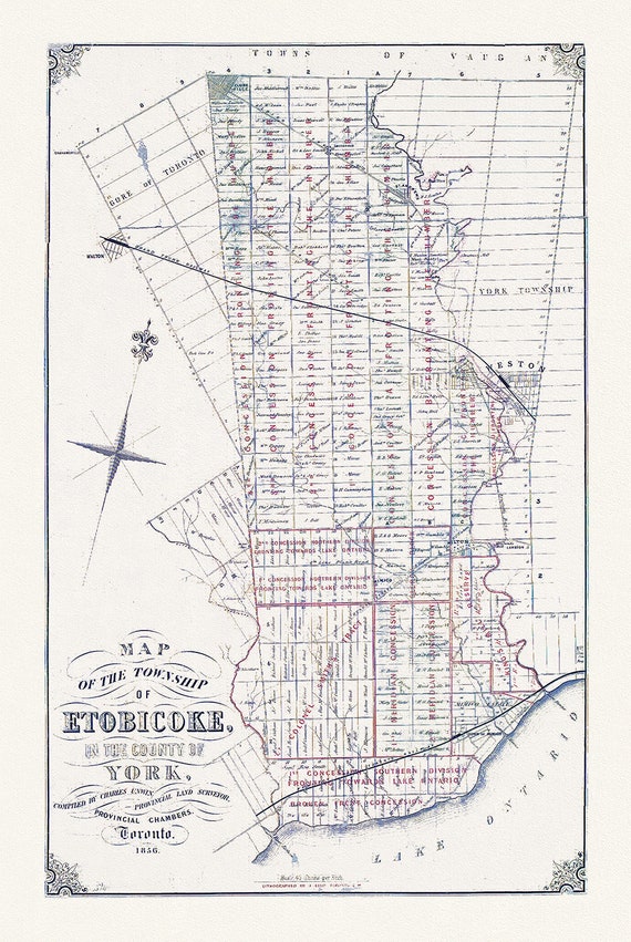
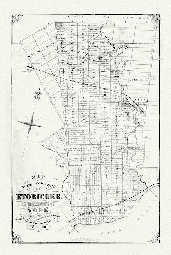 Map of the township of Etobicoke, in the county of York, 1856 Ver. 2PR, map on durable cotton canvas, 50 x 70 cm, 20 x 25" approx.
$41.63
Map of the township of Etobicoke, in the county of York, 1856 Ver. 2PR, map on durable cotton canvas, 50 x 70 cm, 20 x 25" approx.
$41.63
 Map of the Township of Etobicoke, 1856
$41.63
Map of the Township of Etobicoke, 1856
$41.63
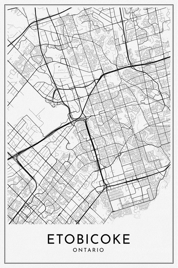 Etobicoke, Toronto, A Modern Map
$41.63
Etobicoke, Toronto, A Modern Map
$41.63
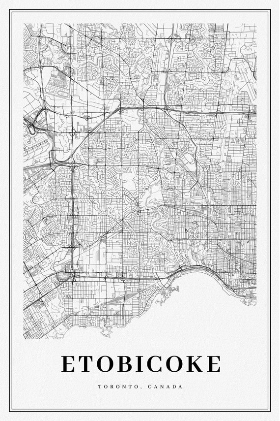 Etobicoke, Toronto, A Modern Map Ver. II , map on durable cotton canvas, 50 x 70 cm, 20 x 25" approx.
$41.63
Etobicoke, Toronto, A Modern Map Ver. II , map on durable cotton canvas, 50 x 70 cm, 20 x 25" approx.
$41.63
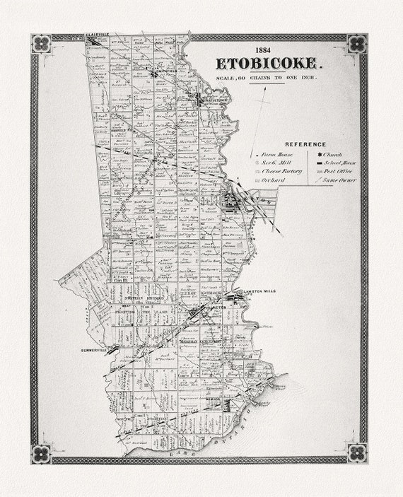 Etobicoke, York County Atlas, 1884
$41.63
Etobicoke, York County Atlas, 1884
$41.63