
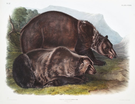
 J.J. Audobon, Grizzly Bear (Ursus ferox) from the viviparous quadrupeds of North America (1845) , on canvas, 50 x 70 cm, 20 x 25" approx.
$45.20
J.J. Audobon, Grizzly Bear (Ursus ferox) from the viviparous quadrupeds of North America (1845) , on canvas, 50 x 70 cm, 20 x 25" approx.
$45.20
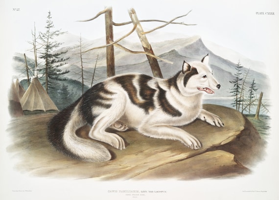 J.J. Audobon, Hare-Indian Dog (Canis familiaris) from the viviparous quadrupeds of North America (1845) , 50 x 70 cm, 20 x 25" approx.
$45.20
J.J. Audobon, Hare-Indian Dog (Canis familiaris) from the viviparous quadrupeds of North America (1845) , 50 x 70 cm, 20 x 25" approx.
$45.20
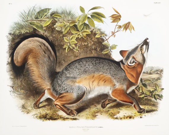 J.J. Audobon, Grey Fox (Canis Virginianus) from the viviparous quadrupeds of North America (1845), on canvas, 50 x 70 cm, 20 x 25" approx.
$45.20
J.J. Audobon, Grey Fox (Canis Virginianus) from the viviparous quadrupeds of North America (1845), on canvas, 50 x 70 cm, 20 x 25" approx.
$45.20
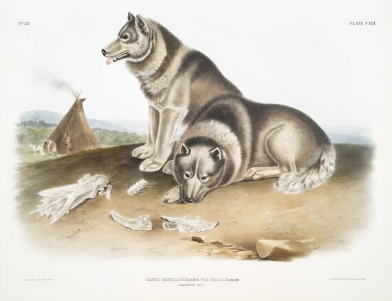 J.J. Audobon, Esquimaux Dog (Canis familiaris) from the viviparous quadrupeds of North America (1845), canvas, 50 x 70 cm, 20 x 25" approx.
$45.20
J.J. Audobon, Esquimaux Dog (Canis familiaris) from the viviparous quadrupeds of North America (1845), canvas, 50 x 70 cm, 20 x 25" approx.
$45.20
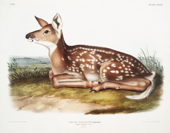 J.J. Audobon, North American Deer (Cervus Virginianus) from the viviparous quadrupeds of North America (1845) , 50 x 70 cm, 20 x 25" approx.
$45.20
J.J. Audobon, North American Deer (Cervus Virginianus) from the viviparous quadrupeds of North America (1845) , 50 x 70 cm, 20 x 25" approx.
$45.20
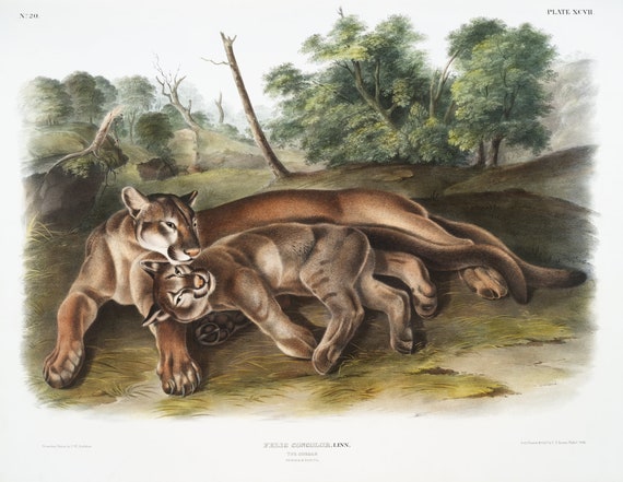 J.J. Audobon, Cougar (Felis concolor) from the viviparous quadrupeds of North America (1845), on canvas, 50 x 70 cm, 20 x 25" approx.
$45.20
J.J. Audobon, Cougar (Felis concolor) from the viviparous quadrupeds of North America (1845), on canvas, 50 x 70 cm, 20 x 25" approx.
$45.20
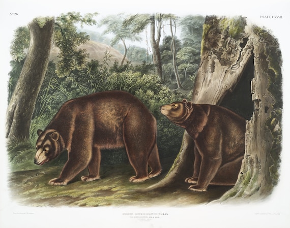 J.J. Audobon, Cinnamon Bear (Ursus Americanus var. Cinnamonum) from the viviparous quadrupeds of North America (1845), 20 x 25" approx.
$45.20
J.J. Audobon, Cinnamon Bear (Ursus Americanus var. Cinnamonum) from the viviparous quadrupeds of North America (1845), 20 x 25" approx.
$45.20
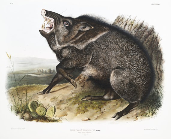 J.J. Audobon, Collared Peccary (Dycoteles torquatus) from the viviparous quadrupeds of North America (1845), 50 x 70 cm, 20 x 25" approx.
$45.20
J.J. Audobon, Collared Peccary (Dycoteles torquatus) from the viviparous quadrupeds of North America (1845), 50 x 70 cm, 20 x 25" approx.
$45.20
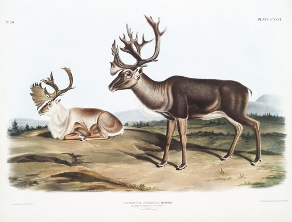 J.J. Audobon, Caribou or North American Rein Deer (Tarandus furcifer) from the viviparous quadrupeds of North America (1845) 20 x 25"
$45.20
J.J. Audobon, Caribou or North American Rein Deer (Tarandus furcifer) from the viviparous quadrupeds of North America (1845) 20 x 25"
$45.20
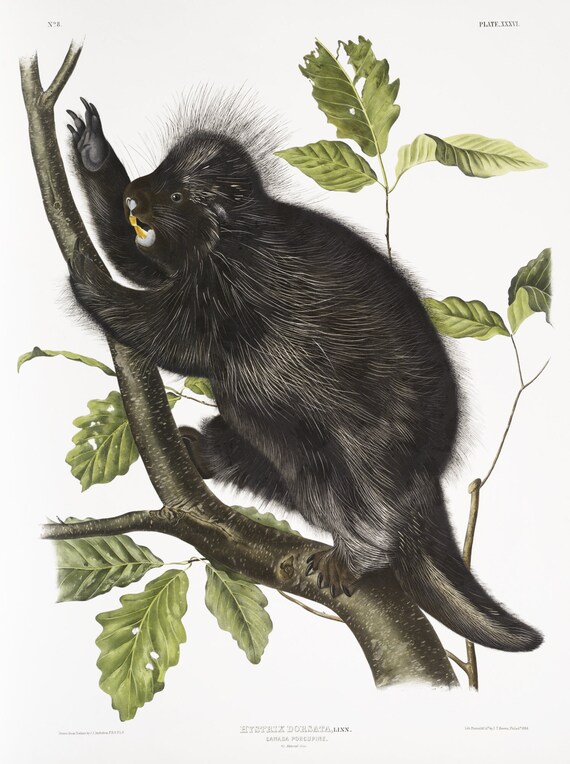 J.J. Audobon, Canada Porcupine (Nystrix dorsata) from the viviparous quadrupeds of North America (1845) , 50 x 70 cm, 20 x 25" approx.
$45.20
J.J. Audobon, Canada Porcupine (Nystrix dorsata) from the viviparous quadrupeds of North America (1845) , 50 x 70 cm, 20 x 25" approx.
$45.20
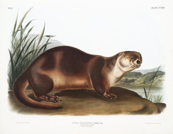 J.J. Audobon, Canada Otter (Lutra Canadensis) from the viviparous quadrupeds of North America (1845), canvas, 50 x 70 cm, 20 x 25" approx.
$45.20
J.J. Audobon, Canada Otter (Lutra Canadensis) from the viviparous quadrupeds of North America (1845), canvas, 50 x 70 cm, 20 x 25" approx.
$45.20
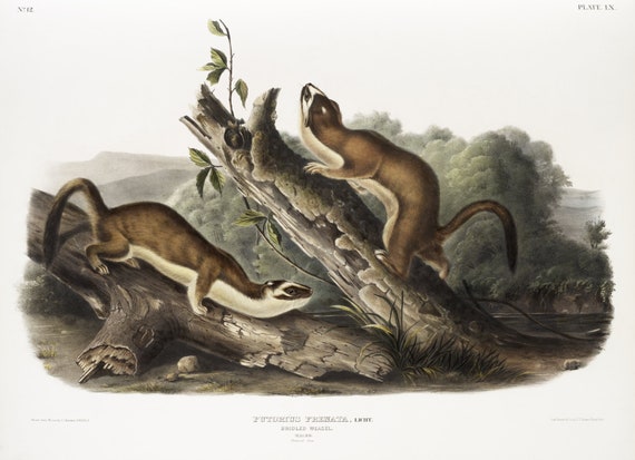 J.J. Audobon, Bridled Weasel (Putorius frenata) from the viviparous quadrupeds of North America (1845) , 50 x 70 cm, 20 x 25" approx.
$45.20
J.J. Audobon, Bridled Weasel (Putorius frenata) from the viviparous quadrupeds of North America (1845) , 50 x 70 cm, 20 x 25" approx.
$45.20
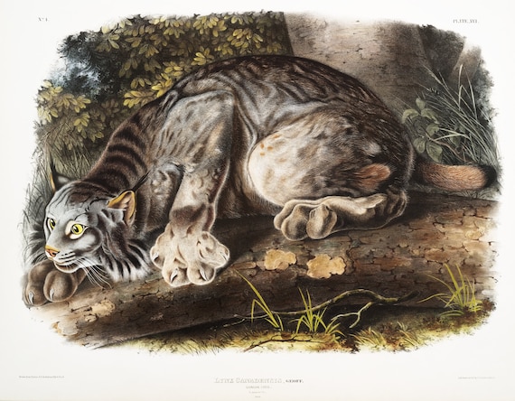 J.J. Audobon, Canada Lynx (Lynx Canadensis) from the viviparous quadrupeds of North America (1845) , canvas, 50 x 70 cm, 20 x 25" approx.
$45.20
J.J. Audobon, Canada Lynx (Lynx Canadensis) from the viviparous quadrupeds of North America (1845) , canvas, 50 x 70 cm, 20 x 25" approx.
$45.20
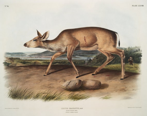 J.J. Audobon, Black-tailed Deer (Cervus macrotis) from the viviparous quadrupeds of North America (1845), 50 x 70 cm, 20 x 25" approx.
$45.20
J.J. Audobon, Black-tailed Deer (Cervus macrotis) from the viviparous quadrupeds of North America (1845), 50 x 70 cm, 20 x 25" approx.
$45.20
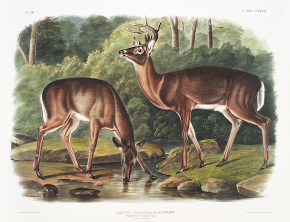 J.J. Audobon, Deer or Virginian Deer (Cervus Virginianus) from the viviparous quadrupeds of North America (1845) , 20 x 25" approx.
$45.20
J.J. Audobon, Deer or Virginian Deer (Cervus Virginianus) from the viviparous quadrupeds of North America (1845) , 20 x 25" approx.
$45.20
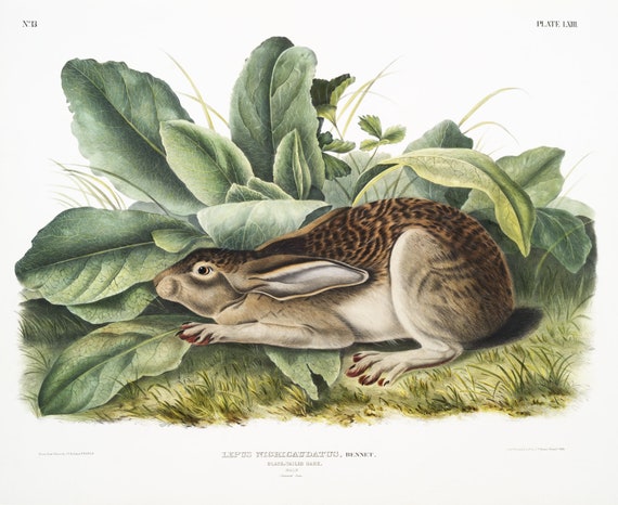 J.J. Audobon, Black-tailed Hare (Lepus negricaudatus) from the viviparous quadrupeds of North America (1845), 50 x 70 cm, 20 x 25" approx.
$45.20
J.J. Audobon, Black-tailed Hare (Lepus negricaudatus) from the viviparous quadrupeds of North America (1845), 50 x 70 cm, 20 x 25" approx.
$45.20
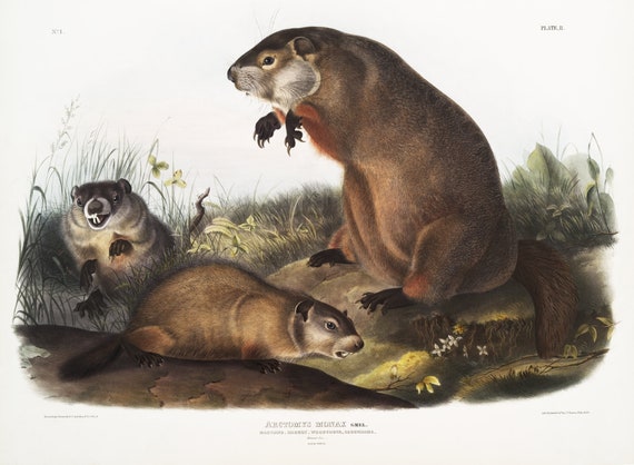 J.J. Audobon, Ground Hog, Woodchuck (Arctomys monax) from the viviparous quadrupeds of North America (1845), 50 x 70 cm, 20 x 25" approx.
$45.20
J.J. Audobon, Ground Hog, Woodchuck (Arctomys monax) from the viviparous quadrupeds of North America (1845), 50 x 70 cm, 20 x 25" approx.
$45.20
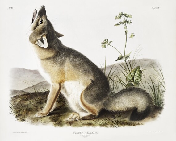 J.J. Audobon, Swift Fox (Vulpes velox) from the viviparous quadrupeds of North America (1845), on canvas, 50 x 70 cm, 20 x 25" approx.
$45.20
J.J. Audobon, Swift Fox (Vulpes velox) from the viviparous quadrupeds of North America (1845), on canvas, 50 x 70 cm, 20 x 25" approx.
$45.20
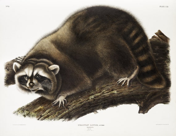 J.J. Audobon, Raccoon (Procyon lotor) from the viviparous quadrupeds of North America (1845) , on canvas, 50 x 70 cm, 20 x 25" approx.
$45.20
J.J. Audobon, Raccoon (Procyon lotor) from the viviparous quadrupeds of North America (1845) , on canvas, 50 x 70 cm, 20 x 25" approx.
$45.20
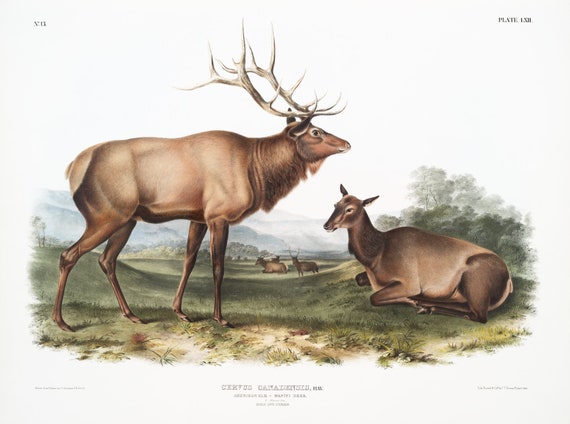 J.J. Audobon, North American Elk (Cervus Canadensis) from the viviparous quadrupeds of North America (1845) , 50 x 70 cm, 20 x 25" approx.
$45.20
J.J. Audobon, North American Elk (Cervus Canadensis) from the viviparous quadrupeds of North America (1845) , 50 x 70 cm, 20 x 25" approx.
$45.20