
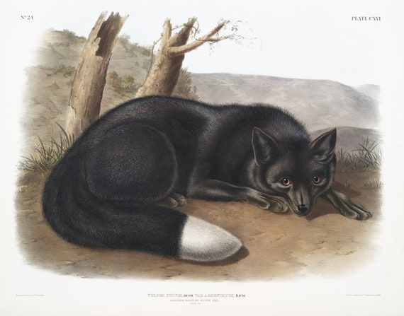
 J.J. Audobon, Black or Silver Fox (Vulpes fulvus) from the viviparous quadrupeds of North America (1845), 50 x 70 cm, 20 x 25" approx.
$45.41
J.J. Audobon, Black or Silver Fox (Vulpes fulvus) from the viviparous quadrupeds of North America (1845), 50 x 70 cm, 20 x 25" approx.
$45.41
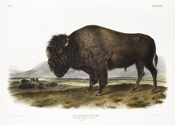 J.J. Audobon, Bison (Bos Americanus) from the viviparous quadrupeds of North America (1845), print on canvas, 50 x 70 cm, 20 x 25" approx.
$45.41
J.J. Audobon, Bison (Bos Americanus) from the viviparous quadrupeds of North America (1845), print on canvas, 50 x 70 cm, 20 x 25" approx.
$45.41
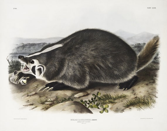 J.J. Audobon, Badger (Meles Labradoria) from the viviparous quadrupeds of North America (1845), 50 x 70 cm, 20 x 25" approx.
$45.41
J.J. Audobon, Badger (Meles Labradoria) from the viviparous quadrupeds of North America (1845), 50 x 70 cm, 20 x 25" approx.
$45.41
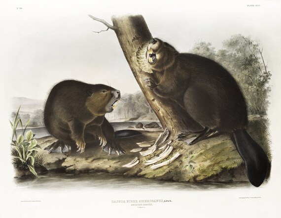 J.J. Audobon, Beaver (Castor fiber Americanus) from the viviparous quadrupeds of North America (1845)' print, 50 x 70 cm, 20 x 25" approx.
$45.41
J.J. Audobon, Beaver (Castor fiber Americanus) from the viviparous quadrupeds of North America (1845)' print, 50 x 70 cm, 20 x 25" approx.
$45.41
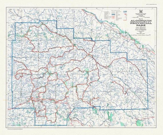 Historic Algonquin Park Map 47A, 1960 , map on heavy cotton canvas, 20 x 25" approx.
$49.19
Historic Algonquin Park Map 47A, 1960 , map on heavy cotton canvas, 20 x 25" approx.
$49.19
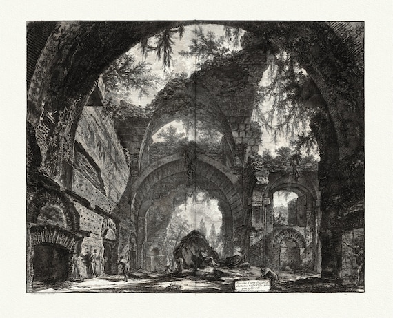 Giovanni Battista Piranesi, Vedute di Roma, Ruins of a Sculpture Gallery at Hadrian's Villa at Tivoli, 1760, cotton canvas, 22x27" approx.
$45.41
Giovanni Battista Piranesi, Vedute di Roma, Ruins of a Sculpture Gallery at Hadrian's Villa at Tivoli, 1760, cotton canvas, 22x27" approx.
$45.41
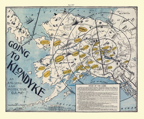 Klondike Game Co., Going to Klondyke, 1897, vintage print on canvas, 50 x 70 cm, 20 x 25" approx.
$45.41
Klondike Game Co., Going to Klondyke, 1897, vintage print on canvas, 50 x 70 cm, 20 x 25" approx.
$45.41
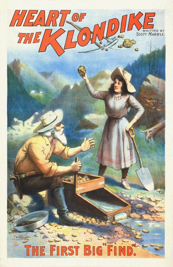 The Heart of the Klondike, The First Big Find, A Book, vintage print on canvas, 50 x 70 cm, 20 x 25" approx.
$45.41
The Heart of the Klondike, The First Big Find, A Book, vintage print on canvas, 50 x 70 cm, 20 x 25" approx.
$45.41
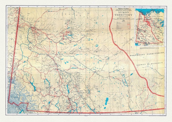 Yukon Territory, South of Latitude 65 degrees ,1936, Vintage Map on Cotton Canvas, 22x27" approx.
$45.41
Yukon Territory, South of Latitude 65 degrees ,1936, Vintage Map on Cotton Canvas, 22x27" approx.
$45.41
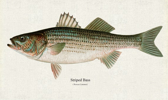 Striped Bass (Roccus Lineatus), 1913, Denton auth., fishing print reprinted on durable cotton canvas, 50 x 70 cm, 20 x 25" approx.
$45.41
Striped Bass (Roccus Lineatus), 1913, Denton auth., fishing print reprinted on durable cotton canvas, 50 x 70 cm, 20 x 25" approx.
$45.41
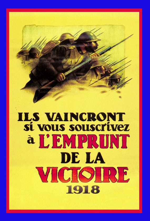 Canada WW I Poster, L'Emprunt de la Victoire, 1918 , vintage war poster reprinted on heavy cotton canvas, 50 x 70 cm, 20 x 25" approx.
$45.41
Canada WW I Poster, L'Emprunt de la Victoire, 1918 , vintage war poster reprinted on heavy cotton canvas, 50 x 70 cm, 20 x 25" approx.
$45.41
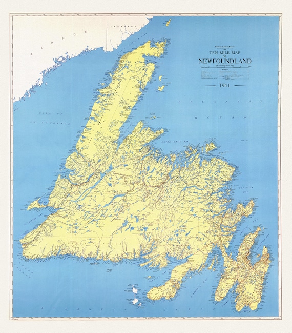 A Ten Mile Map of Newfoundland, 1941 , map on heavy cotton canvas, 50 x 70 cm, 20 x 25" approx.
$45.41
A Ten Mile Map of Newfoundland, 1941 , map on heavy cotton canvas, 50 x 70 cm, 20 x 25" approx.
$45.41
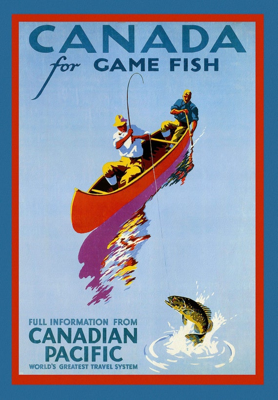 Canada for Game Fish, Canadian Pacific, c. 1950 , travel poster on heavy cotton canvas, 22x27" approx.
$45.41
Canada for Game Fish, Canadian Pacific, c. 1950 , travel poster on heavy cotton canvas, 22x27" approx.
$45.41
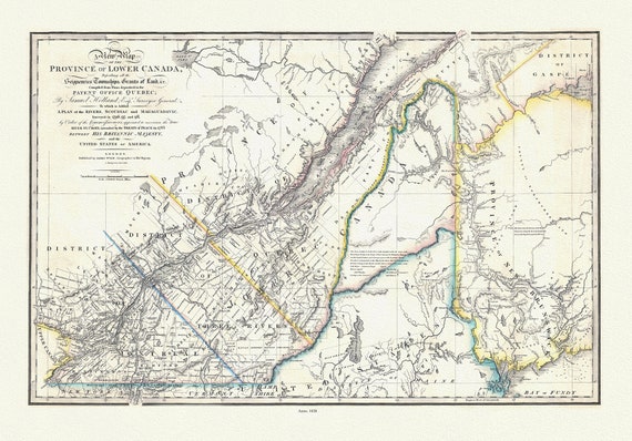 Quebec: Wyld, Map Of The Province Of Lower Canada, 1838 , map on heavy cotton canvas, 22x27" approx.
$41.62
Quebec: Wyld, Map Of The Province Of Lower Canada, 1838 , map on heavy cotton canvas, 22x27" approx.
$41.62
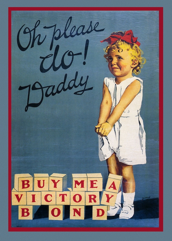 Canada WW I Poster, Oh Please Daddy, Buy Me a Victory Bond, 1915, on heavy cotton canvas, 22x27" approx.
$45.41
Canada WW I Poster, Oh Please Daddy, Buy Me a Victory Bond, 1915, on heavy cotton canvas, 22x27" approx.
$45.41
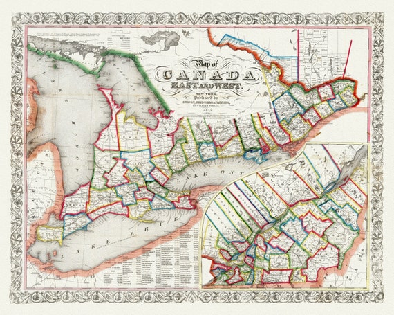 Ensign, Bridgman & Fanning, A Map of Canada East And West, 1855, map on heavy cotton canvas, 22x27" approx.
$45.41
Ensign, Bridgman & Fanning, A Map of Canada East And West, 1855, map on heavy cotton canvas, 22x27" approx.
$45.41
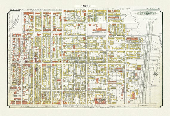 Plate 28, Toronto Downtown East, Cabbagetown & Regent Park, 1903, map on heavy cotton canvas, 20 x 30", 50 x 76cm, approx.
$45.41
Plate 28, Toronto Downtown East, Cabbagetown & Regent Park, 1903, map on heavy cotton canvas, 20 x 30", 50 x 76cm, approx.
$45.41
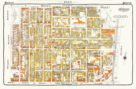 Plate 28, Toronto Central East, Cabbagetown, 1913, map on heavy cotton canvas, 20 x 30" approx.
$45.41
Plate 28, Toronto Central East, Cabbagetown, 1913, map on heavy cotton canvas, 20 x 30" approx.
$45.41
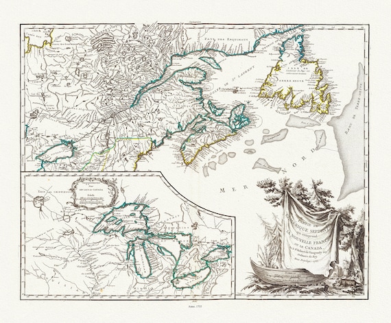 Nouvelle France ou le Canada, 1755, map on heavy cotton canvas, 22x27", 22x27" approx.
$45.41
Nouvelle France ou le Canada, 1755, map on heavy cotton canvas, 22x27", 22x27" approx.
$45.41
 Plate 114, Toronto East, Danforth Ave., Dawes Ave., 1913, map on heavy cotton canvas, 20 x 30" or 50 x 75cm. approx.
$45.41
Plate 114, Toronto East, Danforth Ave., Dawes Ave., 1913, map on heavy cotton canvas, 20 x 30" or 50 x 75cm. approx.
$45.41