
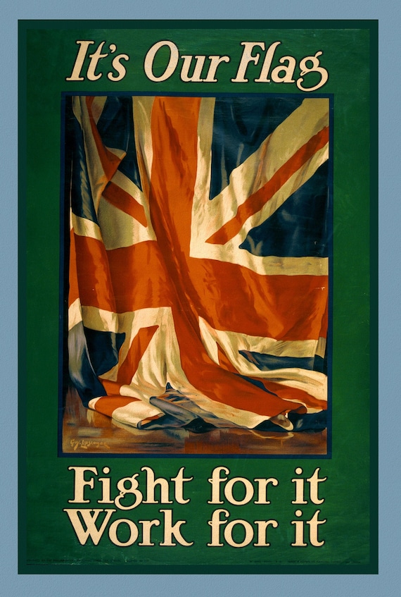
 It's our flag. Fight for it. Work for it, Canada WW I Poster, 1915
$45.41
It's our flag. Fight for it. Work for it, Canada WW I Poster, 1915
$45.41
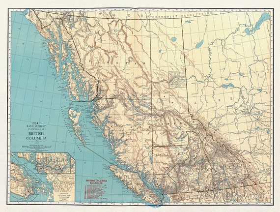 British Columbia, Commercial Atlas, Rand McNally & Company, 1924, map on heavy cotton canvas, 50 x 70cm, 20 x 25" approx.
$45.41
British Columbia, Commercial Atlas, Rand McNally & Company, 1924, map on heavy cotton canvas, 50 x 70cm, 20 x 25" approx.
$45.41
 Plate 61, Toronto West, High Park North to Junction, 1913
$45.41
Plate 61, Toronto West, High Park North to Junction, 1913
$45.41
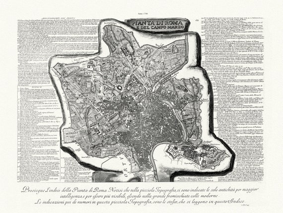 Giovanni Battista Piranesi, Vedute di Roma, Map Of Rome, Part. 1, 1748, map on heavy cotton canvas, 22x27" approx.
$45.41
Giovanni Battista Piranesi, Vedute di Roma, Map Of Rome, Part. 1, 1748, map on heavy cotton canvas, 22x27" approx.
$45.41
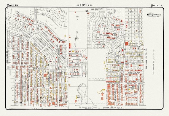 Plate 73, Toronto Uptown West, Wychwood North, 1923, Map on heavy cotton canvas, 18x27in. approx.
$45.41
Plate 73, Toronto Uptown West, Wychwood North, 1923, Map on heavy cotton canvas, 18x27in. approx.
$45.41
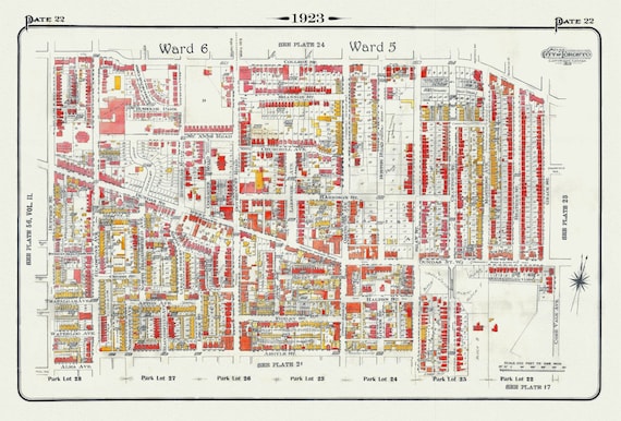 Plate 22, Toronto West, Parkdale & Brockton, 1923, Map on heavy cotton canvas, 18x27in. approx.
$45.41
Plate 22, Toronto West, Parkdale & Brockton, 1923, Map on heavy cotton canvas, 18x27in. approx.
$45.41
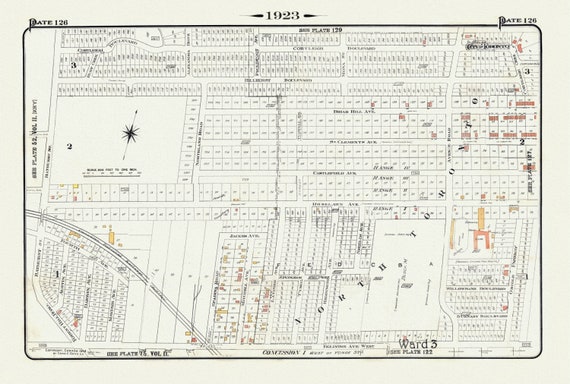 Plate 126, Toronto Uptown, Hunt Club, 1923, Map on heavy cotton canvas, 18x27in. approx.
$45.41
Plate 126, Toronto Uptown, Hunt Club, 1923, Map on heavy cotton canvas, 18x27in. approx.
$45.41
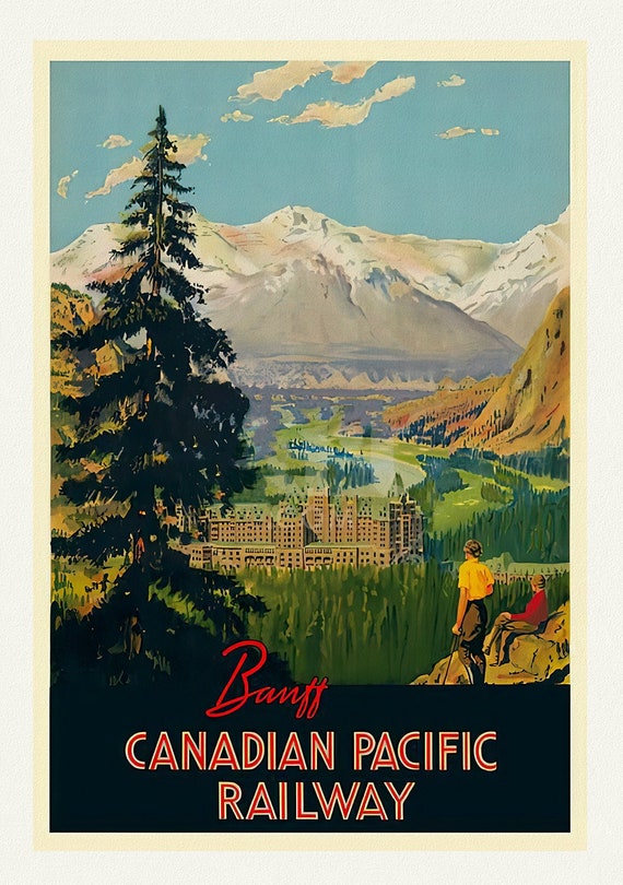 Banff, Canadian Pacific Railway , vintage travel poster reprinted on heavy cotton canvas, 50 x 70 cm, 20 x 25" approx.
$45.41
Banff, Canadian Pacific Railway , vintage travel poster reprinted on heavy cotton canvas, 50 x 70 cm, 20 x 25" approx.
$45.41
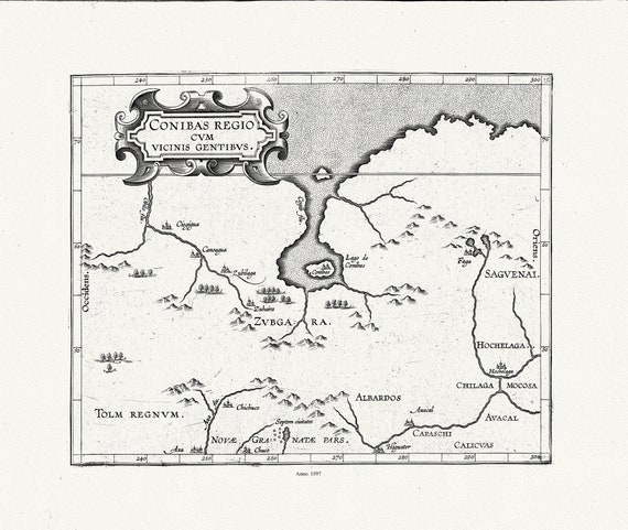 Wytfliet, Corneille, Conibas regio cum vicinis gentibus, Central Canada, 1597E
$45.41
Wytfliet, Corneille, Conibas regio cum vicinis gentibus, Central Canada, 1597E
$45.41
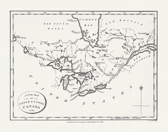 Morse, New Map of Upper & Lower Canada, 1794 , map on heavy cotton canvas, 22x27" approx.
$45.41
Morse, New Map of Upper & Lower Canada, 1794 , map on heavy cotton canvas, 22x27" approx.
$45.41
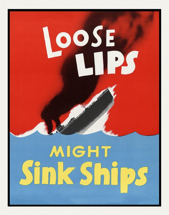 Loose Lips Might Sink Ships
$45.41
Loose Lips Might Sink Ships
$45.41
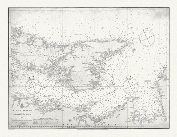 Nautical Chart, Gulf of St. Lawrence. Sheet IX, Eastern Part of Northumberland Strait, 1872, map on heavy cotton canvas, 20 x 25" approx.
$45.41
Nautical Chart, Gulf of St. Lawrence. Sheet IX, Eastern Part of Northumberland Strait, 1872, map on heavy cotton canvas, 20 x 25" approx.
$45.41
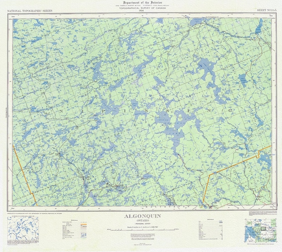 Topographical Map of Algonquin, 1934 , map on heavy cotton canvas, 22x27" approx.
$45.41
Topographical Map of Algonquin, 1934 , map on heavy cotton canvas, 22x27" approx.
$45.41
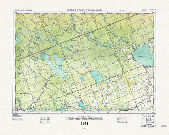 Historic Algonquin Park Map, Round Lake, National Topographic Series, 1951 , map on heavy cotton canvas, 45 x 65 cm, 18 x 24" approx.
$45.41
Historic Algonquin Park Map, Round Lake, National Topographic Series, 1951 , map on heavy cotton canvas, 45 x 65 cm, 18 x 24" approx.
$45.41
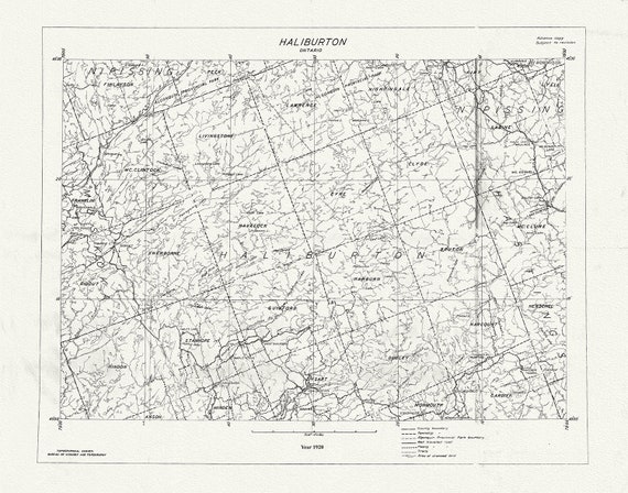 Historic Algonquin Park Map, National Topographic Series, Haliburton County, 1920
$45.41
Historic Algonquin Park Map, National Topographic Series, Haliburton County, 1920
$45.41
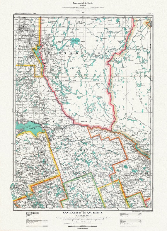 Historic Algonquin Park Map, Nipissing District, 1922, map on heavy cotton canvas, 20 x 30" or 50 x 75cm. approx.
$45.41
Historic Algonquin Park Map, Nipissing District, 1922, map on heavy cotton canvas, 20 x 30" or 50 x 75cm. approx.
$45.41
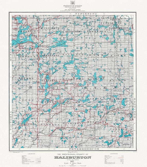 Historic Algonquin Park Map, Haliburton County, 1937 Ver. A, map on heavy cotton canvas, 45 x 65 cm, 18 x 24" approx.
$45.41
Historic Algonquin Park Map, Haliburton County, 1937 Ver. A, map on heavy cotton canvas, 45 x 65 cm, 18 x 24" approx.
$45.41
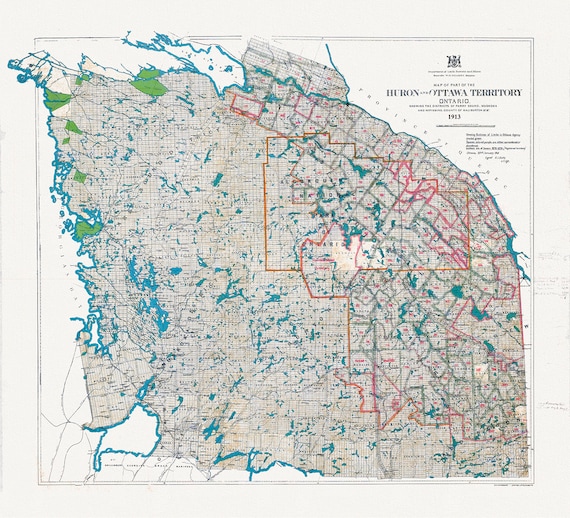 Algonquin Park Area, Part of the Huron and Ottawa Territories, 1913 , map on heavy cotton canvas, 45 x 65 cm, 18 x 24" approx.
$45.41
Algonquin Park Area, Part of the Huron and Ottawa Territories, 1913 , map on heavy cotton canvas, 45 x 65 cm, 18 x 24" approx.
$45.41
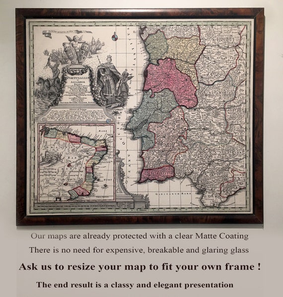 Have you been saving a Vintage Picture Frame in Your Garage?
$45.41
Have you been saving a Vintage Picture Frame in Your Garage?
$45.41
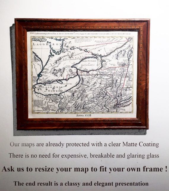 Order a Custom Sized Canvas Map to fit an Existing Frame that you are Saving !!
$45.41
Order a Custom Sized Canvas Map to fit an Existing Frame that you are Saving !!
$45.41