
 Banff in the Canadian Rockies, vintage travel poster on durable cotton canvas, 50 x 70 cm, 20 x 25" approx
$45.20
Banff in the Canadian Rockies, vintage travel poster on durable cotton canvas, 50 x 70 cm, 20 x 25" approx
$45.20
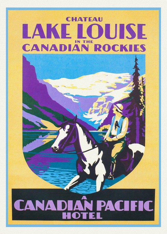 Chateau Lake Louise in the Canadian Rockies, vintage print on canvas, 50 x 70 cm, 20 x 25" approx.
$45.20
Chateau Lake Louise in the Canadian Rockies, vintage print on canvas, 50 x 70 cm, 20 x 25" approx.
$45.20
 Trans-Canada, Canadian Pacific Railway Ver. XXXVI, vintage poster on durable cotton canvas, 50 x 70 cm, 20 x 25" approx.
$45.20
Trans-Canada, Canadian Pacific Railway Ver. XXXVI, vintage poster on durable cotton canvas, 50 x 70 cm, 20 x 25" approx.
$45.20
 Trans-Canada, Canadian Pacific Railway Ver. XXX
$45.20
Trans-Canada, Canadian Pacific Railway Ver. XXX
$45.20
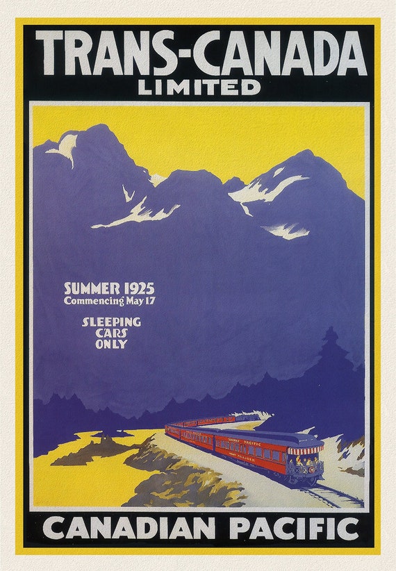
 Trans-Canada, Canadian Pacific Railway Ver. V , vintage poster on durable cotton canvas, 50 x 70 cm, 20 x 25" approx.
$45.20
Trans-Canada, Canadian Pacific Railway Ver. V , vintage poster on durable cotton canvas, 50 x 70 cm, 20 x 25" approx.
$45.20
 CNR Across Canada, vintage war poster on durable cotton canvas, 50 x 70 cm, 20 x 25" approx.
$45.20
CNR Across Canada, vintage war poster on durable cotton canvas, 50 x 70 cm, 20 x 25" approx.
$45.20
 CPR, Travel by Train, Ver. II , vintage poster on durable cotton canvas, 50 x 70 cm, 20 x 25" approx.
$45.20
CPR, Travel by Train, Ver. II , vintage poster on durable cotton canvas, 50 x 70 cm, 20 x 25" approx.
$45.20
 Trans-Canada, Canadian Pacific Railway Ver. VI, vintage war poster on durable cotton canvas, 50 x 70 cm, 20 x 25" approx.
$45.20
Trans-Canada, Canadian Pacific Railway Ver. VI, vintage war poster on durable cotton canvas, 50 x 70 cm, 20 x 25" approx.
$45.20
 Trans-Canada Ltd., Canadian Pacific Ver. III , vintage poster on durable cotton canvas, 50 x 70 cm, 20 x 25" approx.
$45.20
Trans-Canada Ltd., Canadian Pacific Ver. III , vintage poster on durable cotton canvas, 50 x 70 cm, 20 x 25" approx.
$45.20
 Trans Canada Ltd., Canadian Pacific, 1925, vintage poster on durable cotton canvas, 50 x 70 cm, 20 x 25" approx.
$45.20
Trans Canada Ltd., Canadian Pacific, 1925, vintage poster on durable cotton canvas, 50 x 70 cm, 20 x 25" approx.
$45.20
 Trans Canada Ltd., Fastest Train Across the Continent, vintage poster on durable cotton canvas, 50 x 70 cm, 20 x 25" approx.
$45.20
Trans Canada Ltd., Fastest Train Across the Continent, vintage poster on durable cotton canvas, 50 x 70 cm, 20 x 25" approx.
$45.20
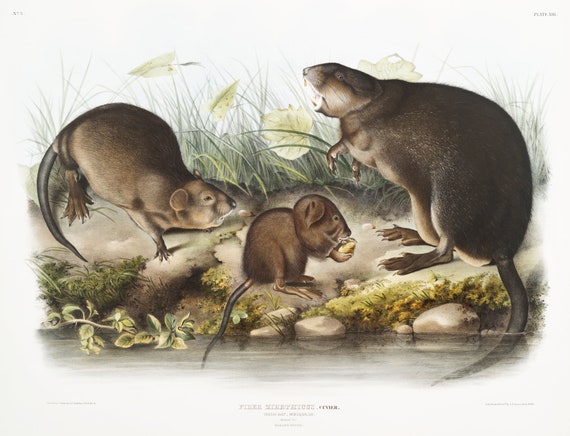 J.J. Audobon, Musk-Rat, Musquash (Fiber Zibethicus) from the viviparous quadrupeds of North America (1845) , 50 x 70 cm, 20 x 25" approx.
$45.20
J.J. Audobon, Musk-Rat, Musquash (Fiber Zibethicus) from the viviparous quadrupeds of North America (1845) , 50 x 70 cm, 20 x 25" approx.
$45.20
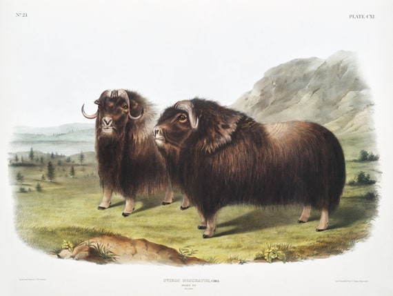 J.J. Audobon, Musk Ox (Ovibos moschatus) from the viviparous quadrupeds of North America (1845), on canvas, 50 x 70 cm, 20 x 25" approx.
$45.20
J.J. Audobon, Musk Ox (Ovibos moschatus) from the viviparous quadrupeds of North America (1845), on canvas, 50 x 70 cm, 20 x 25" approx.
$45.20
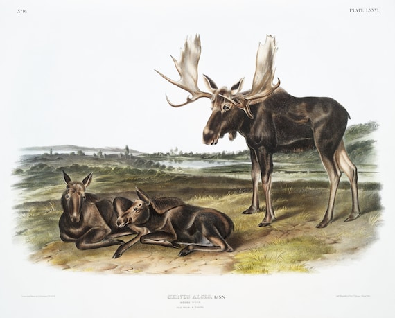 J.J. Audobon, Moose Deer (Servus alces) from the viviparous quadrupeds of North America (1845) , on canvas, 50 x 70 cm, 20 x 25" approx.
$45.20
J.J. Audobon, Moose Deer (Servus alces) from the viviparous quadrupeds of North America (1845) , on canvas, 50 x 70 cm, 20 x 25" approx.
$45.20
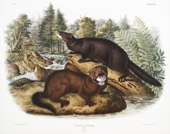 J.J. Audobon, Mink (Putorius vison) from the viviparous quadrupeds of North America (1845), print on canvas, 50 x 70 cm, 20 x 25" approx.
$45.20
J.J. Audobon, Mink (Putorius vison) from the viviparous quadrupeds of North America (1845), print on canvas, 50 x 70 cm, 20 x 25" approx.
$45.20
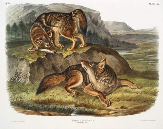 J.J. Audobon, Prairie Wolf (Canis latrans) from the viviparous quadrupeds of North America (1845), on canvas, 50 x 70 cm, 20 x 25" approx.
$45.20
J.J. Audobon, Prairie Wolf (Canis latrans) from the viviparous quadrupeds of North America (1845), on canvas, 50 x 70 cm, 20 x 25" approx.
$45.20
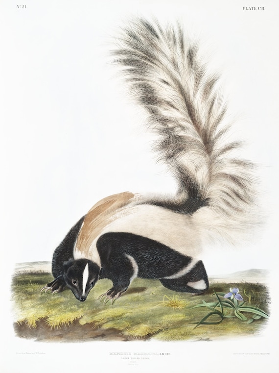 J.J. Audobon, Large-tailed Skunk (Mephitis macroura) from the viviparous quadrupeds of North America (1845), 50 x 70 cm, 20 x 25" approx.
$45.20
J.J. Audobon, Large-tailed Skunk (Mephitis macroura) from the viviparous quadrupeds of North America (1845), 50 x 70 cm, 20 x 25" approx.
$45.20
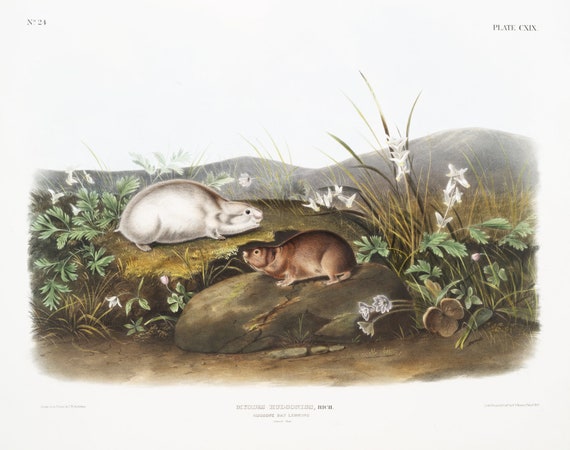 J.J. Audobon, Hudson Bay Lemming (Myodes Hudsonius) from the viviparous quadrupeds of North America (1845) ,canvas, 20 x 25" approx.
$45.20
J.J. Audobon, Hudson Bay Lemming (Myodes Hudsonius) from the viviparous quadrupeds of North America (1845) ,canvas, 20 x 25" approx.
$45.20
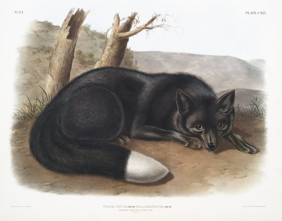 J.J. Audobon, North American Black or Silver Fox (Vulpes fulvus) from the viviparous quadrupeds of North America (1845) , 20 x 25" approx.
$45.20
J.J. Audobon, North American Black or Silver Fox (Vulpes fulvus) from the viviparous quadrupeds of North America (1845) , 20 x 25" approx.
$45.20
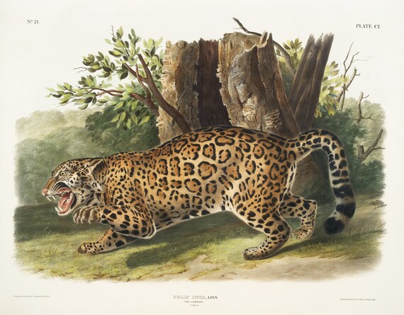 J.J. Audobon, Jaguar (Felis onca) from the viviparous quadrupeds of North America (1845), on canvas, 50 x 70 cm, 20 x 25" approx.
$45.20
J.J. Audobon, Jaguar (Felis onca) from the viviparous quadrupeds of North America (1845), on canvas, 50 x 70 cm, 20 x 25" approx.
$45.20