
 Map of the North West Territory illustrating the British and United States boundary line, , 1872-3-4, map on cotton canvas, 22x27" approx.
$41.75
Map of the North West Territory illustrating the British and United States boundary line, , 1872-3-4, map on cotton canvas, 22x27" approx.
$41.75
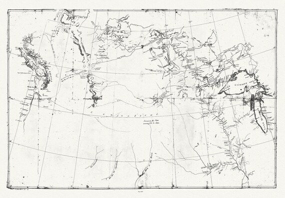 Meriwether Lewis, A Map showing the Mississippi, the Missouri above Kansas, Lakes Michigan, Superior, and Winnipeg, 1803, canvas, 22x27"
$41.75
Meriwether Lewis, A Map showing the Mississippi, the Missouri above Kansas, Lakes Michigan, Superior, and Winnipeg, 1803, canvas, 22x27"
$41.75
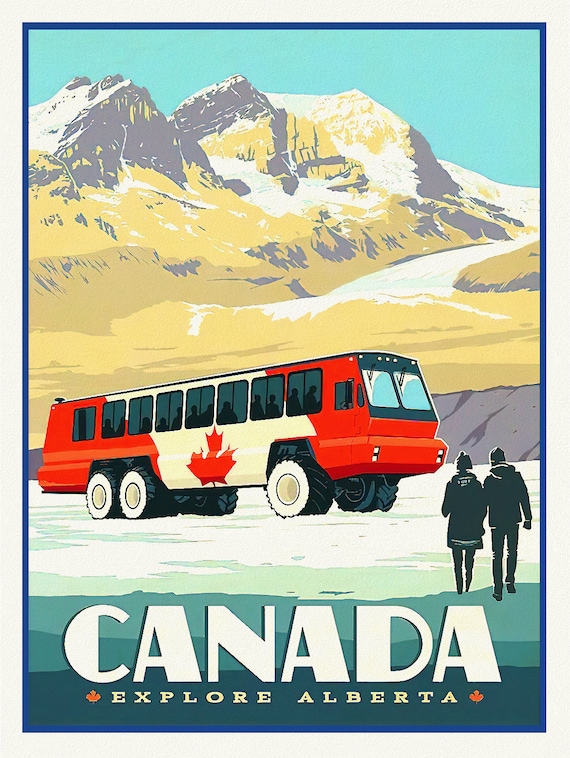 Canada, Explore Alberta! , travel poster on heavy cotton canvas, 45 x 65 cm, 18 x 24" approx.
$37.95
Canada, Explore Alberta! , travel poster on heavy cotton canvas, 45 x 65 cm, 18 x 24" approx.
$37.95
 E Canadian Pacific, Visit Canada Ver. II , travel poster on heavy cotton canvas, 45 x 65 cm, 18 x 24" approx.
$41.75
E Canadian Pacific, Visit Canada Ver. II , travel poster on heavy cotton canvas, 45 x 65 cm, 18 x 24" approx.
$41.75
 Septemtrionaliora Americae a Groenlandia, per Freta Davidis et Hudson, de Straet Davis end Straet Hudson tot Terra Neuf, 1765, 22x27" canvas
$41.75
Septemtrionaliora Americae a Groenlandia, per Freta Davidis et Hudson, de Straet Davis end Straet Hudson tot Terra Neuf, 1765, 22x27" canvas
$41.75
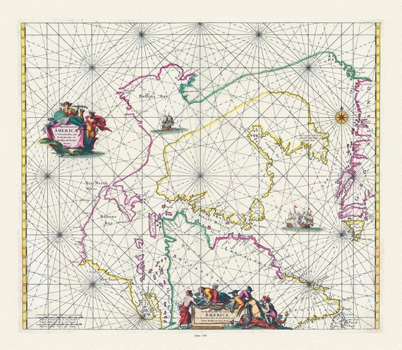
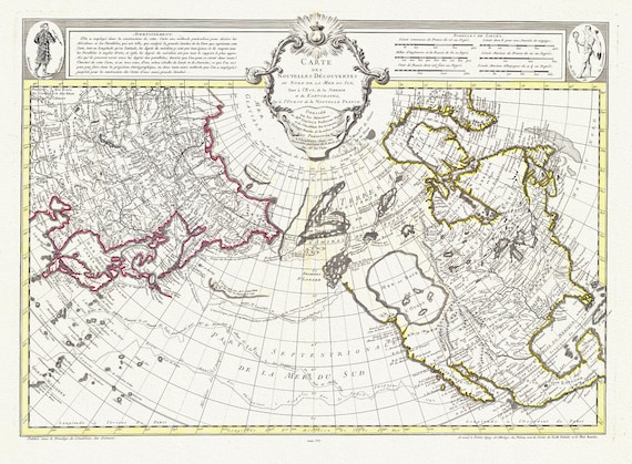
 Vaugondy et Diderot, Mapping of the Northwest Passage, 1772, map on heavy cotton canvas, 22x27" approx.
$41.75
Vaugondy et Diderot, Mapping of the Northwest Passage, 1772, map on heavy cotton canvas, 22x27" approx.
$41.75
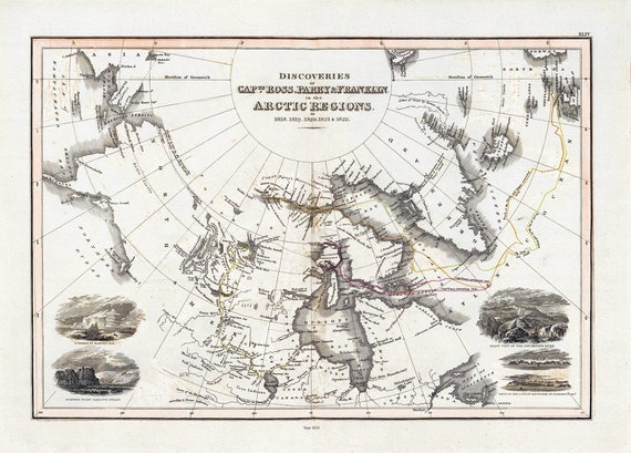 Thomson et Wyld, Discoveries Capts. Ross, Parry & Franklin in the Arctic Regions, 1824, map on heavy cotton canvas, 22x27" approx.
$41.75
Thomson et Wyld, Discoveries Capts. Ross, Parry & Franklin in the Arctic Regions, 1824, map on heavy cotton canvas, 22x27" approx.
$41.75
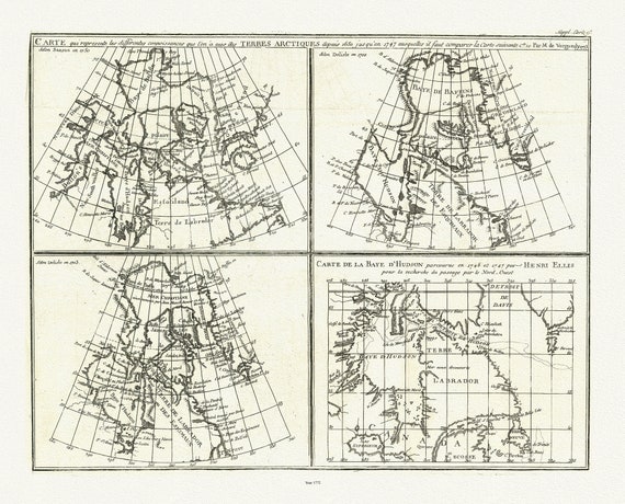
 Chart containing part of the Icy Sea, Greenland, Islands about Baffins Bay and Hudsons Bay, 1776 , map on heavy cotton canvas, 22x27" approx
$41.75
Chart containing part of the Icy Sea, Greenland, Islands about Baffins Bay and Hudsons Bay, 1776 , map on heavy cotton canvas, 22x27" approx
$41.75
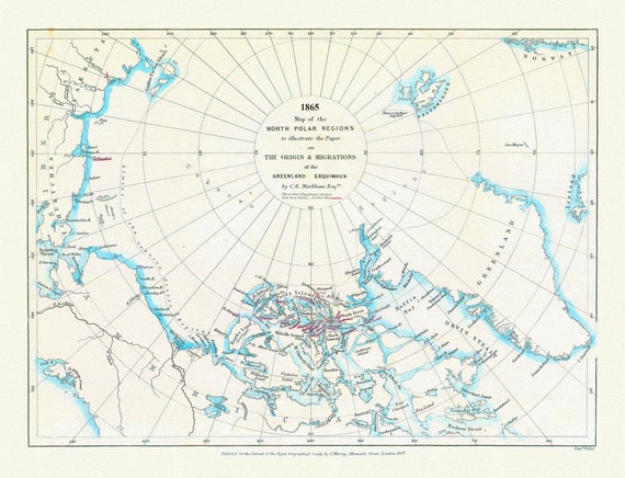 Map of the north polar regions to illustrate the origin & migrations of the Greenland Esquimaux, 1865 ,on heavy cotton canvas, 22x27"
$41.75
Map of the north polar regions to illustrate the origin & migrations of the Greenland Esquimaux, 1865 ,on heavy cotton canvas, 22x27"
$41.75
 Buache et Delisle, Carte Des Nouvelles Decouvertes Au Nord de la Mer de Sud, 1752, map on heavy cotton canvas, 22x27" approx.
$41.75
Buache et Delisle, Carte Des Nouvelles Decouvertes Au Nord de la Mer de Sud, 1752, map on heavy cotton canvas, 22x27" approx.
$41.75
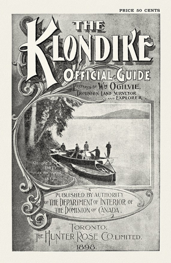 The Klondike Official Guide, 1898, travel poster on heavy cotton canvas, 45 x 65 cm, 18 x 24" approx.
$41.75
The Klondike Official Guide, 1898, travel poster on heavy cotton canvas, 45 x 65 cm, 18 x 24" approx.
$41.75
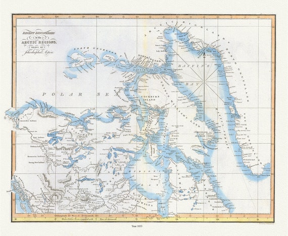 Recent discoveries in the Arctic Regions, 1833, Aspen auth. , map on durable cotton canvas, 50 x 70 cm, 20 x 25" approx.
$41.75
Recent discoveries in the Arctic Regions, 1833, Aspen auth. , map on durable cotton canvas, 50 x 70 cm, 20 x 25" approx.
$41.75
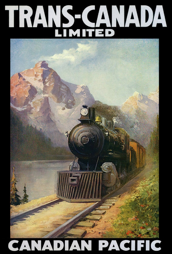 Trans-Canada Ltd., Canadian Pacific Ver. II vintage print on canvas, 50 x 70 cm, 20 x 25" approx.
$41.75
Trans-Canada Ltd., Canadian Pacific Ver. II vintage print on canvas, 50 x 70 cm, 20 x 25" approx.
$41.75
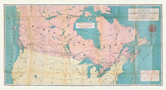 Canada, its history, productions and natural resources, 1886, map on heavy cotton canvas, 16x36" approx.
$45.54
Canada, its history, productions and natural resources, 1886, map on heavy cotton canvas, 16x36" approx.
$45.54
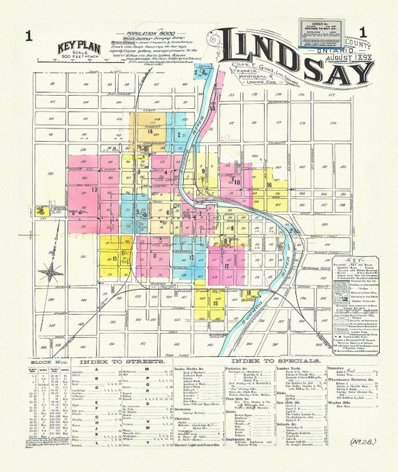 Key Plan, Lindsay, Ontario, 1898, map on heavy cotton canvas, 45 x 65 cm, 18 x 24" approx.
$41.75
Key Plan, Lindsay, Ontario, 1898, map on heavy cotton canvas, 45 x 65 cm, 18 x 24" approx.
$41.75
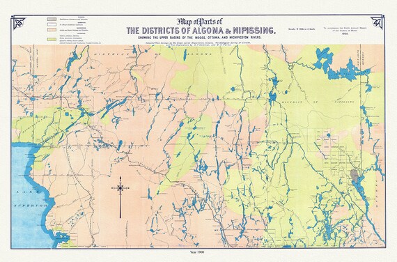 Algoma and Nipissing Districts, a geological map, 1900 , map on heavy cotton canvas, 45 x 65 cm, 18 x 24" approx.
$41.75
Algoma and Nipissing Districts, a geological map, 1900 , map on heavy cotton canvas, 45 x 65 cm, 18 x 24" approx.
$41.75
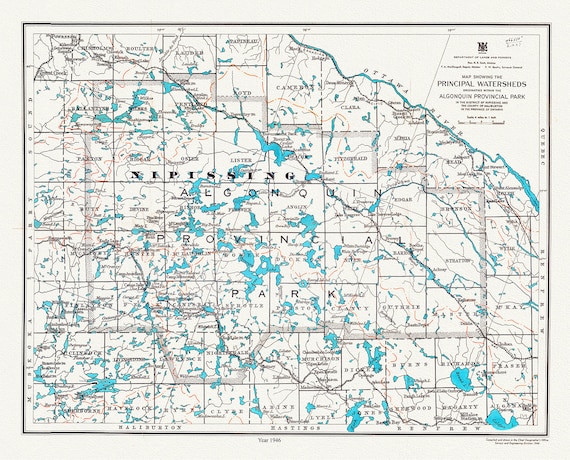 Algonquin Provincial Park, Principal Watersheds, 1946 , map on heavy cotton canvas, 45 x 65 cm, 18 x 24" approx.
$41.75
Algonquin Provincial Park, Principal Watersheds, 1946 , map on heavy cotton canvas, 45 x 65 cm, 18 x 24" approx.
$41.75
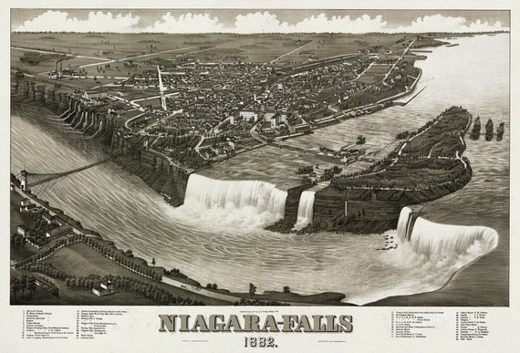 Niagara-Falls, 1882, A Birds' Eye View, , map on heavy cotton canvas, 22x27" approx.
$41.75
Niagara-Falls, 1882, A Birds' Eye View, , map on heavy cotton canvas, 22x27" approx.
$41.75
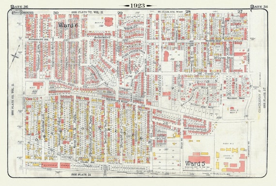 Plate 36, Toronto Northwest, North Dovercourt & Brackondale, 1923, Map on heavy cotton canvas, 18x27in. approx.
$41.75
Plate 36, Toronto Northwest, North Dovercourt & Brackondale, 1923, Map on heavy cotton canvas, 18x27in. approx.
$41.75
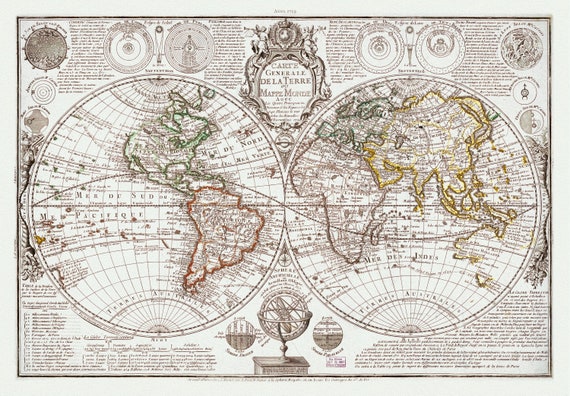 Danet, Carte Generale de la Terre, 1729, Map on heavy cotton canvas, 22x27in. approx.
$41.75
Danet, Carte Generale de la Terre, 1729, Map on heavy cotton canvas, 22x27in. approx.
$41.75