
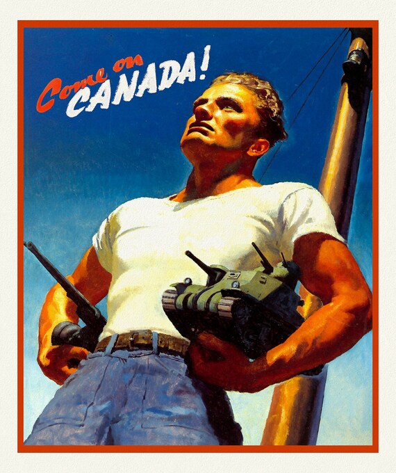
 Come on Canada! Ver. II, vintage war poster on durable cotton canvas, 50 x 70 cm, 20 x 25" approx.
$41.69
Come on Canada! Ver. II, vintage war poster on durable cotton canvas, 50 x 70 cm, 20 x 25" approx.
$41.69
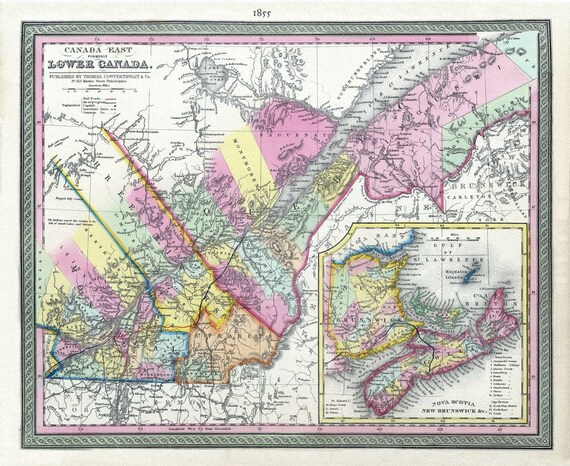 Lower Canada, 1855, Mitchell auth., map on heavy cotton canvas, 50 x 70cm, 20 x 25" approx.
$41.69
Lower Canada, 1855, Mitchell auth., map on heavy cotton canvas, 50 x 70cm, 20 x 25" approx.
$41.69
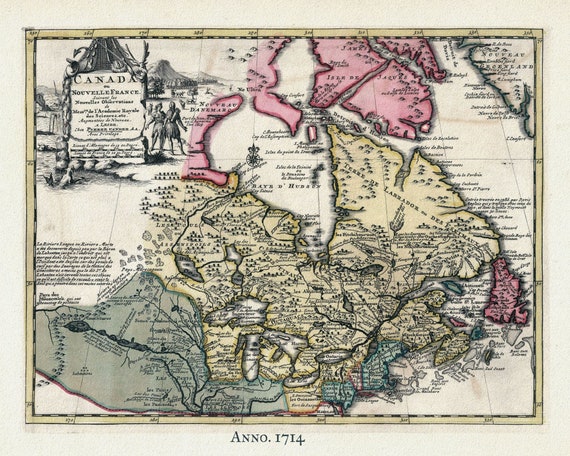 Nouvelles France, 1714, Pieter van der Aa auth. , map on heavy cotton canvas, 50 x 70cm, 20 x 25" approx.
$41.69
Nouvelles France, 1714, Pieter van der Aa auth. , map on heavy cotton canvas, 50 x 70cm, 20 x 25" approx.
$41.69
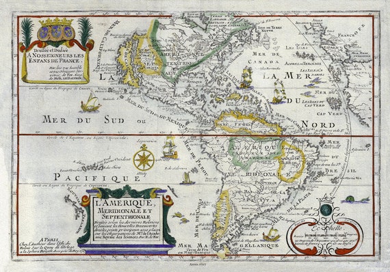 Western Hemishere, 1717, de Fer auth., map on heavy cotton canvas, 50 x 70cm, 20 x 25" approx.
$41.69
Western Hemishere, 1717, de Fer auth., map on heavy cotton canvas, 50 x 70cm, 20 x 25" approx.
$41.69
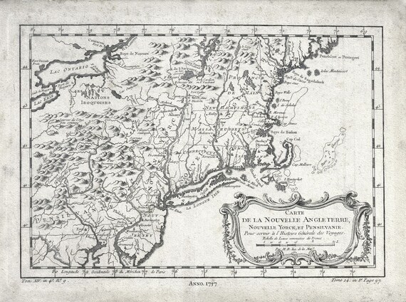 New England, 1757, Bellin auth. , map on heavy cotton canvas, 50 x 70cm, 20 x 25" approx.
$41.69
New England, 1757, Bellin auth. , map on heavy cotton canvas, 50 x 70cm, 20 x 25" approx.
$41.69
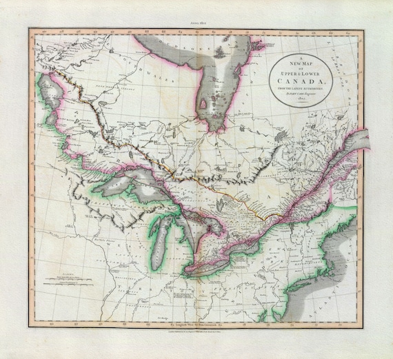 Upper & Lower Canada, 1801, Carey, auth. map on heavy cotton canvas, 50 x 70cm, 20 x 25" approx.
$41.69
Upper & Lower Canada, 1801, Carey, auth. map on heavy cotton canvas, 50 x 70cm, 20 x 25" approx.
$41.69
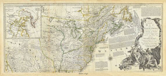
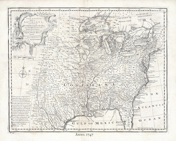 Canada, Louisiana, 1747, Bowen, , map on heavy cotton canvas, 50 x 70cm, 20 x 25" approx.
$41.69
Canada, Louisiana, 1747, Bowen, , map on heavy cotton canvas, 50 x 70cm, 20 x 25" approx.
$41.69
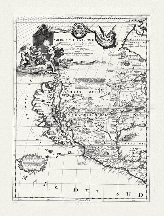 America Settentrionale colle nuoue scoperte fin al'anno 1688, diuisa nelle sue parti secundo lo stato.1688.Coronelli, canvas, 20 x 25"
$41.69
America Settentrionale colle nuoue scoperte fin al'anno 1688, diuisa nelle sue parti secundo lo stato.1688.Coronelli, canvas, 20 x 25"
$41.69
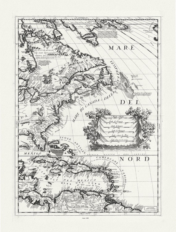 America Settentrionale le colle nuoue scoperte fin al'anno 1688, diuisa nelle sue parti secundo lo stato.1688.Coronelli, canvas, 20 x 25"
$41.69
America Settentrionale le colle nuoue scoperte fin al'anno 1688, diuisa nelle sue parti secundo lo stato.1688.Coronelli, canvas, 20 x 25"
$41.69
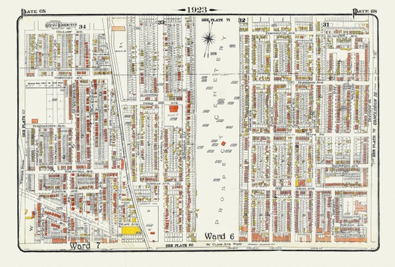 Plate 68, Toronto North West, Caledonia & St. Clair, Prospect Cemetery, 1923, Map on heavy cotton canvas, 18x27in. approx.
$41.69
Plate 68, Toronto North West, Caledonia & St. Clair, Prospect Cemetery, 1923, Map on heavy cotton canvas, 18x27in. approx.
$41.69
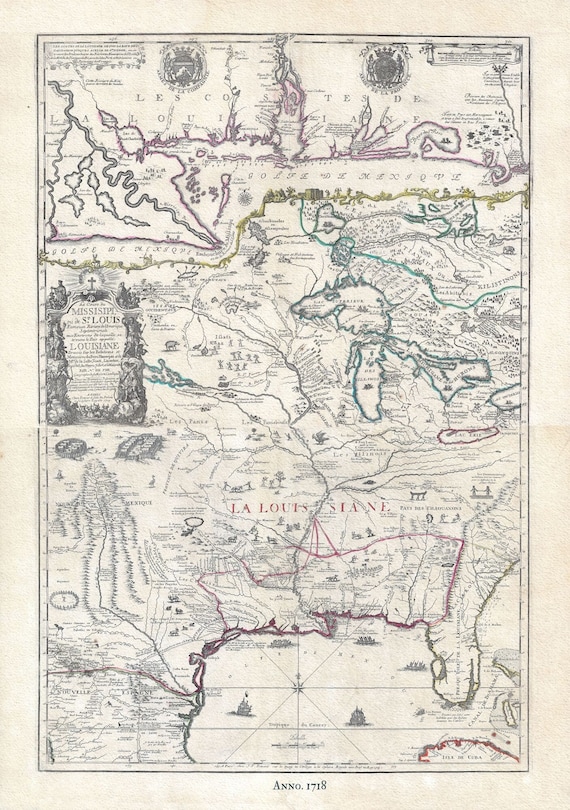 Louisiana & Great Lakes, 1718, de Fer auth. , map on heavy cotton canvas, 50 x 70cm, 20 x 27" approx.
$41.69
Louisiana & Great Lakes, 1718, de Fer auth. , map on heavy cotton canvas, 50 x 70cm, 20 x 27" approx.
$41.69
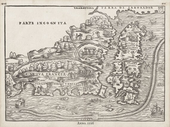 Gastaldi, La Nuova Francia, 1556, map on heavy cotton canvas, 50 x 70cm, 20 x 27" approx.
$41.69
Gastaldi, La Nuova Francia, 1556, map on heavy cotton canvas, 50 x 70cm, 20 x 27" approx.
$41.69
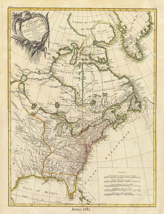 North America II, 1783, Bonne auth., map on heavy cotton canvas, 50 x 70cm, 20 x 27" approx.
$41.69
North America II, 1783, Bonne auth., map on heavy cotton canvas, 50 x 70cm, 20 x 27" approx.
$41.69
 North America, 1747, Bowen auth. , map on heavy cotton canvas, 50 x 70cm, 20 x 27" approx.
$41.69
North America, 1747, Bowen auth. , map on heavy cotton canvas, 50 x 70cm, 20 x 27" approx.
$41.69
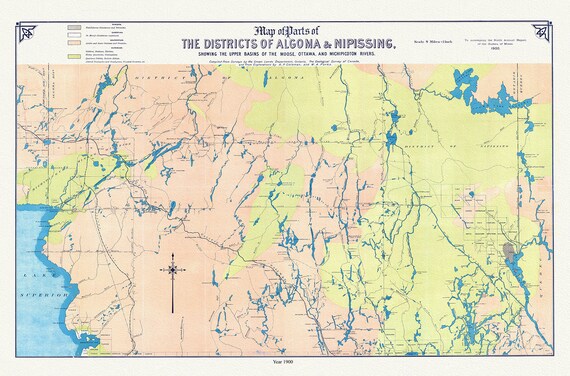 Algoma and Nipissing Districts, a geological map, 1900 , map on heavy cotton canvas, 45 x 65 cm, 18 x 24" approx.
$41.69
Algoma and Nipissing Districts, a geological map, 1900 , map on heavy cotton canvas, 45 x 65 cm, 18 x 24" approx.
$41.69
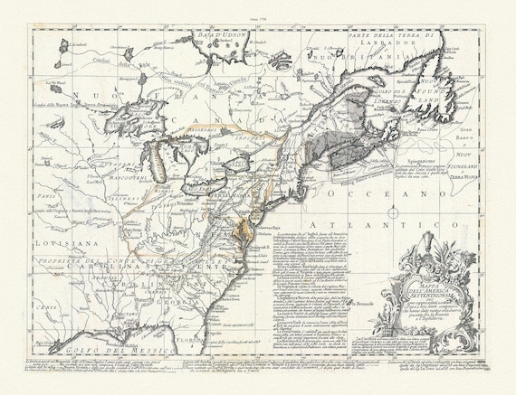
 Part of North America,containing Canada, the north parts of New England and New York, with Nova Scotia and Newfoundland,1777, canvas, 20x25"
$41.69
Part of North America,containing Canada, the north parts of New England and New York, with Nova Scotia and Newfoundland,1777, canvas, 20x25"
$41.69
 Nova Francia et Canada, 1597, , map on heavy cotton canvas, 50 x 70cm, 20 x 27" approx.
$41.69
Nova Francia et Canada, 1597, , map on heavy cotton canvas, 50 x 70cm, 20 x 27" approx.
$41.69
 Mappa dell' America Settentrionale et i paesi e che hanno dato motivo alla guerra presente fra la Francia e l'Inghilterra, 1758, Bellin,
$41.69
Mappa dell' America Settentrionale et i paesi e che hanno dato motivo alla guerra presente fra la Francia e l'Inghilterra, 1758, Bellin,
$41.69
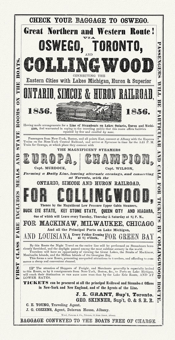 Railways to Collingwood, 1856, map on durable cotton canvas, 16x29" approx.
$41.69
Railways to Collingwood, 1856, map on durable cotton canvas, 16x29" approx.
$41.69
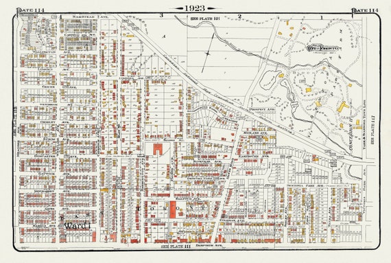 Plate 114, Toronto East, Danforth, Dentonia, Dawes Road, 1923, Map on heavy cotton canvas, 18x27in. approx.
$41.69
Plate 114, Toronto East, Danforth, Dentonia, Dawes Road, 1923, Map on heavy cotton canvas, 18x27in. approx.
$41.69