
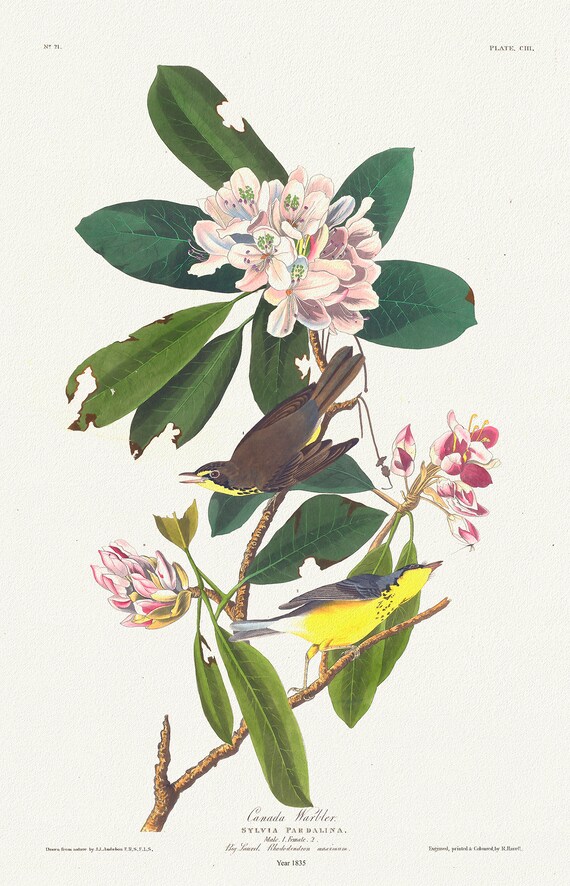
 J.J. Audobon, Canada Warbler. Sylvia pardalina. 1835, bird print on durable cotton canvas, 19x27inches(50x70cm) approx.
$41.75
J.J. Audobon, Canada Warbler. Sylvia pardalina. 1835, bird print on durable cotton canvas, 19x27inches(50x70cm) approx.
$41.75
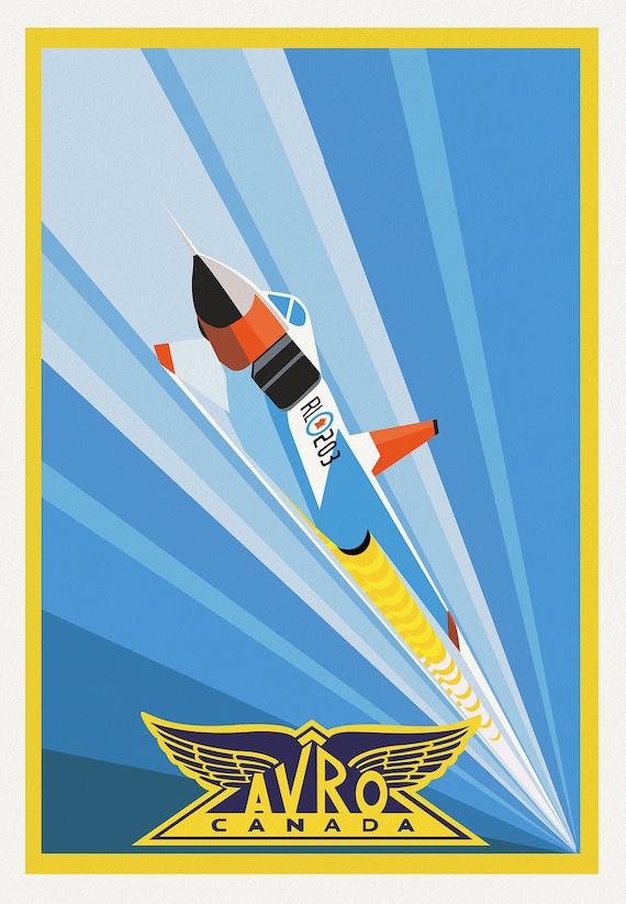 Avro Arrow Canada, Aviation Poster, on heavy cotton canvas, 20 x 27" approx.
$41.75
Avro Arrow Canada, Aviation Poster, on heavy cotton canvas, 20 x 27" approx.
$41.75
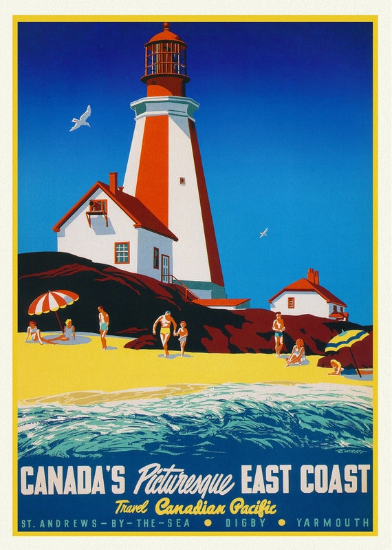 Canada's Picturesque East Coast, Travel Canadian Pacific , travel poster on heavy cotton canvas, 20x25" approx.
$41.75
Canada's Picturesque East Coast, Travel Canadian Pacific , travel poster on heavy cotton canvas, 20x25" approx.
$41.75
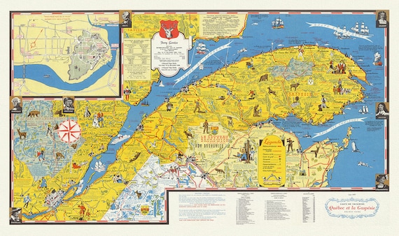 Quebec: Carte de vacanes, Quebec et la Gaspesie Holiday guide, 1959, map on heavy cotton canvas, 22x27" approx.
$41.75
Quebec: Carte de vacanes, Quebec et la Gaspesie Holiday guide, 1959, map on heavy cotton canvas, 22x27" approx.
$41.75
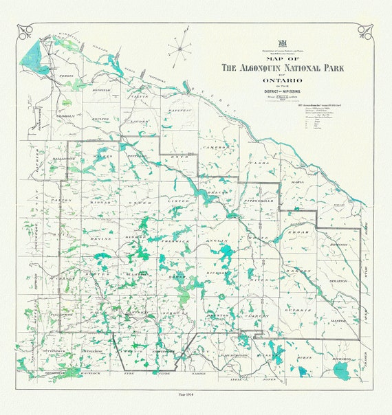 Historic Algonquin Park Map, 1914, map on heavy cotton canvas, 20x27" approx
$41.75
Historic Algonquin Park Map, 1914, map on heavy cotton canvas, 20x27" approx
$41.75
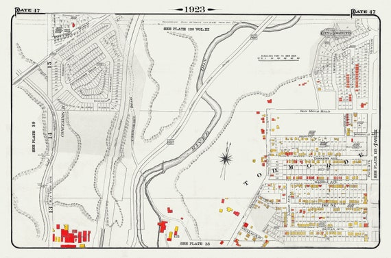 Plate 47, Toronto East York, Todmorden, 1923, Map on heavy cotton canvas, 18x27in. approx.
$41.75
Plate 47, Toronto East York, Todmorden, 1923, Map on heavy cotton canvas, 18x27in. approx.
$41.75
 Plate 41, Toronto West, Junction Triangle, 1903, map on heavy cotton canvas, 20 x 30", 50 x 76cm, approx.
$41.75
Plate 41, Toronto West, Junction Triangle, 1903, map on heavy cotton canvas, 20 x 30", 50 x 76cm, approx.
$41.75
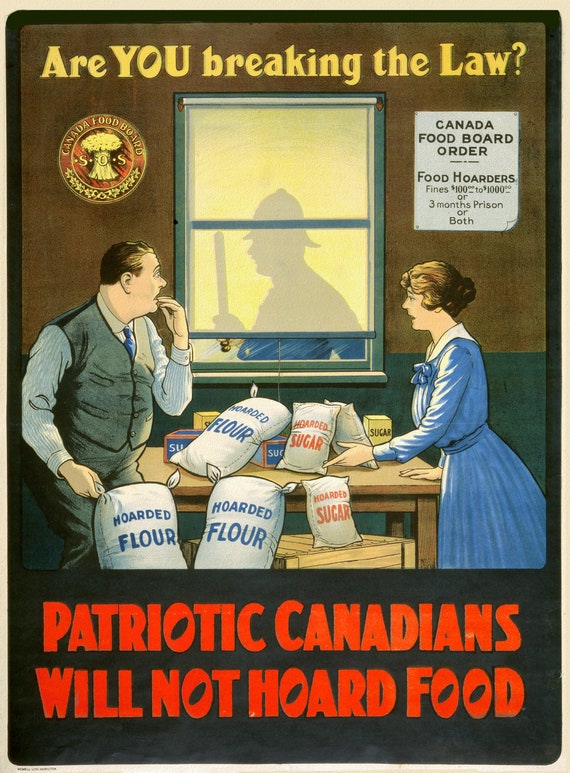 Are you Breaking the Law? Patriotic Canadians will not Hoard Food, Canada WW I Poster, 1914, on heavy cotton canvas, 22x27in
$41.75
Are you Breaking the Law? Patriotic Canadians will not Hoard Food, Canada WW I Poster, 1914, on heavy cotton canvas, 22x27in
$41.75
 Romani Imperii Imago, 1607, (The Roman Empire), map on heavy cotton canvas, 22x27" approx.
$41.75
Romani Imperii Imago, 1607, (The Roman Empire), map on heavy cotton canvas, 22x27" approx.
$41.75
 Canada Department of the Interior, West sheet. Geological Map of the Dominion of Canada, 1915, map on heavy cotton canvas, 22x27" approx.
$41.75
Canada Department of the Interior, West sheet. Geological Map of the Dominion of Canada, 1915, map on heavy cotton canvas, 22x27" approx.
$41.75
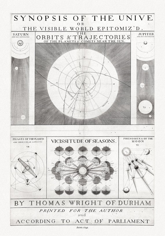 Thomas Wright, A synopsis of the Universe, or, the visible world epitomiz'd, Plate 1, 1742 ,map on heavy cotton canvas, 22x27" approx.
$41.75
Thomas Wright, A synopsis of the Universe, or, the visible world epitomiz'd, Plate 1, 1742 ,map on heavy cotton canvas, 22x27" approx.
$41.75
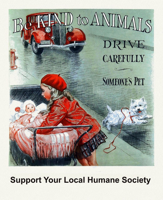 Be Kind to Animals, Support Your Local Humane Society, vintage poster on heavy cotton canvas, 50 x 70cm, 20 x 25" approx.
$41.75
Be Kind to Animals, Support Your Local Humane Society, vintage poster on heavy cotton canvas, 50 x 70cm, 20 x 25" approx.
$41.75
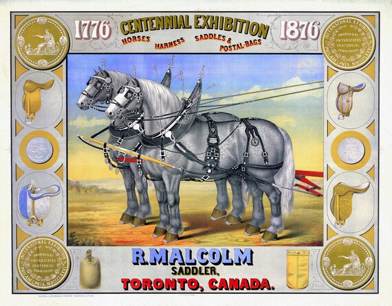 Poster, Centennial Exhibition, R. Malcolm, Sadler, Toronto, 1876
$41.75
Poster, Centennial Exhibition, R. Malcolm, Sadler, Toronto, 1876
$41.75
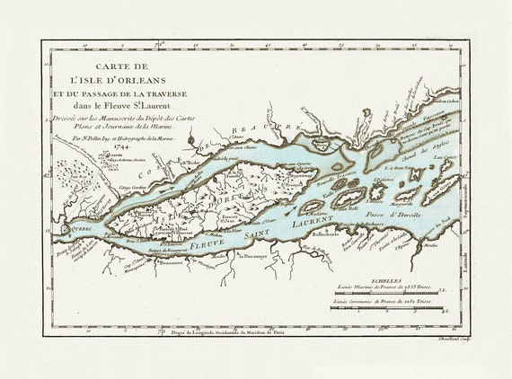 Bellin, Carte de L'Isle d'Orleans, 1745 , map on heavy cotton canvas, 20x27" approx.
$41.75
Bellin, Carte de L'Isle d'Orleans, 1745 , map on heavy cotton canvas, 20x27" approx.
$41.75
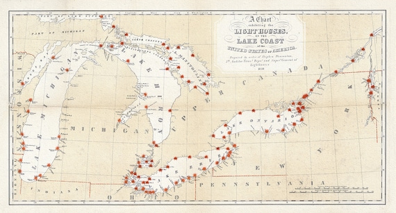 Great Lakes Lighthouses, 1848 , map on heavy cotton canvas, 50 x 70cm, 20 x 25" approx.
$41.75
Great Lakes Lighthouses, 1848 , map on heavy cotton canvas, 50 x 70cm, 20 x 25" approx.
$41.75
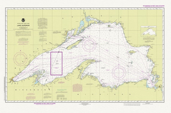 Nautical Chart of Lake Superior, 2016, map on heavy cotton canvas, 50 x 70cm, 20 x 25" approx.
$45.54
Nautical Chart of Lake Superior, 2016, map on heavy cotton canvas, 50 x 70cm, 20 x 25" approx.
$45.54
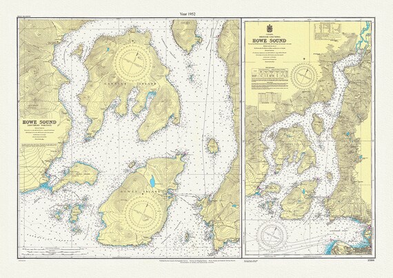 Howe Sound, British Columbia, A Topographical Map,1952
$41.75
Howe Sound, British Columbia, A Topographical Map,1952
$41.75
 Map showing mounted police stations in the North West Territories, 1904, map on heavy cotton canvas, 22x27" approx.
$41.75
Map showing mounted police stations in the North West Territories, 1904, map on heavy cotton canvas, 22x27" approx.
$41.75
 Bird's eye view of Chatham, Ontario, 1870, map on heavy cotton canvas, 22x27" approx.
$41.75
Bird's eye view of Chatham, Ontario, 1870, map on heavy cotton canvas, 22x27" approx.
$41.75
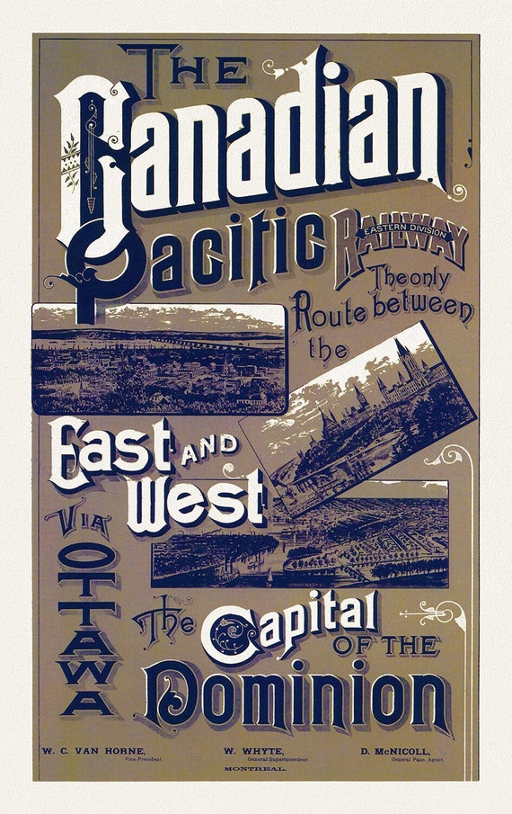 Canadian Pacific Railways, Eastern Division, 1887, vintage print on canvas, 50 x 70 cm, 20 x 25" approx.
$41.75
Canadian Pacific Railways, Eastern Division, 1887, vintage print on canvas, 50 x 70 cm, 20 x 25" approx.
$41.75