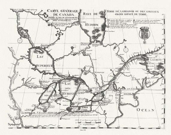
 Carte Générale de Canada, Lahontan auth.,1703, map on durable cotton canvas, 50 x 70 cm, 20 x 25" approx.
$41.32
Carte Générale de Canada, Lahontan auth.,1703, map on durable cotton canvas, 50 x 70 cm, 20 x 25" approx.
$41.32
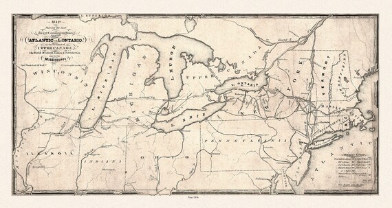 Map showing the most direct commercial route from the Atlantic, 1836 Ver. II, Price auth., on canvas, 50 x 70 cm, 20 x 25" approx.
$41.32
Map showing the most direct commercial route from the Atlantic, 1836 Ver. II, Price auth., on canvas, 50 x 70 cm, 20 x 25" approx.
$41.32
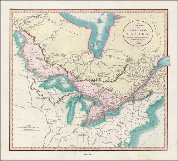 A New Map of Upper & Lower Canada, From the Latest Authorities, 1807, John Cary auth., cotton canvas, 50 x 70 cm, 20 x 25" approx.
$41.32
A New Map of Upper & Lower Canada, From the Latest Authorities, 1807, John Cary auth., cotton canvas, 50 x 70 cm, 20 x 25" approx.
$41.32
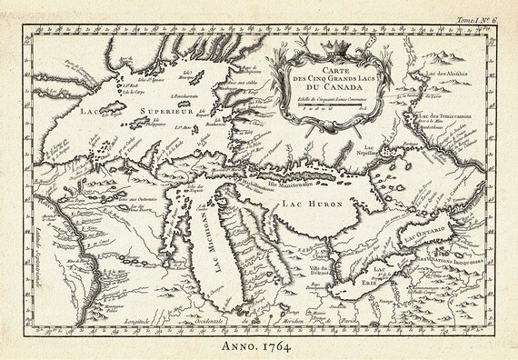 Carte des Cinq Grand Lacs du Canada, Bellin auth.,1764 Ver. II, map on durable cotton canvas, 50 x 70 cm, 20 x 25" approx.
$41.32
Carte des Cinq Grand Lacs du Canada, Bellin auth.,1764 Ver. II, map on durable cotton canvas, 50 x 70 cm, 20 x 25" approx.
$41.32
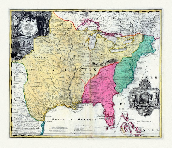
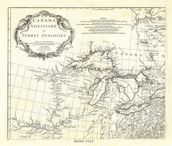 Canada, Louisiane et Terres Angloises, 1755, map on durable cotton canvas, 50 x 70 cm, 20 x 25" approx.
$41.32
Canada, Louisiane et Terres Angloises, 1755, map on durable cotton canvas, 50 x 70 cm, 20 x 25" approx.
$41.32
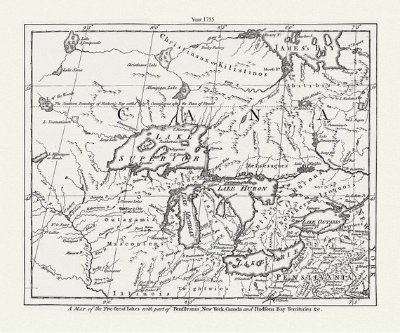 The Five Great Lakes with part of Pensilvania, New York, Canada and Hudsons Bay territories &c.,1755 , canvas, 50 x 70 cm, 20 x 25" approx.
$41.32
The Five Great Lakes with part of Pensilvania, New York, Canada and Hudsons Bay territories &c.,1755 , canvas, 50 x 70 cm, 20 x 25" approx.
$41.32
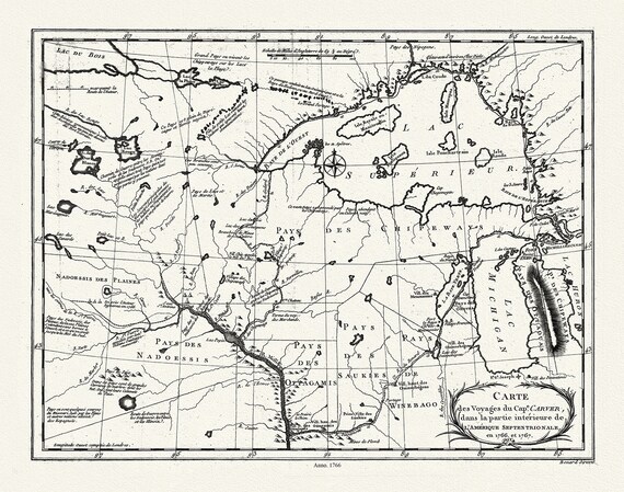 Carte des voyages du Cape. Carver, dans la partie intérieure de l'Amérique septentrionale en 1766, et 1767., 50 x 70 cm, 20 x 25" approx.
$41.32
Carte des voyages du Cape. Carver, dans la partie intérieure de l'Amérique septentrionale en 1766, et 1767., 50 x 70 cm, 20 x 25" approx.
$41.32
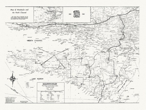 Map of Manitoulin and the North Channel 1862 to 1962, map on durable cotton canvas, 50 x 70 cm, 20 x 25" approx.
$41.32
Map of Manitoulin and the North Channel 1862 to 1962, map on durable cotton canvas, 50 x 70 cm, 20 x 25" approx.
$41.32
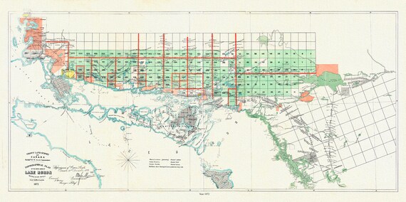 Lake Huron, North Shore, A Topographical plan of the north shore of shewing recent surveys, 1872, on canvas, 50 x 70 cm, 20 x 25" approx.
$41.32
Lake Huron, North Shore, A Topographical plan of the north shore of shewing recent surveys, 1872, on canvas, 50 x 70 cm, 20 x 25" approx.
$41.32
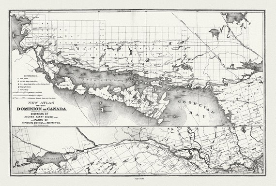 Lake Huron, North Shore, Algoma, Manitoulin, Parry Sound, 1880 , map on durable cotton canvas, 50 x 70 cm, 20 x 25" approx.
$41.32
Lake Huron, North Shore, Algoma, Manitoulin, Parry Sound, 1880 , map on durable cotton canvas, 50 x 70 cm, 20 x 25" approx.
$41.32
 RCMP, Maintain The Right, Ver. IX , vintage poster on heavy cotton canvas, 50 x 70 cm, 20 x 25" approx.
$41.32
RCMP, Maintain The Right, Ver. IX , vintage poster on heavy cotton canvas, 50 x 70 cm, 20 x 25" approx.
$41.32
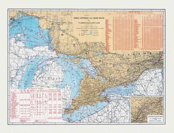 Department of the Interior, Canals, Lighthouses and sailing routes on St. Lawrence River & Great Lakes, 1915, cotton canvas, 22x27" approx.
$41.32
Department of the Interior, Canals, Lighthouses and sailing routes on St. Lawrence River & Great Lakes, 1915, cotton canvas, 22x27" approx.
$41.32
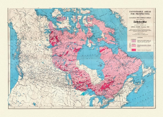 Etsy- Map of Favourable Areas for Prospecting in the Canadian Precambrian Shield, 1943, map on heavy cotton canvas, 22x27" approx.
$41.32
Etsy- Map of Favourable Areas for Prospecting in the Canadian Precambrian Shield, 1943, map on heavy cotton canvas, 22x27" approx.
$41.32
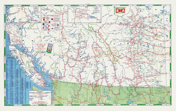 Road Map of the Provinces of British Columbia and Alberta, 1940 , map on heavy cotton canvas, 22x27" approx.
$41.32
Road Map of the Provinces of British Columbia and Alberta, 1940 , map on heavy cotton canvas, 22x27" approx.
$41.32
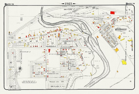 Plate 76, Toronto West, Etobicoke, Lambton Mills & Kingsway, 1923, Map on heavy cotton canvas, 18x27in. approx.
$41.32
Plate 76, Toronto West, Etobicoke, Lambton Mills & Kingsway, 1923, Map on heavy cotton canvas, 18x27in. approx.
$41.32
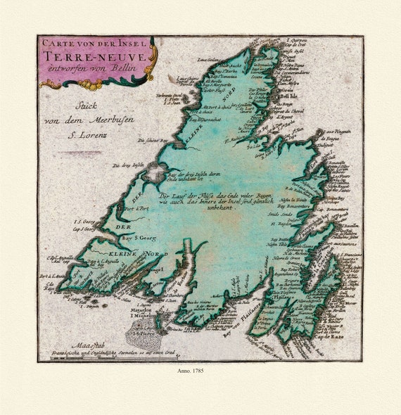 Map of Newfoundland, Canada, 1785, Authors Bellin et Raspe, on Heavy durable cotton canvas, approx. 20 x 24"
$41.32
Map of Newfoundland, Canada, 1785, Authors Bellin et Raspe, on Heavy durable cotton canvas, approx. 20 x 24"
$41.32
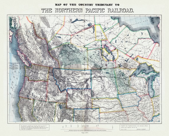 Northern Pacific Railroad, compiled from English, Canadian, and American sources, 1871, map on heavy cotton canvas, 22x27" approx.
$33.80
Northern Pacific Railroad, compiled from English, Canadian, and American sources, 1871, map on heavy cotton canvas, 22x27" approx.
$33.80
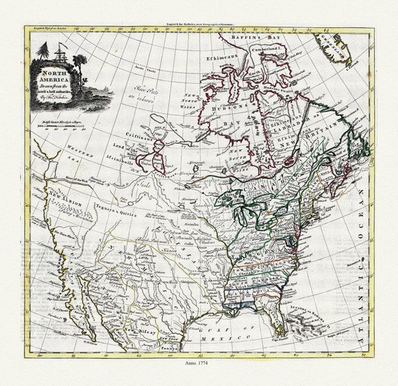 Guthrie et Kitchin, North America, 1774 , map on heavy cotton canvas, 22x27" approx.
$41.32
Guthrie et Kitchin, North America, 1774 , map on heavy cotton canvas, 22x27" approx.
$41.32
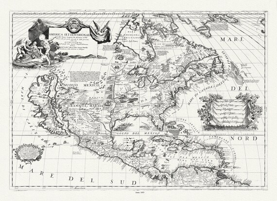 Coronelli (Vicenzo 1650-1718), America Settentrionale, 1693, map on heavy cotton canvas, 22x27" approx.
$41.32
Coronelli (Vicenzo 1650-1718), America Settentrionale, 1693, map on heavy cotton canvas, 22x27" approx.
$41.32
 Hennepin, Amplissima regionis Mississipi, Francisc Riviere Mississippi in America septentrionali, 1687, map on heavy cotton canvas, 22x27"
$41.32
Hennepin, Amplissima regionis Mississipi, Francisc Riviere Mississippi in America septentrionali, 1687, map on heavy cotton canvas, 22x27"
$41.32