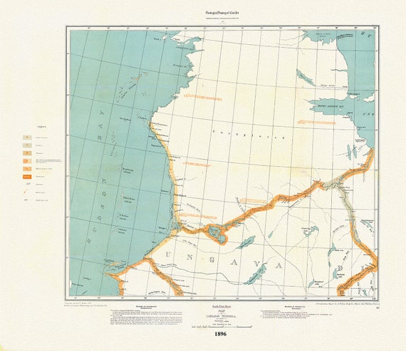
 Labrador Peninsula, NW Sheet, 1896 , map on heavy cotton canvas, 45 x 65 cm, 18 x 24" approx.
$41.32
Labrador Peninsula, NW Sheet, 1896 , map on heavy cotton canvas, 45 x 65 cm, 18 x 24" approx.
$41.32
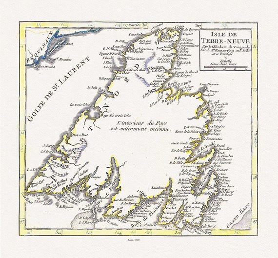 Isle de Terre-neuve, Vaugondy auth., 1749 , map on heavy cotton canvas, 45 x 65 cm, 18 x 24" approx.
$41.32
Isle de Terre-neuve, Vaugondy auth., 1749 , map on heavy cotton canvas, 45 x 65 cm, 18 x 24" approx.
$41.32
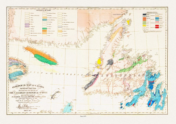 Geological map of Canada and Newfoundland, 1875 , map on heavy cotton canvas, 45 x 65 cm, 18 x 24" approx.
$41.32
Geological map of Canada and Newfoundland, 1875 , map on heavy cotton canvas, 45 x 65 cm, 18 x 24" approx.
$41.32
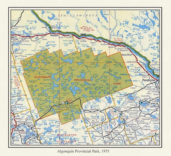 Algonquin Provincial Park, 1955 , map on heavy cotton canvas, 22x27" approx.
$41.32
Algonquin Provincial Park, 1955 , map on heavy cotton canvas, 22x27" approx.
$41.32
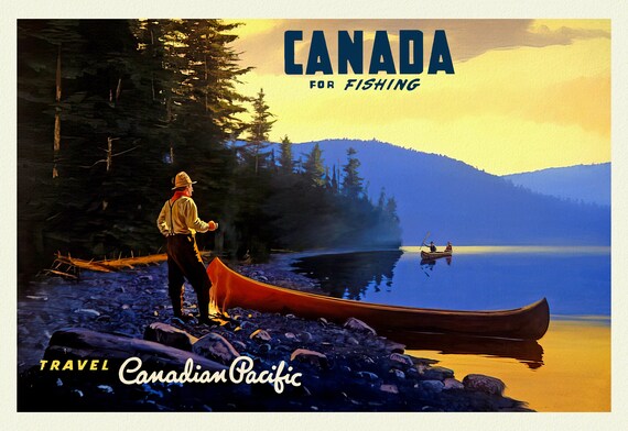 Canada For Fishing, Canadian Pacific Ver. 21 , vintage nature print on canvas, 50 x 70 cm, 20 x 25" approx.
$41.32
Canada For Fishing, Canadian Pacific Ver. 21 , vintage nature print on canvas, 50 x 70 cm, 20 x 25" approx.
$41.32
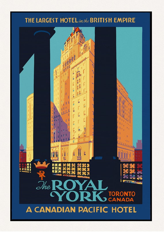 Royal York Hotel, Largest in the British Empire, Travel Poster, Toronto, on heavy cotton canvas, 22x27" approx.
$41.32
Royal York Hotel, Largest in the British Empire, Travel Poster, Toronto, on heavy cotton canvas, 22x27" approx.
$41.32
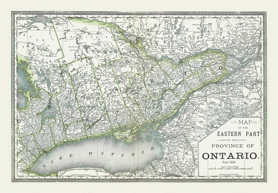 H.H. Hardesty & Co., Map of Ontario, No. 2, Eastern Part, 1884, map on heavy cotton canvas, 22x27" approx
$41.32
H.H. Hardesty & Co., Map of Ontario, No. 2, Eastern Part, 1884, map on heavy cotton canvas, 22x27" approx
$41.32
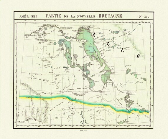 Vandermaelen, Partie, Nouvelle Bretagne (Manitoba, Lake Winnipeg), 1827 , map on heavy cotton canvas, 22x27" approx.
$41.32
Vandermaelen, Partie, Nouvelle Bretagne (Manitoba, Lake Winnipeg), 1827 , map on heavy cotton canvas, 22x27" approx.
$41.32
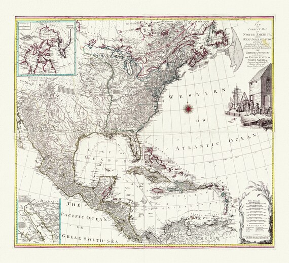 A map of North America with the West India Islands, Divided according to the Treaty of Peace, concluded at Paris Jan., 1783,canvas 22x27"
$41.32
A map of North America with the West India Islands, Divided according to the Treaty of Peace, concluded at Paris Jan., 1783,canvas 22x27"
$41.32
 Mercator, Atlas Cosmographicae, Americae Nova Tabula, 1574 ,Map on heavy cotton canvas, 22x27in. approx.
$41.32
Mercator, Atlas Cosmographicae, Americae Nova Tabula, 1574 ,Map on heavy cotton canvas, 22x27in. approx.
$41.32
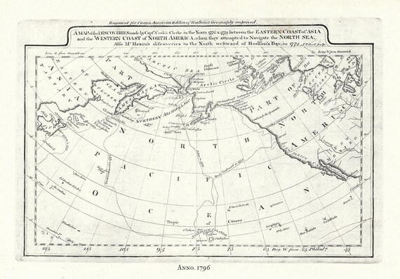 Captain Cook's Voyages in the Pacific Northwest, map on heavy cotton canvas, 50 x 70cm, 20 x 25" approx.
$41.32
Captain Cook's Voyages in the Pacific Northwest, map on heavy cotton canvas, 50 x 70cm, 20 x 25" approx.
$41.32
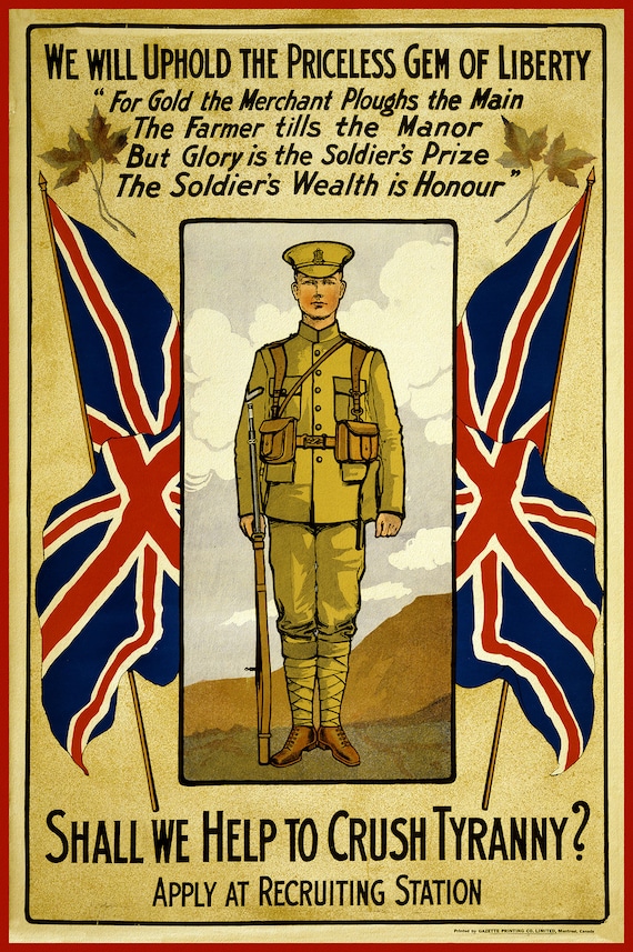 Canada WW I Poster, We Will Uphold the Priceless Gem of Liberty ... shall we help to crush tyranny, 1914, on cotton canvas, 22x27" approx.
$41.32
Canada WW I Poster, We Will Uphold the Priceless Gem of Liberty ... shall we help to crush tyranny, 1914, on cotton canvas, 22x27" approx.
$41.32
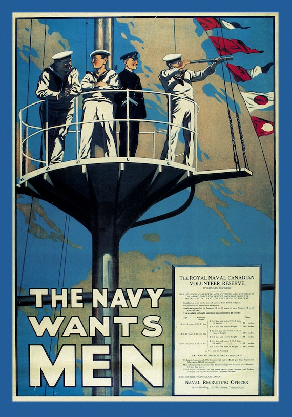 Canada WW I Poster, The Navy Wants Men!, 1915, on heavy cotton canvas, 22x27" approx.
$37.56
Canada WW I Poster, The Navy Wants Men!, 1915, on heavy cotton canvas, 22x27" approx.
$37.56
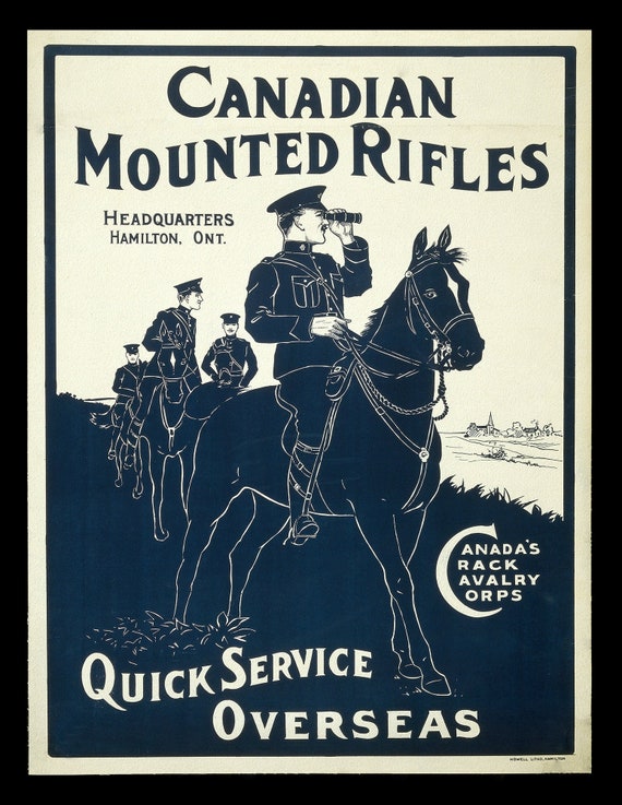 Canada WW I Poster, Canadian Mounted Rifles, 1914, on heavy cotton canvas, 50 x 70 cm, 20 x 25" approx.
$41.32
Canada WW I Poster, Canadian Mounted Rifles, 1914, on heavy cotton canvas, 50 x 70 cm, 20 x 25" approx.
$41.32
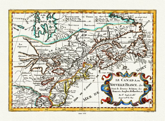 Le Canada ou Nouvelle France, 1656 Ver. II, Map on heavy cotton canvas, 1656,22x27" approx.
$41.32
Le Canada ou Nouvelle France, 1656 Ver. II, Map on heavy cotton canvas, 1656,22x27" approx.
$41.32
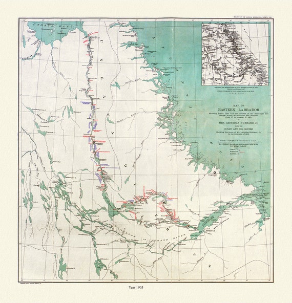 Labrador, Hubbard auth., 1908
$41.32
Labrador, Hubbard auth., 1908
$41.32
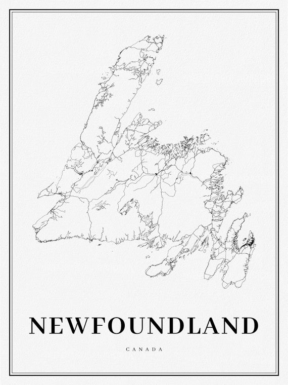 Newfoundland, A Modern Map on heavy cotton canvas, 45 x 65 cm, 18 x 24" approx.
$41.32
Newfoundland, A Modern Map on heavy cotton canvas, 45 x 65 cm, 18 x 24" approx.
$41.32
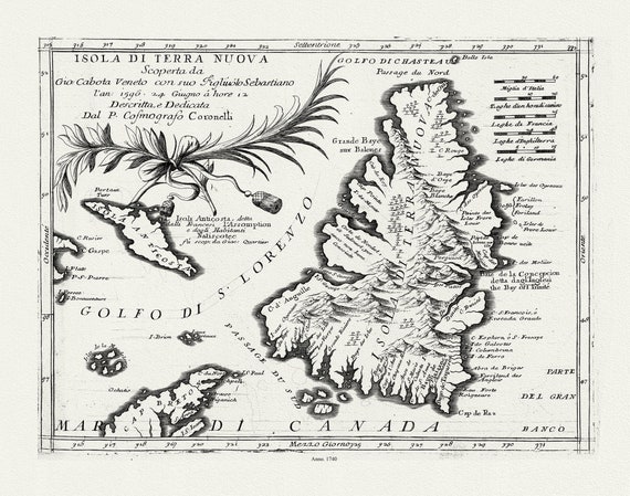 Coronelli, Map of Newfoundland,1692 Ver. III , map on heavy cotton canvas, 45 x 65 cm, 18 x 24" approx.
$41.32
Coronelli, Map of Newfoundland,1692 Ver. III , map on heavy cotton canvas, 45 x 65 cm, 18 x 24" approx.
$41.32
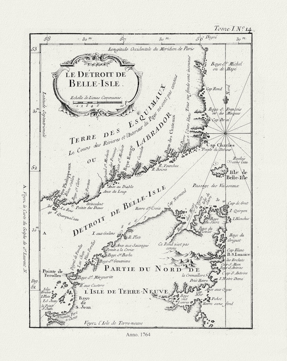 E Bellin, Le Detroit de Belle-Isle, 1764 , map on heavy cotton canvas, 45 x 65 cm, 18 x 24" approx.
$41.32
E Bellin, Le Detroit de Belle-Isle, 1764 , map on heavy cotton canvas, 45 x 65 cm, 18 x 24" approx.
$41.32
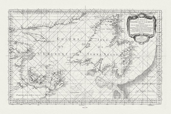 Bellin, Carte reduite du Golphe de St. Laurent, 1754
$41.32
Bellin, Carte reduite du Golphe de St. Laurent, 1754
$41.32