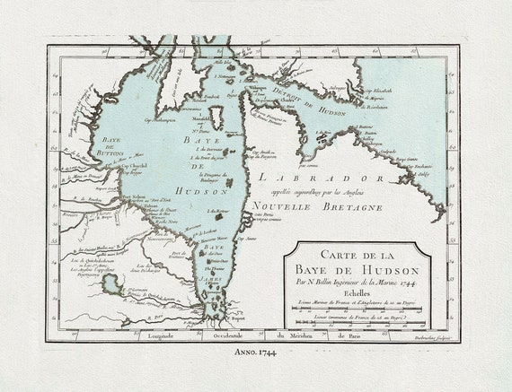
 Bellin, Carte de la Bye de Hudson, 1744 Ver. II, map on heavy cotton canvas, 22x27" approx.
$41.32
Bellin, Carte de la Bye de Hudson, 1744 Ver. II, map on heavy cotton canvas, 22x27" approx.
$41.32
 Historic Algonquin Park Map, Grand Trunk Railway, 1912, map on heavy cotton canvas, 22x27" approx.
$41.32
Historic Algonquin Park Map, Grand Trunk Railway, 1912, map on heavy cotton canvas, 22x27" approx.
$41.32
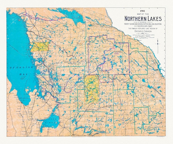 Muskoka-Haliburton: Map of the Northern Lakes, 1901, map on heavy cotton canvas, 22x27" approx.
$41.32
Muskoka-Haliburton: Map of the Northern Lakes, 1901, map on heavy cotton canvas, 22x27" approx.
$41.32
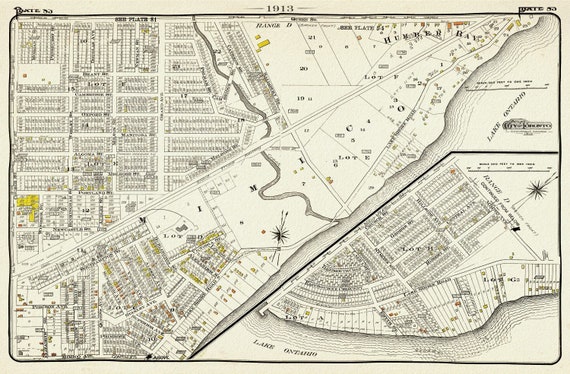 Plate 83, Toronto West, South Etobicoke South, Mimico, 1913, map on heavy cotton canvas, 20 x 30" or 50 x 75cm. approx.
$41.32
Plate 83, Toronto West, South Etobicoke South, Mimico, 1913, map on heavy cotton canvas, 20 x 30" or 50 x 75cm. approx.
$41.32
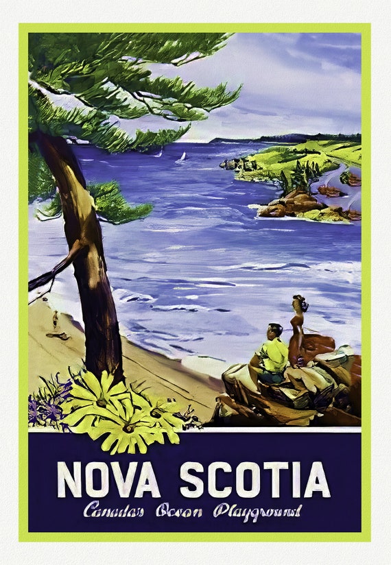 Nova Scotia, Canada's Ocean Playground, 1965, Travel Poster on heavy cotton canvas, 22x27" approx.
$41.32
Nova Scotia, Canada's Ocean Playground, 1965, Travel Poster on heavy cotton canvas, 22x27" approx.
$41.32
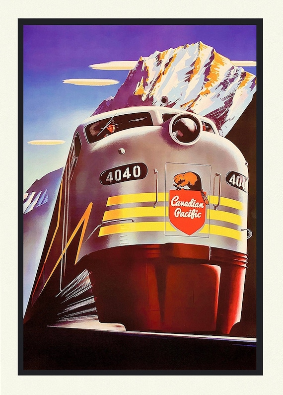 The Rocky Mountains, by Canadian Pacific, on heavy cotton canvas, 22x27" approx.
$41.32
The Rocky Mountains, by Canadian Pacific, on heavy cotton canvas, 22x27" approx.
$41.32
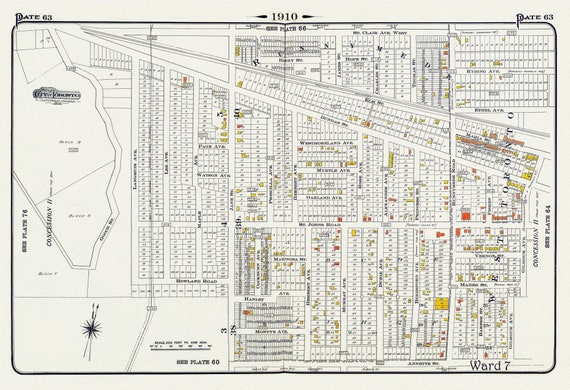 Plate 63, Toronto West, Junction & Stockyards, 1910 , map on heavy cotton canvas, 20 x 30" approx.
$41.32
Plate 63, Toronto West, Junction & Stockyards, 1910 , map on heavy cotton canvas, 20 x 30" approx.
$41.32
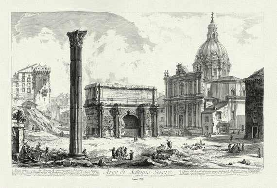 Giovanni Battista Piranesi, Arch of Septimius Severus, 1760, map on heavy cotton canvas, 22x27" approx.
$41.32
Giovanni Battista Piranesi, Arch of Septimius Severus, 1760, map on heavy cotton canvas, 22x27" approx.
$41.32
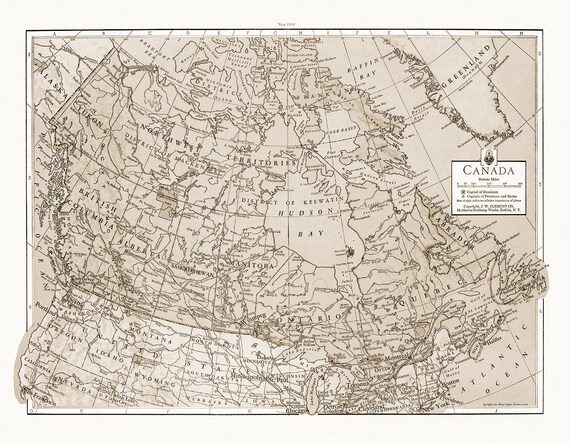 J.W. Clement Co., Canada, 1943 Ver. S, map on heavy cotton canvas, 20 x 25" approx.
$41.32
J.W. Clement Co., Canada, 1943 Ver. S, map on heavy cotton canvas, 20 x 25" approx.
$41.32
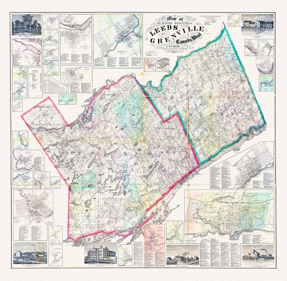 Map of the United Counties of Leeds and Grenville, Canada West.1861, map on durable cotton canvas, 50 x 70 cm, 20 x 25" approx.
$41.32
Map of the United Counties of Leeds and Grenville, Canada West.1861, map on durable cotton canvas, 50 x 70 cm, 20 x 25" approx.
$41.32
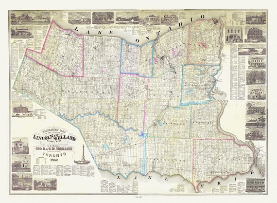 Wellend & Lincoln Counties, Treamaine auth., 1862, map on durable cotton canvas, 50 x 70 cm, 20 x 25" approx.
$41.32
Wellend & Lincoln Counties, Treamaine auth., 1862, map on durable cotton canvas, 50 x 70 cm, 20 x 25" approx.
$41.32
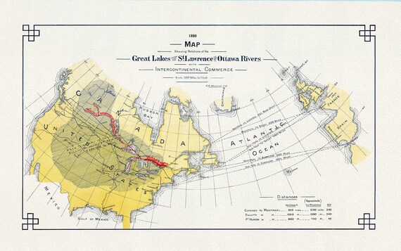 Great Lakes St. Lawrence, Ottawa Rivers and InterContinental Commerce, 1880, map on heavy cotton canvas, 50x70cm (20 x 25") approx.
$41.32
Great Lakes St. Lawrence, Ottawa Rivers and InterContinental Commerce, 1880, map on heavy cotton canvas, 50x70cm (20 x 25") approx.
$41.32
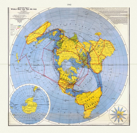 Renner, Northern Hemisphere -Polar View, 1942, Map printed on to heavy cotton canvas, 22x27in. approx.
$41.32
Renner, Northern Hemisphere -Polar View, 1942, Map printed on to heavy cotton canvas, 22x27in. approx.
$41.32
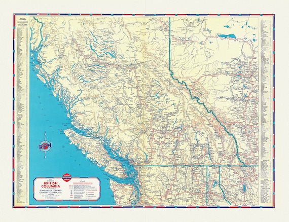 A Road Map of British Columbia, 1937
$41.32
A Road Map of British Columbia, 1937
$41.32
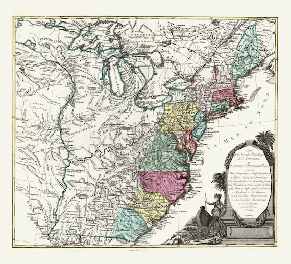 Lotter, Carte de la nouvelle république de lʾAmérique ou les treize Provinces Unies, 1778 , map on heavy cotton canvas, 22x27" approx.
$41.32
Lotter, Carte de la nouvelle république de lʾAmérique ou les treize Provinces Unies, 1778 , map on heavy cotton canvas, 22x27" approx.
$41.32
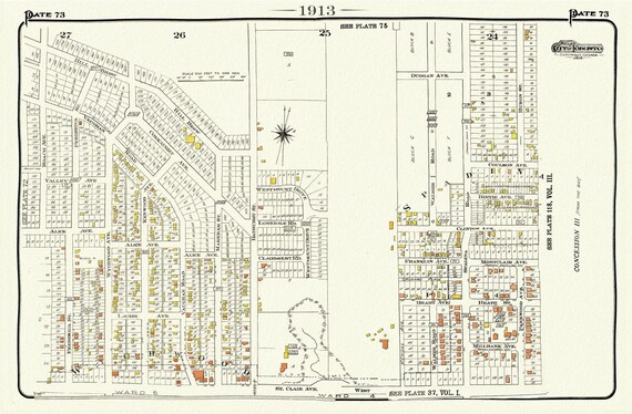 Plate 73, Toronto West, St. Clair & Vaughan Rd., 1913, map on heavy cotton canvas, 20 x 30" or 50 x 75cm. approx.
$33.80
Plate 73, Toronto West, St. Clair & Vaughan Rd., 1913, map on heavy cotton canvas, 20 x 30" or 50 x 75cm. approx.
$33.80
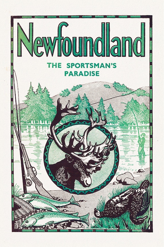 Newfoundland, A Sportman's Paradise, 1960, a travel poster on heavy cotton canvas, 45 x 65 cm, 18 x 24" approx.
$41.32
Newfoundland, A Sportman's Paradise, 1960, a travel poster on heavy cotton canvas, 45 x 65 cm, 18 x 24" approx.
$41.32
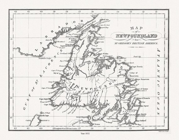 Map of Newfoundland in British America, McGregor auth., 1832, map on heavy cotton canvas, 45 x 65 cm, 18 x 24" approx.
$41.32
Map of Newfoundland in British America, McGregor auth., 1832, map on heavy cotton canvas, 45 x 65 cm, 18 x 24" approx.
$41.32
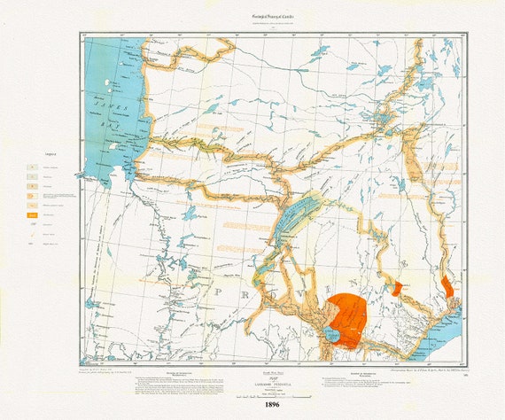 Labrador Peninsula, SW Sheet, 1896 , map on heavy cotton canvas, 45 x 65 cm, 18 x 24" approx.
$41.32
Labrador Peninsula, SW Sheet, 1896 , map on heavy cotton canvas, 45 x 65 cm, 18 x 24" approx.
$41.32
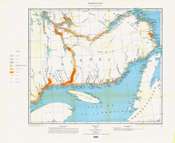 Labrador Peninsula, SE Sheet, 1896, map on heavy cotton canvas, 45 x 65 cm, 18 x 24" approx.
$41.32
Labrador Peninsula, SE Sheet, 1896, map on heavy cotton canvas, 45 x 65 cm, 18 x 24" approx.
$41.32