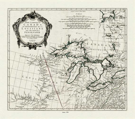
 Anville et al., Partie occidentale du Canada et septentrionale de la Louisiane avec une partie de la Pensilvanie, 1784 , on canvas 22x27"
$41.48
Anville et al., Partie occidentale du Canada et septentrionale de la Louisiane avec une partie de la Pensilvanie, 1784 , on canvas 22x27"
$41.48
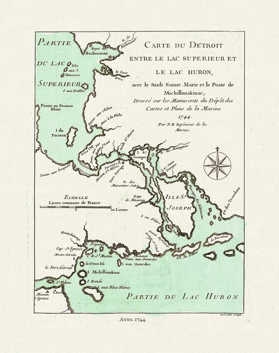 Bellin, Carte du Detroit entre le Lac Superieur et Huron, avec le Sault Ste. Marie, 1744, map on heavy cotton canvas, 22x27" approx.
$41.48
Bellin, Carte du Detroit entre le Lac Superieur et Huron, avec le Sault Ste. Marie, 1744, map on heavy cotton canvas, 22x27" approx.
$41.48
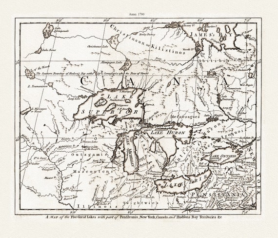 A Map of the Five Great Lakes with part of Pensilvania, New York, Canada, and Hudsons Bay Territories &c., 1780, on cotton canvas, 22x27"
$41.48
A Map of the Five Great Lakes with part of Pensilvania, New York, Canada, and Hudsons Bay Territories &c., 1780, on cotton canvas, 22x27"
$41.48
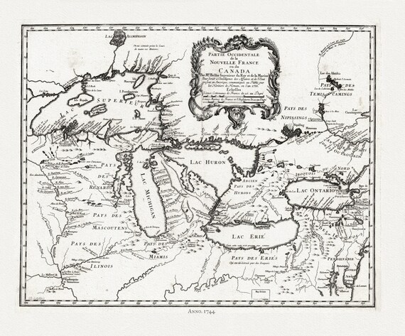 Bellin, Partie occidentale de la Nouvelle France ou du Canada, 1744 , map on heavy cotton canvas, 22x27" approx.
$41.48
Bellin, Partie occidentale de la Nouvelle France ou du Canada, 1744 , map on heavy cotton canvas, 22x27" approx.
$41.48
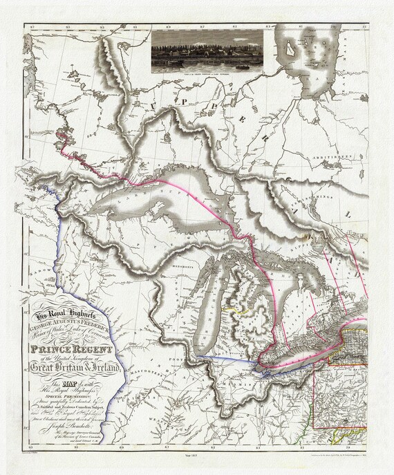 Bouchette et Faden, West sheet, Map of the Provinces of Upper and Lower Canada,etc.,1815, map on heavy cotton canvas, 22x27" approx.
$41.48
Bouchette et Faden, West sheet, Map of the Provinces of Upper and Lower Canada,etc.,1815, map on heavy cotton canvas, 22x27" approx.
$41.48
 Bellin, Carte des Cinq Grande Lacs du Canada, 1764, map on heavy cotton canvas, 22x27" approx.
$41.48
Bellin, Carte des Cinq Grande Lacs du Canada, 1764, map on heavy cotton canvas, 22x27" approx.
$41.48
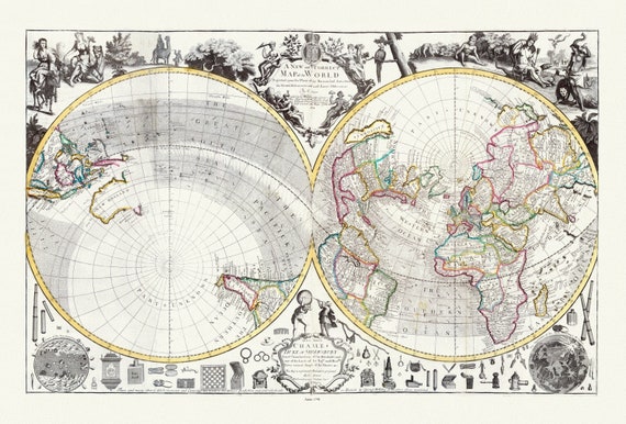 Willdey, No. 2. A New and Correct Map of the World Projected upon the Plane of the Horizon, 1714, Map on heavy cotton canvas, 22x27in.
$41.48
Willdey, No. 2. A New and Correct Map of the World Projected upon the Plane of the Horizon, 1714, Map on heavy cotton canvas, 22x27in.
$41.48
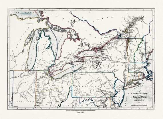 Conrad et Lewis, A correct map of the seat of war, 1812, map on heavy cotton canvas, 22x27" approx.
$41.48
Conrad et Lewis, A correct map of the seat of war, 1812, map on heavy cotton canvas, 22x27" approx.
$41.48
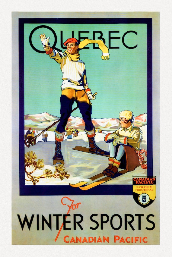 Canadian Pacific, Quebec for Winter Sports, c. 1954 , travel poster on heavy cotton canvas, 22x27" approx.
$41.48
Canadian Pacific, Quebec for Winter Sports, c. 1954 , travel poster on heavy cotton canvas, 22x27" approx.
$41.48
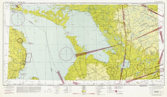 Aeronautical Chart, Ontario, Lake Huron Section, 1942, map on heavy cotton canvas, 20 x 27" approx.
$41.48
Aeronautical Chart, Ontario, Lake Huron Section, 1942, map on heavy cotton canvas, 20 x 27" approx.
$41.48
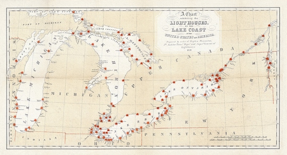 Great Lakes Lighthouses, 1848 , map on heavy cotton canvas, 50 x 70cm, 20 x 25" approx.
$41.48
Great Lakes Lighthouses, 1848 , map on heavy cotton canvas, 50 x 70cm, 20 x 25" approx.
$41.48
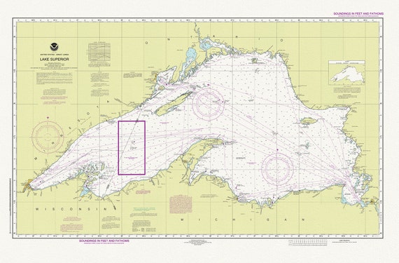 Nautical Chart of Lake Superior, 2016, map on heavy cotton canvas, 50 x 70cm, 20 x 25" approx.
$45.25
Nautical Chart of Lake Superior, 2016, map on heavy cotton canvas, 50 x 70cm, 20 x 25" approx.
$45.25
 Northern Ontario Road Map, 1955, map on heavy cotton canvas, 50 x 70 cm (20x25") approx.
$41.48
Northern Ontario Road Map, 1955, map on heavy cotton canvas, 50 x 70 cm (20x25") approx.
$41.48
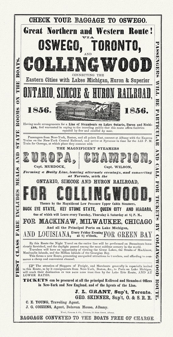 Railways to Collingwood, 1856, map on durable cotton canvas, 16x29" approx.
$41.48
Railways to Collingwood, 1856, map on durable cotton canvas, 16x29" approx.
$41.48
 Society for the Diffusion of Useful Knowledge, North America, Lake Superior, 1838, map on heavy cotton canvas, 50 x 70cm, 20 x 27" approx.
$41.48
Society for the Diffusion of Useful Knowledge, North America, Lake Superior, 1838, map on heavy cotton canvas, 50 x 70cm, 20 x 27" approx.
$41.48
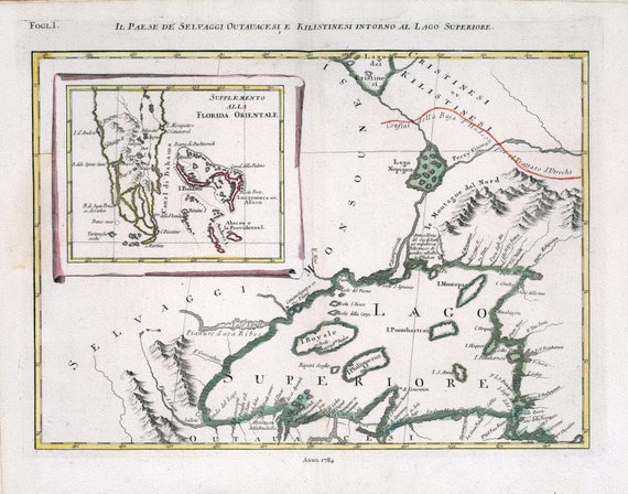 Zatta, Il Paese de' Selvaggi Outauacesi, e Kilistinesi Intorno al Lago Superiore, 1784 , map on heavy cotton canvas, 50x70cm approx.
$41.48
Zatta, Il Paese de' Selvaggi Outauacesi, e Kilistinesi Intorno al Lago Superiore, 1784 , map on heavy cotton canvas, 50x70cm approx.
$41.48
 Zatta, Upper Canada, 1778, map on heavy cotton canvas, 50x70cm (20 x 25") approx.
$41.48
Zatta, Upper Canada, 1778, map on heavy cotton canvas, 50x70cm (20 x 25") approx.
$41.48
 apres Vaugondy, Partie Occidentale du Canada et Septentrionale de la Louisiane, 1779, map on heavy cotton canvas, 50x70cm (20 x 25") approx.
$41.48
apres Vaugondy, Partie Occidentale du Canada et Septentrionale de la Louisiane, 1779, map on heavy cotton canvas, 50x70cm (20 x 25") approx.
$41.48
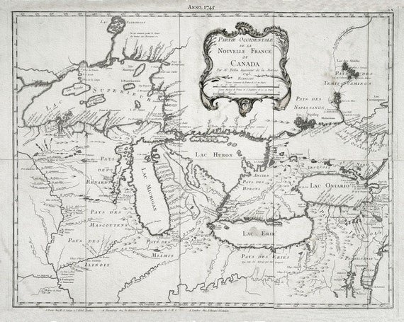 Jacques Nicolas Bellin, Le Canada, 1745, map on heavy cotton canvas, 50x70cm (20 x 25") approx.
$41.48
Jacques Nicolas Bellin, Le Canada, 1745, map on heavy cotton canvas, 50x70cm (20 x 25") approx.
$41.48
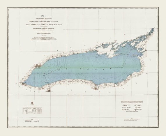 International boundary between the U.S. and Canada through the St. Lawrence River and Great Lakes, 1951 , map on canvas, 50x70cm approx.
$41.48
International boundary between the U.S. and Canada through the St. Lawrence River and Great Lakes, 1951 , map on canvas, 50x70cm approx.
$41.48