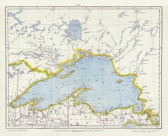
 Letts, North Shore, Lake Superior, Canada, 1883 , map on heavy cotton canvas, 22x27" approx.
$41.48
Letts, North Shore, Lake Superior, Canada, 1883 , map on heavy cotton canvas, 22x27" approx.
$41.48
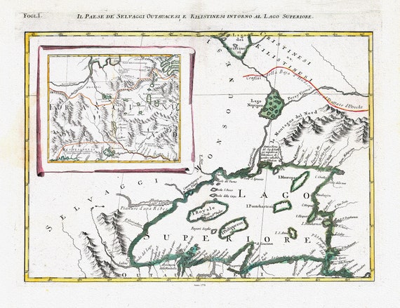 Zatta, Zuiliani, Novelli et Pitteri-Il Paese de' Selvaggi Outauacesi, e Kilistinesi Intorno al Lago Superiore, 1778, on cotton canvas,22x27"
$41.48
Zatta, Zuiliani, Novelli et Pitteri-Il Paese de' Selvaggi Outauacesi, e Kilistinesi Intorno al Lago Superiore, 1778, on cotton canvas,22x27"
$41.48
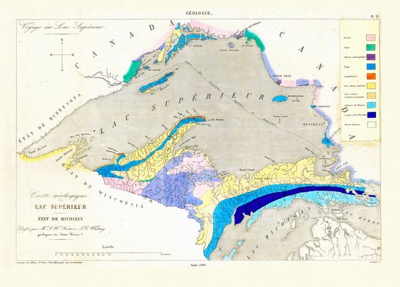 Fostes et Whitney, Carte geologique du Lac Superieur, 1849 , map on heavy cotton canvas, 22x27" approx.
$41.48
Fostes et Whitney, Carte geologique du Lac Superieur, 1849 , map on heavy cotton canvas, 22x27" approx.
$41.48
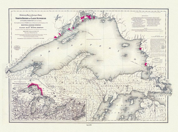 Colton, Preliminary map to a geological survey of the north shore of Lake Superior, Ontario, 1871 ,map on cotton canvas, 20 x 25" approx.
$41.48
Colton, Preliminary map to a geological survey of the north shore of Lake Superior, Ontario, 1871 ,map on cotton canvas, 20 x 25" approx.
$41.48
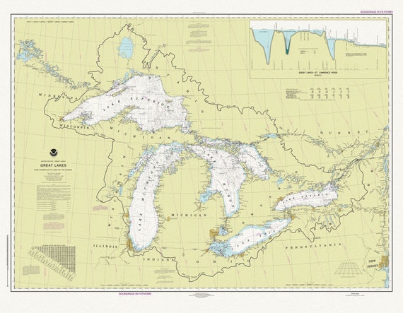 A Nautical Chart of The Great Lakes, 2016 Chart of The Great Lakes, 2016, map on heavy cotton canvas, 50x70cm (20 x 25") approx.
$41.48
A Nautical Chart of The Great Lakes, 2016 Chart of The Great Lakes, 2016, map on heavy cotton canvas, 50x70cm (20 x 25") approx.
$41.48
 The Straits between Georgian Bay and Lake Superior, map on durable cotton canvas, 50 x 70 cm, 20 x 25" approx.
$41.48
The Straits between Georgian Bay and Lake Superior, map on durable cotton canvas, 50 x 70 cm, 20 x 25" approx.
$41.48
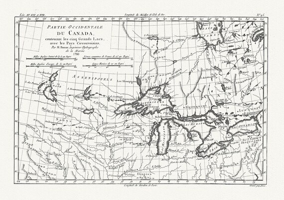 Raynall et Bonne, Partie Occidentale Du Canada, 1780, map on heavy cotton canvas, 50 x 70cm, 20 x 27" approx.
$41.48
Raynall et Bonne, Partie Occidentale Du Canada, 1780, map on heavy cotton canvas, 50 x 70cm, 20 x 27" approx.
$41.48
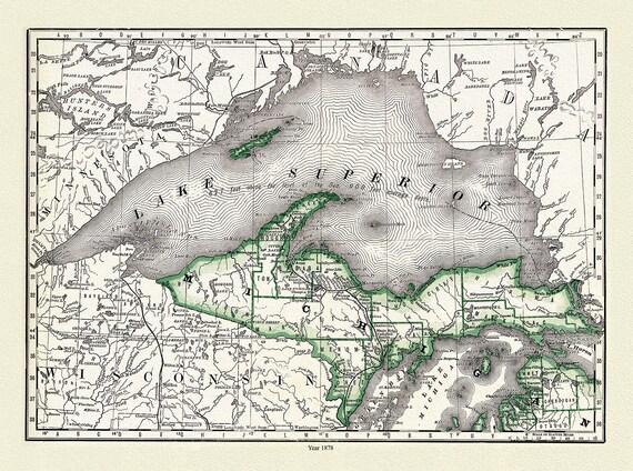 Rand, McNally & Co., Lake Superior and Northern Michigan, 1878,
$41.48
Rand, McNally & Co., Lake Superior and Northern Michigan, 1878,
$41.48
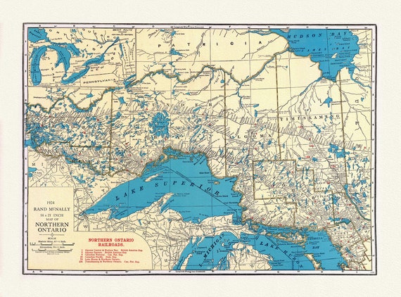 North Shore, Lake Superior, Ontario, 1924, Map on heavy cotton canvas, 22x27" approx.
$41.48
North Shore, Lake Superior, Ontario, 1924, Map on heavy cotton canvas, 22x27" approx.
$41.48
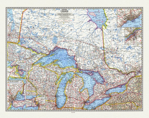 Central Canada, National Geographic, 1963, map on durable cotton canvas, 50 x 70 cm, 20 x 25" approx.
$41.48
Central Canada, National Geographic, 1963, map on durable cotton canvas, 50 x 70 cm, 20 x 25" approx.
$41.48
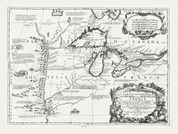 Partie occidentale du Canada ou de la Nouvelle France ou sont les Nations des Ilinois, avec la Louisiane, Coronelli, 1688, canvas 20 x 25"
$41.48
Partie occidentale du Canada ou de la Nouvelle France ou sont les Nations des Ilinois, avec la Louisiane, Coronelli, 1688, canvas 20 x 25"
$41.48
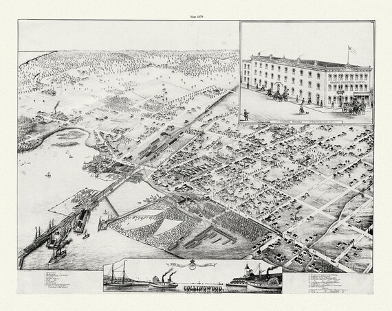 A Bird's eye view of Collingwood, Ontario, Brosius auth., 1879, map on durable cotton canvas, 50 x 70 cm or 20x25" approx.
$41.48
A Bird's eye view of Collingwood, Ontario, Brosius auth., 1879, map on durable cotton canvas, 50 x 70 cm or 20x25" approx.
$41.48
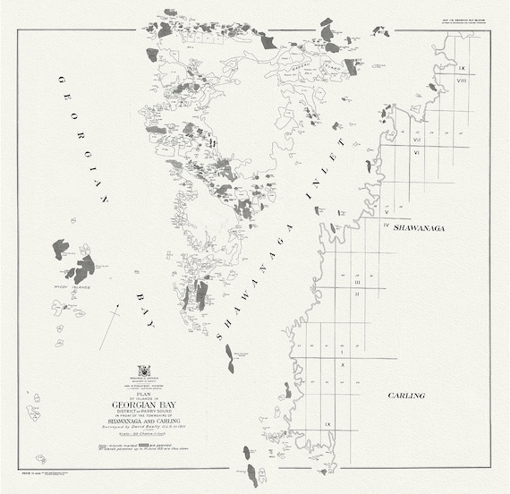 Plan of islands in Georgian Bay district of Parry Sound, in front of the townships of Shawanaga and Carling, 1931
$41.48
Plan of islands in Georgian Bay district of Parry Sound, in front of the townships of Shawanaga and Carling, 1931
$41.48
 Map of the North Shore Indian Reservations of Lake Huron, 1927 , map on durable cotton canvas, 50 x 70 cm or 20x25" approx.
$41.48
Map of the North Shore Indian Reservations of Lake Huron, 1927 , map on durable cotton canvas, 50 x 70 cm or 20x25" approx.
$41.48
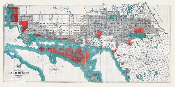
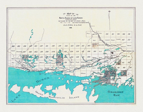 North shore of Lake Huron compiled from map issued by the Dept. of Crown Lands and from rangers' maps,1888, 50 x 70 cm or 20x25" approx.
$41.48
North shore of Lake Huron compiled from map issued by the Dept. of Crown Lands and from rangers' maps,1888, 50 x 70 cm or 20x25" approx.
$41.48
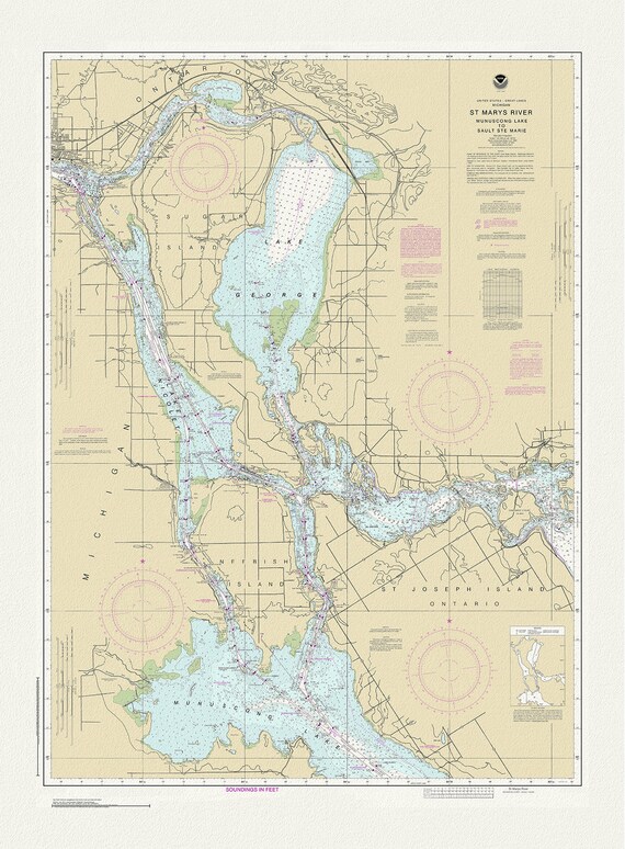 St. Mary's River, Manuscong Lake to Sault Ste Marie, 1983 , map on durable cotton canvas, 50 x 70 cm or 20x25" approx.
$41.48
St. Mary's River, Manuscong Lake to Sault Ste Marie, 1983 , map on durable cotton canvas, 50 x 70 cm or 20x25" approx.
$41.48
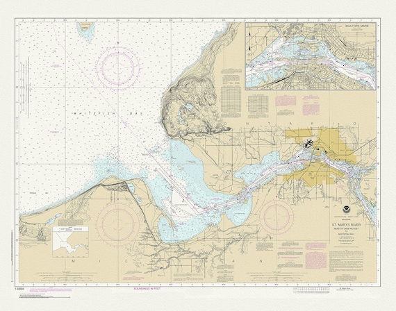 St Mary's River, Head of Lake Nicolet to Whitefish Bay, 1983 , map on durable cotton canvas, 50 x 70 cm or 20x25" approx.
$41.48
St Mary's River, Head of Lake Nicolet to Whitefish Bay, 1983 , map on durable cotton canvas, 50 x 70 cm or 20x25" approx.
$41.48
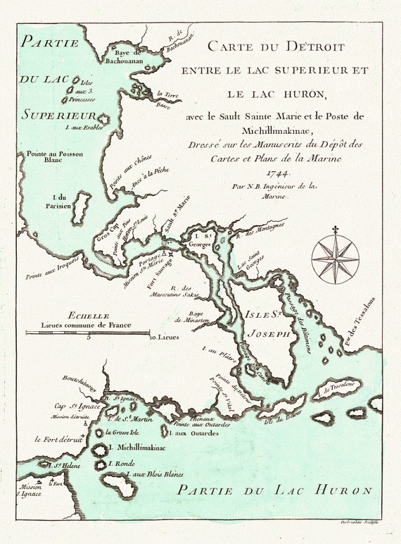 Jacques Nicolas, Detroit entre Superieur et Huron, Bellin auth., 1745, map on durable cotton canvas, 50 x 70 cm or 20x25" approx.
$41.48
Jacques Nicolas, Detroit entre Superieur et Huron, Bellin auth., 1745, map on durable cotton canvas, 50 x 70 cm or 20x25" approx.
$41.48
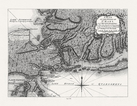 Plan of the Straits of St. Mary, and Michilimakinac shewing the two westernmost settlements of Canada, 1750, 50 x 70 cm, 20 x 25" approx.
$41.48
Plan of the Straits of St. Mary, and Michilimakinac shewing the two westernmost settlements of Canada, 1750, 50 x 70 cm, 20 x 25" approx.
$41.48
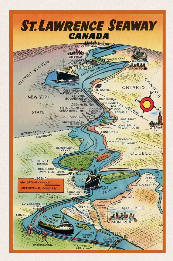 St. Lawrence Seaway Canada , map on durable cotton canvas, 50 x 70 cm, 20 x 25" approx.
$41.48
St. Lawrence Seaway Canada , map on durable cotton canvas, 50 x 70 cm, 20 x 25" approx.
$41.48