
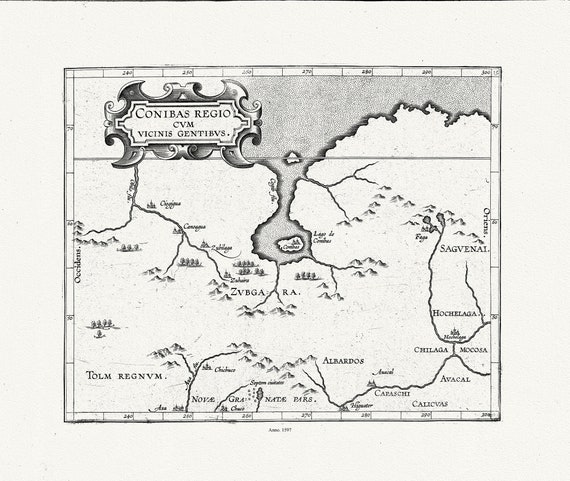
 Wytfliet, Corneille, Conibas regio cum vicinis gentibus, (Central Canada), 1597, map on heavy cotton canvas, 22x27" approx.
$41.63
Wytfliet, Corneille, Conibas regio cum vicinis gentibus, (Central Canada), 1597, map on heavy cotton canvas, 22x27" approx.
$41.63
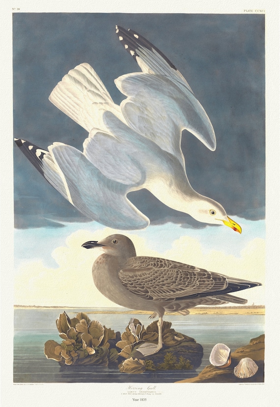 J.J. Audobon, Herring gull. Larus argentatus, c.1 v.3 plate 291, 1835, vintage nature print on canvas, 50 x 70 cm, 20 x 25" approx.
$41.63
J.J. Audobon, Herring gull. Larus argentatus, c.1 v.3 plate 291, 1835, vintage nature print on canvas, 50 x 70 cm, 20 x 25" approx.
$41.63
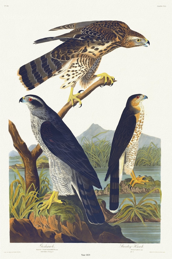 J.J. Audubon, Goshawk, Stanley hawk. Falco palumbarius, Linn. Adult male, 1. Young, 2. Falco stanleii, 1835 , 20 x 25" approx.
$41.63
J.J. Audubon, Goshawk, Stanley hawk. Falco palumbarius, Linn. Adult male, 1. Young, 2. Falco stanleii, 1835 , 20 x 25" approx.
$41.63
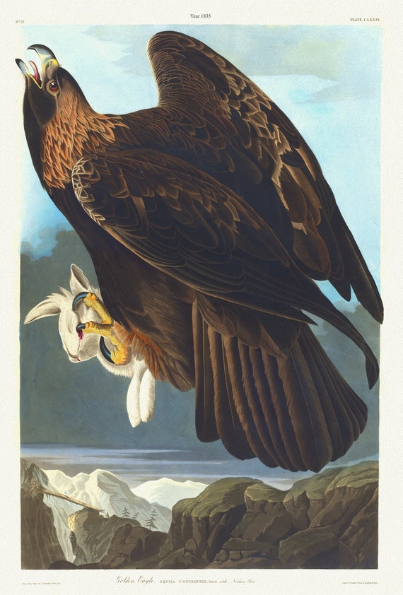 J.J. Audubon, Golden eagle. Aquila chrysaetos. Female adult. Northern hare. 1835, nature print on canvas, 50 x 70 cm, 20 x 25" approx.
$41.63
J.J. Audubon, Golden eagle. Aquila chrysaetos. Female adult. Northern hare. 1835, nature print on canvas, 50 x 70 cm, 20 x 25" approx.
$41.63
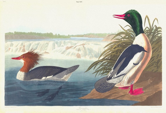 J.J. Audubon, Goosander. Mergus merganser, L. Male, 1. Female, 2. 1835, vintage nature print on canvas, 50 x 70 cm, 20 x 25" approx.
$41.63
J.J. Audubon, Goosander. Mergus merganser, L. Male, 1. Female, 2. 1835, vintage nature print on canvas, 50 x 70 cm, 20 x 25" approx.
$41.63
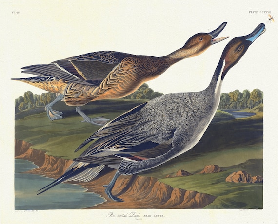 J.J. Audobon, Pin tailed duck. Anas acuta. c.1 v.3 plate 227, 1835, vintage nature print on canvas, 50 x 70 cm, 20 x 25" approx.
$41.63
J.J. Audobon, Pin tailed duck. Anas acuta. c.1 v.3 plate 227, 1835, vintage nature print on canvas, 50 x 70 cm, 20 x 25" approx.
$41.63
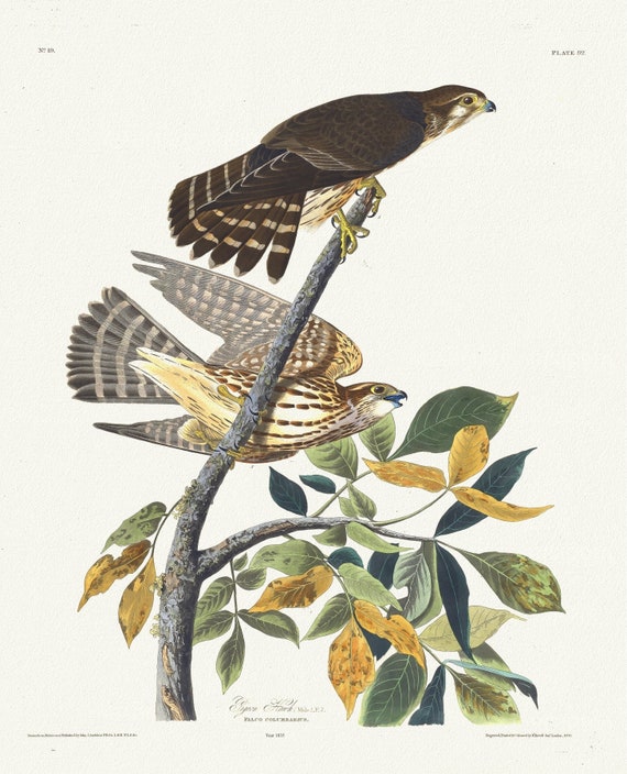 J.J. Audobon, Pigeon hawk. Male, 1. F, 2. Falco columbarius. c.2 v.1 plate 92, 1835 , vintage print on canvas, 50 x 70 cm, 20 x 25" approx.
$41.63
J.J. Audobon, Pigeon hawk. Male, 1. F, 2. Falco columbarius. c.2 v.1 plate 92, 1835 , vintage print on canvas, 50 x 70 cm, 20 x 25" approx.
$41.63
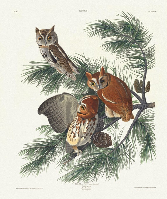 J.J. Audobon, Mottled owl. Adult, 1. Young, 2 & 3. . c.2 v.1 plate 97, 1835 , vintage print on canvas, 50 x 70 cm, 20 x 25" approx.
$41.63
J.J. Audobon, Mottled owl. Adult, 1. Young, 2 & 3. . c.2 v.1 plate 97, 1835 , vintage print on canvas, 50 x 70 cm, 20 x 25" approx.
$41.63
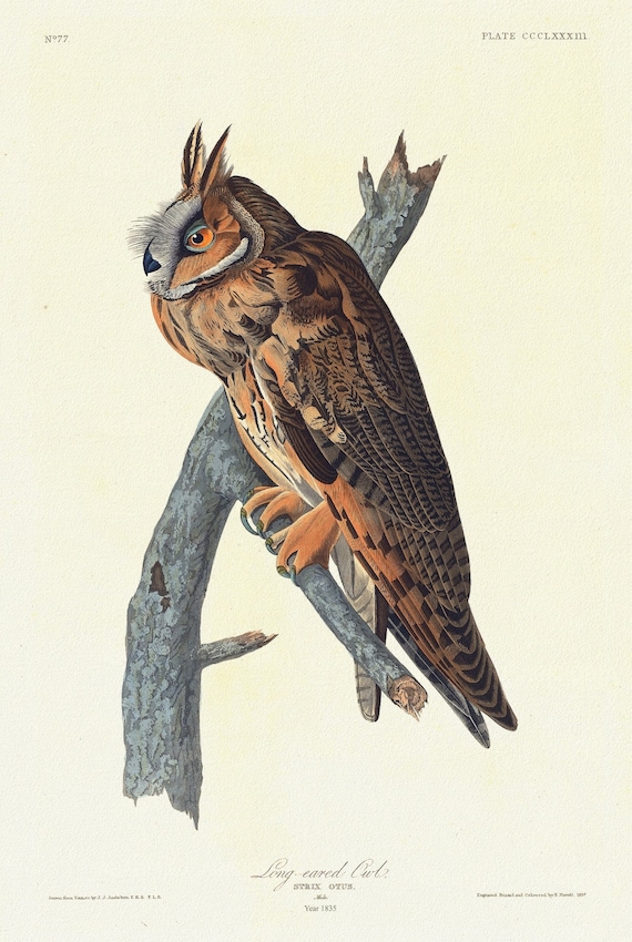 J.J. Audobon, Long-eared owl .Strix otus. Male. c.1 v.4 plate 383, 1835, vintage nature print on canvas, 50 x 70 cm, 20 x 25" approx.
$41.63
J.J. Audobon, Long-eared owl .Strix otus. Male. c.1 v.4 plate 383, 1835, vintage nature print on canvas, 50 x 70 cm, 20 x 25" approx.
$41.63
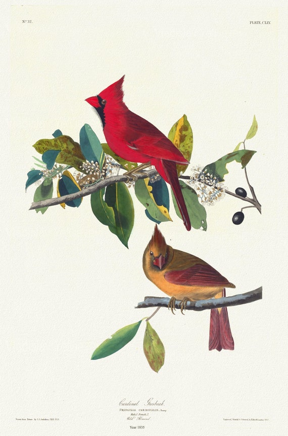 J.J. Audubon, Cardinal grosbeak. Fringilla cardinalis, Bonap. Male, 1. Female, 2, 1835, print on canvas, 50 x 70 cm, 20 x 25" approx.
$41.63
J.J. Audubon, Cardinal grosbeak. Fringilla cardinalis, Bonap. Male, 1. Female, 2, 1835, print on canvas, 50 x 70 cm, 20 x 25" approx.
$41.63
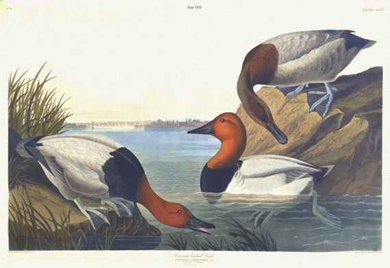 J.J. Audubon, Canvas backed duck. Fuligula vallisneria, Steph. 1, 2. Male. 3. Female, 1835, print on canvas, 50 x 70 cm, 20 x 25" approx.
$41.63
J.J. Audubon, Canvas backed duck. Fuligula vallisneria, Steph. 1, 2. Male. 3. Female, 1835, print on canvas, 50 x 70 cm, 20 x 25" approx.
$41.63
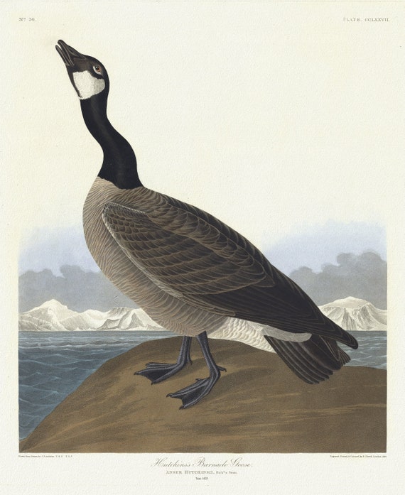 J.J. Audubon, Eutchins's barnacle goose. Anser Hutchinsii, Rich'd & Swain, 1835, print on canvas, 50 x 70 cm, 20 x 25" approx.
$41.63
J.J. Audubon, Eutchins's barnacle goose. Anser Hutchinsii, Rich'd & Swain, 1835, print on canvas, 50 x 70 cm, 20 x 25" approx.
$41.63
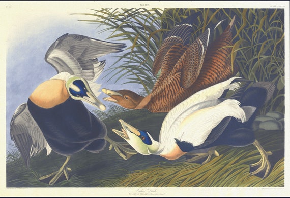 J.J. Audubon, Eider duck. Fuligula mollissima. Male, 1. Female, 2, 1835, vintage nature print on canvas, 50 x 70 cm, 20 x 25" approx.
$41.63
J.J. Audubon, Eider duck. Fuligula mollissima. Male, 1. Female, 2, 1835, vintage nature print on canvas, 50 x 70 cm, 20 x 25" approx.
$41.63
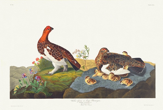 J.J. Audobon, Willow Grouse or large ptarmigan. Tetrao saliceti, 1835, bird print on durable cotton canvas, 19x27inches(50x70cm)
$41.63
J.J. Audobon, Willow Grouse or large ptarmigan. Tetrao saliceti, 1835, bird print on durable cotton canvas, 19x27inches(50x70cm)
$41.63
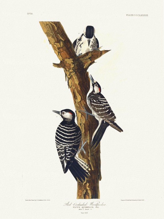 J.J. Audobon, Red-cockaded woodpecker Picus querulus, c.1 v.4 plate 389, 1835, vintage nature print on canvas, 50 x 70 cm, 20 x 25" approx.
$41.63
J.J. Audobon, Red-cockaded woodpecker Picus querulus, c.1 v.4 plate 389, 1835, vintage nature print on canvas, 50 x 70 cm, 20 x 25" approx.
$41.63
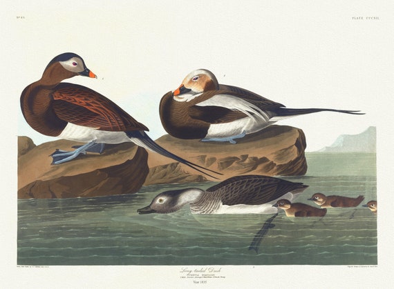 J.J. Audobon, Long-tailed duck. Fuligula glacialis. c.1 v.4 plate 312, 1835, vintage print on canvas, 50 x 70 cm, 20 x 25" approx.
$41.63
J.J. Audobon, Long-tailed duck. Fuligula glacialis. c.1 v.4 plate 312, 1835, vintage print on canvas, 50 x 70 cm, 20 x 25" approx.
$41.63
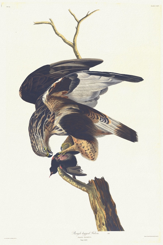 J.J. Audobon, Rough-legged falcon Falco lagopus. Male. c.1 v.2 plate 166, 1835 , print on canvas, 50 x 70 cm, 20 x 25" approx.
$41.63
J.J. Audobon, Rough-legged falcon Falco lagopus. Male. c.1 v.2 plate 166, 1835 , print on canvas, 50 x 70 cm, 20 x 25" approx.
$41.63
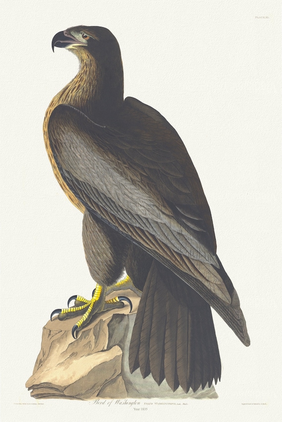 J.J. Audubon, Falco washingtonii, 1835 , vintage nature print on canvas, 50 x 70 cm, 20 x 25" approx.
$41.63
J.J. Audubon, Falco washingtonii, 1835 , vintage nature print on canvas, 50 x 70 cm, 20 x 25" approx.
$41.63
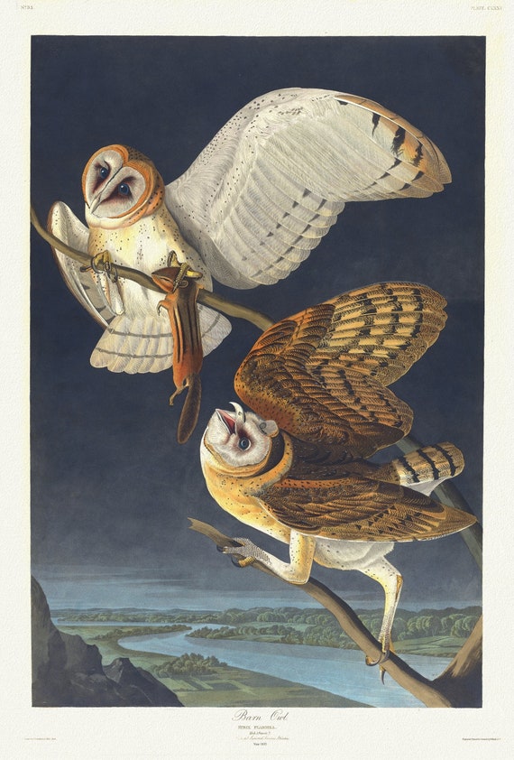 J.J. Audubon, Barn owl. Strix flammea, 1835, vintage nature print on canvas, 50 x 70 cm, 20 x 25" approx.
$41.63
J.J. Audubon, Barn owl. Strix flammea, 1835, vintage nature print on canvas, 50 x 70 cm, 20 x 25" approx.
$41.63
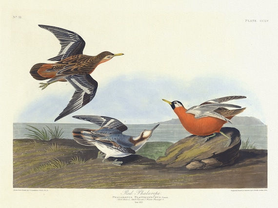 J.J. Audubon, , Red phalarope. Phalaropus platyrhynchus, Temm. Adult male, 1. Adult female, 2, 1835 , canvas, 50 x 70 cm, 20 x 25" approx.
$41.63
J.J. Audubon, , Red phalarope. Phalaropus platyrhynchus, Temm. Adult male, 1. Adult female, 2, 1835 , canvas, 50 x 70 cm, 20 x 25" approx.
$41.63