
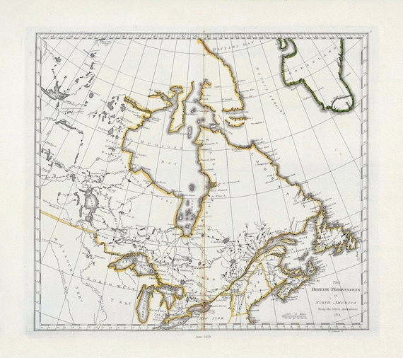
 Carey, British Possessions in North America, 1818, map on heavy cotton canvas, 20 x 25" approx.
$41.63
Carey, British Possessions in North America, 1818, map on heavy cotton canvas, 20 x 25" approx.
$41.63
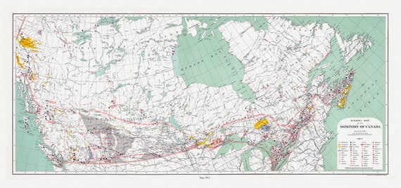 Canada. Department of Interior et Chalifour, Map Mineral map of the Dominion of Canada, 1915 , map on heavy cotton canvas, 20 x 25" approx.
$41.63
Canada. Department of Interior et Chalifour, Map Mineral map of the Dominion of Canada, 1915 , map on heavy cotton canvas, 20 x 25" approx.
$41.63
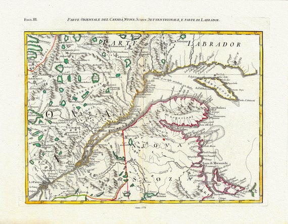 Mitchell, Rayanal et Zatta,Parte Orientale del Canada, Nuova Scozia Settentrionale, e Parte di Labrador, 1778, on canvas, 22x27"
$41.63
Mitchell, Rayanal et Zatta,Parte Orientale del Canada, Nuova Scozia Settentrionale, e Parte di Labrador, 1778, on canvas, 22x27"
$41.63
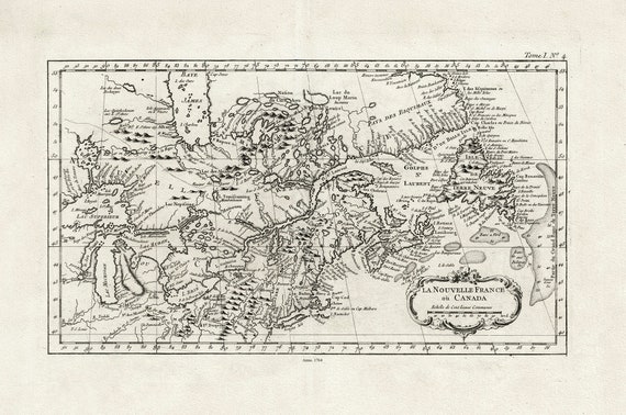
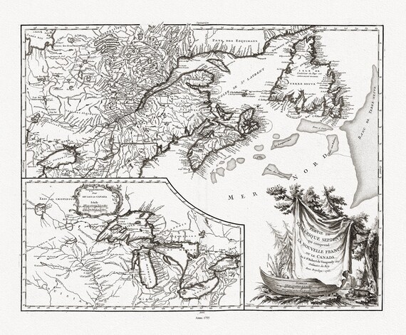 Vaugondy (Robert de, Gilles, 1688-1766), Nouvelle France ou le Canada, 1755 , map on heavy cotton canvas, 22x27" approx.
$41.63
Vaugondy (Robert de, Gilles, 1688-1766), Nouvelle France ou le Canada, 1755 , map on heavy cotton canvas, 22x27" approx.
$41.63
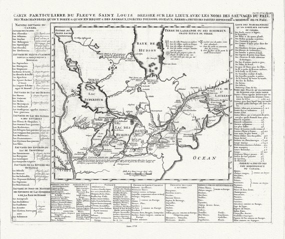 Henri Chatelain, Le Canada, 1719, map on heavy cotton canvas, 22x27" approx.
$41.63
Henri Chatelain, Le Canada, 1719, map on heavy cotton canvas, 22x27" approx.
$41.63
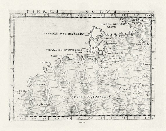 Ptolemy, Gastaldi et Mattioli, Tierra Nueva, 1548 , map on heavy cotton canvas, 22x27" approx.
$41.63
Ptolemy, Gastaldi et Mattioli, Tierra Nueva, 1548 , map on heavy cotton canvas, 22x27" approx.
$41.63
 J.W. Clement Co., Canada, 1943 Ver. BW, map on heavy cotton canvas, 22x27" approx.
$41.63
J.W. Clement Co., Canada, 1943 Ver. BW, map on heavy cotton canvas, 22x27" approx.
$41.63
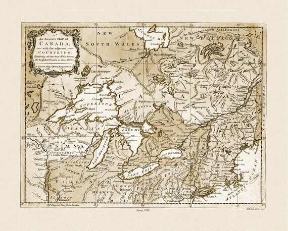 Canada, with the adjacent countries exhibiting the seat of war between the English & French in those parts, 1761 Ver. S, canvas-22x27"
$41.63
Canada, with the adjacent countries exhibiting the seat of war between the English & French in those parts, 1761 Ver. S, canvas-22x27"
$41.63
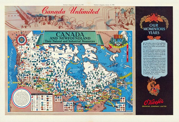 Canada and Newfoundland, Their natural and industrial resources, MacLean's Magazine, 1945, map on heavy cotton canvas, 22x27" approx.
$41.63
Canada and Newfoundland, Their natural and industrial resources, MacLean's Magazine, 1945, map on heavy cotton canvas, 22x27" approx.
$41.63
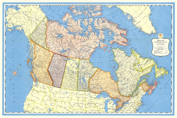 Hammond's Superior Map of Canada, 1957 , map on heavy cotton canvas, 22x27" approx.
$41.63
Hammond's Superior Map of Canada, 1957 , map on heavy cotton canvas, 22x27" approx.
$41.63
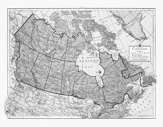
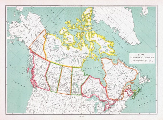 Canada territorial divisions, 1915, map on heavy cotton canvas, 22x27" approx
$41.63
Canada territorial divisions, 1915, map on heavy cotton canvas, 22x27" approx
$41.63
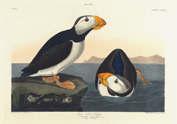 J..J. Audobon, Large-billed puffin. Mormon glacialis, c.1 v.3 plate 293, 1835 , nature print on canvas, 50 x 70 cm, 20 x 25" approx.
$41.63
J..J. Audobon, Large-billed puffin. Mormon glacialis, c.1 v.3 plate 293, 1835 , nature print on canvas, 50 x 70 cm, 20 x 25" approx.
$41.63
 Bellin, La Nouvelle France où Canada, 1764 Ver. 2 , map on heavy cotton canvas, 50 x 70cm, 20 x 25" approx.
$41.63
Bellin, La Nouvelle France où Canada, 1764 Ver. 2 , map on heavy cotton canvas, 50 x 70cm, 20 x 25" approx.
$41.63
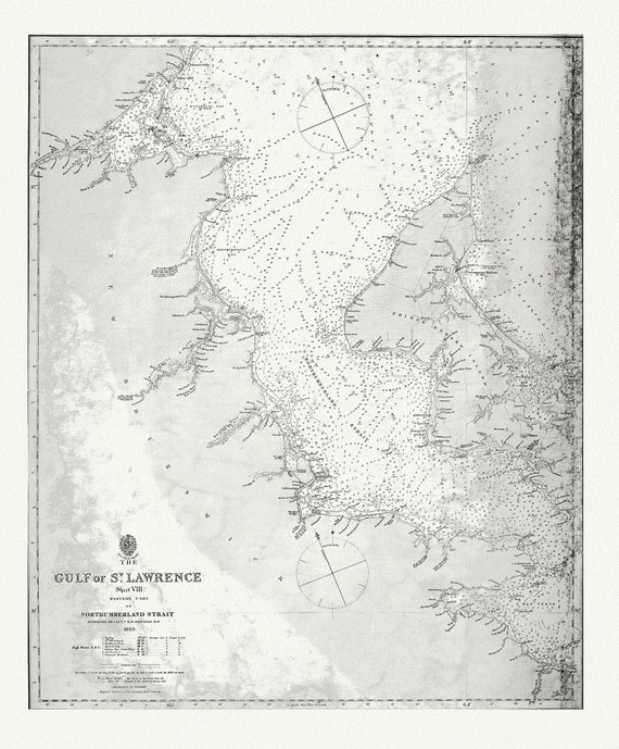 Nautical Chart, The Gulf of St. Lawrence, Western Part of Northumberland Strait, 1839, map on heavy cotton canvas, 20 x 25" approx.
$41.63
Nautical Chart, The Gulf of St. Lawrence, Western Part of Northumberland Strait, 1839, map on heavy cotton canvas, 20 x 25" approx.
$41.63
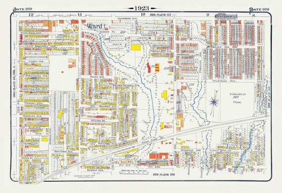 Plate 109, Toronto East, Leslieville North, Monarch Park, 1923, Map on heavy cotton canvas, 18x27in. approx.
$41.63
Plate 109, Toronto East, Leslieville North, Monarch Park, 1923, Map on heavy cotton canvas, 18x27in. approx.
$41.63
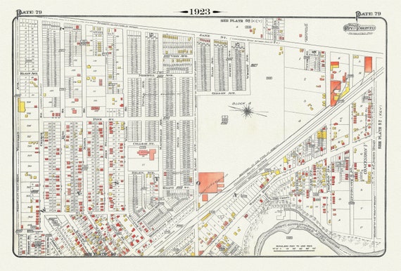 Plate 79, Toronto North West, Weston, 1923, Map on heavy cotton canvas, 18x27in. approx.
$41.63
Plate 79, Toronto North West, Weston, 1923, Map on heavy cotton canvas, 18x27in. approx.
$41.63
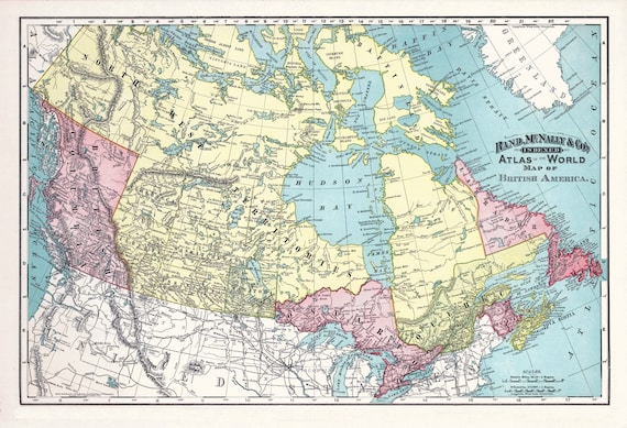 Rand, McNally & Co., British America (Canada), 1892, map on heavy cotton canvas, 22x27" approx.
$41.63
Rand, McNally & Co., British America (Canada), 1892, map on heavy cotton canvas, 22x27" approx.
$41.63
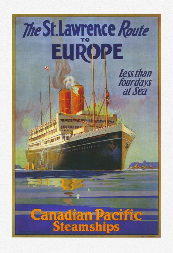 Canadian Pacific, to Europe , Ver. I, travel poster reprinted on durable cotton canvas, 50 x 70 cm, 20 x 25" approx.
$41.63
Canadian Pacific, to Europe , Ver. I, travel poster reprinted on durable cotton canvas, 50 x 70 cm, 20 x 25" approx.
$41.63
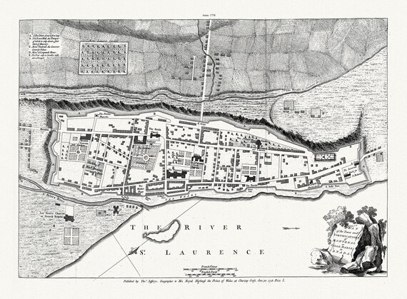 Jefferys, Town and Fortifications of Montreal or Ville Marie in Canada, 1758, map on heavy cotton canvas, 20x27" approx.
$41.63
Jefferys, Town and Fortifications of Montreal or Ville Marie in Canada, 1758, map on heavy cotton canvas, 20x27" approx.
$41.63
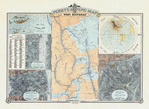 Perry's Mining Map of the Southern District of West Kootenay, 1893, Map on heavy cotton canvas, 22x27" approx.
$41.63
Perry's Mining Map of the Southern District of West Kootenay, 1893, Map on heavy cotton canvas, 22x27" approx.
$41.63