
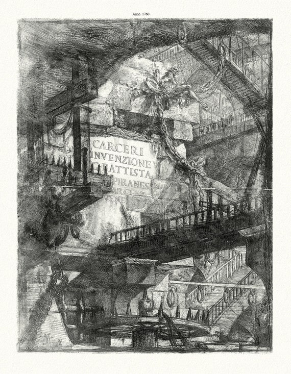
 Giovanni Battista Piranesi, Le Carceri d'Invenzione, Planche VIII, 1760, une gravure sur toile de coton épais, 56x70cm environ
$41.63
Giovanni Battista Piranesi, Le Carceri d'Invenzione, Planche VIII, 1760, une gravure sur toile de coton épais, 56x70cm environ
$41.63
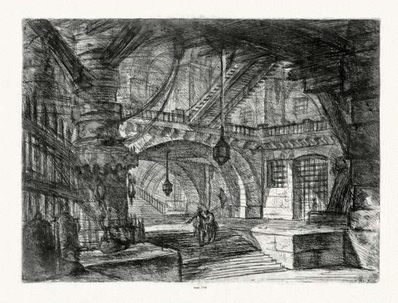 Giovanni Battista Piranesi, Le Carceri d'Invenzione, Planche VII, 1760, une gravure sur toile de coton épais, 56x70cm environ
$41.63
Giovanni Battista Piranesi, Le Carceri d'Invenzione, Planche VII, 1760, une gravure sur toile de coton épais, 56x70cm environ
$41.63
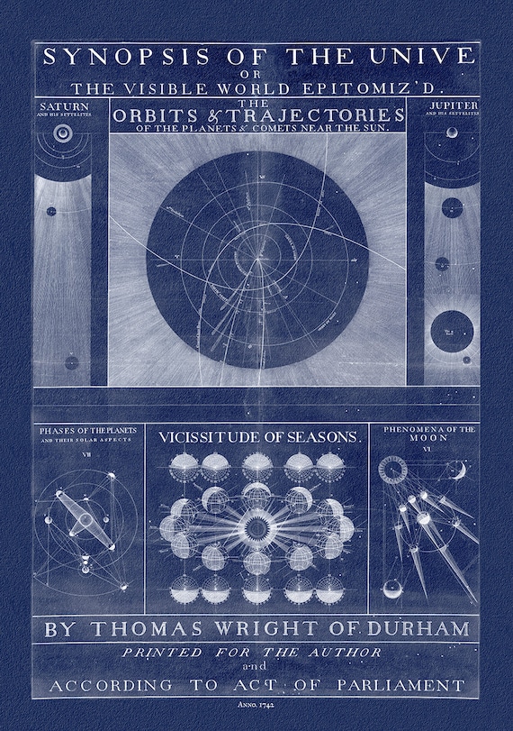 Thomas Wright, A synopsis of the Universe, or, the visible world epitomiz'd, Plate 1, cyanotype, 1742, heavy cotton canvas, 22x27" approx.
$41.63
Thomas Wright, A synopsis of the Universe, or, the visible world epitomiz'd, Plate 1, cyanotype, 1742, heavy cotton canvas, 22x27" approx.
$41.63
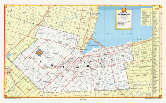 City of Hamilton, County of Wentworth and vicinity, with an index for points of interest, 1966 , map on cotton canvas, 20 x 25" approx.
$41.63
City of Hamilton, County of Wentworth and vicinity, with an index for points of interest, 1966 , map on cotton canvas, 20 x 25" approx.
$41.63
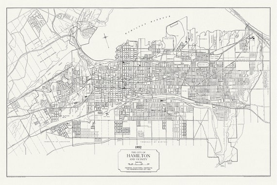 The City of Hamilton and Vicinity, federal electoral districts, The Representation Act, 1952 , map on heavy cotton canvas, 20 x 25" approx.
$41.63
The City of Hamilton and Vicinity, federal electoral districts, The Representation Act, 1952 , map on heavy cotton canvas, 20 x 25" approx.
$41.63
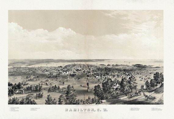 Hamilton, Ontario, Canada West, 1859 , map on heavy cotton canvas, 50 x 70 cm, 20 x 25" approx.
$41.63
Hamilton, Ontario, Canada West, 1859 , map on heavy cotton canvas, 50 x 70 cm, 20 x 25" approx.
$41.63
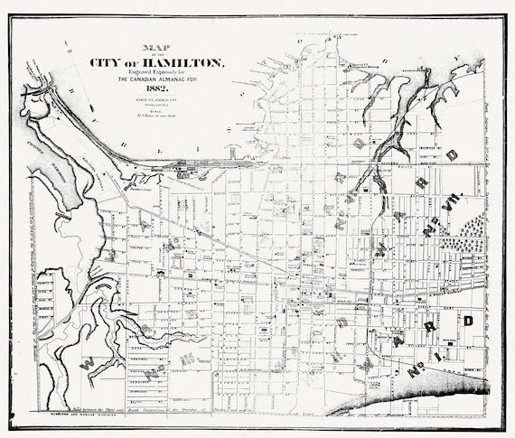 Hamilton, Ontario, 1882, map on heavy cotton canvas, 50 x 70cm, 20 x 25" approx.
$41.63
Hamilton, Ontario, 1882, map on heavy cotton canvas, 50 x 70cm, 20 x 25" approx.
$41.63
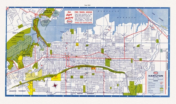 Hamilton, Ontario, 1963, map on heavy cotton canvas, 50 x 70 cm, 20 x 25" approx.
$41.63
Hamilton, Ontario, 1963, map on heavy cotton canvas, 50 x 70 cm, 20 x 25" approx.
$41.63
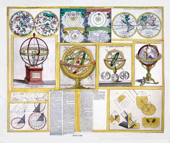 Ferguson, Collection of nine images including astronomical instruments, celestial charts, and a world map, 1769, canvas, 22x27"
$41.63
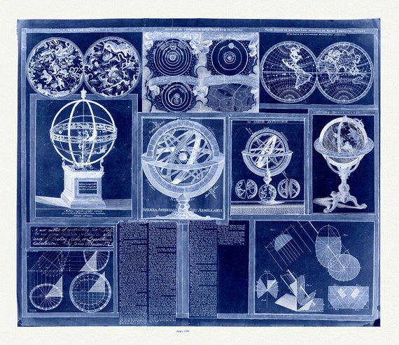
Ferguson, Collection of nine images including astronomical instruments, celestial charts, and a world map, 1769, canvas, 22x27"
$41.63
 Ferguson, A Collection of nine images including astronomical instruments, celestial charts, and a world map, cyanotype, 1769, canvas, 22x27"
$41.63
Ferguson, A Collection of nine images including astronomical instruments, celestial charts, and a world map, cyanotype, 1769, canvas, 22x27"
$41.63
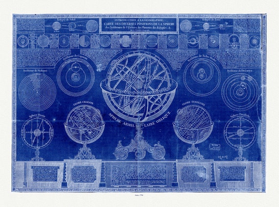 la geographie carte des diverses positions de la sphere, des systhemes de Univers, des planettes, des eclypses, cyanotype, 1798, 22x27
$41.63
la geographie carte des diverses positions de la sphere, des systhemes de Univers, des planettes, des eclypses, cyanotype, 1798, 22x27
$41.63
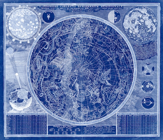 Allard, Planisphaerii coelestis hemisphaerium meridionale calculatum ad finem, pro aevo XVIII praesente, Cyanotype, 1700, canvas 22x27"
$41.63
Allard, Planisphaerii coelestis hemisphaerium meridionale calculatum ad finem, pro aevo XVIII praesente, Cyanotype, 1700, canvas 22x27"
$41.63
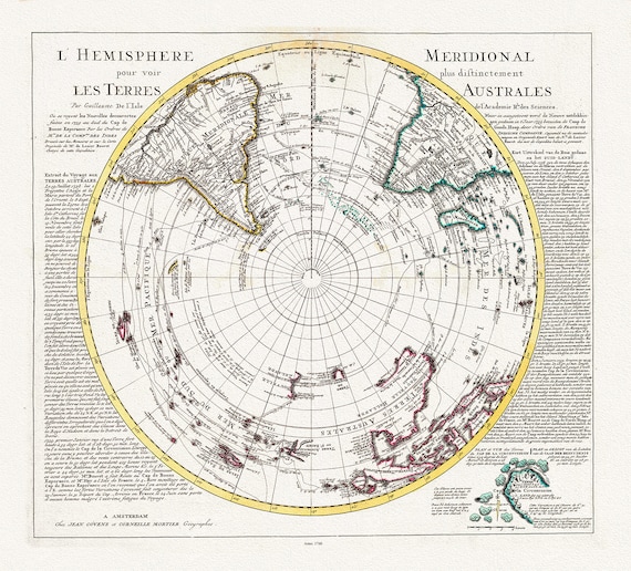 Visscher, Schenk, L'isle et Mortier, L' Hemisphere meridional pour voir plus distinctement les Terres Arctiques, 1740, on canvas, 22x27in
$41.63
Visscher, Schenk, L'isle et Mortier, L' Hemisphere meridional pour voir plus distinctement les Terres Arctiques, 1740, on canvas, 22x27in
$41.63
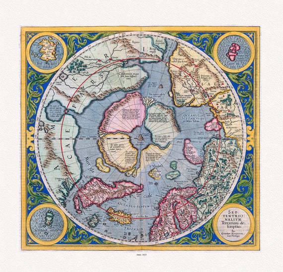 Mercator et Hondius, Septentrionalium Terrarum descriptio. Per Gerardum Mercatorem Cum Privilegio, 1623, on heavy cotton canvas, 22x27in.
$41.63
Mercator et Hondius, Septentrionalium Terrarum descriptio. Per Gerardum Mercatorem Cum Privilegio, 1623, on heavy cotton canvas, 22x27in.
$41.63
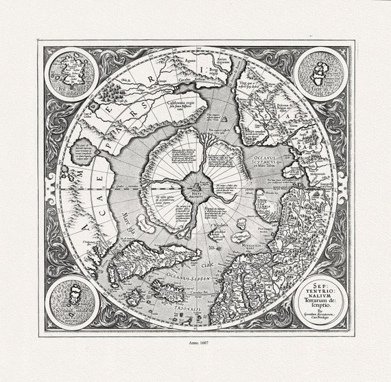 Mercator et Hondius, Septentrionalium Terrarum descriptio. Per Gerardum Mercatorem , 1607, Map on heavy cotton canvas, 22x27in. approx.
$41.63
Mercator et Hondius, Septentrionalium Terrarum descriptio. Per Gerardum Mercatorem , 1607, Map on heavy cotton canvas, 22x27in. approx.
$41.63
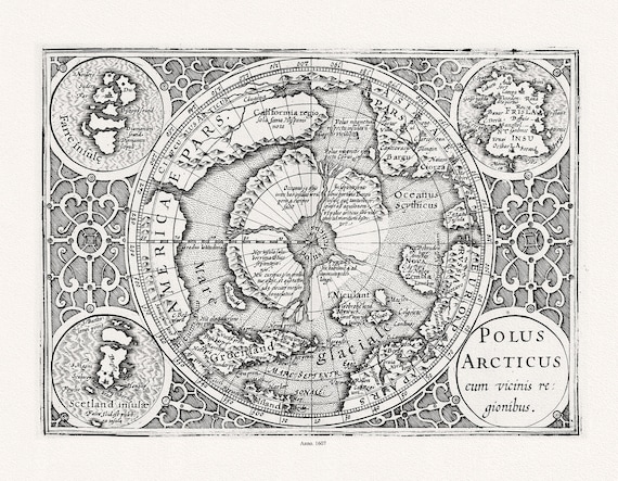 Mercator et Hondius, Polus Arcticus cum vicinis regionibus, 1607, Map printed on to heavy cotton canvas, 22x27in. approx.
$41.63
Mercator et Hondius, Polus Arcticus cum vicinis regionibus, 1607, Map printed on to heavy cotton canvas, 22x27in. approx.
$41.63
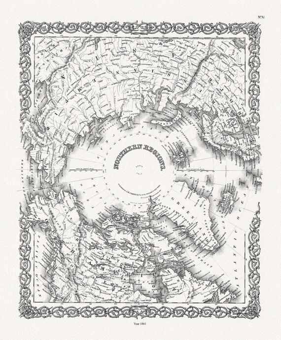 G.W. Colton, Northern Regions, 1861, Map printed on to heavy cotton canvas, 22x27in. approx.
$41.63
G.W. Colton, Northern Regions, 1861, Map printed on to heavy cotton canvas, 22x27in. approx.
$41.63
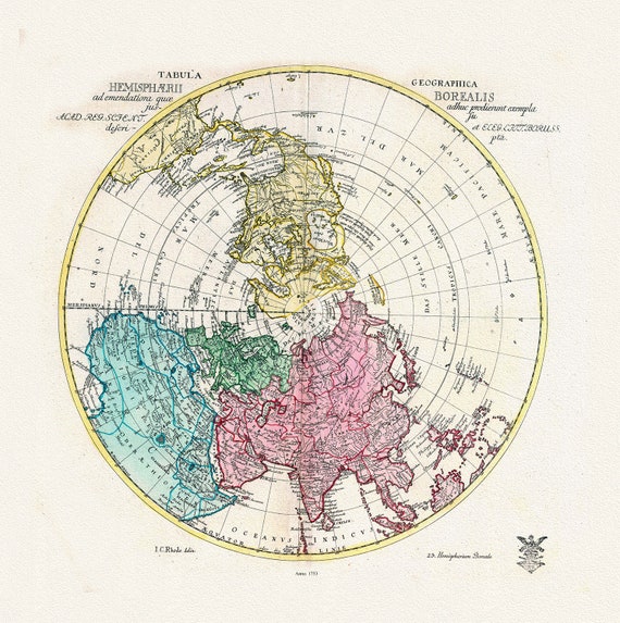 Euler, Sauerbrey et Rhode, Tabula Geographica Hemisphaerii Borealis, 1753, Map printed on to heavy cotton canvas, 22x27in. approx.
$41.63
Euler, Sauerbrey et Rhode, Tabula Geographica Hemisphaerii Borealis, 1753, Map printed on to heavy cotton canvas, 22x27in. approx.
$41.63
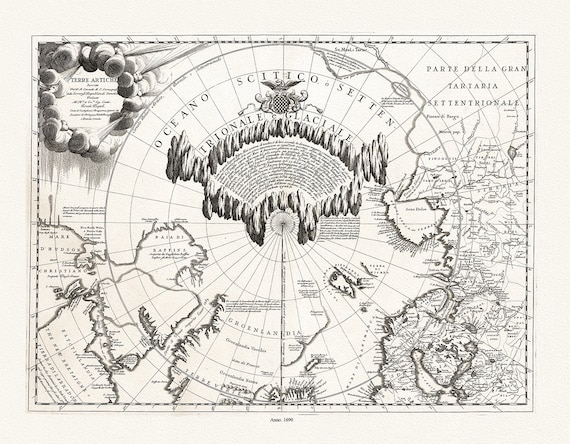 Coronelli, Terre Artiche, 1690, Map printed on to heavy cotton canvas, 22x27in. approx.
$41.63
Coronelli, Terre Artiche, 1690, Map printed on to heavy cotton canvas, 22x27in. approx.
$41.63
 Cassinni & Aa, Planisphere Terrestre, suivant les nouvelles observations des astronomes, 1713, printed on to heavy cotton canvas, 22x27in.
$41.63
Cassinni & Aa, Planisphere Terrestre, suivant les nouvelles observations des astronomes, 1713, printed on to heavy cotton canvas, 22x27in.
$41.63