
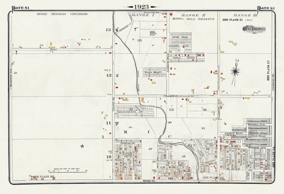
 Plate 81, Toronto West, Mimico & Etobicoke, Kingsway, 1923, Map on heavy cotton canvas, 18x27in. approx.
$41.63
Plate 81, Toronto West, Mimico & Etobicoke, Kingsway, 1923, Map on heavy cotton canvas, 18x27in. approx.
$41.63
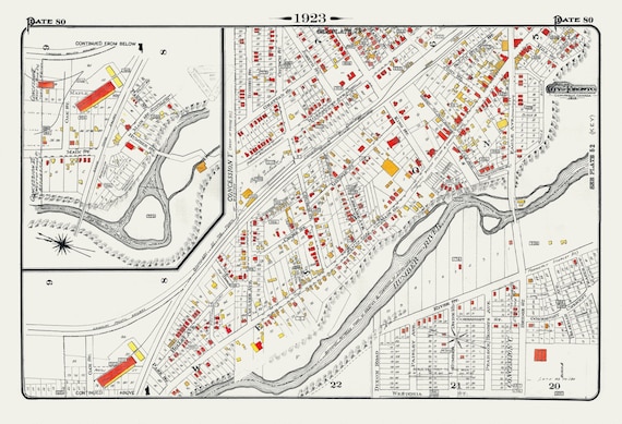 Plate 80, Toronto North and West, Weston, 1923, Map on heavy cotton canvas, 18x27in. approx.
$41.63
Plate 80, Toronto North and West, Weston, 1923, Map on heavy cotton canvas, 18x27in. approx.
$41.63
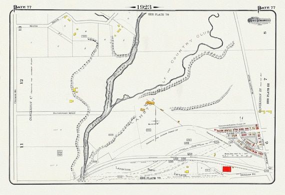 Plate 77, Toronto West and North, Lambton, 1923, Map on heavy cotton canvas, 18x27in. approx.
$41.63
Plate 77, Toronto West and North, Lambton, 1923, Map on heavy cotton canvas, 18x27in. approx.
$41.63
 Plate 75, Toronto Uptown West, Forrest Hill at Bathurst Street, 1923, Map on heavy cotton canvas, 18x27in. approx.
$41.63
Plate 75, Toronto Uptown West, Forrest Hill at Bathurst Street, 1923, Map on heavy cotton canvas, 18x27in. approx.
$41.63
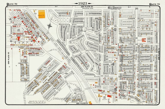 Plate 70, Toronto West and North, Weston Road & Mount Dennis, 1923, Map on heavy cotton canvas, 18x27in. approx.
$41.63
Plate 70, Toronto West and North, Weston Road & Mount Dennis, 1923, Map on heavy cotton canvas, 18x27in. approx.
$41.63
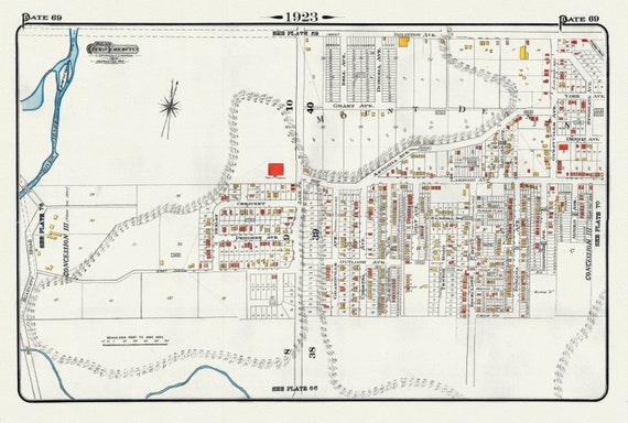 Plate 69, Toronto West, Mount Dennis, Eglinton & Jane, 1923, Map on heavy cotton canvas, 18x27in. approx.
$41.63
Plate 69, Toronto West, Mount Dennis, Eglinton & Jane, 1923, Map on heavy cotton canvas, 18x27in. approx.
$41.63
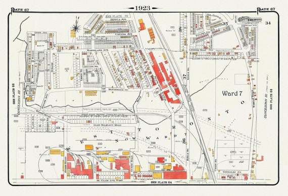 Plate 67, Toronto West, Stockyards North, 1923, Map on heavy cotton canvas, 18x27in. approx.
$41.63
Plate 67, Toronto West, Stockyards North, 1923, Map on heavy cotton canvas, 18x27in. approx.
$41.63
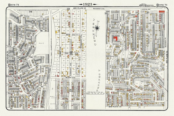 Plate 71, Toronto West North, Prospect Cemetery, 1923, Map on heavy cotton canvas, 18x27in. approx.
$41.63
Plate 71, Toronto West North, Prospect Cemetery, 1923, Map on heavy cotton canvas, 18x27in. approx.
$41.63
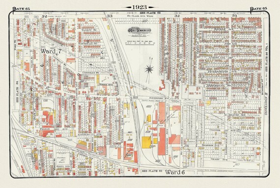 Plate 65, Toronto West, Junction Triangle & Brockton North, 1923, Map on heavy cotton canvas, 18x27in. approx.
$41.63
Plate 65, Toronto West, Junction Triangle & Brockton North, 1923, Map on heavy cotton canvas, 18x27in. approx.
$41.63
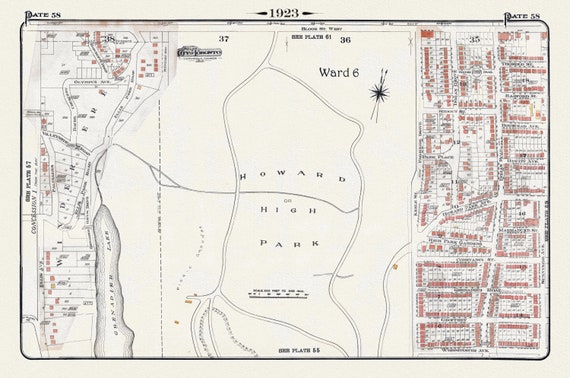 Plate 58, Toronto West, High Park Central, 1923, Map on heavy cotton canvas, 18x27in. approx.
$41.63
Plate 58, Toronto West, High Park Central, 1923, Map on heavy cotton canvas, 18x27in. approx.
$41.63
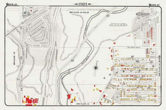 Plate 47, Toronto East York, Todmorden, 1923, Map on heavy cotton canvas, 18x27in. approx.
$41.63
Plate 47, Toronto East York, Todmorden, 1923, Map on heavy cotton canvas, 18x27in. approx.
$41.63
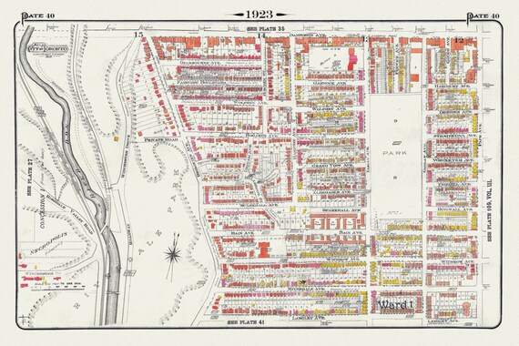 Plate 40, Toronto East, Riverdale, Withrow Park, 1923, Map on heavy cotton canvas, 18x27in. approx.
$41.63
Plate 40, Toronto East, Riverdale, Withrow Park, 1923, Map on heavy cotton canvas, 18x27in. approx.
$41.63
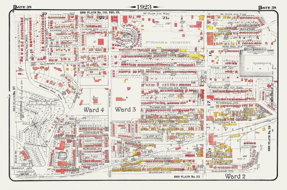 Plate 38, Toronto Uptown, Rosedale, Cottingham, Forest Hill South, 1923, Map on heavy cotton canvas, 18x27in. approx.
$41.63
Plate 38, Toronto Uptown, Rosedale, Cottingham, Forest Hill South, 1923, Map on heavy cotton canvas, 18x27in. approx.
$41.63
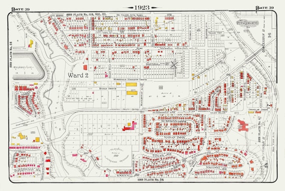 Plate 39, Toronto Uptown, Rosedale & Moore Park, 1923, Map on heavy cotton canvas, 18x27in. approx.
$41.63
Plate 39, Toronto Uptown, Rosedale & Moore Park, 1923, Map on heavy cotton canvas, 18x27in. approx.
$41.63
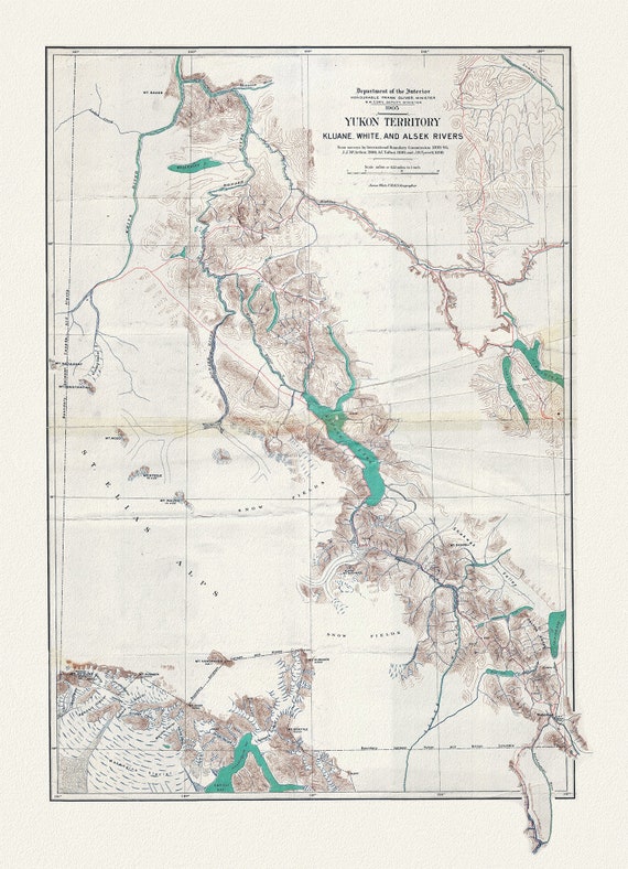 Yukon Territory, 1905, map on durable cotton canvas, 50 x 70 cm, 20 x 25" approx.
$41.63
Yukon Territory, 1905, map on durable cotton canvas, 50 x 70 cm, 20 x 25" approx.
$41.63
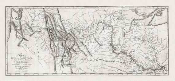 Lewis and Clark's track, across the western portion of North America in 1804, 5 & 6, , map on heavy cotton canvas, 22x27" approx.
$41.63
Lewis and Clark's track, across the western portion of North America in 1804, 5 & 6, , map on heavy cotton canvas, 22x27" approx.
$41.63
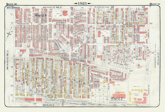 Plate 36, Toronto Northwest, North Dovercourt & Brackondale, 1923, Map on heavy cotton canvas, 18x27in. approx.
$41.63
Plate 36, Toronto Northwest, North Dovercourt & Brackondale, 1923, Map on heavy cotton canvas, 18x27in. approx.
$41.63
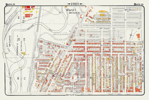 Plate 35, Toronto East York, Chester, 1923, Map on heavy cotton canvas, 18x27in. approx.
$41.63
Plate 35, Toronto East York, Chester, 1923, Map on heavy cotton canvas, 18x27in. approx.
$41.63
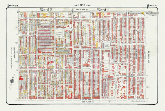 Plate 32, Toronto West, Bloorcourt, Seaton Village, Annex , 1923, Map on heavy cotton canvas, 18x27in. approx.
$41.63
Plate 32, Toronto West, Bloorcourt, Seaton Village, Annex , 1923, Map on heavy cotton canvas, 18x27in. approx.
$41.63
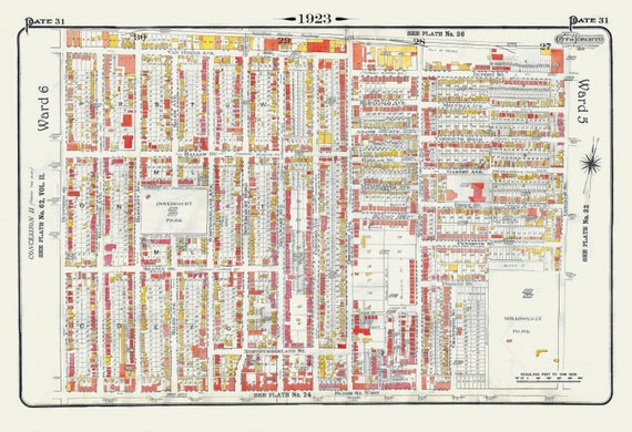 Plate 31, Toronto West, Bloorcourt, Dovercourt, 1923, Map on heavy cotton canvas, 18x27in. approx.
$41.63
Plate 31, Toronto West, Bloorcourt, Dovercourt, 1923, Map on heavy cotton canvas, 18x27in. approx.
$41.63