
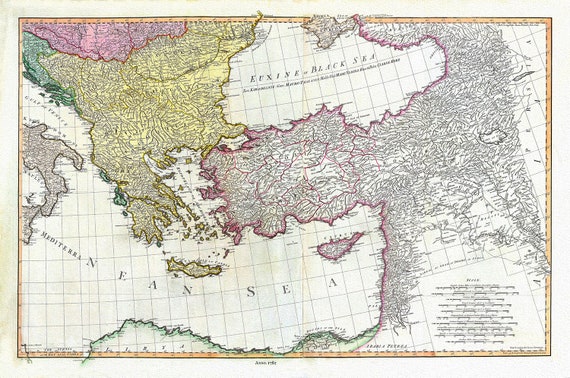
 William Faden, Mediterranean Eastern Portion, 1785, map on heavy cotton canvas, 22x27" approx.
$41.63
William Faden, Mediterranean Eastern Portion, 1785, map on heavy cotton canvas, 22x27" approx.
$41.63
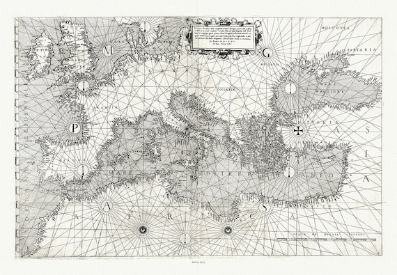 Giacomo Gastaldi, Europe & Mediterranean, 1572 , map on heavy cotton canvas, 22x27" approx.
$41.63
Giacomo Gastaldi, Europe & Mediterranean, 1572 , map on heavy cotton canvas, 22x27" approx.
$41.63
 Un Nouvelle Carte des Conciles et Particuliers qui se sonr Tenus en Europe, en Asie, Afrique, 1718, on heavy cotton canvas 22x27approx.
$41.63
Un Nouvelle Carte des Conciles et Particuliers qui se sonr Tenus en Europe, en Asie, Afrique, 1718, on heavy cotton canvas 22x27approx.
$41.63
 Canada Travel Poster, Winter Vacations Unlimited, poster on heavy cotton canvas, 22x27" approx.
$41.63
Canada Travel Poster, Winter Vacations Unlimited, poster on heavy cotton canvas, 22x27" approx.
$41.63
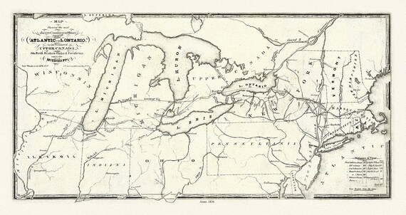 Price, Map showing the direct commercial route from the Atlantic via L. Ontario, to the province of Upper Canada, Mississippi, 1836, 18x27"
$41.63
Price, Map showing the direct commercial route from the Atlantic via L. Ontario, to the province of Upper Canada, Mississippi, 1836, 18x27"
$41.63
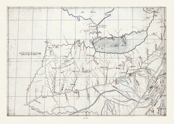 Patten, A trader's map of the Ohio country before 1753, map on heavy cotton canvas, 22x27" approx.
$41.63
Patten, A trader's map of the Ohio country before 1753, map on heavy cotton canvas, 22x27" approx.
$41.63
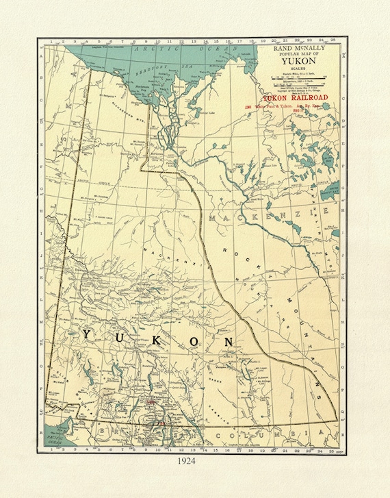 Yukon, 1924, Map on heavy cotton canvas, 27x22" approx.
$41.63
Yukon, 1924, Map on heavy cotton canvas, 27x22" approx.
$41.63
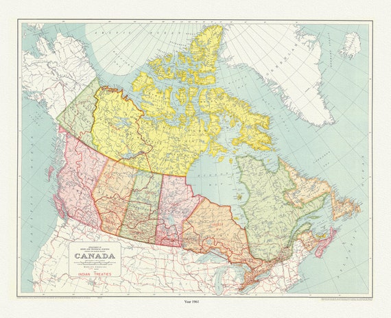 Map outlining a number of treaties between Indigenous peoples and the Canadian government, 1961, map on canvas, 50 x 70 cm, 20 x 25" approx.
$41.63
Map outlining a number of treaties between Indigenous peoples and the Canadian government, 1961, map on canvas, 50 x 70 cm, 20 x 25" approx.
$41.63
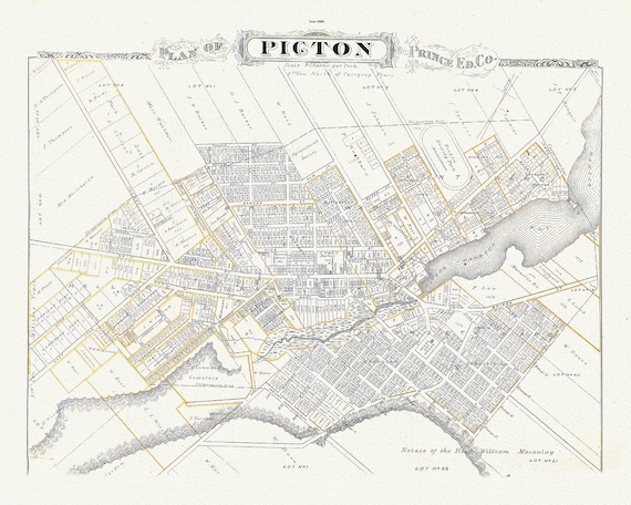
 Town of Picton in Prince Edward County, Tremaine auth.,1863 , map on heavy cotton canvas, 45 x 65 cm, 18 x 24" approx.
$41.63
Town of Picton in Prince Edward County, Tremaine auth.,1863 , map on heavy cotton canvas, 45 x 65 cm, 18 x 24" approx.
$41.63
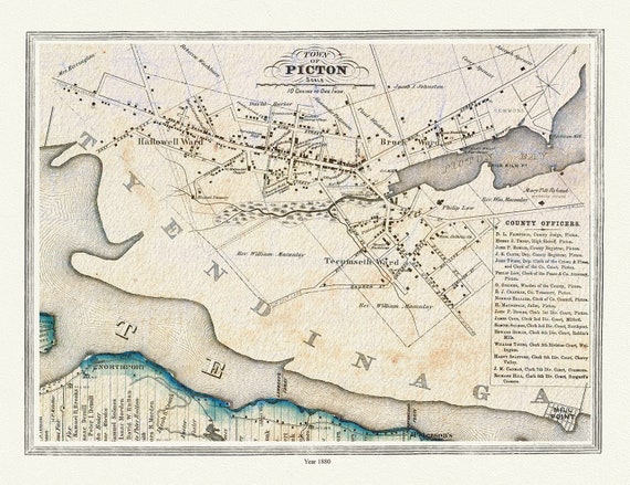
 Plan of Picton, Prince Edward County, Ontario, 1880, map on heavy cotton canvas, 45 x 65 cm, 18 x 24" approx.
$41.63
Plan of Picton, Prince Edward County, Ontario, 1880, map on heavy cotton canvas, 45 x 65 cm, 18 x 24" approx.
$41.63
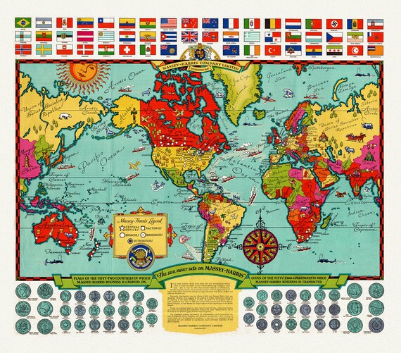 The Sun Never Sets on Massey-Harris, 1938, on heavy cotton canvas, 22x27" approx.
$41.63
The Sun Never Sets on Massey-Harris, 1938, on heavy cotton canvas, 22x27" approx.
$41.63
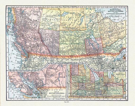 Appleton, Map of Manitoba, British Columbia and the Northwest Territories, 1891 , map on heavy cotton canvas, 22x27" approx.
$41.63
Appleton, Map of Manitoba, British Columbia and the Northwest Territories, 1891 , map on heavy cotton canvas, 22x27" approx.
$41.63
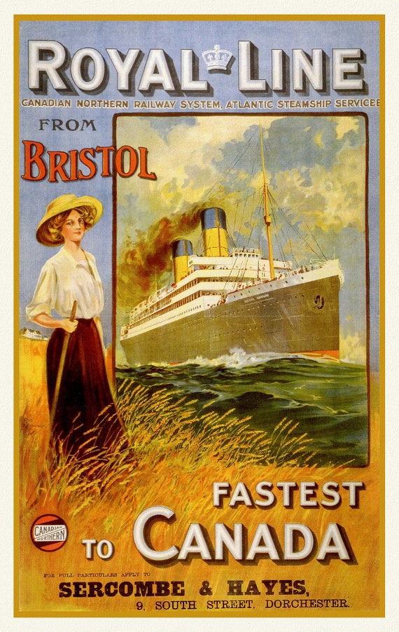 Royal Line, Fastest to Canada, travel poster reprinted on durable cotton canvas, 50 x 70 cm, 20 x 25" approx.
$34.06
Royal Line, Fastest to Canada, travel poster reprinted on durable cotton canvas, 50 x 70 cm, 20 x 25" approx.
$34.06
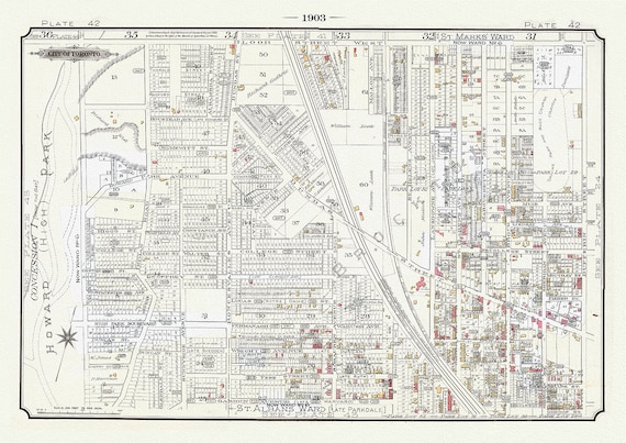 Plate 42A ,Toronto West, High Park to Brockton, 1903 Ver. II, map on heavy cotton canvas, 20 x 30" or 50 x 75cm. approx.
$41.63
Plate 42A ,Toronto West, High Park to Brockton, 1903 Ver. II, map on heavy cotton canvas, 20 x 30" or 50 x 75cm. approx.
$41.63
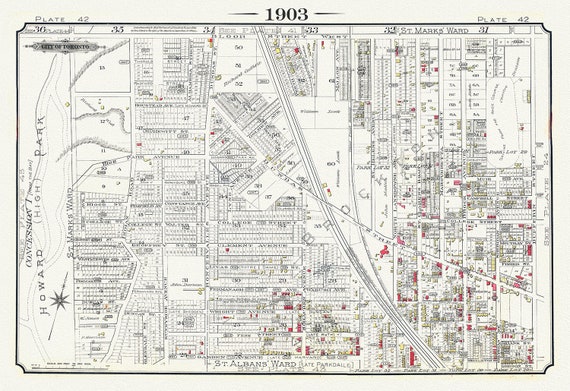 Plate 42, Toronto West, High Park to Brockton, Roncesvalles Village, 1903 Version I
$41.63
Plate 42, Toronto West, High Park to Brockton, Roncesvalles Village, 1903 Version I
$41.63
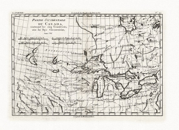 Bonne, Partie Occidentale du Canada, contenant les Cinq Grands Lacs, avec les pays circonvoisins, 1780, map on cotton canvas, 22x27" approx.
$41.63
Bonne, Partie Occidentale du Canada, contenant les Cinq Grands Lacs, avec les pays circonvoisins, 1780, map on cotton canvas, 22x27" approx.
$41.63
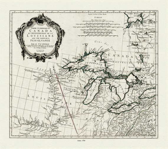 Anville et al., Partie occidentale du Canada et septentrionale de la Louisiane avec une partie de la Pensilvanie, 1784 , on canvas 22x27"
$41.63
Anville et al., Partie occidentale du Canada et septentrionale de la Louisiane avec une partie de la Pensilvanie, 1784 , on canvas 22x27"
$41.63
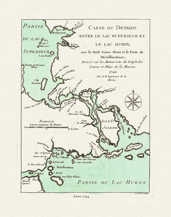 Bellin, Carte du Detroit entre le Lac Superieur et Huron, avec le Sault Ste. Marie, 1744, map on heavy cotton canvas, 22x27" approx.
$41.63
Bellin, Carte du Detroit entre le Lac Superieur et Huron, avec le Sault Ste. Marie, 1744, map on heavy cotton canvas, 22x27" approx.
$41.63
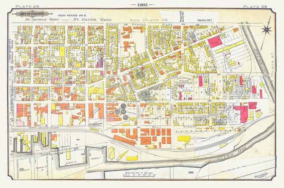 Plate 29, Toronto Downtown East, Corktown & Distillery, 1903, map on heavy cotton canvas, 20 x 30" or 50 x 75cm. approx
$41.63
Plate 29, Toronto Downtown East, Corktown & Distillery, 1903, map on heavy cotton canvas, 20 x 30" or 50 x 75cm. approx
$41.63
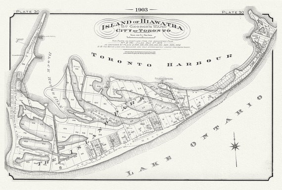 Plate 30, Toronto, Island of Hiawatha, 1903 , map on heavy cotton canvas, 20 x 30", 50 x 76cm, approx.
$41.63
Plate 30, Toronto, Island of Hiawatha, 1903 , map on heavy cotton canvas, 20 x 30", 50 x 76cm, approx.
$41.63