
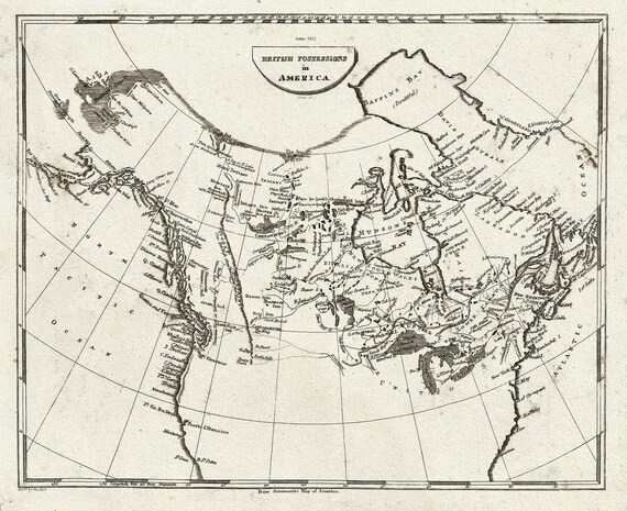
 Arrowsmith, British possessions in America, 1812, map on heavy cotton canvas, 22x27" approx.
$41.63
Arrowsmith, British possessions in America, 1812, map on heavy cotton canvas, 22x27" approx.
$41.63
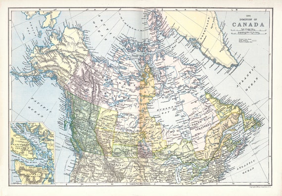 Appleton, Dominion of Canada, 1891, map on heavy cotton canvas, 22x27" approx.
$41.63
Appleton, Dominion of Canada, 1891, map on heavy cotton canvas, 22x27" approx.
$41.63
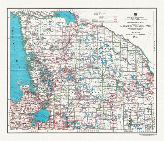 Historic Algonquin Park Map & Surrounding Area, Algonquin Story, 1946 , map on heavy cotton canvas, 20x27" approx.
$41.63
Historic Algonquin Park Map & Surrounding Area, Algonquin Story, 1946 , map on heavy cotton canvas, 20x27" approx.
$41.63
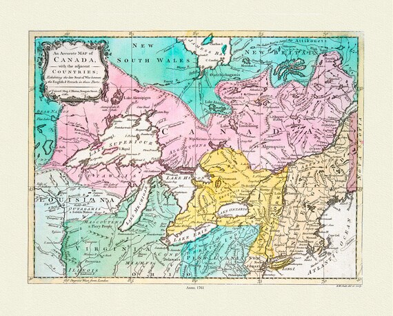 An Accurate Map of Canada, with the adjacent countries exhibiting the late seat of war between the English & French 1761, canvas, 22x27"
$41.63
An Accurate Map of Canada, with the adjacent countries exhibiting the late seat of war between the English & French 1761, canvas, 22x27"
$41.63
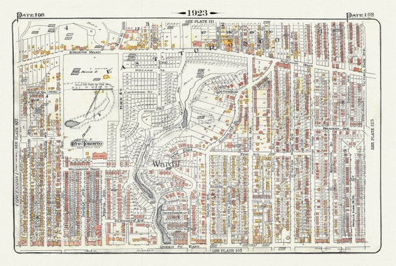 Plate 108, Toronto East, Beach North of Queen St. & Pine Avenue, 1923, Map on heavy cotton canvas, 18x27in. approx.
$41.63
Plate 108, Toronto East, Beach North of Queen St. & Pine Avenue, 1923, Map on heavy cotton canvas, 18x27in. approx.
$41.63
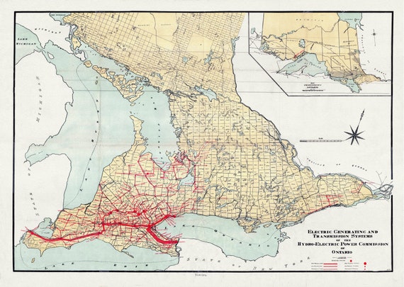 The Electric Generating and Transmission Systems of the Hydro, Electric Power Commission of Ontario, 1914 , map on canvas, 22x27" approx.
$41.63
The Electric Generating and Transmission Systems of the Hydro, Electric Power Commission of Ontario, 1914 , map on canvas, 22x27" approx.
$41.63
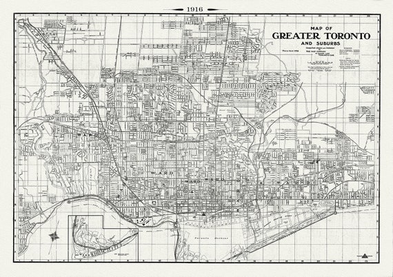 Map of Greater Toronto & Suburbs, 1916 , map on heavy cotton canvas, 22x27" approx.
$41.63
Map of Greater Toronto & Suburbs, 1916 , map on heavy cotton canvas, 22x27" approx.
$41.63
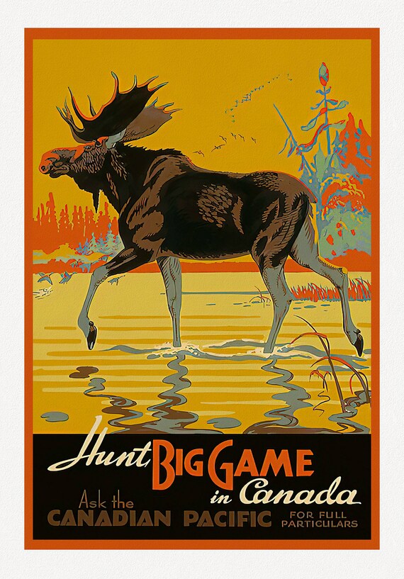 Canadian Pacific, Hunt Big Game in Canada , travel poster on heavy cotton canvas, 22x27" approx.
$41.63
Canadian Pacific, Hunt Big Game in Canada , travel poster on heavy cotton canvas, 22x27" approx.
$41.63
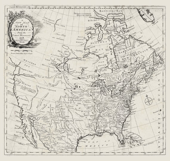 Carver, A new map of North America, from the latest discoveries, 1778 , map on heavy cotton canvas, 22x27" approx.
$41.63
Carver, A new map of North America, from the latest discoveries, 1778 , map on heavy cotton canvas, 22x27" approx.
$41.63
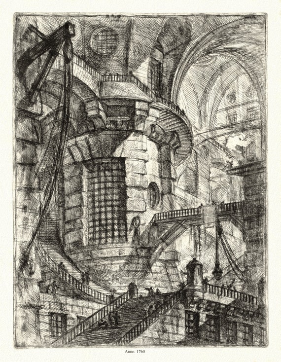 Giovanni Battista Piranesi ,Le Carceri d'Invenzione, Planche XX, 1760, une gravure sur toile de coton épais, 56x70cm environ
$41.63
Giovanni Battista Piranesi ,Le Carceri d'Invenzione, Planche XX, 1760, une gravure sur toile de coton épais, 56x70cm environ
$41.63
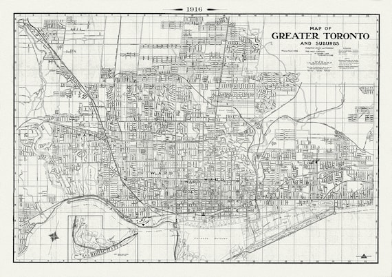 Toronto: Map of Greater Toronto & Suburbs, 1916 , map on heavy cotton canvas, 22x27" approx.
$41.63
Toronto: Map of Greater Toronto & Suburbs, 1916 , map on heavy cotton canvas, 22x27" approx.
$41.63
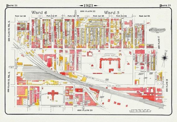 Plate 21, Toronto West, Parkdale & Liberty Village, Lunatic Asylum, 1923, Map on heavy cotton canvas, 18x27in. approx.
$41.63
Plate 21, Toronto West, Parkdale & Liberty Village, Lunatic Asylum, 1923, Map on heavy cotton canvas, 18x27in. approx.
$41.63
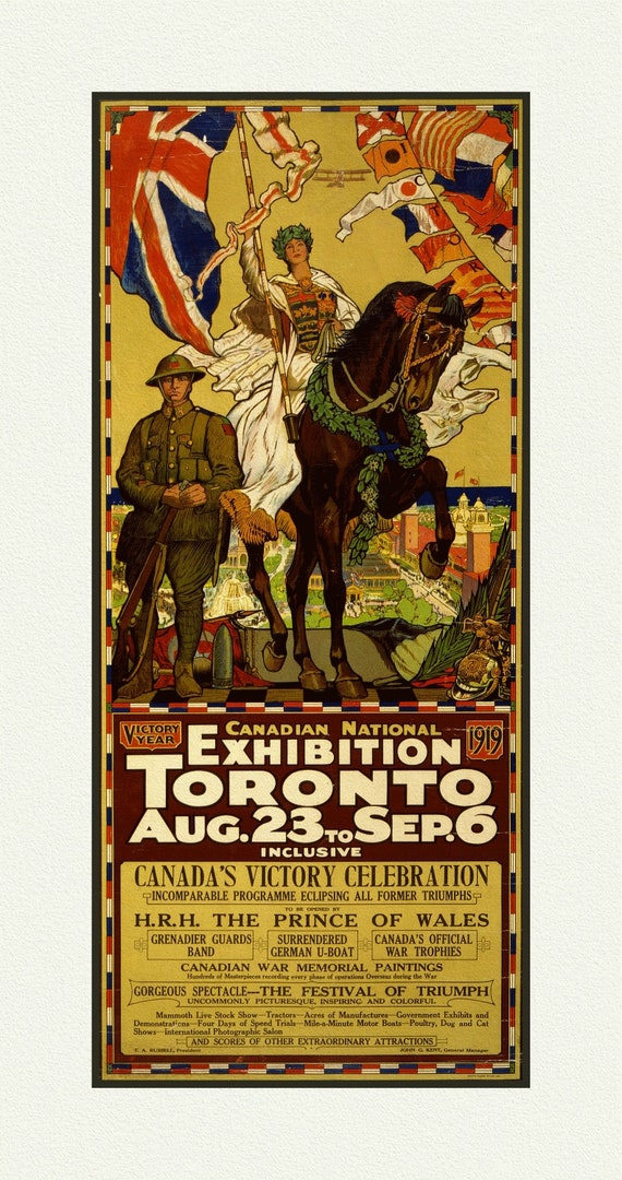 Canadian National Exhibition, 1919, Poster on Heavy Cotton Canvas, approx. 27x18"
$41.63
Canadian National Exhibition, 1919, Poster on Heavy Cotton Canvas, approx. 27x18"
$41.63
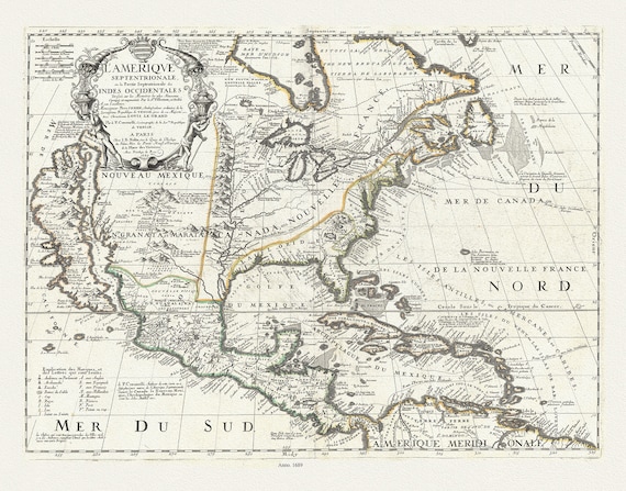 L'Amerique Septentrionale, ou la Partie Septentrionale des Indes Occidentales, 1689, Nolin auth. , map on canvas, 20 x 25" approx.
$41.63
L'Amerique Septentrionale, ou la Partie Septentrionale des Indes Occidentales, 1689, Nolin auth. , map on canvas, 20 x 25" approx.
$41.63
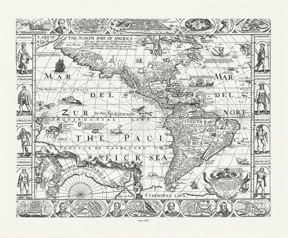 North and South America ,1658, Walton auth. map on durable cotton canvas, 50 x 70 cm, 20 x 25" approx.
$41.63
North and South America ,1658, Walton auth. map on durable cotton canvas, 50 x 70 cm, 20 x 25" approx.
$41.63
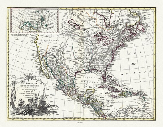 L'Amérique septentrionale, 1757, Covens et Mortier auths., map on durable cotton canvas, 50 x 70 cm, 20 x 25" approx.
$41.63
L'Amérique septentrionale, 1757, Covens et Mortier auths., map on durable cotton canvas, 50 x 70 cm, 20 x 25" approx.
$41.63
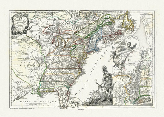 l'Amerique Septle. pour servir a l'intelligence de la guerre entre les Anglois et les insurgents,1777, Beaurain auth. canvas 20 x 25"
$41.63
l'Amerique Septle. pour servir a l'intelligence de la guerre entre les Anglois et les insurgents,1777, Beaurain auth. canvas 20 x 25"
$41.63
 Newfoundland and Labrador Tourist Development Office, 1960 , map on heavy cotton canvas, 50 x 70 cm, 20 x 25" approx.
$41.63
Newfoundland and Labrador Tourist Development Office, 1960 , map on heavy cotton canvas, 50 x 70 cm, 20 x 25" approx.
$41.63
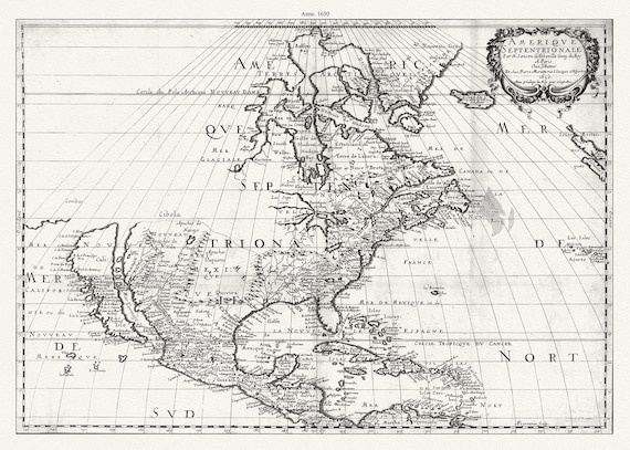 Amérique septentrionale, 1650, Marriette auth. , map on durable cotton canvas, 50 x 70 cm, 20 x 25" approx.
$41.63
Amérique septentrionale, 1650, Marriette auth. , map on durable cotton canvas, 50 x 70 cm, 20 x 25" approx.
$41.63
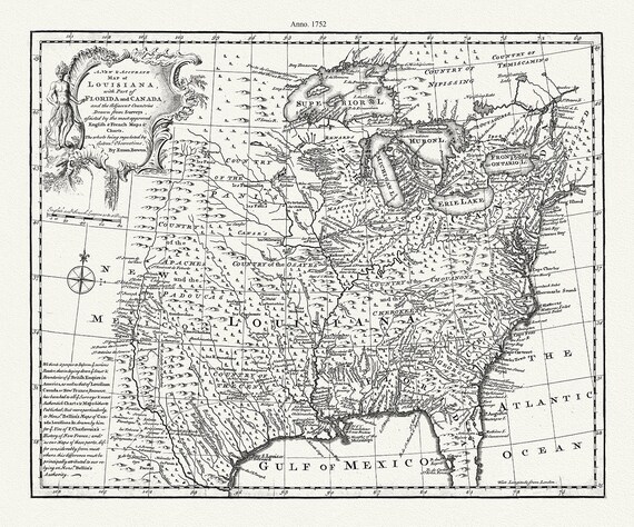 A new & accurate map of Louisiana, with part of Florida and Canada, and the adjacent countries, 1752, Bowen auth. canvas, 20 x 25" approx.
$41.63
A new & accurate map of Louisiana, with part of Florida and Canada, and the adjacent countries, 1752, Bowen auth. canvas, 20 x 25" approx.
$41.63