
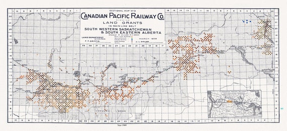
 Canadian Pacific Railway Co. shewing Land Grants in Mainline Belt, South Western Saskatchewan & South Eastern Alberta, 1909, 14 x 36" approx
$38.30
Canadian Pacific Railway Co. shewing Land Grants in Mainline Belt, South Western Saskatchewan & South Eastern Alberta, 1909, 14 x 36" approx
$38.30
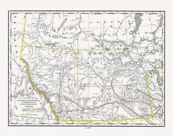 Alberta, Assiniboia, Athabasca & Saskatchewan, North West Territories, 1898 , map on heavy cotton canvas, 45 x 65 cm, 18 x 24" approx.
$34.47
Alberta, Assiniboia, Athabasca & Saskatchewan, North West Territories, 1898 , map on heavy cotton canvas, 45 x 65 cm, 18 x 24" approx.
$34.47
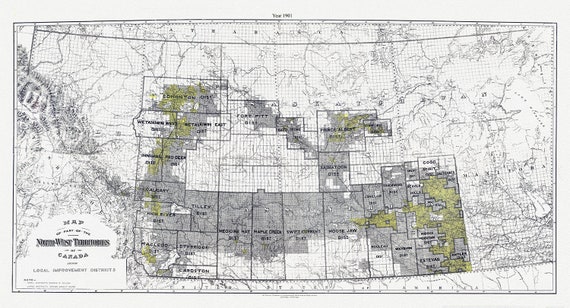 A Map of part of the North-West Territories of Canada, showing local improvement districts, 1901
$34.47
A Map of part of the North-West Territories of Canada, showing local improvement districts, 1901
$34.47
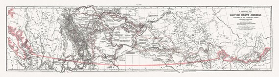 General Map of the Routes in North America Explored by Captain Palliser, during the years 1857, 1858, 1859,& 1860 ' on canvas 18 x 24" about
$34.47
General Map of the Routes in North America Explored by Captain Palliser, during the years 1857, 1858, 1859,& 1860 ' on canvas 18 x 24" about
$34.47
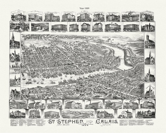 St. Stephen, New Brunswick and Calais, Maine, A Birdseye View, 1889, map on durable cotton canvas, 50 x 70 cm, 20 x 25" approx.
$34.47
St. Stephen, New Brunswick and Calais, Maine, A Birdseye View, 1889, map on durable cotton canvas, 50 x 70 cm, 20 x 25" approx.
$34.47
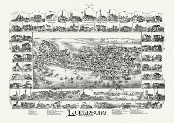 Lunenburg, Nova Scotia, A Bird's Eye View, 1890 , map on durable cotton canvas, 50 x 70 cm, 20 x 25" approx.
$34.47
Lunenburg, Nova Scotia, A Bird's Eye View, 1890 , map on durable cotton canvas, 50 x 70 cm, 20 x 25" approx.
$34.47
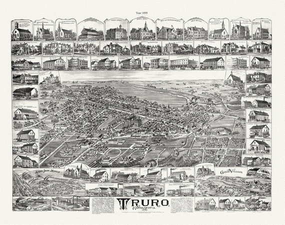 Truro, Nova Scotia, A Birdseye View, 1889 , vintage print on canvas, 50 x 70 cm, 20 x 25" approx.
$34.47
Truro, Nova Scotia, A Birdseye View, 1889 , vintage print on canvas, 50 x 70 cm, 20 x 25" approx.
$34.47
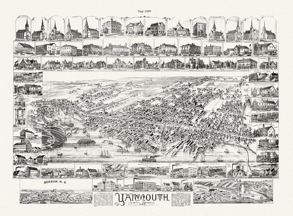 Yarmouth, Nova Scotia, A Bird's Eye View, 1889 , map on durable cotton canvas, 50 x 70 cm, 20 x 25" approx.
$34.47
Yarmouth, Nova Scotia, A Bird's Eye View, 1889 , map on durable cotton canvas, 50 x 70 cm, 20 x 25" approx.
$34.47
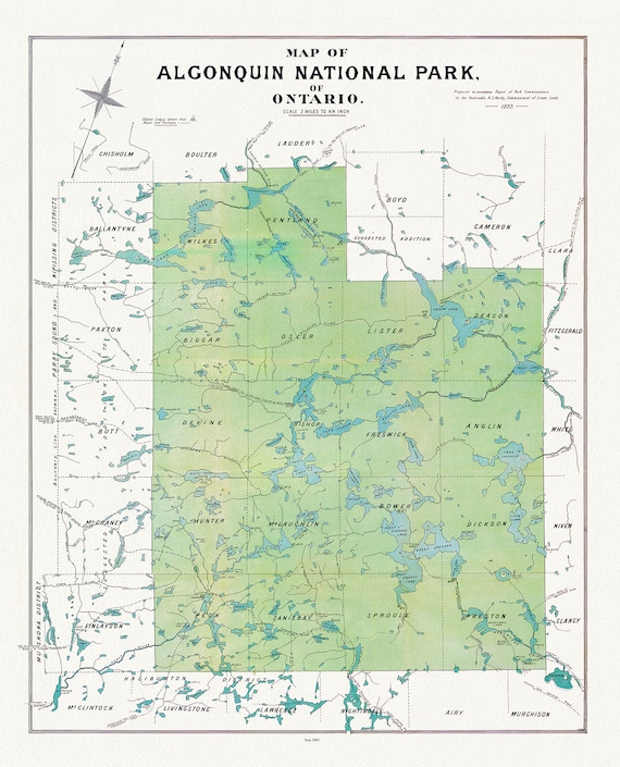 Historic Algonquin Park Map, Algonquin Park Commission, 1893, map on heavy cotton canvas, 20x27" approx.
$34.47
Historic Algonquin Park Map, Algonquin Park Commission, 1893, map on heavy cotton canvas, 20x27" approx.
$34.47
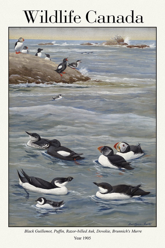 Wildlife Canada, Black Guillemot, Puffin, Razor-billed Auk, Dovekie, Brunnich's Murre, 1905
$34.47
Wildlife Canada, Black Guillemot, Puffin, Razor-billed Auk, Dovekie, Brunnich's Murre, 1905
$34.47
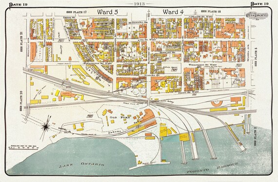 Plate 19 Toronto West ,Waterfront, Bathurst, 1913
$34.47
Plate 19 Toronto West ,Waterfront, Bathurst, 1913
$34.47
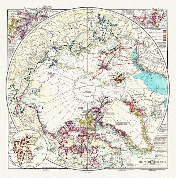 The North Pole Region, National Geographic Society, 1907, map on heavy cotton canvas, 50 x 70 cm, 20 x 25" approx.
$34.47
The North Pole Region, National Geographic Society, 1907, map on heavy cotton canvas, 50 x 70 cm, 20 x 25" approx.
$34.47
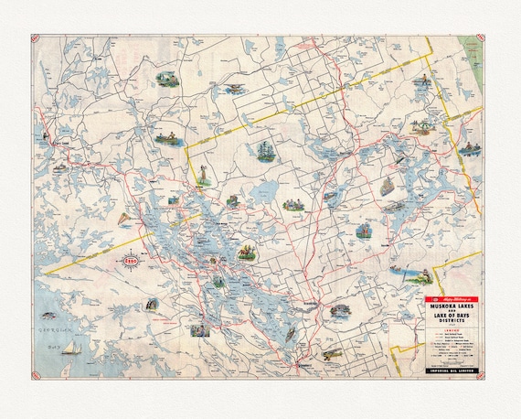 Happy motoring in Muskoka Lakes and Lake of Bays Districts, Ontario, 1949
$34.47
Happy motoring in Muskoka Lakes and Lake of Bays Districts, Ontario, 1949
$34.47
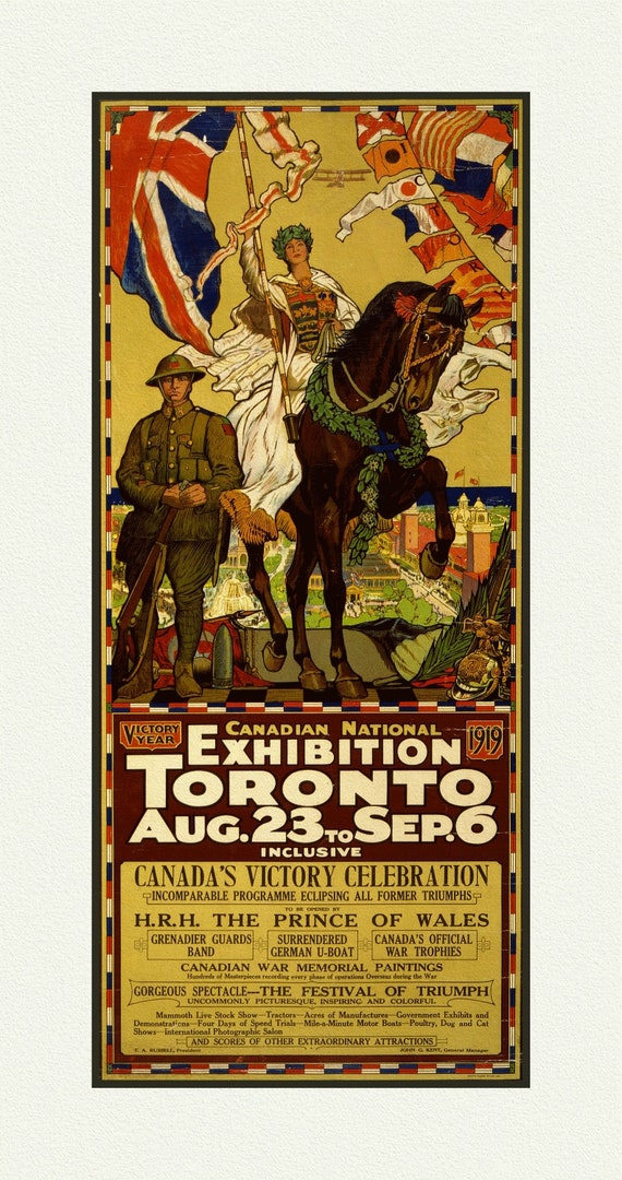 Canadian National Exhibition, 1919, Poster on Heavy Cotton Canvas, approx. 27x18"
$34.47
Canadian National Exhibition, 1919, Poster on Heavy Cotton Canvas, approx. 27x18"
$34.47
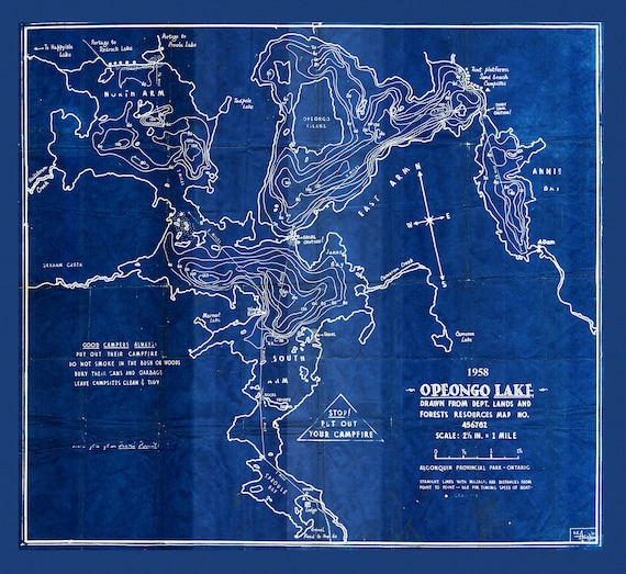 Historic Algonquin Park Map, Depth Map, Opeongo Lake, 1958 Cyanotype , map on heavy cotton canvas, 20x27" approx
$34.47
Historic Algonquin Park Map, Depth Map, Opeongo Lake, 1958 Cyanotype , map on heavy cotton canvas, 20x27" approx
$34.47
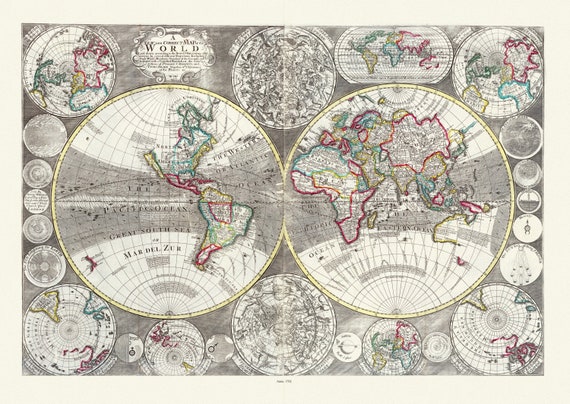 Willday, No. 1. A New and Correct Map of the World laid down according to the newest observations, 1702, Map on heavy cotton canvas, 22x27in
$34.47
Willday, No. 1. A New and Correct Map of the World laid down according to the newest observations, 1702, Map on heavy cotton canvas, 22x27in
$34.47
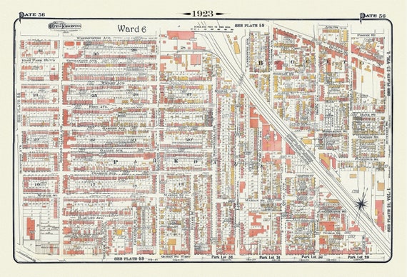 Plate 56, Toronto West, High Park East, Parkdale & Brockton, 1923, Map on heavy cotton canvas, 18x27in. approx.
$34.47
Plate 56, Toronto West, High Park East, Parkdale & Brockton, 1923, Map on heavy cotton canvas, 18x27in. approx.
$34.47
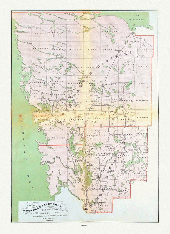 Muskoka & Parry Sound District, 1893 , map on heavy cotton canvas, 20 x 25" approx.
$34.47
Muskoka & Parry Sound District, 1893 , map on heavy cotton canvas, 20 x 25" approx.
$34.47
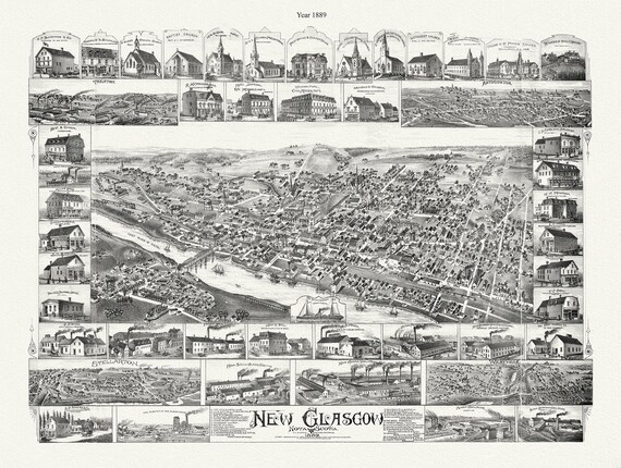 New Glasgow, Nova Scotia, 1889 , map on durable cotton canvas, 50 x 70 cm, 20 x 25" approx.
$34.47
New Glasgow, Nova Scotia, 1889 , map on durable cotton canvas, 50 x 70 cm, 20 x 25" approx.
$34.47
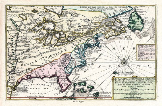 Canada, 1705, Fer auth., map on durable cotton canvas, 50 x 70 cm, 20 x 25" approx.
$34.47
Canada, 1705, Fer auth., map on durable cotton canvas, 50 x 70 cm, 20 x 25" approx.
$34.47