
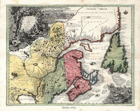
 Part of North America,containing Canada, the north parts of New England and New York, with Nova Scotia and Newfoundland,1777, canvas, 20x25"
$34.47
Part of North America,containing Canada, the north parts of New England and New York, with Nova Scotia and Newfoundland,1777, canvas, 20x25"
$34.47
 Nova Francia et Canada, 1597, , map on heavy cotton canvas, 50 x 70cm, 20 x 27" approx.
$34.47
Nova Francia et Canada, 1597, , map on heavy cotton canvas, 50 x 70cm, 20 x 27" approx.
$34.47
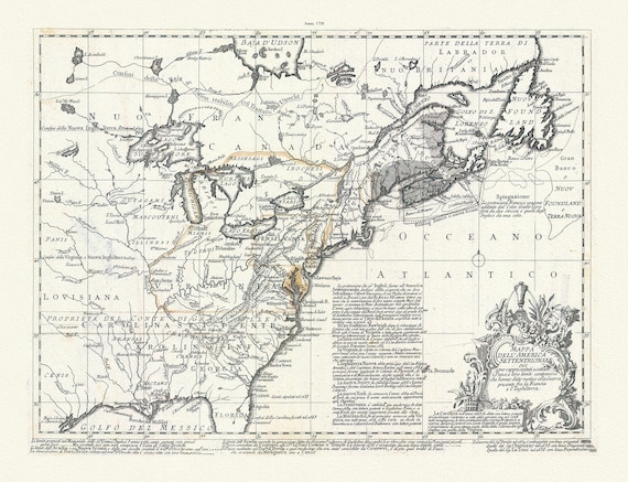 Mappa dell' America Settentrionale et i paesi e che hanno dato motivo alla guerra presente fra la Francia e l'Inghilterra, 1758, Bellin,
$34.47
Mappa dell' America Settentrionale et i paesi e che hanno dato motivo alla guerra presente fra la Francia e l'Inghilterra, 1758, Bellin,
$34.47
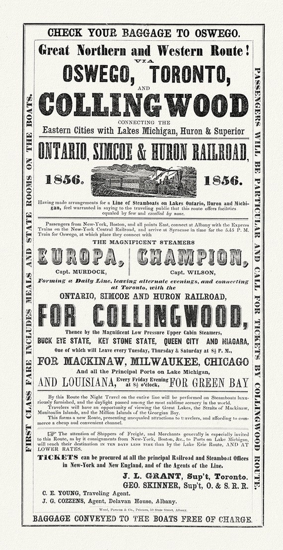 Railways to Collingwood, 1856, map on durable cotton canvas, 16x29" approx.
$34.47
Railways to Collingwood, 1856, map on durable cotton canvas, 16x29" approx.
$34.47
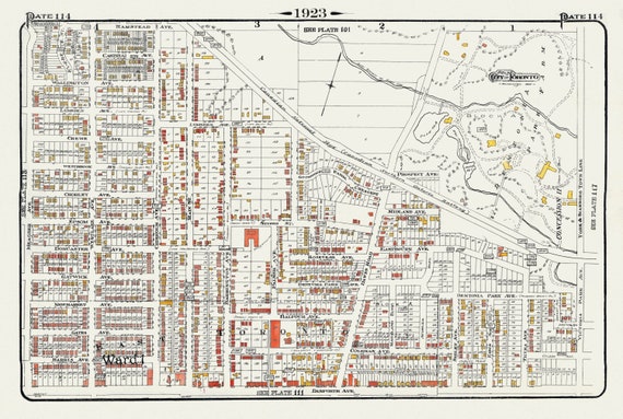 Plate 114, Toronto East, Danforth, Dentonia, Dawes Road, 1923, Map on heavy cotton canvas, 18x27in. approx.
$34.47
Plate 114, Toronto East, Danforth, Dentonia, Dawes Road, 1923, Map on heavy cotton canvas, 18x27in. approx.
$34.47
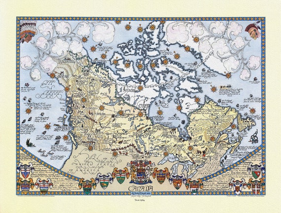 Canada, 1964, on heavy cotton canvas, 22x27" approx.
$34.47
Canada, 1964, on heavy cotton canvas, 22x27" approx.
$34.47
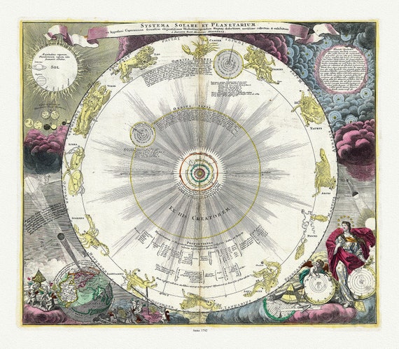 Systema solare et planetarium ex hypothesi Copernicana secundum elegantissimas illustrissimi quondam Hugenij deductiones novissime ,1742
$34.47
Systema solare et planetarium ex hypothesi Copernicana secundum elegantissimas illustrissimi quondam Hugenij deductiones novissime ,1742
$34.47
 E Newfoundland, 1898 , map on heavy cotton canvas, 45 x 65 cm, 18 x 24" approx.
$34.47
E Newfoundland, 1898 , map on heavy cotton canvas, 45 x 65 cm, 18 x 24" approx.
$34.47
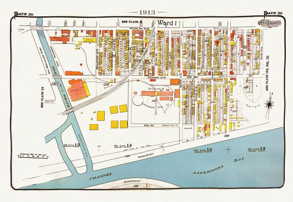 Plate 30, Toronto Waterfront East, Leslieville South, 1913, map on heavy cotton canvas, 20 x 30" approx.
$34.47
Plate 30, Toronto Waterfront East, Leslieville South, 1913, map on heavy cotton canvas, 20 x 30" approx.
$34.47
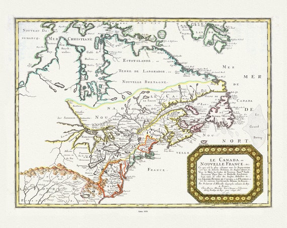 Nouvelle France, qui de diverses Relations des Anglois, Danois. Vers le Midy les Costes de Virginie, Nouvlle Suede, Nouveau Pays Bas, 1656,
$34.47
Nouvelle France, qui de diverses Relations des Anglois, Danois. Vers le Midy les Costes de Virginie, Nouvlle Suede, Nouveau Pays Bas, 1656,
$34.47
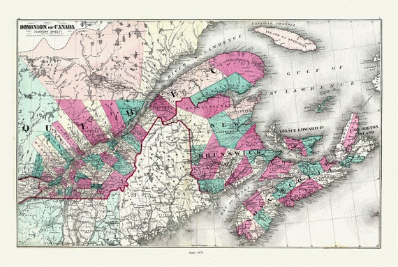 Dominion of Canada. Eastern Sheet. 1878, map on heavy cotton canvas, 50x70cm (20 x 25") approx.
$34.47
Dominion of Canada. Eastern Sheet. 1878, map on heavy cotton canvas, 50x70cm (20 x 25") approx.
$34.47
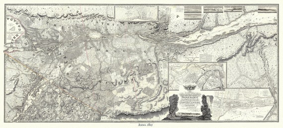 Lower Canada, 1815, Faden auth., map on heavy cotton canvas, 50x70cm (20 x 25") approx.
$34.47
Lower Canada, 1815, Faden auth., map on heavy cotton canvas, 50x70cm (20 x 25") approx.
$34.47
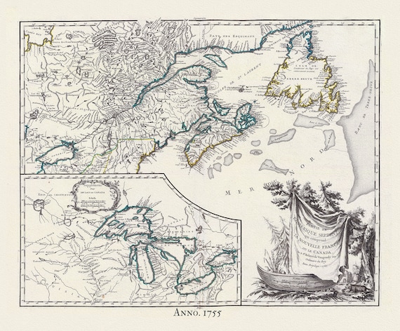 Canada, Nouvelles France,1755, Vaugondy auth., map on heavy cotton canvas, 50x70cm (20 x 25") approx.
$34.47
Canada, Nouvelles France,1755, Vaugondy auth., map on heavy cotton canvas, 50x70cm (20 x 25") approx.
$34.47
 Canada, Nouvelles France, 1720, Seutter auth., map on heavy cotton canvas, 50x70cm (20 x 25") approx.
$34.47
Canada, Nouvelles France, 1720, Seutter auth., map on heavy cotton canvas, 50x70cm (20 x 25") approx.
$34.47
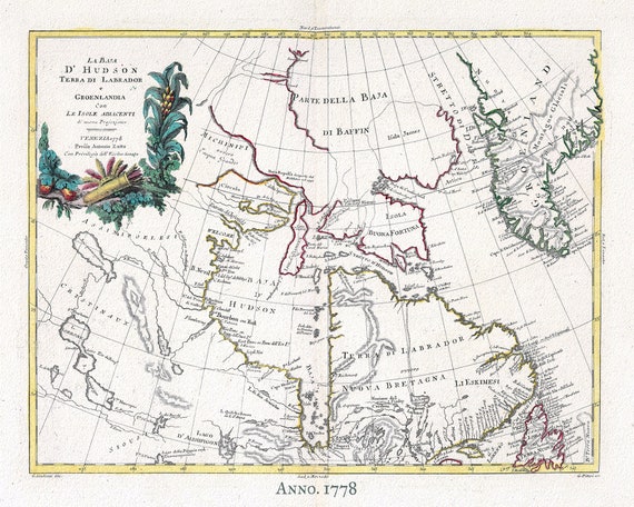 Canada, Labrador & Greenland, 1778 ,Zatta auth. , map on heavy cotton canvas, 50x70cm (20 x 25") approx.
$34.47
Canada, Labrador & Greenland, 1778 ,Zatta auth. , map on heavy cotton canvas, 50x70cm (20 x 25") approx.
$34.47
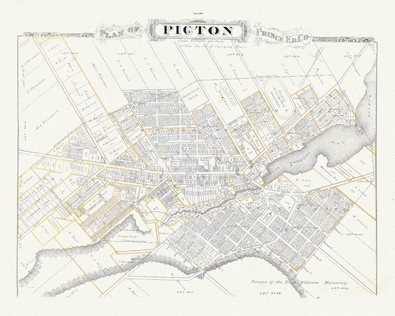 Plan of Picton, Prince Edward County, Ontario, 1880, map on heavy cotton canvas, 45 x 65 cm, 18 x 24" approx.
$34.47
Plan of Picton, Prince Edward County, Ontario, 1880, map on heavy cotton canvas, 45 x 65 cm, 18 x 24" approx.
$34.47
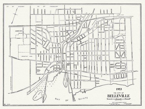 The City of Belleville, Hastings County, Ontario, 1953
$34.47
The City of Belleville, Hastings County, Ontario, 1953
$34.47
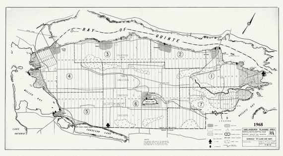 Prince Edward County, Ameliasburgh planning area, 1968, map on heavy cotton canvas, 45 x 65 cm, 18 x 24" approx.
$34.47
Prince Edward County, Ameliasburgh planning area, 1968, map on heavy cotton canvas, 45 x 65 cm, 18 x 24" approx.
$34.47
 J.J. Audobon, Red tailed hawk. Male, 1. F, 2. Falco borealis. c.2 v.1 plate 51, 1835
$34.47
J.J. Audobon, Red tailed hawk. Male, 1. F, 2. Falco borealis. c.2 v.1 plate 51, 1835
$34.47
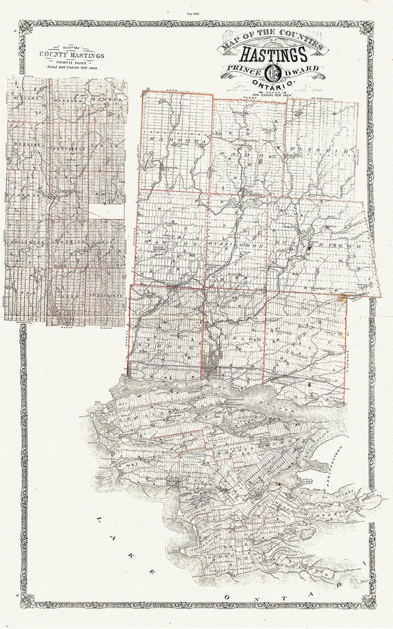 Map of Hastings County, Ontario, 1880 , map on heavy cotton canvas, 45 x 65 cm, 18 x 24" approx.
$34.47
Map of Hastings County, Ontario, 1880 , map on heavy cotton canvas, 45 x 65 cm, 18 x 24" approx.
$34.47