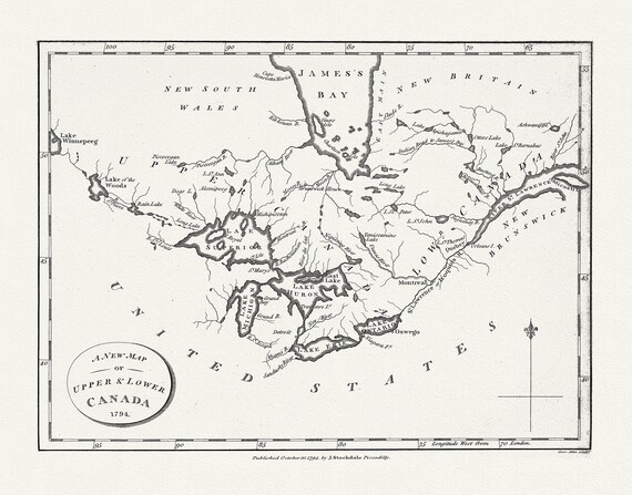
 Morse, New Map of Upper & Lower Canada, 1794 , map on heavy cotton canvas, 22x27" approx.
$41.36
Morse, New Map of Upper & Lower Canada, 1794 , map on heavy cotton canvas, 22x27" approx.
$41.36
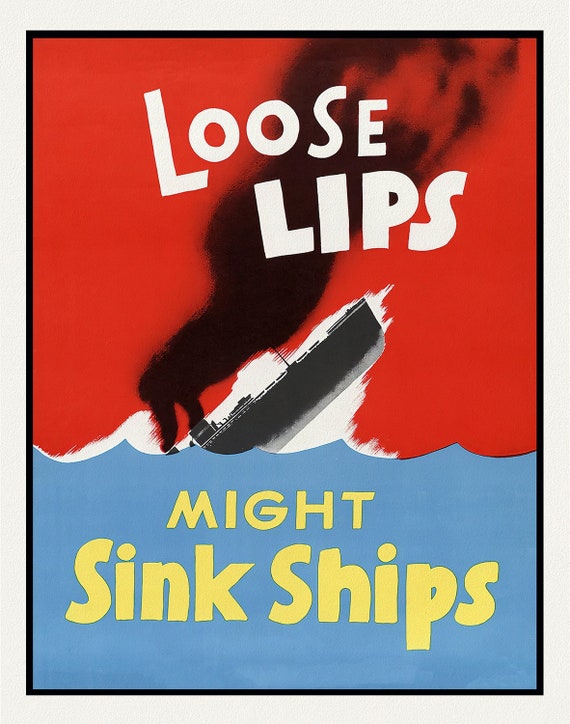 Loose Lips Might Sink Ships
$41.36
Loose Lips Might Sink Ships
$41.36
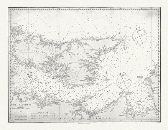 Nautical Chart, Gulf of St. Lawrence. Sheet IX, Eastern Part of Northumberland Strait, 1872, map on heavy cotton canvas, 20 x 25" approx.
$41.36
Nautical Chart, Gulf of St. Lawrence. Sheet IX, Eastern Part of Northumberland Strait, 1872, map on heavy cotton canvas, 20 x 25" approx.
$41.36
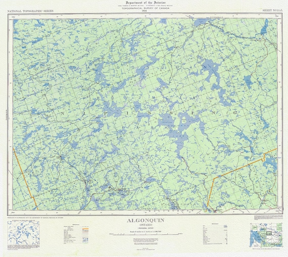 Topographical Map of Algonquin, 1934 , map on heavy cotton canvas, 22x27" approx.
$41.36
Topographical Map of Algonquin, 1934 , map on heavy cotton canvas, 22x27" approx.
$41.36
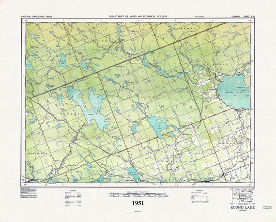 Historic Algonquin Park Map, Round Lake, National Topographic Series, 1951 , map on heavy cotton canvas, 45 x 65 cm, 18 x 24" approx.
$41.36
Historic Algonquin Park Map, Round Lake, National Topographic Series, 1951 , map on heavy cotton canvas, 45 x 65 cm, 18 x 24" approx.
$41.36
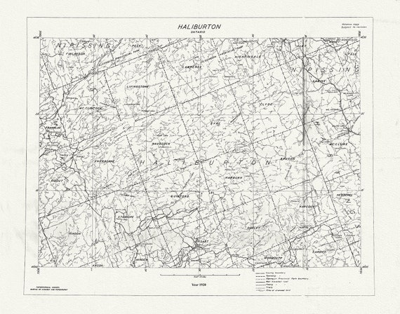 Historic Algonquin Park Map, National Topographic Series, Haliburton County, 1920
$41.36
Historic Algonquin Park Map, National Topographic Series, Haliburton County, 1920
$41.36
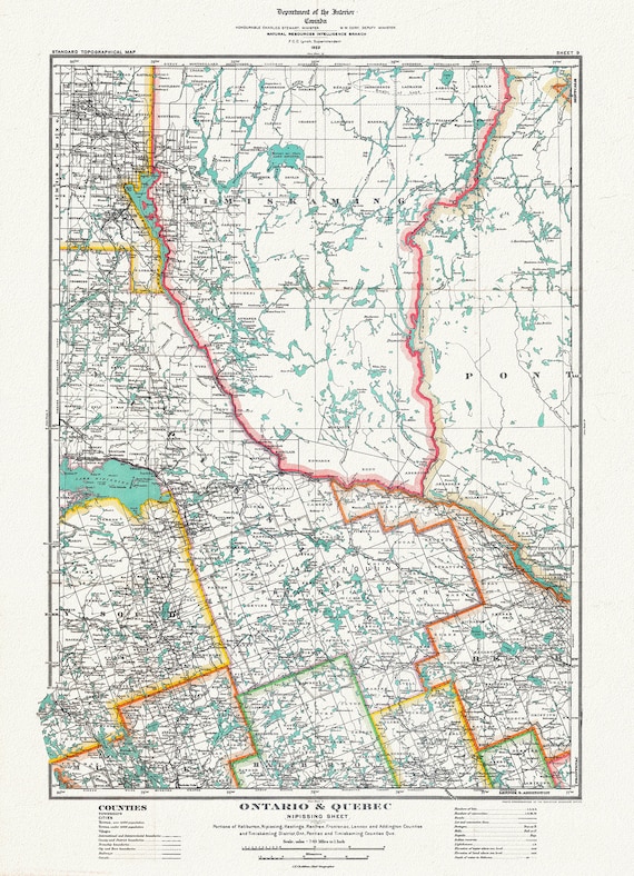 Historic Algonquin Park Map, Nipissing District, 1922, map on heavy cotton canvas, 20 x 30" or 50 x 75cm. approx.
$41.36
Historic Algonquin Park Map, Nipissing District, 1922, map on heavy cotton canvas, 20 x 30" or 50 x 75cm. approx.
$41.36
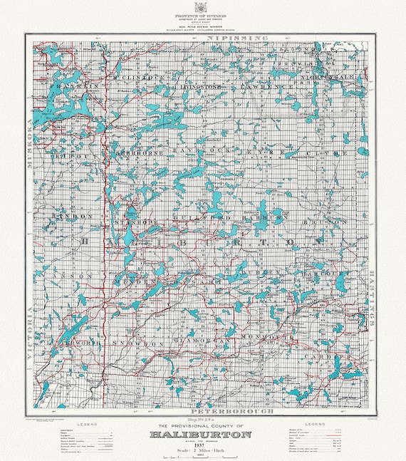 Historic Algonquin Park Map, Haliburton County, 1937 Ver. A, map on heavy cotton canvas, 45 x 65 cm, 18 x 24" approx.
$41.36
Historic Algonquin Park Map, Haliburton County, 1937 Ver. A, map on heavy cotton canvas, 45 x 65 cm, 18 x 24" approx.
$41.36
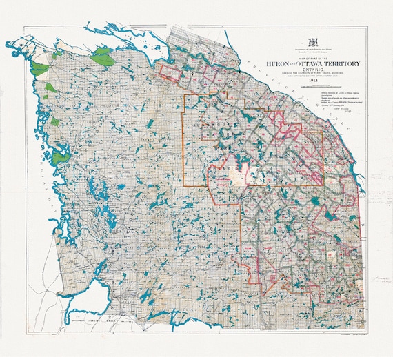 Algonquin Park Area, Part of the Huron and Ottawa Territories, 1913 , map on heavy cotton canvas, 45 x 65 cm, 18 x 24" approx.
$41.36
Algonquin Park Area, Part of the Huron and Ottawa Territories, 1913 , map on heavy cotton canvas, 45 x 65 cm, 18 x 24" approx.
$41.36
 Have you been saving a Vintage Picture Frame in Your Garage?
$41.36
Have you been saving a Vintage Picture Frame in Your Garage?
$41.36
 Order a Custom Sized Canvas Map to fit an Existing Frame that you are Saving !!
$41.36
Order a Custom Sized Canvas Map to fit an Existing Frame that you are Saving !!
$41.36
 Quebec: Tourist map of Gaspé Peninsula and vicinity, 1929 , map on heavy cotton canvas, 22x27" approx.
$41.36
Quebec: Tourist map of Gaspé Peninsula and vicinity, 1929 , map on heavy cotton canvas, 22x27" approx.
$41.36
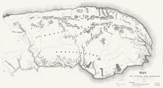 Quebec: Map of the counties of Gaspe and Bonaventure exhibiting the lands adjudicated unsurveyed, Clergy Reserves, 1857 , canvas, 22x27"
$41.36
Quebec: Map of the counties of Gaspe and Bonaventure exhibiting the lands adjudicated unsurveyed, Clergy Reserves, 1857 , canvas, 22x27"
$41.36
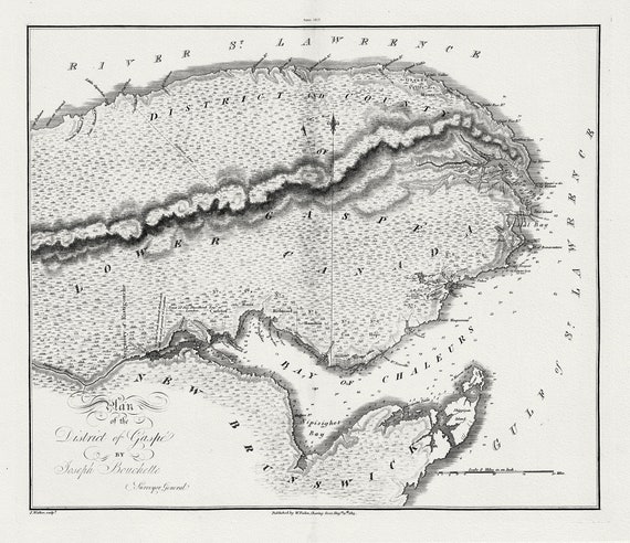 Quebec: Bouchette et Faden, Plan of the District of Gaspe, 1815 , map on heavy cotton canvas, 22x27" approx.
$41.36
Quebec: Bouchette et Faden, Plan of the District of Gaspe, 1815 , map on heavy cotton canvas, 22x27" approx.
$41.36
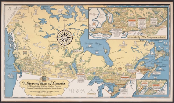 Poster Map Print on heavy Canvas, A Literary Map of Canada,1936, 22x27" approx.
$41.36
Poster Map Print on heavy Canvas, A Literary Map of Canada,1936, 22x27" approx.
$41.36
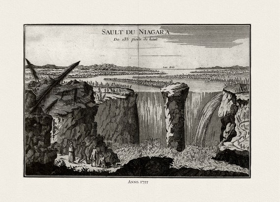 La Rouge, Sault du Niagara, de 135 pieds de haut, 1755, on heavy cotton canvas, 22x27" approx.
$41.36
La Rouge, Sault du Niagara, de 135 pieds de haut, 1755, on heavy cotton canvas, 22x27" approx.
$41.36
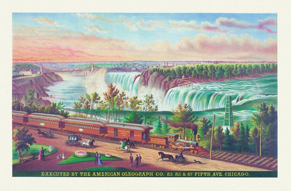 Canadian Southern Railway, 1872, a decorative print on heavy cotton canvas, 22x27" approx.
$41.36
Canadian Southern Railway, 1872, a decorative print on heavy cotton canvas, 22x27" approx.
$41.36
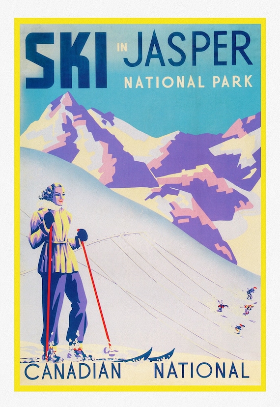 Ski in Jasper, Canadian National, travel poster on heavy cotton canvas, 20x25" approx.
$41.36
Ski in Jasper, Canadian National, travel poster on heavy cotton canvas, 20x25" approx.
$41.36
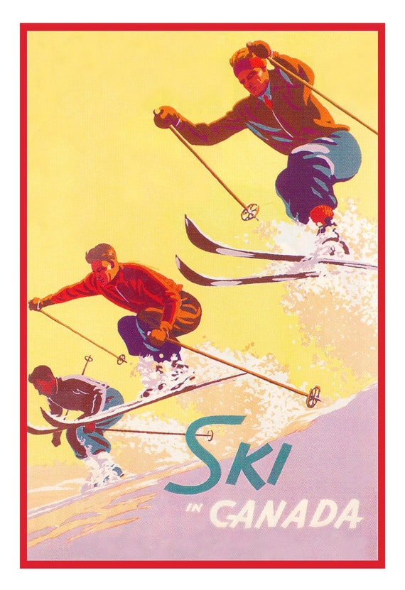 Ski in Canada! Ver. III , travel poster on heavy cotton canvas, 20x25" approx.
$41.36
Ski in Canada! Ver. III , travel poster on heavy cotton canvas, 20x25" approx.
$41.36
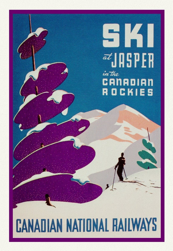 Ski at Jasper, Canadian National Railways, travel poster on heavy cotton canvas, 20x25" approx.
$41.36
Ski at Jasper, Canadian National Railways, travel poster on heavy cotton canvas, 20x25" approx.
$41.36