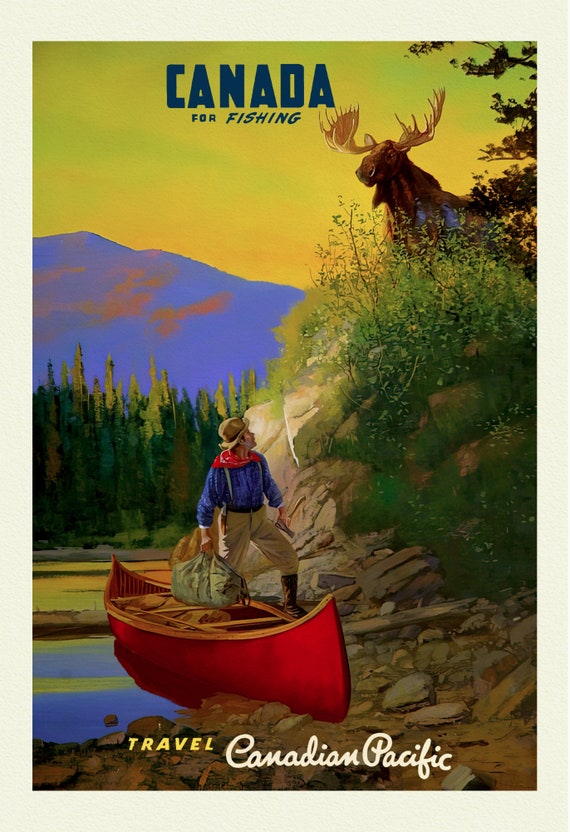
 Canada For Fishing, Canadian Pacific Ver. 19, travel nature poster on durable cotton canvas, 50 x 70 cm, 20 x 25" approx
$41.36
Canada For Fishing, Canadian Pacific Ver. 19, travel nature poster on durable cotton canvas, 50 x 70 cm, 20 x 25" approx
$41.36
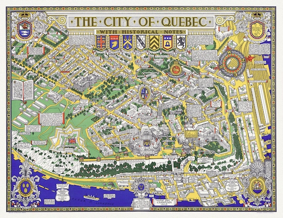 Maw, City of Quebec with Historical Notes, 1932, map on heavy cotton canvas, 20x27" approx.
$41.36
Maw, City of Quebec with Historical Notes, 1932, map on heavy cotton canvas, 20x27" approx.
$41.36
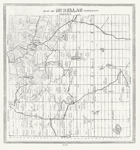
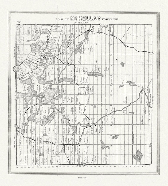 Muskoka-Haliburton, McKellar Township, 1893, map on heavy cotton canvas, 20 x 25" approx.
$41.36
Muskoka-Haliburton, McKellar Township, 1893, map on heavy cotton canvas, 20 x 25" approx.
$41.36
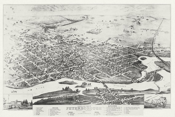 Bird's eye view of Peterborough, Ontario, Canada, 1875, map on durable cotton canvas, 50 x 70 cm, 20 x 25" approx.
$41.36
Bird's eye view of Peterborough, Ontario, Canada, 1875, map on durable cotton canvas, 50 x 70 cm, 20 x 25" approx.
$41.36
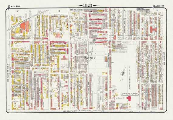 Plate 106, Toronto East, Leslieville and North, 1923, Map on heavy cotton canvas, 18x27in. approx.
$41.36
Plate 106, Toronto East, Leslieville and North, 1923, Map on heavy cotton canvas, 18x27in. approx.
$41.36
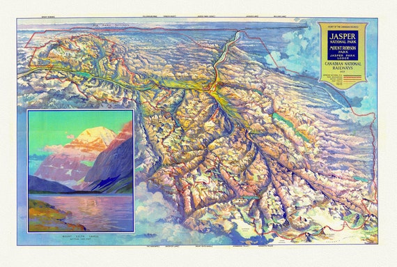 CNR, Pictorial Map of Jasper National Park and Mount Robson Park, 1935
$41.36
CNR, Pictorial Map of Jasper National Park and Mount Robson Park, 1935
$41.36
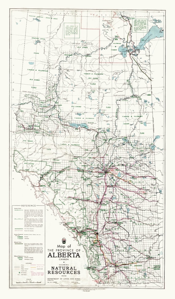 Map of the Province of Alberta, Canada, showing natural resources, 1945 ,on heavy cotton canvas, 22x27" approx.
$41.36
Map of the Province of Alberta, Canada, showing natural resources, 1945 ,on heavy cotton canvas, 22x27" approx.
$41.36
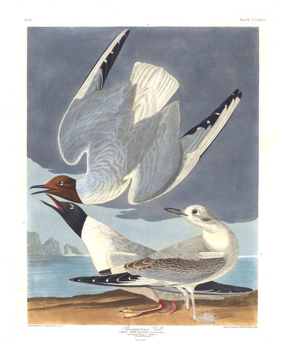 J.J. Audobon, Bonapartian gull .Larus bonapartii, Swain and Rich. Male ,1835, vintage nature print on canvas, 50 x 70 cm, 20 x 25" approx.
$41.36
J.J. Audobon, Bonapartian gull .Larus bonapartii, Swain and Rich. Male ,1835, vintage nature print on canvas, 50 x 70 cm, 20 x 25" approx.
$41.36
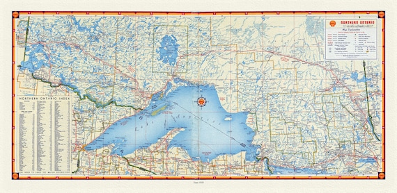 Shell Oil of Canada, Northern Ontario, 1959, Map on canvas, 16 x 27" approx.
$41.36
Shell Oil of Canada, Northern Ontario, 1959, Map on canvas, 16 x 27" approx.
$41.36
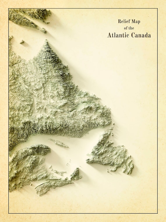 Relief Map of Atlantic Canada, 1924 Ver. IV , map on heavy cotton canvas, 50 x 70 cm, 20 x 25" approx.
$41.36
Relief Map of Atlantic Canada, 1924 Ver. IV , map on heavy cotton canvas, 50 x 70 cm, 20 x 25" approx.
$41.36
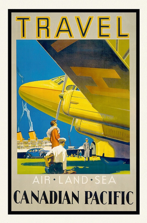 Travel Canadian Pacific, Air, Land, and Sea, travel poster reprinted on durable cotton canvas, 50 x 70 cm, 20 x 25" approx.
$41.36
Travel Canadian Pacific, Air, Land, and Sea, travel poster reprinted on durable cotton canvas, 50 x 70 cm, 20 x 25" approx.
$41.36
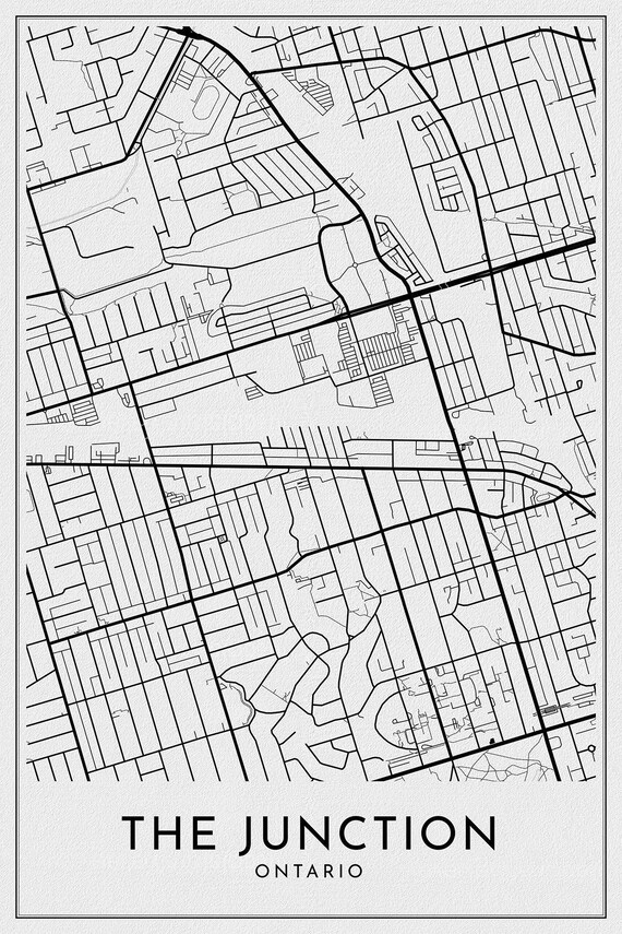 Toronto: The Junction, Toronto, A Modern Map, on durable canvas 50 x 70 cm, 20 x 25" approx.
$41.36
Toronto: The Junction, Toronto, A Modern Map, on durable canvas 50 x 70 cm, 20 x 25" approx.
$41.36
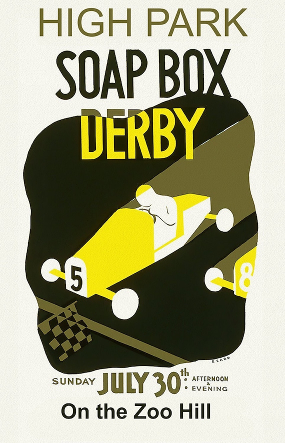 Toronto: High Park Soap Box Derby on the Zoo Hill, vintage poster on canvas, 20 x 25" approx.
$41.36
Toronto: High Park Soap Box Derby on the Zoo Hill, vintage poster on canvas, 20 x 25" approx.
$41.36
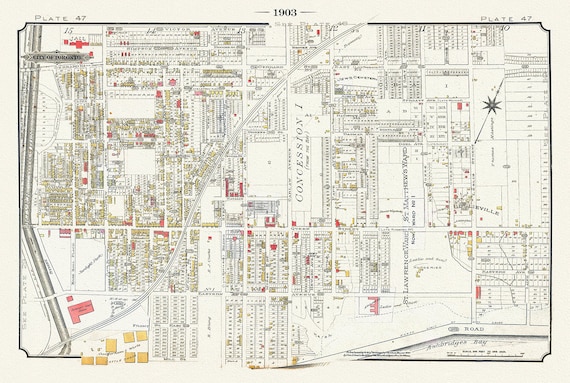 Plate 47, Toronto East, Riverdale & Leslieville, 1903, map on heavy cotton canvas, 20 x 30" or 50 x 75cm. approx.
$41.36
Plate 47, Toronto East, Riverdale & Leslieville, 1903, map on heavy cotton canvas, 20 x 30" or 50 x 75cm. approx.
$41.36
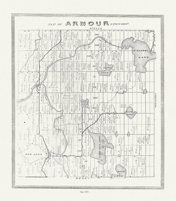 Muskoka-Haliburton, Armour Township, 1893, map on heavy cotton canvas, 20 x 25" approx.
$41.36
Muskoka-Haliburton, Armour Township, 1893, map on heavy cotton canvas, 20 x 25" approx.
$41.36
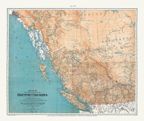 Province of British Columbia, 1893 , map on heavy cotton canvas, 45 x 65 cm, 18 x 24" approx.
$41.36
Province of British Columbia, 1893 , map on heavy cotton canvas, 45 x 65 cm, 18 x 24" approx.
$41.36
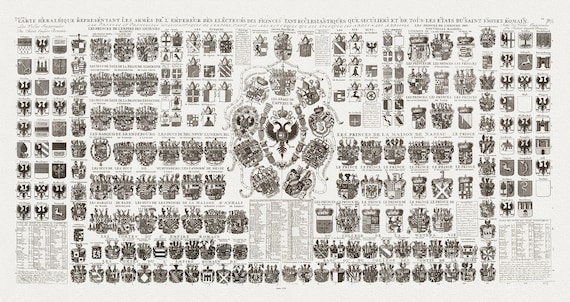 Heraldic Crests of the Roman Empire, Carte Heraldique Representant Les Armes De L' Empereur, 1720, on heavy cotton canvas, 18x43" approx.
$67.68
Heraldic Crests of the Roman Empire, Carte Heraldique Representant Les Armes De L' Empereur, 1720, on heavy cotton canvas, 18x43" approx.
$67.68
 British Columbia, Southern Part, A Modern Map, map on heavy cotton canvas, 45 x 65 cm, 18 x 24" approx.
$41.36
British Columbia, Southern Part, A Modern Map, map on heavy cotton canvas, 45 x 65 cm, 18 x 24" approx.
$41.36
 Muskoka-Haliburton, McKellar Township, 1893, map on heavy cotton canvas, 20 x 25" approx.
$41.36
Muskoka-Haliburton, McKellar Township, 1893, map on heavy cotton canvas, 20 x 25" approx.
$41.36
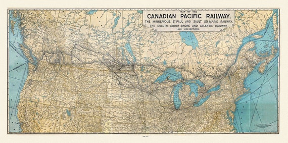 Map of the Canadian Pacific Railway, the Minneapolis, St. Paul and Sault Ste. Marie, Railway, Duluth, South Shore et c., 1907, 22x27" canvas
$41.36
Map of the Canadian Pacific Railway, the Minneapolis, St. Paul and Sault Ste. Marie, Railway, Duluth, South Shore et c., 1907, 22x27" canvas
$41.36