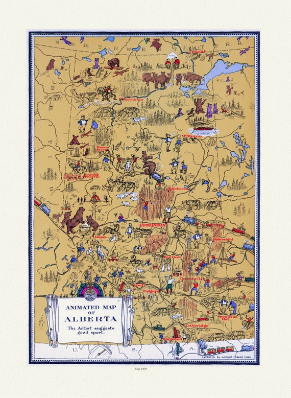
 An Animated Map of Alberta, 1929
$41.48
An Animated Map of Alberta, 1929
$41.48
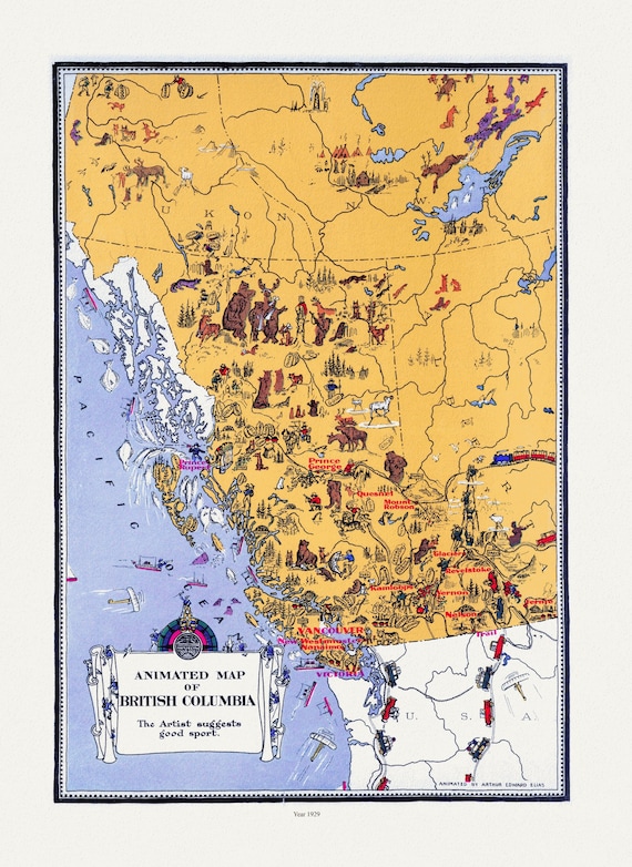 An Animated Map of British Columbia, 1929, on heavy cotton canvas, 22x27"approx.
$41.48
An Animated Map of British Columbia, 1929, on heavy cotton canvas, 22x27"approx.
$41.48
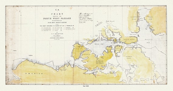 Chart Shewing the North West Passage discovered by H.M. Ship Investigator also the search of Franklin by Sir Jas. Ross, 1848 & 49
$41.48
Chart Shewing the North West Passage discovered by H.M. Ship Investigator also the search of Franklin by Sir Jas. Ross, 1848 & 49
$41.48
 Holidays in Canada, In the Canadian Rockies, on heavy cotton canvas, 22x27" approx.
$41.48
Holidays in Canada, In the Canadian Rockies, on heavy cotton canvas, 22x27" approx.
$41.48
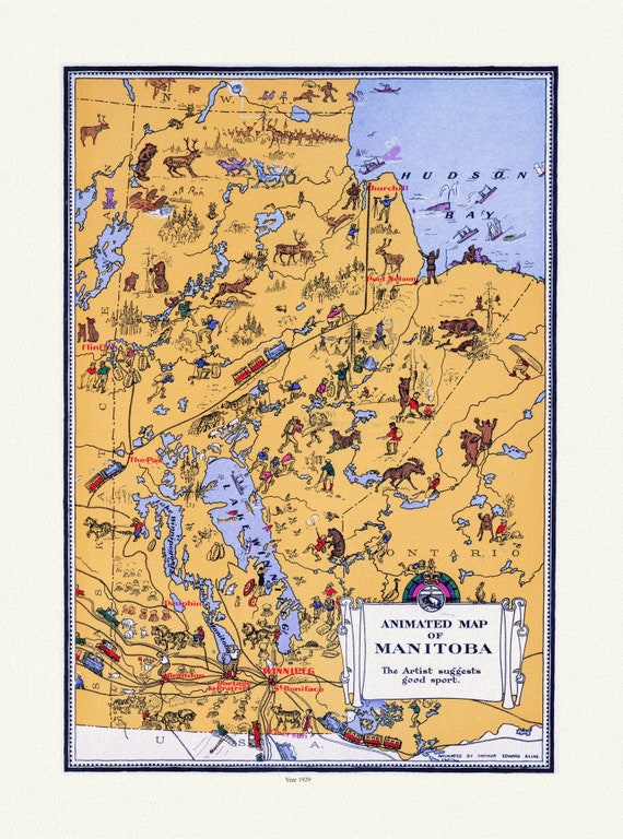 An Animated Map of Manitoba, 1929, on heavy cotton canvas, 22x27" approx.
$41.48
An Animated Map of Manitoba, 1929, on heavy cotton canvas, 22x27" approx.
$41.48
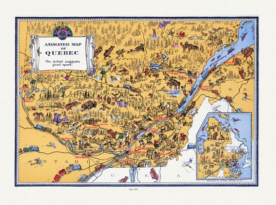 An Animated Map of Quebec, 1929, On heavy durable cotton canvas, 22x27" approx.
$41.48
An Animated Map of Quebec, 1929, On heavy durable cotton canvas, 22x27" approx.
$41.48
 Toronto Humane Society, Be Kind to Animals, vintage poster on heavy cotton canvas, 50 x 70cm, 20 x 25" approx.
$41.48
Toronto Humane Society, Be Kind to Animals, vintage poster on heavy cotton canvas, 50 x 70cm, 20 x 25" approx.
$41.48
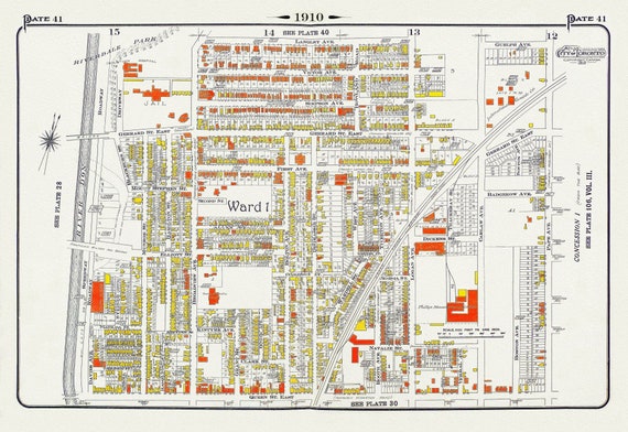 Plate 41, Toronto East, Riverdale & Leslieville, 1910 , map on heavy cotton canvas, 20 x 30" approx.
$41.48
Plate 41, Toronto East, Riverdale & Leslieville, 1910 , map on heavy cotton canvas, 20 x 30" approx.
$41.48
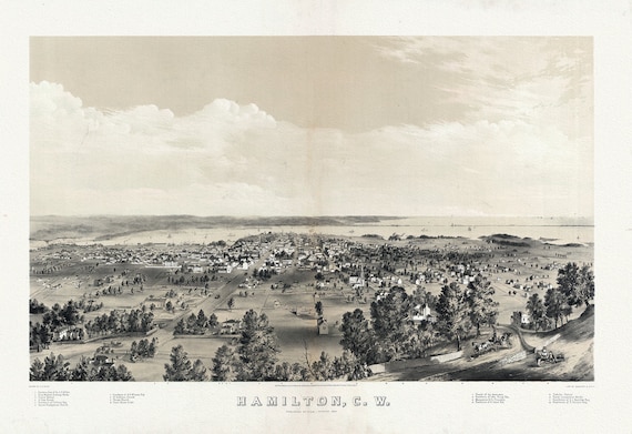 Hamilton, Ontario, Canada West, 1859, map on heavy cotton canvas, 20 x 25" approx.
$41.48
Hamilton, Ontario, Canada West, 1859, map on heavy cotton canvas, 20 x 25" approx.
$41.48
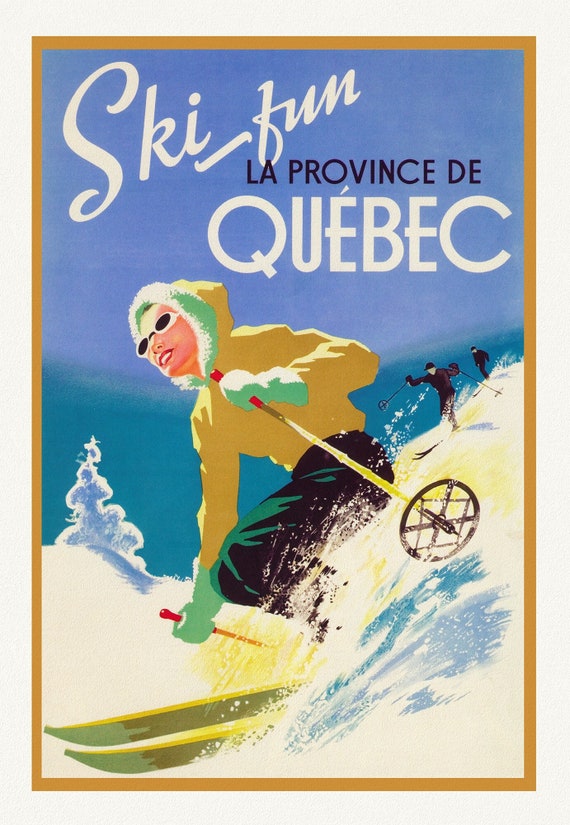 Ski Quebec , travel poster on heavy cotton canvas, 20x25" approx.
$41.48
Ski Quebec , travel poster on heavy cotton canvas, 20x25" approx.
$41.48
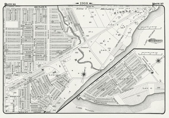 Plate 83, Toronto West, Mimico & Humber Bay, 1910, map on heavy cotton canvas, 20 x 30" approx.
$41.48
Plate 83, Toronto West, Mimico & Humber Bay, 1910, map on heavy cotton canvas, 20 x 30" approx.
$41.48
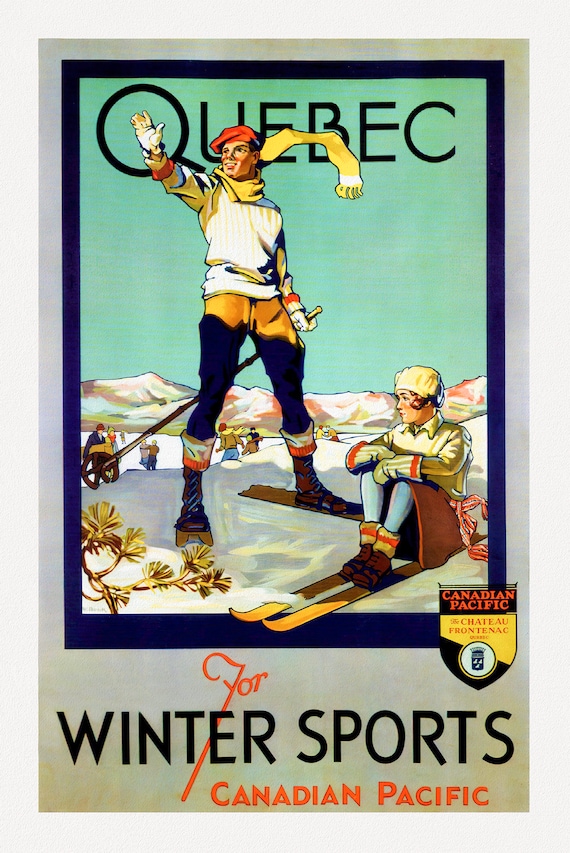 Canadian Pacific, Quebec for Winter Sports, c. 1954 , travel poster on heavy cotton canvas, 22x27" approx.
$41.48
Canadian Pacific, Quebec for Winter Sports, c. 1954 , travel poster on heavy cotton canvas, 22x27" approx.
$41.48
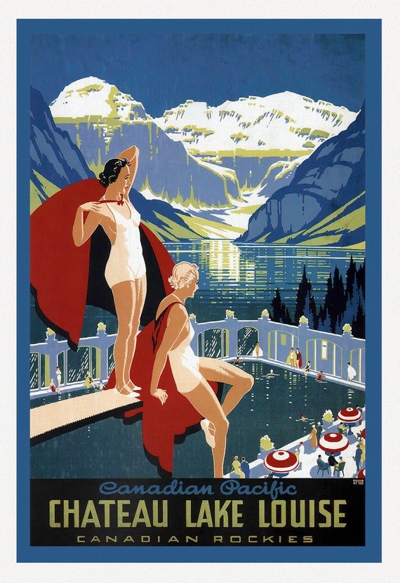 Canadian Pacific, Chateau Lake Louise, Canadian Rockies, c. 1960, travel poster on heavy cotton canvas, 22x27" approx.
$41.48
Canadian Pacific, Chateau Lake Louise, Canadian Rockies, c. 1960, travel poster on heavy cotton canvas, 22x27" approx.
$41.48
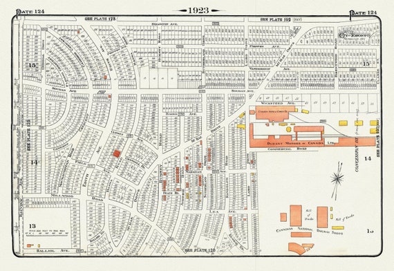 Plate 124, Toronto North, Leaside, 1923, Map on heavy cotton canvas, 18x27in. approx.
$41.48
Plate 124, Toronto North, Leaside, 1923, Map on heavy cotton canvas, 18x27in. approx.
$41.48
 Plate 83, Toronto West, Mimico & Humber Bay, 1923, Map on heavy cotton canvas, 18x27in. approx.
$41.48
Plate 83, Toronto West, Mimico & Humber Bay, 1923, Map on heavy cotton canvas, 18x27in. approx.
$41.48
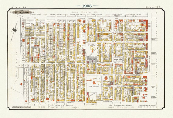 Plate 23, Toronto West, Kensington Market & Little Italy, 1903, map on heavy cotton canvas, 20 x 30" or 50 x 75cm. approx.
$41.48
Plate 23, Toronto West, Kensington Market & Little Italy, 1903, map on heavy cotton canvas, 20 x 30" or 50 x 75cm. approx.
$41.48
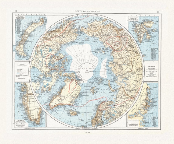 Andree et London Times, North Polar Regions,1900, Map printed on to heavy cotton canvas, 22x27in. approx.
$41.48
Andree et London Times, North Polar Regions,1900, Map printed on to heavy cotton canvas, 22x27in. approx.
$41.48
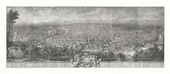 Vasi, Prospetto Dell alma citta di Roma visto dal Monte Gianicolo, 1765, map on heavy cotton canvas, 16x27" approx.
$41.48
Vasi, Prospetto Dell alma citta di Roma visto dal Monte Gianicolo, 1765, map on heavy cotton canvas, 16x27" approx.
$41.48
 William Faden, A Plan of the island of St. John, 1777, Map on Heavy Canvas, approx. 20x24"
$41.48
William Faden, A Plan of the island of St. John, 1777, Map on Heavy Canvas, approx. 20x24"
$41.48
 Zatta, Zuiliani, Novelli et Pitteri, Le isole di Terra Nuova e Capo Breton, 1778, Map of Newfoundland on heavy canvas, 20x24" approx.
$41.48
Zatta, Zuiliani, Novelli et Pitteri, Le isole di Terra Nuova e Capo Breton, 1778, Map of Newfoundland on heavy canvas, 20x24" approx.
$41.48