 Historic Algonquin Park Map Haliburton West, National Topographic Series, 1938, map on heavy cotton canvas, 20x27" approx.
$41.48
Historic Algonquin Park Map Haliburton West, National Topographic Series, 1938, map on heavy cotton canvas, 20x27" approx.
$41.48
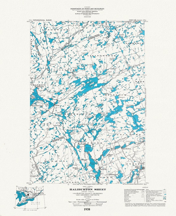
 Historic Algonquin Park Map, Haliburton East, National Topographic Series, 1938, map on heavy cotton canvas, 22x27" approx.
$41.48
Historic Algonquin Park Map, Haliburton East, National Topographic Series, 1938, map on heavy cotton canvas, 22x27" approx.
$41.48
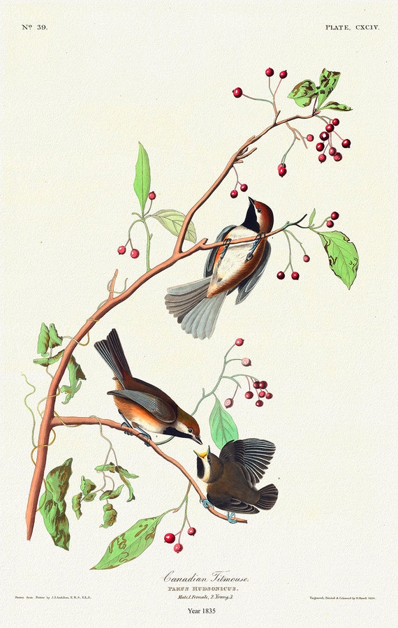 J.J. Audobon, Canadian Titmouse. Parus hudsonicus. 1835, bird print on durable cotton canvas, 19x27inches(50x70cm) approx.
$41.48
J.J. Audobon, Canadian Titmouse. Parus hudsonicus. 1835, bird print on durable cotton canvas, 19x27inches(50x70cm) approx.
$41.48
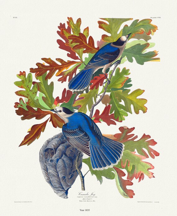 J.J. Audobon, Canada Jay. Corvus canadensis, 1835, bird print on durable cotton canvas, 19x27inches(50x70cm) approx.
$41.48
J.J. Audobon, Canada Jay. Corvus canadensis, 1835, bird print on durable cotton canvas, 19x27inches(50x70cm) approx.
$41.48
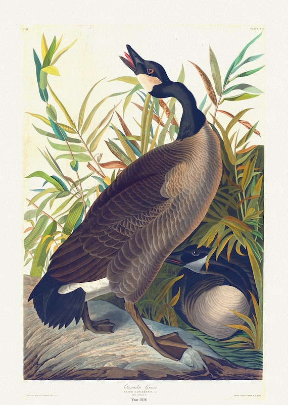 J.J. Audobon, Canada Goose, bird print on durable cotton canvas, 19x27inches(50x70cm) approx.
$41.48
J.J. Audobon, Canada Goose, bird print on durable cotton canvas, 19x27inches(50x70cm) approx.
$41.48
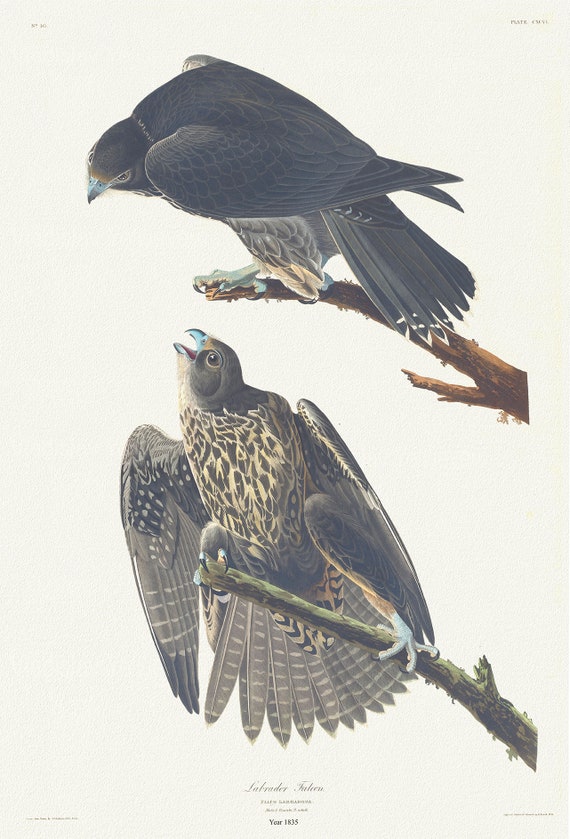 J.J. Audobon, Labrador Falcon. Falco Labradora. 1835, bird print on durable cotton canvas, 19x27inches(50x70cm) approx.
$41.48
J.J. Audobon, Labrador Falcon. Falco Labradora. 1835, bird print on durable cotton canvas, 19x27inches(50x70cm) approx.
$41.48
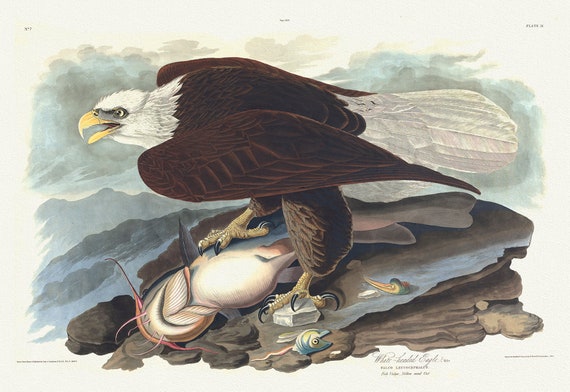 J.J. Audobon, White-headed eagle. Falco leucocephalus 1835, bird print on durable cotton canvas, 19x27inches(50x70cm) approx.
$41.48
J.J. Audobon, White-headed eagle. Falco leucocephalus 1835, bird print on durable cotton canvas, 19x27inches(50x70cm) approx.
$41.48
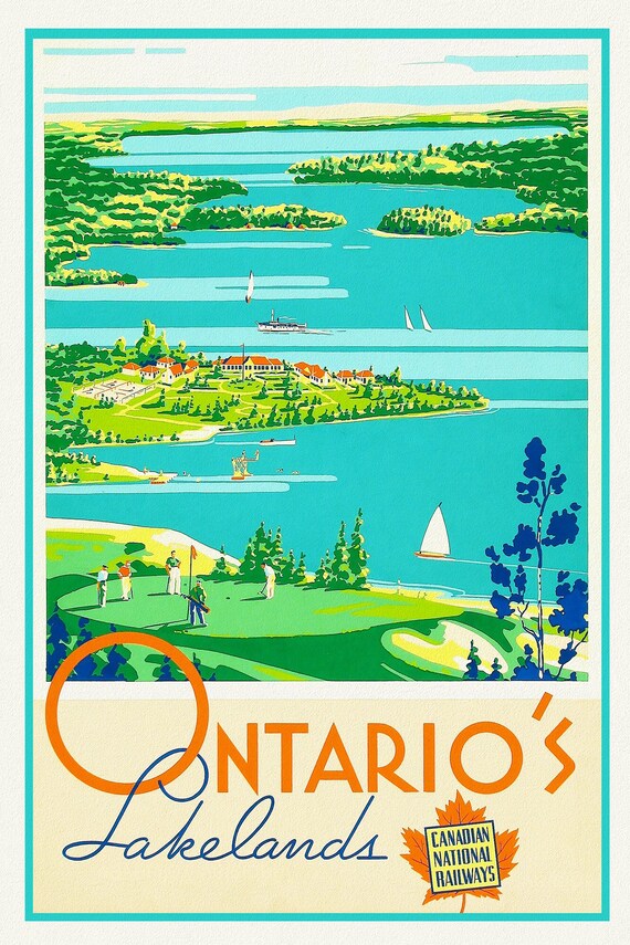 Ontario's Lakelands, Canadian National Railways , travel poster on heavy cotton canvas, 20x25" approx.
$41.48
Ontario's Lakelands, Canadian National Railways , travel poster on heavy cotton canvas, 20x25" approx.
$41.48
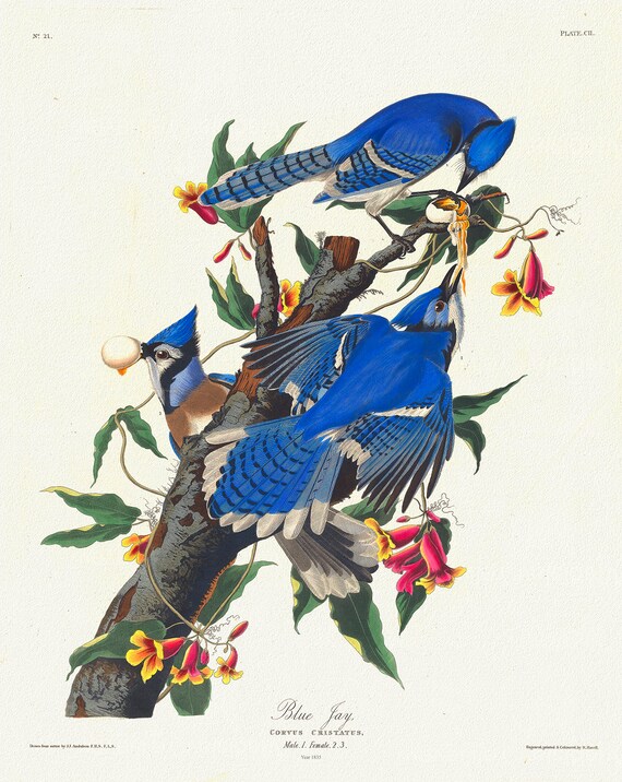 J.J. Audobon, Blue jay, 1835, bird print on durable cotton canvas, 19x27inches(50x70cm)
$41.48
J.J. Audobon, Blue jay, 1835, bird print on durable cotton canvas, 19x27inches(50x70cm)
$41.48
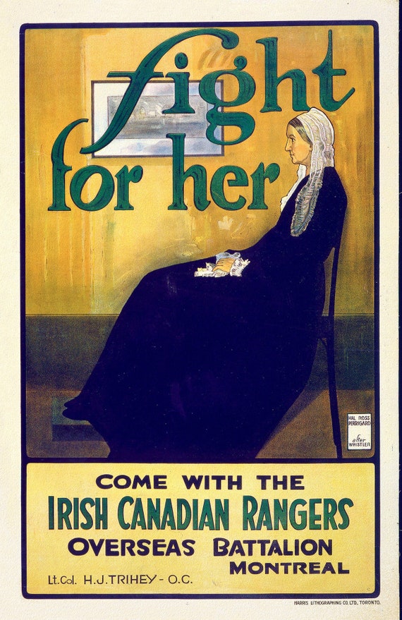 Canada WW I Poster, after Whistler, Fight for her. Come with the Irish Canadian Rangers Overseas Battalion, Montreal, 1915, on canvas,22x27"
$41.48
Canada WW I Poster, after Whistler, Fight for her. Come with the Irish Canadian Rangers Overseas Battalion, Montreal, 1915, on canvas,22x27"
$41.48
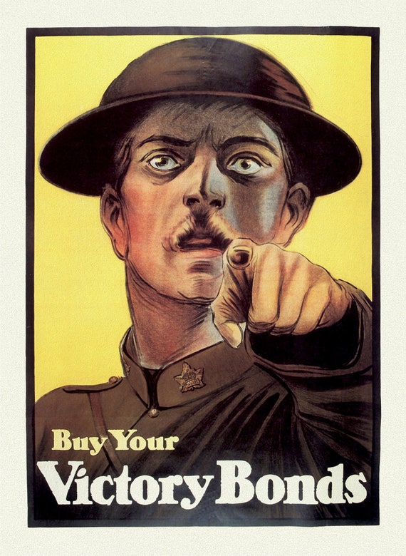 Canada WW I Poster, Canada Victory Bonds, 1915, on heavy natural canvas, 22x27" approx
$41.48
Canada WW I Poster, Canada Victory Bonds, 1915, on heavy natural canvas, 22x27" approx
$41.48
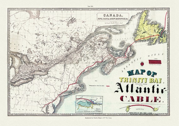 Map of Trinity Bay, Telegraph Station of the Atlantic Cable, 1901, on heavy canvas, 22x27" approx.
$41.48
Map of Trinity Bay, Telegraph Station of the Atlantic Cable, 1901, on heavy canvas, 22x27" approx.
$41.48
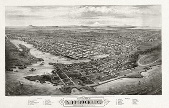 Bird's-eye view of Victoria, Vancouver Island, B.C., 1878, on heavy cotton canvas, 22x27" approx.
$41.48
Bird's-eye view of Victoria, Vancouver Island, B.C., 1878, on heavy cotton canvas, 22x27" approx.
$41.48
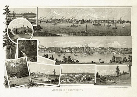 Panoramic Map of Victoria, B.C. and vicinity,1884, on heavy cotton canvas, 22x27" approx.
$41.48
Panoramic Map of Victoria, B.C. and vicinity,1884, on heavy cotton canvas, 22x27" approx.
$41.48
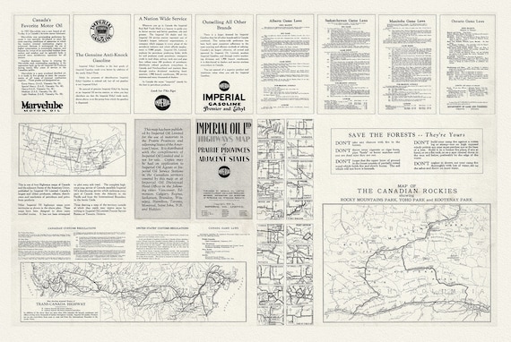 Canadian Rockies. Map Showing Proposed Routes of Trans-Canada Highway, 1930, on heavy canvas, approx.22x27"
$41.48
Canadian Rockies. Map Showing Proposed Routes of Trans-Canada Highway, 1930, on heavy canvas, approx.22x27"
$41.48
 Map Of The Grand Trunk Pacific Railway In British Columbia, 1910, Map on heavy cotton canvas, 22x27" approx.
$41.48
Map Of The Grand Trunk Pacific Railway In British Columbia, 1910, Map on heavy cotton canvas, 22x27" approx.
$41.48
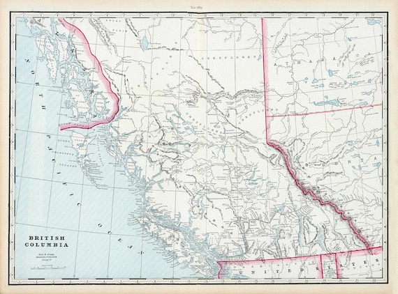 Map of British Columbia,1899, on heavy canvas, 22x27' approx.
$41.48
Map of British Columbia,1899, on heavy canvas, 22x27' approx.
$41.48
 Johannes Blaue, Atlas van Loon, Orbus Terrarum,1664 Ver. D, Map on heavy cotton canvas, 22x27in. approx.
$41.48
Johannes Blaue, Atlas van Loon, Orbus Terrarum,1664 Ver. D, Map on heavy cotton canvas, 22x27in. approx.
$41.48
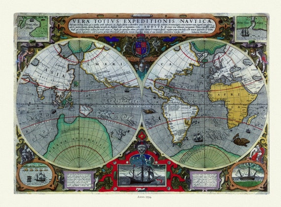 Hondius, Vera totius expeditionis nauticæ, descriptio D. Franc, 1595, Map on heavy cotton canvas, 22x27in. approx.
$41.48
Hondius, Vera totius expeditionis nauticæ, descriptio D. Franc, 1595, Map on heavy cotton canvas, 22x27in. approx.
$41.48
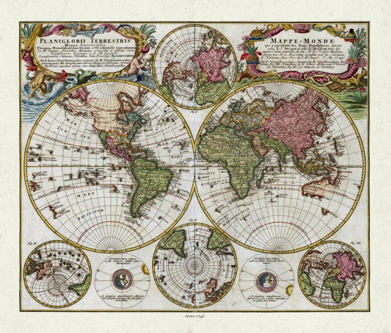 Homann, Mappe-Monde, 1746, Map on heavy cotton canvas, 22x27in. approx.
$41.48
Homann, Mappe-Monde, 1746, Map on heavy cotton canvas, 22x27in. approx.
$41.48