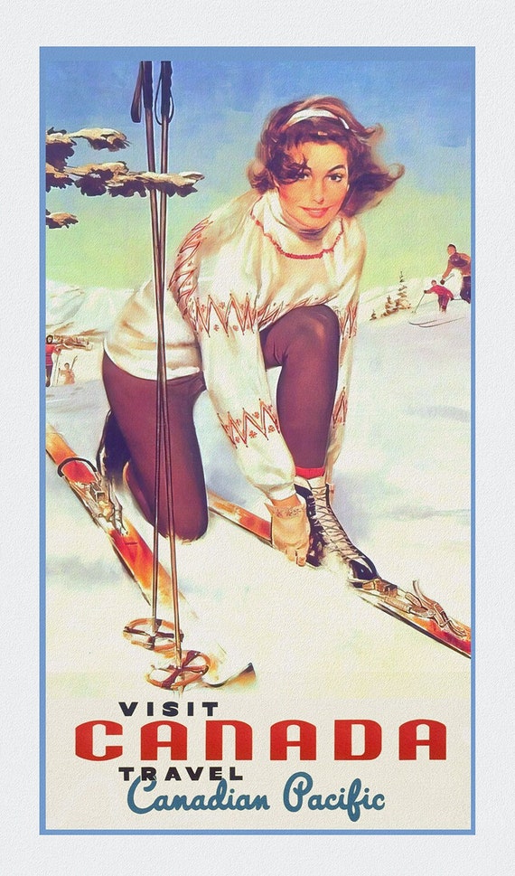
 Canadian Pacific, Visit Canada, travel poster on heavy cotton canvas, 50 x 70 cm, 20 x 25" approx.
$41.48
Canadian Pacific, Visit Canada, travel poster on heavy cotton canvas, 50 x 70 cm, 20 x 25" approx.
$41.48
 Ski Fun!, British Columbia, travel poster on heavy cotton canvas, 45 x 65 cm, 18 x 24" approx.
$41.48
Ski Fun!, British Columbia, travel poster on heavy cotton canvas, 45 x 65 cm, 18 x 24" approx.
$41.48
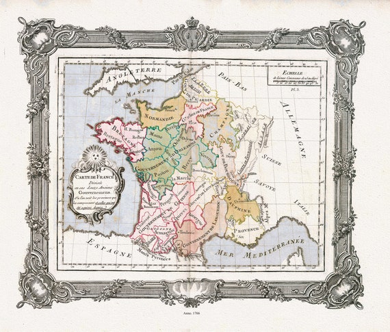 Brion de la Tour, Carte de France divisee en ses douze anciens Gouvernemens, 1766 ,une carte sur toile de coton épais, 56x70cm environ
$41.48
Brion de la Tour, Carte de France divisee en ses douze anciens Gouvernemens, 1766 ,une carte sur toile de coton épais, 56x70cm environ
$41.48
 Rossi, Veteris Galliae Tabulam (France), 1712 ,une carte sur toile de coton épais, 56x70cm environ
$41.48
Rossi, Veteris Galliae Tabulam (France), 1712 ,une carte sur toile de coton épais, 56x70cm environ
$41.48
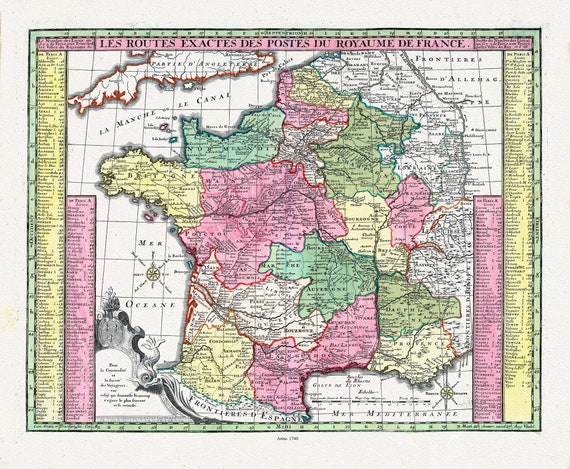 Seutter, Matthaeus ,No.7, Les Routes Exactes des Postes du Royaume de France, 1740 ,une carte sur toile de coton épais, 56x70cm environ
$41.48
Seutter, Matthaeus ,No.7, Les Routes Exactes des Postes du Royaume de France, 1740 ,une carte sur toile de coton épais, 56x70cm environ
$41.48
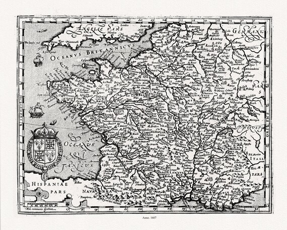 Mercator et Hondius, Gallia, 1607 ,une carte sur toile de coton épais, 56x70cm environ
$41.48
Mercator et Hondius, Gallia, 1607 ,une carte sur toile de coton épais, 56x70cm environ
$41.48
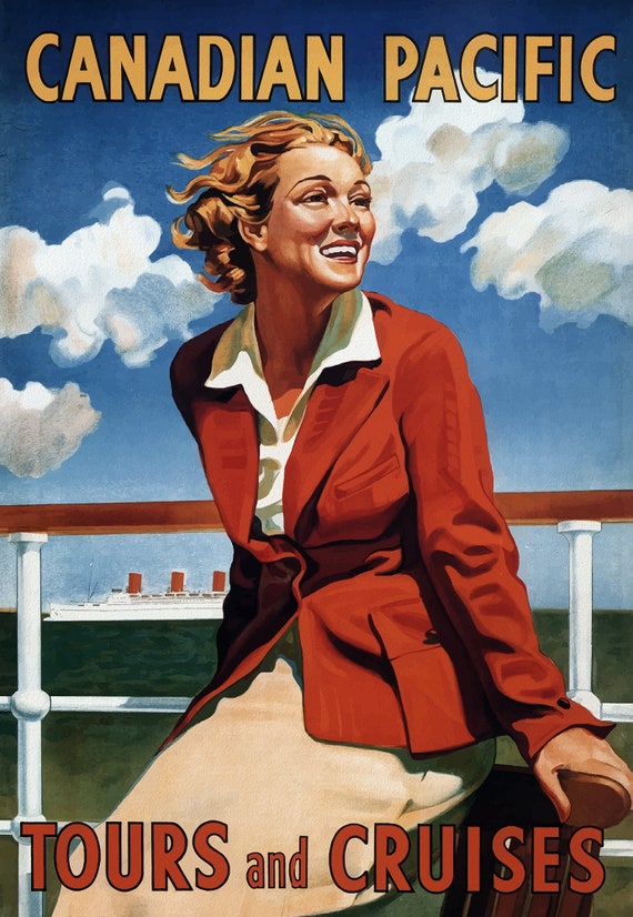 Canadian Pacific Tours and Cruises , travel poster on heavy cotton canvas, 20x25" approx.
$41.48
Canadian Pacific Tours and Cruises , travel poster on heavy cotton canvas, 20x25" approx.
$41.48
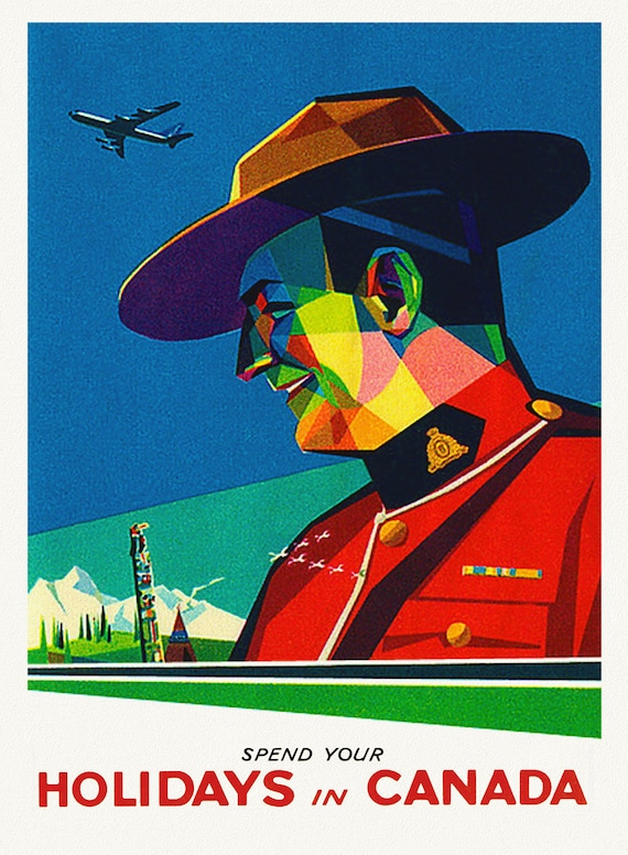 Spend Your Holidays in Canada , travel poster on heavy cotton canvas, 20x25" approx.
$41.48
Spend Your Holidays in Canada , travel poster on heavy cotton canvas, 20x25" approx.
$41.48
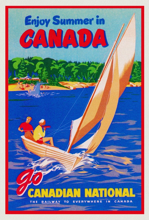 Enjoy Summer in Canada, Canadian National Railway , travel poster on heavy cotton canvas, 20x25" approx.
$41.48
Enjoy Summer in Canada, Canadian National Railway , travel poster on heavy cotton canvas, 20x25" approx.
$41.48
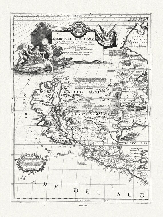 Coronelli (Vicenzo 1650-1718)-America Settentrionale (parte occidentale), 1693, map on heavy cotton canvas, 20 x 25" approx.
$41.48
Coronelli (Vicenzo 1650-1718)-America Settentrionale (parte occidentale), 1693, map on heavy cotton canvas, 20 x 25" approx.
$41.48
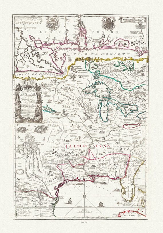 Fer, Composite Le cours de Missisipi, ou de St. Louis, Partie meridionale de la Riviere de Missisipi, 1720, on cotton canvas, 20 x 25"
$41.48
Fer, Composite Le cours de Missisipi, ou de St. Louis, Partie meridionale de la Riviere de Missisipi, 1720, on cotton canvas, 20 x 25"
$41.48
 Liechtenstern et Hartl, Nord America, 1805, map on heavy cotton canvas, 20 x 25" approx.
$41.48
Liechtenstern et Hartl, Nord America, 1805, map on heavy cotton canvas, 20 x 25" approx.
$41.48
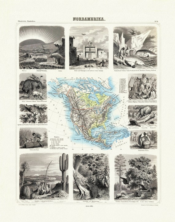 Brockhaus, Nordamerica, 1863, map on heavy cotton canvas, 20 x 25" approx
$41.48
Brockhaus, Nordamerica, 1863, map on heavy cotton canvas, 20 x 25" approx
$41.48
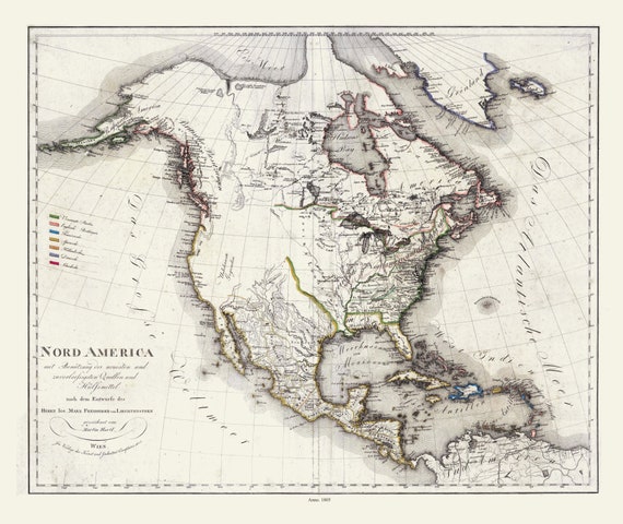
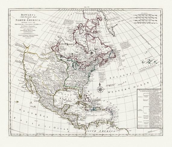 Bowles's new pocket map of North America, divided into it's provinces, colonies, states, &c.,1784 Ver.2 , on cotton canvas, 20 x 25" approx.
$41.48
Bowles's new pocket map of North America, divided into it's provinces, colonies, states, &c.,1784 Ver.2 , on cotton canvas, 20 x 25" approx.
$41.48
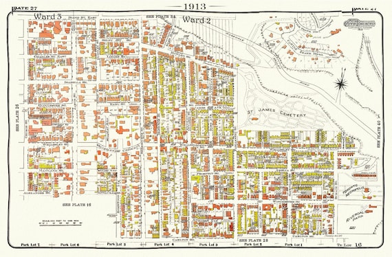 Plate 27, Toronto Central East, Cabbagetown, St. James, 1913, map on heavy cotton canvas, 20 x 30" approx.
$41.48
Plate 27, Toronto Central East, Cabbagetown, St. James, 1913, map on heavy cotton canvas, 20 x 30" approx.
$41.48
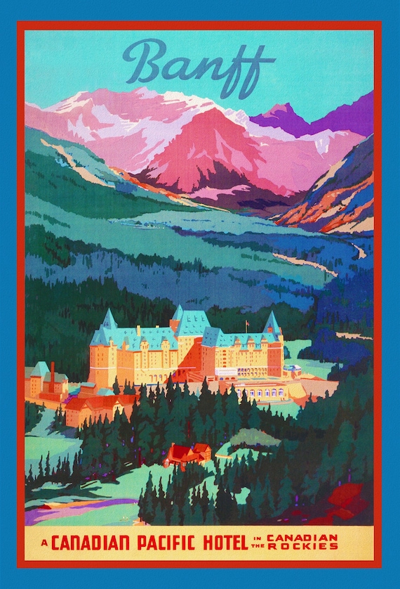 Banff, Canadian Pacific Hotels in the Canadian Rockies , travel poster on heavy cotton canvas, 20x25" approx.
$41.48
Banff, Canadian Pacific Hotels in the Canadian Rockies , travel poster on heavy cotton canvas, 20x25" approx.
$41.48
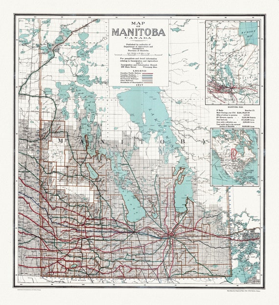 Map of Manitoba Canada, 1917, map on heavy cotton canvas, 22x27" approx.
$41.48
Map of Manitoba Canada, 1917, map on heavy cotton canvas, 22x27" approx.
$41.48
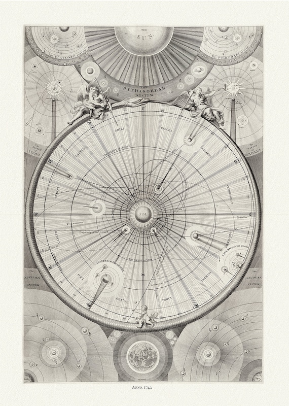 Thomas Wright, A synopsis of the universe, or, the visible world epitomiz'd, Plate 2, 1742 ,map on heavy cotton canvas, 22x27" approx.
$41.48
Thomas Wright, A synopsis of the universe, or, the visible world epitomiz'd, Plate 2, 1742 ,map on heavy cotton canvas, 22x27" approx.
$41.48
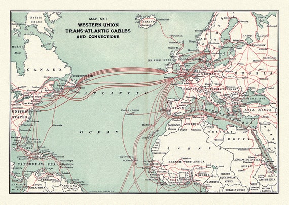 Western Union Trans-Atlantic cables, 1900, map on heavy cotton canvas, 50 x 70 cm (20x25") approx.
$41.48
Western Union Trans-Atlantic cables, 1900, map on heavy cotton canvas, 50 x 70 cm (20x25") approx.
$41.48
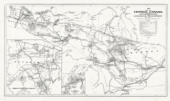 Map of Central Canada Showing Transportation and Commercial Development, 1927, map on heavy cotton canvas, 50 x 70cm, 20 x 25" approx.
$41.48
Map of Central Canada Showing Transportation and Commercial Development, 1927, map on heavy cotton canvas, 50 x 70cm, 20 x 25" approx.
$41.48