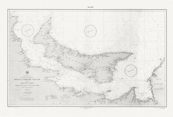
 PEI: Prince Edward Island and adjacent coasts, from Sea Wolf Island to Escuminac Point, 1889, Nautical chart on canvas 20x25" approx.
$41.48
PEI: Prince Edward Island and adjacent coasts, from Sea Wolf Island to Escuminac Point, 1889, Nautical chart on canvas 20x25" approx.
$41.48
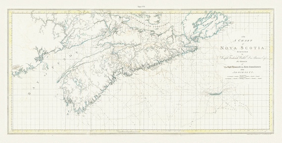 A chart of Nova Scotia, 1775, Des Barres auth., map on durable cotton canvas, 50 x 90 cm, 20 x 30" approx.
$41.48
A chart of Nova Scotia, 1775, Des Barres auth., map on durable cotton canvas, 50 x 90 cm, 20 x 30" approx.
$41.48
 Be Kind to Animals, Support Your Local Humane Society Ver. V , vintage poster on heavy cotton canvas, 20x25" approx.
$45.25
Be Kind to Animals, Support Your Local Humane Society Ver. V , vintage poster on heavy cotton canvas, 20x25" approx.
$45.25
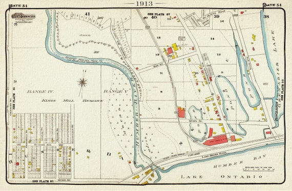 Plate 54, Toronto West, High Park, Swansea, 1913, map on heavy cotton canvas, 20 x 30" approx.
$41.48
Plate 54, Toronto West, High Park, Swansea, 1913, map on heavy cotton canvas, 20 x 30" approx.
$41.48
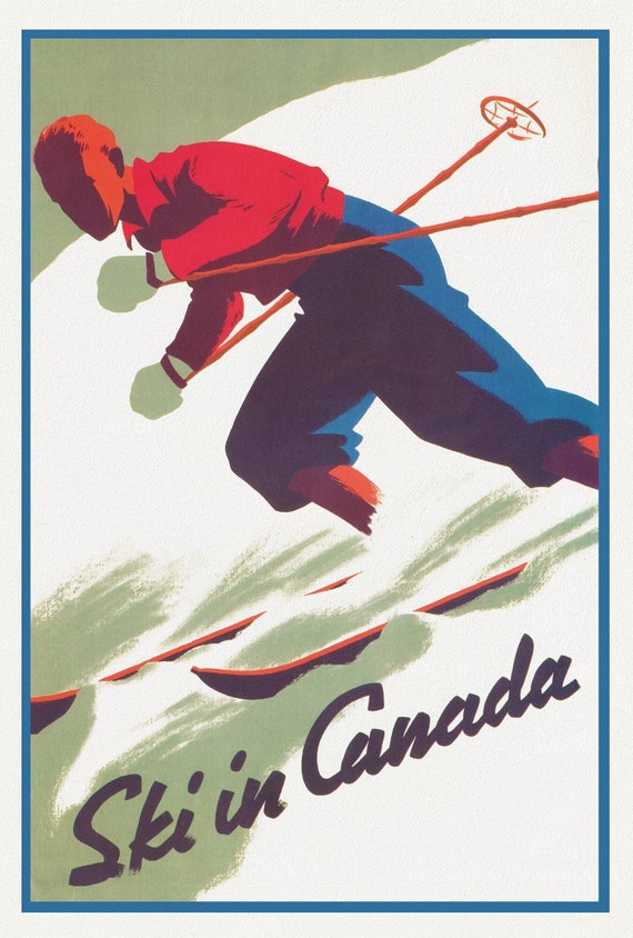 Ski in Canada! Ver. II , travel poster on heavy cotton canvas, 20x25" approx.
$41.48
Ski in Canada! Ver. II , travel poster on heavy cotton canvas, 20x25" approx.
$41.48
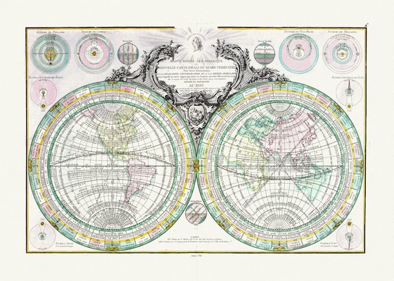 Lattre, (Jean, 1743 -1793), Mappe-Monde Geo Spherique, 1760, Map on heavy cotton canvas, 22x27in. approx.
$41.48
Lattre, (Jean, 1743 -1793), Mappe-Monde Geo Spherique, 1760, Map on heavy cotton canvas, 22x27in. approx.
$41.48
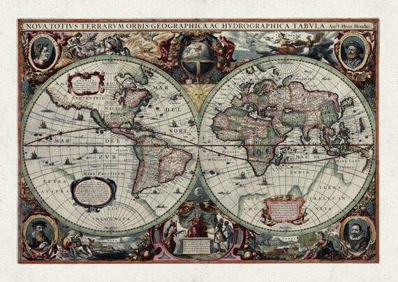 Hondius, Terrarum Orbis, 1640, Map on heavy cotton canvas, 22x27in. approx.
$41.48
Hondius, Terrarum Orbis, 1640, Map on heavy cotton canvas, 22x27in. approx.
$41.48
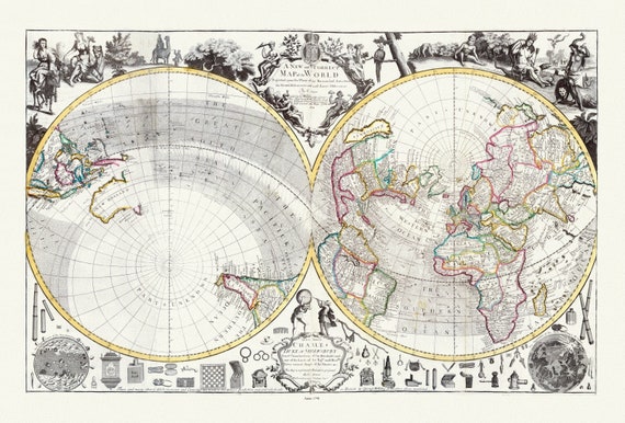 Willdey, No. 2. A New and Correct Map of the World Projected upon the Plane of the Horizon, 1714, Map on heavy cotton canvas, 22x27in.
$41.48
Willdey, No. 2. A New and Correct Map of the World Projected upon the Plane of the Horizon, 1714, Map on heavy cotton canvas, 22x27in.
$41.48
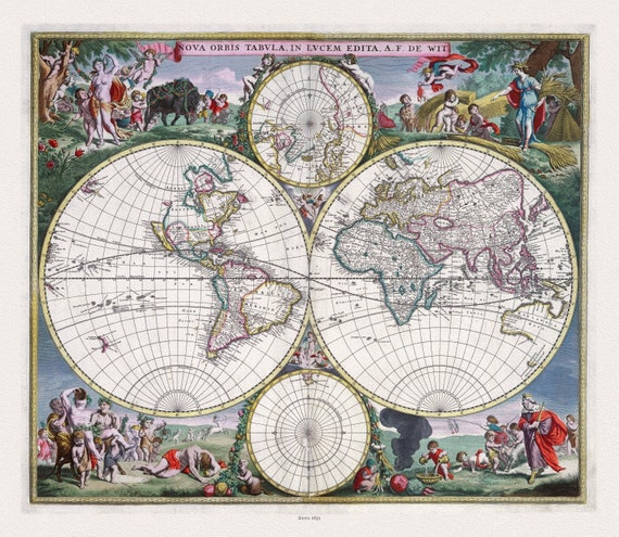 Wit, Nova Orbis Tabula, in Lucem Edita,1682, Map on heavy cotton canvas, 22x27in. approx.
$41.48
Wit, Nova Orbis Tabula, in Lucem Edita,1682, Map on heavy cotton canvas, 22x27in. approx.
$41.48
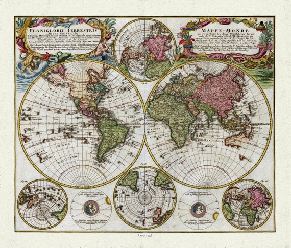 Homann, Mappe-Monde, 1746, Map on heavy cotton canvas, 22x27in. approx.
$41.48
Homann, Mappe-Monde, 1746, Map on heavy cotton canvas, 22x27in. approx.
$41.48
 Henri Chatelain-Tome I. No. 46. Mappe-monde, 1718, Map on heavy cotton canvas, 22x27in. approx.
$41.48
Henri Chatelain-Tome I. No. 46. Mappe-monde, 1718, Map on heavy cotton canvas, 22x27in. approx.
$41.48
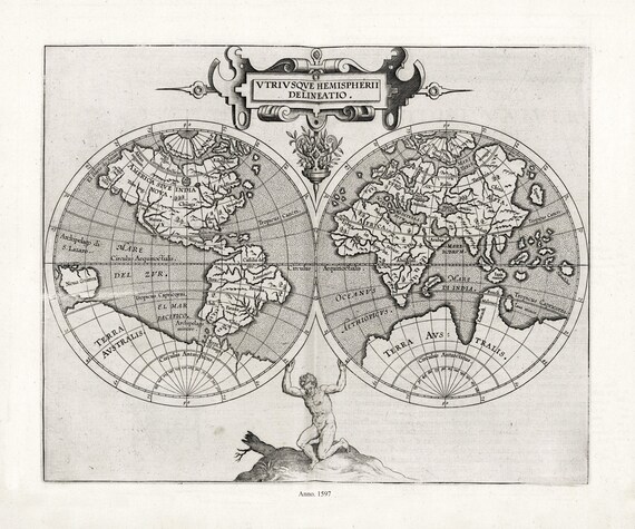 Wytfliet et Magini, Utriusque hemispherii delineatio, 1597, Map on heavy cotton canvas, 22x27in. approx.
$41.48
Wytfliet et Magini, Utriusque hemispherii delineatio, 1597, Map on heavy cotton canvas, 22x27in. approx.
$41.48
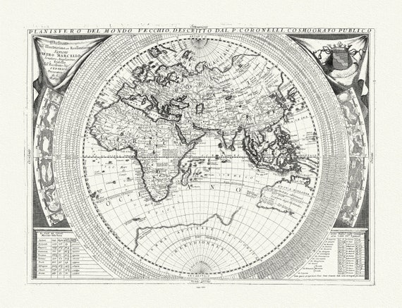 Coronelli, Planisfero del Mondo Vecchio, 1693, Map on heavy cotton canvas, 22x27in. approx.
$41.48
Coronelli, Planisfero del Mondo Vecchio, 1693, Map on heavy cotton canvas, 22x27in. approx.
$41.48
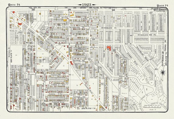 Plate 74, Toronto Uptown West, Vaughan Road to Eglinton, 1923, Map on heavy cotton canvas, 18x27in. approx.
$41.48
Plate 74, Toronto Uptown West, Vaughan Road to Eglinton, 1923, Map on heavy cotton canvas, 18x27in. approx.
$41.48
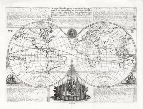
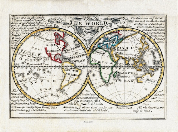 Bowen, The World, 1758, Map on heavy cotton canvas, 22x27in. approx.
$41.48
Bowen, The World, 1758, Map on heavy cotton canvas, 22x27in. approx.
$41.48
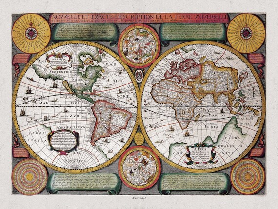 Boisseau, Nouvelle Exacte Description de la Terre Universelle, 1646 D, Map on heavy cotton canvas, 22x27in. approx.
$41.48
Boisseau, Nouvelle Exacte Description de la Terre Universelle, 1646 D, Map on heavy cotton canvas, 22x27in. approx.
$41.48
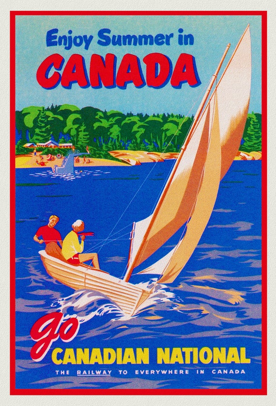 Enjoy Summer in Canada, Canadian National Railway, travel poster on heavy cotton canvas, 45 x 65 cm, 18 x 24" approx.
$41.48
Enjoy Summer in Canada, Canadian National Railway, travel poster on heavy cotton canvas, 45 x 65 cm, 18 x 24" approx.
$41.48
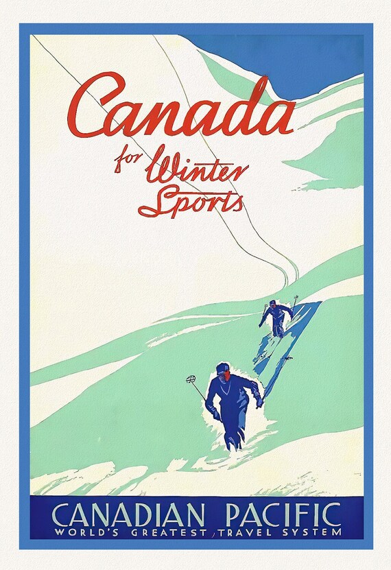 Canada for Winter Sports, Canadian Pacific Travel , vintage poster on heavy cotton canvas, 45 x 65 cm, 18 x 24" approx.
$41.48
Canada for Winter Sports, Canadian Pacific Travel , vintage poster on heavy cotton canvas, 45 x 65 cm, 18 x 24" approx.
$41.48
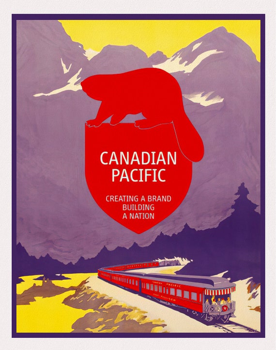 Canadian Pacific, Building a Nation, travel poster on heavy cotton canvas, 50 x 70 cm, 20 x 25" approx.
$41.48
Canadian Pacific, Building a Nation, travel poster on heavy cotton canvas, 50 x 70 cm, 20 x 25" approx.
$41.48
 Canadian Pacific, Cross the Great Lakes, travel poster on heavy cotton canvas, 50 x 70 cm, 20 x 25" approx.
$41.48
Canadian Pacific, Cross the Great Lakes, travel poster on heavy cotton canvas, 50 x 70 cm, 20 x 25" approx.
$41.48