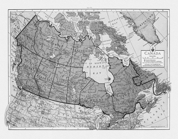
 J.W. Clement Co., Canada, 1943 Ver. Bw7, map on heavy cotton canvas, 22x27" approx.
$41.48
J.W. Clement Co., Canada, 1943 Ver. Bw7, map on heavy cotton canvas, 22x27" approx.
$41.48
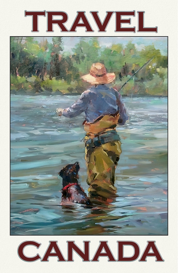 Travel Canada, Fishing Ver. 5, travel poster on durable cotton canvas, 50 x 70 cm, 20 x 25" approx
$41.48
Travel Canada, Fishing Ver. 5, travel poster on durable cotton canvas, 50 x 70 cm, 20 x 25" approx
$41.48
 Travel Canada, Fishing Ver. 4, travel poster on durable cotton canvas, 50 x 70 cm, 20 x 25" approx
$41.48
Travel Canada, Fishing Ver. 4, travel poster on durable cotton canvas, 50 x 70 cm, 20 x 25" approx
$41.48
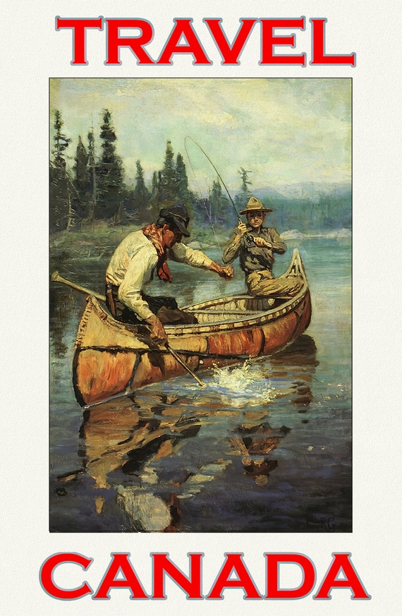 Travel Canada, Fishing Ver. 3 , travel poster on durable cotton canvas, 50 x 70 cm, 20 x 25" approx
$41.48
Travel Canada, Fishing Ver. 3 , travel poster on durable cotton canvas, 50 x 70 cm, 20 x 25" approx
$41.48
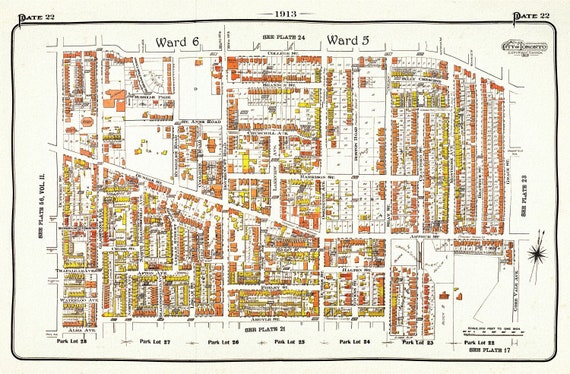 Plate 22, Toronto West, Parkdale, Brockton Village, 1913, map on heavy cotton canvas, 20 x 30" approx.
$41.48
Plate 22, Toronto West, Parkdale, Brockton Village, 1913, map on heavy cotton canvas, 20 x 30" approx.
$41.48
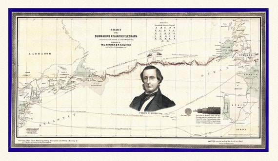 Map of The Submarine Atlantic Telegraph, on heavy canvas, 22x27" approx.
$41.48
Map of The Submarine Atlantic Telegraph, on heavy canvas, 22x27" approx.
$41.48
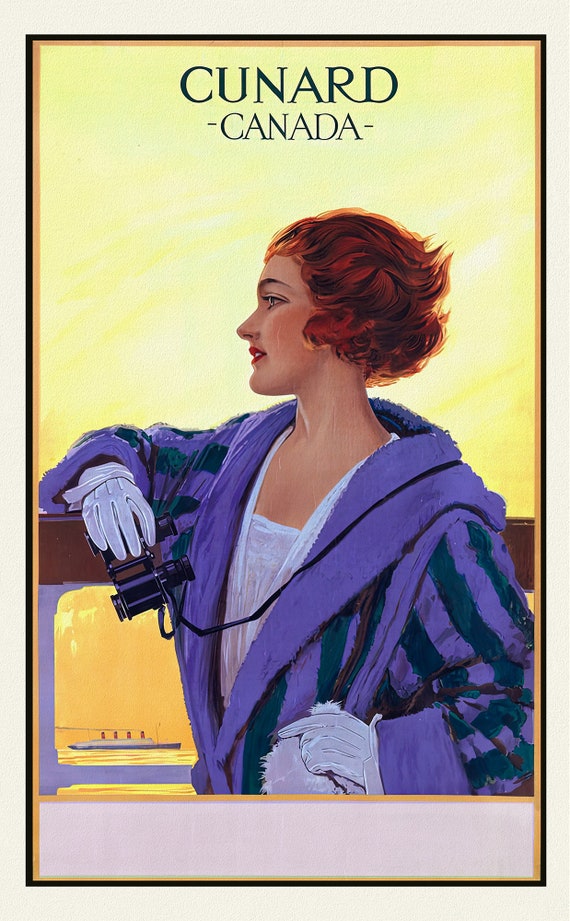 Cunard to Canada, 1925, travel poster on durable cotton canvas, 50 x 70 cm, 20 x 25" approx.
$41.48
Cunard to Canada, 1925, travel poster on durable cotton canvas, 50 x 70 cm, 20 x 25" approx.
$41.48
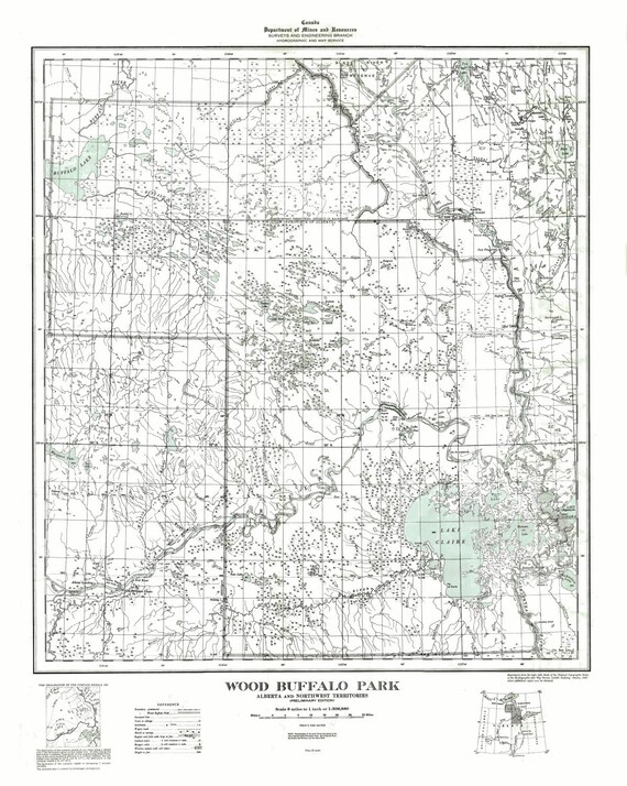 Wood Buffalo Park, Alberta and Northwest Territories, 1947
$41.48
Wood Buffalo Park, Alberta and Northwest Territories, 1947
$41.48
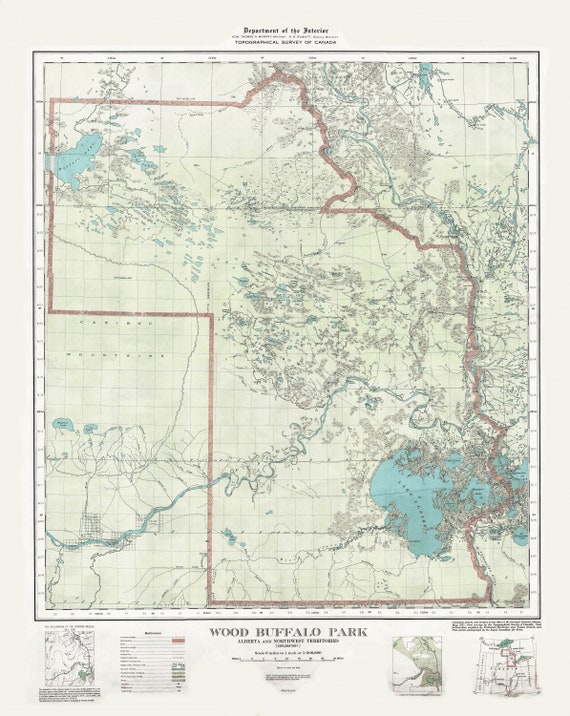 Wood Buffalo Park, Alberta and Northwest Territories, 1931 , map on heavy cotton canvas, 22x27" approx.
$41.48
Wood Buffalo Park, Alberta and Northwest Territories, 1931 , map on heavy cotton canvas, 22x27" approx.
$41.48
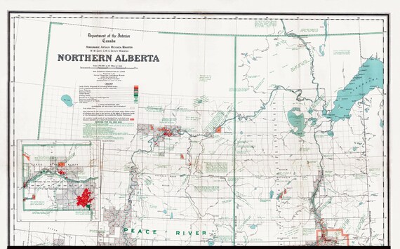 Northern Alberta, map showing disposition of lands, 1918 , map on heavy cotton canvas, 22x27" approx.
$41.48
Northern Alberta, map showing disposition of lands, 1918 , map on heavy cotton canvas, 22x27" approx.
$41.48
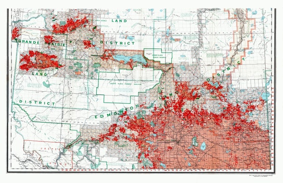 Northern Alberta, map showing disposition of lands, 1918 South Sheet, map on heavy cotton canvas, 22x27" approx.
$41.48
Northern Alberta, map showing disposition of lands, 1918 South Sheet, map on heavy cotton canvas, 22x27" approx.
$41.48
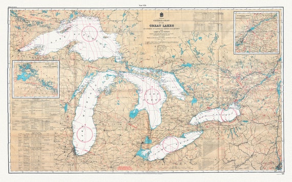 Canada Hydrographic Office, A General Chart of the Great Lakes, 1927 , map on heavy cotton canvas, 50x70cm (20 x 25") approx.
$41.48
Canada Hydrographic Office, A General Chart of the Great Lakes, 1927 , map on heavy cotton canvas, 50x70cm (20 x 25") approx.
$41.48
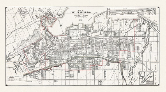 Map of the City of Hamilton, Ontario, 1943, on heavy cotton canvas, 22x27" approx.
$41.48
Map of the City of Hamilton, Ontario, 1943, on heavy cotton canvas, 22x27" approx.
$41.48
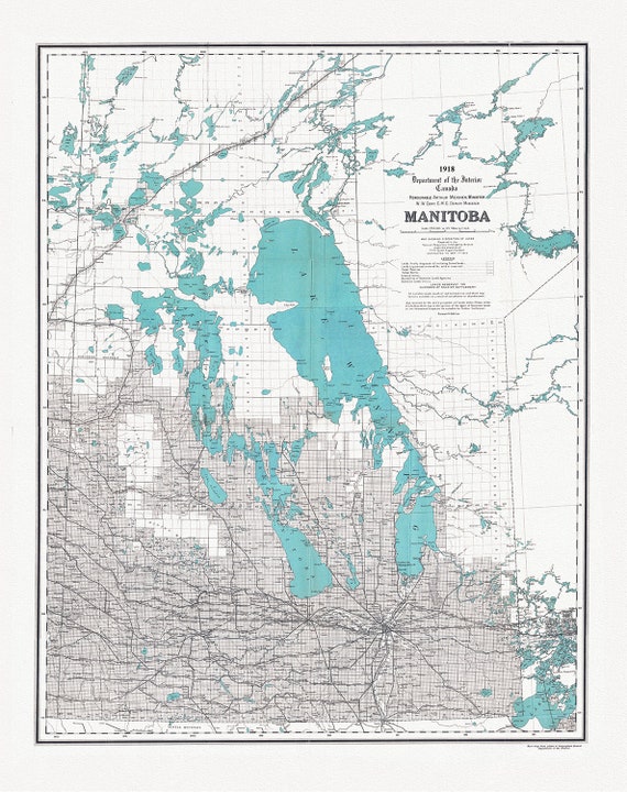 Manitoba, map showing disposition of lands, 1918 , map on heavy cotton canvas, 22x27" approx.
$41.48
Manitoba, map showing disposition of lands, 1918 , map on heavy cotton canvas, 22x27" approx.
$41.48
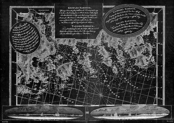 Des Barres, The Sea Coast of Nova Scotia-Keppel Harbor, Knowles Harbor, Tangier Harbor, etc.-1777 , map,canvas, 50 x 70 cm, 20 x 25" approx.
$41.48
Des Barres, The Sea Coast of Nova Scotia-Keppel Harbor, Knowles Harbor, Tangier Harbor, etc.-1777 , map,canvas, 50 x 70 cm, 20 x 25" approx.
$41.48
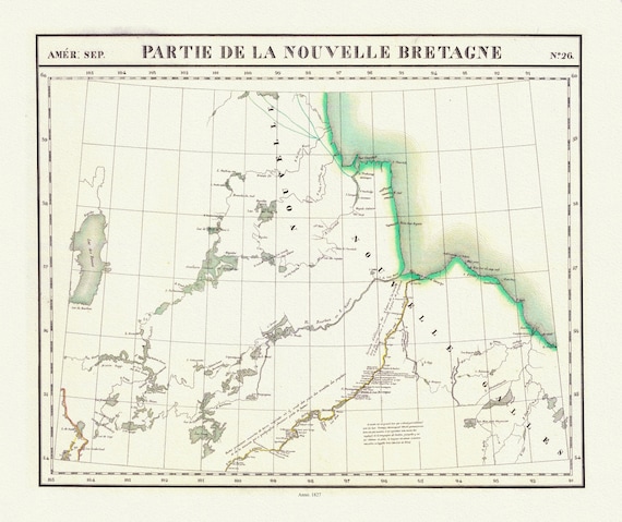 Vandermaelen, Partie, Nouvelle Bretagne (Manitoba), 1827 , map on heavy cotton canvas, 22x27" approx.
$41.48
Vandermaelen, Partie, Nouvelle Bretagne (Manitoba), 1827 , map on heavy cotton canvas, 22x27" approx.
$41.48
 Stanford, Manitoba, 1904 , map on heavy cotton canvas, 22x27" approx.
$41.48
Stanford, Manitoba, 1904 , map on heavy cotton canvas, 22x27" approx.
$41.48
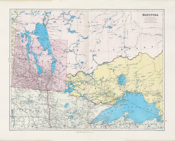
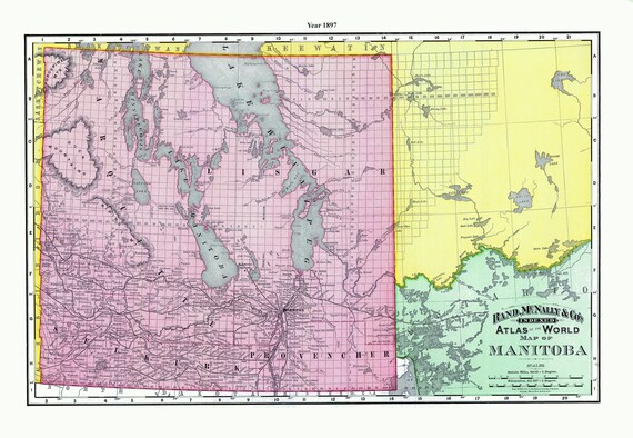 Rand McNally and Company, Manitoba, 1897 , map on heavy cotton canvas, 22x27" approx.
$41.48
Rand McNally and Company, Manitoba, 1897 , map on heavy cotton canvas, 22x27" approx.
$41.48
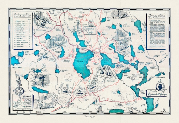 Trails of Limberlost Lodge,Haliburton, Ontario, 1939, Map on heavy cotton canvas, 22x27" approx.
$41.48
Trails of Limberlost Lodge,Haliburton, Ontario, 1939, Map on heavy cotton canvas, 22x27" approx.
$41.48
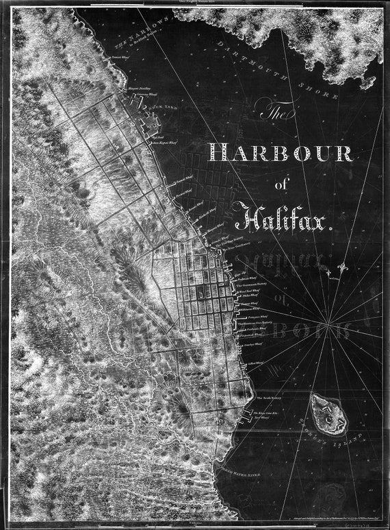 Des Barres, The Sea Coast of Nova Scotia-Harbor of Halifax-1777 , map on durable cotton canvas, 50 x 70 cm, 20 x 25" approx.
$41.48
Des Barres, The Sea Coast of Nova Scotia-Harbor of Halifax-1777 , map on durable cotton canvas, 50 x 70 cm, 20 x 25" approx.
$41.48