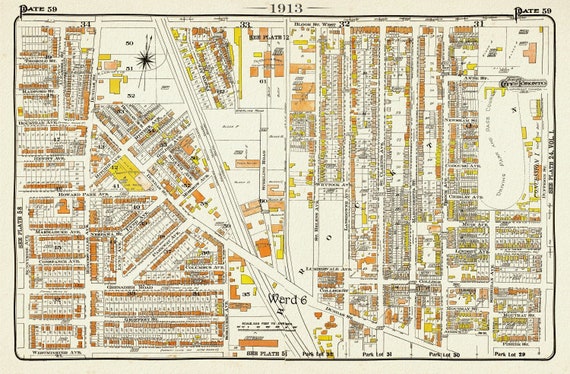
 Plate 59, TorontoWest, Roncesvalles, Brockton North, 1913, map on heavy cotton canvas, 20 x 30" or 50 x 75cm. approx.
$41.36
Plate 59, TorontoWest, Roncesvalles, Brockton North, 1913, map on heavy cotton canvas, 20 x 30" or 50 x 75cm. approx.
$41.36
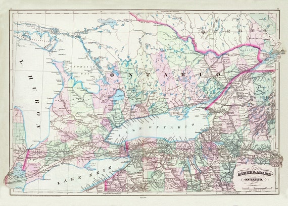 Asher & Adams, Ontario, 1872 , map on heavy cotton canvas, 22x27" approx.
$41.36
Asher & Adams, Ontario, 1872 , map on heavy cotton canvas, 22x27" approx.
$41.36
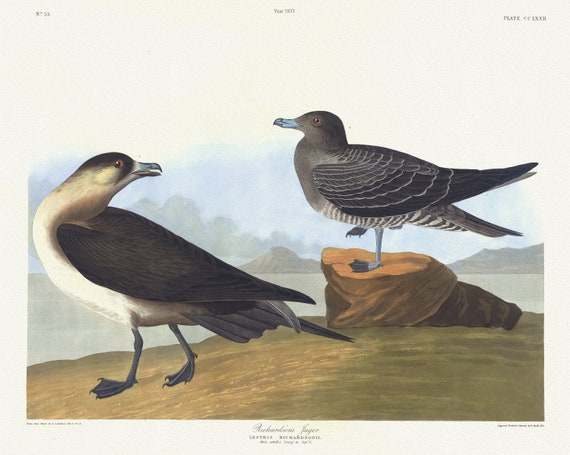 J.J. Audubon, Richardson's jager.Lestris richardsonii. Male adult, 1. Young, 1835, nature print on canvas, 50 x 70 cm, 20 x 25" approx.
$41.36
J.J. Audubon, Richardson's jager.Lestris richardsonii. Male adult, 1. Young, 1835, nature print on canvas, 50 x 70 cm, 20 x 25" approx.
$41.36
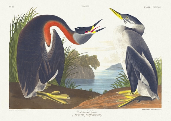
 J.J. Audubon, Red-necked grebe.Podiceps rubricollis, Lath. 1. Adult male spring plumage. 2. Winter plumage, 1835 , 20 x 25" approx.
$41.36
J.J. Audubon, Red-necked grebe.Podiceps rubricollis, Lath. 1. Adult male spring plumage. 2. Winter plumage, 1835 , 20 x 25" approx.
$41.36
 J.J. Audubon, Red-necked grebe.Podiceps rubricollis, Lath. 1. Adult male spring plumage. 2. Winter plumage Ver. II, 1835, canvas, 20 x 25"
$41.36
J.J. Audubon, Red-necked grebe.Podiceps rubricollis, Lath. 1. Adult male spring plumage. 2. Winter plumage Ver. II, 1835, canvas, 20 x 25"
$41.36
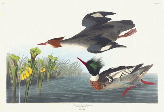 J.J. Audubon, Red-breasted merganser. Mergus serrator, L. Male, 1. Female, 2. Plant, sarracenia flava, 1835, 50 x 70 cm, 20 x 25" approx.
$41.36
J.J. Audubon, Red-breasted merganser. Mergus serrator, L. Male, 1. Female, 2. Plant, sarracenia flava, 1835, 50 x 70 cm, 20 x 25" approx.
$41.36
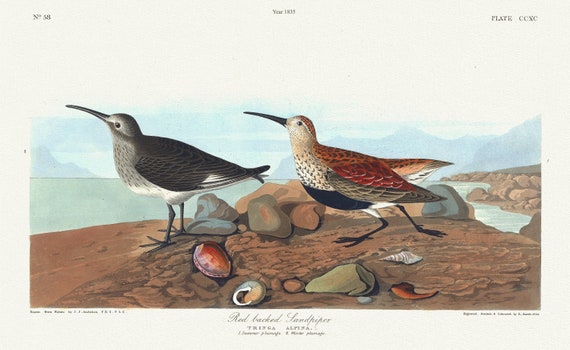 J.J. Audubon, Red-backed sandpiper Tringa alpina. L. 1. Summer plumage. 2. Winter plumage, 1835, on canvas, 50 x 70 cm, 20 x 25" approx.
$16.55
J.J. Audubon, Red-backed sandpiper Tringa alpina. L. 1. Summer plumage. 2. Winter plumage, 1835, on canvas, 50 x 70 cm, 20 x 25" approx.
$16.55
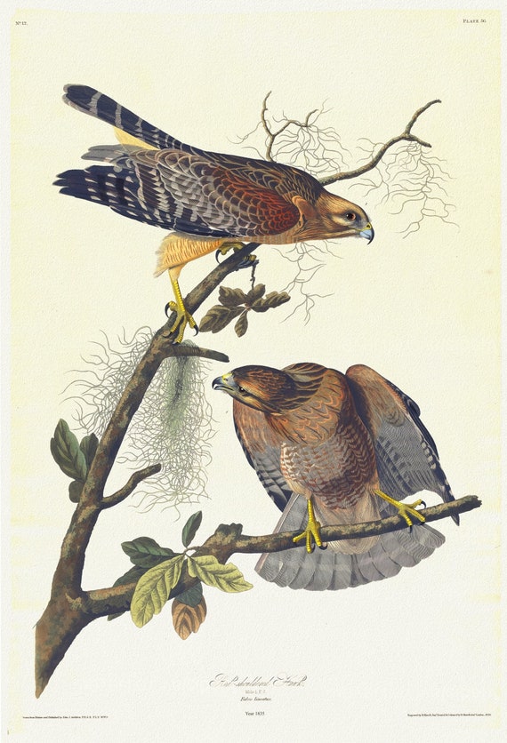
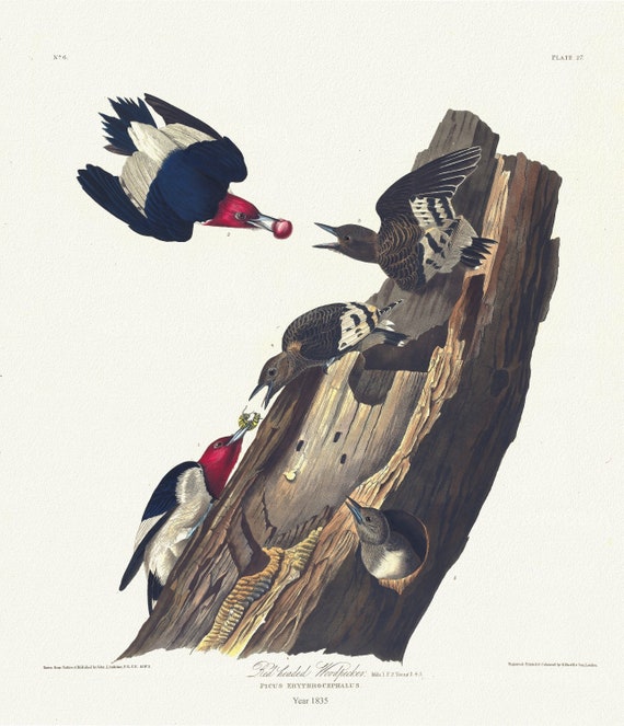 J.J. Audubon, Red headed woodpecker. Male, 1. F, 2. Young, 3, 4, 5. Picus erythrocephalus, 1835 , on canvas, 50 x 70 cm, 20 x 25" approx.
$41.36
J.J. Audubon, Red headed woodpecker. Male, 1. F, 2. Young, 3, 4, 5. Picus erythrocephalus, 1835 , on canvas, 50 x 70 cm, 20 x 25" approx.
$41.36
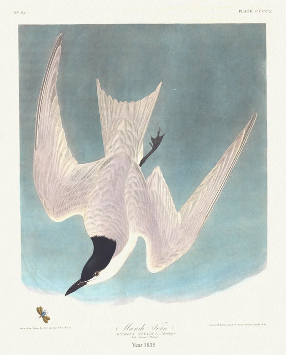 J.J. Audubon, Marsh tern Sterna anglica, Montagu. Male summer plumage, 1835, vintage nature print on canvas, 50 x 70 cm, 20 x 25" approx.
$41.36
J.J. Audubon, Marsh tern Sterna anglica, Montagu. Male summer plumage, 1835, vintage nature print on canvas, 50 x 70 cm, 20 x 25" approx.
$41.36
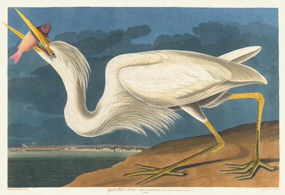 J.J. Audubon, Great white heron. Ardea occidentalis, male adult spring plumage, 1835 , print on canvas, 50 x 70 cm, 20 x 25" approx.
$41.36
J.J. Audubon, Great white heron. Ardea occidentalis, male adult spring plumage, 1835 , print on canvas, 50 x 70 cm, 20 x 25" approx.
$41.36
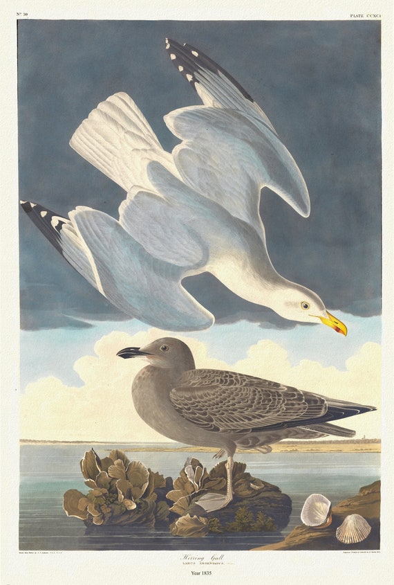 J.J. Audubon, Herring gull. Larus argentatus, Brunn. 1. Adult male spring plumage. 2. Young, 1835, on canvas, 50 x 70 cm, 20 x 25" approx.
$41.36
J.J. Audubon, Herring gull. Larus argentatus, Brunn. 1. Adult male spring plumage. 2. Young, 1835, on canvas, 50 x 70 cm, 20 x 25" approx.
$41.36
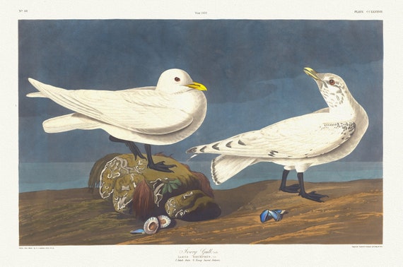 J.J. Audubon, Ivory gull, Lath. Larus eburneus, Gm. 1. Adult male. 2. Young second autumn. Ver. II, canvas, 50 x 70 cm, 20 x 25" approx.
$41.36
J.J. Audubon, Ivory gull, Lath. Larus eburneus, Gm. 1. Adult male. 2. Young second autumn. Ver. II, canvas, 50 x 70 cm, 20 x 25" approx.
$41.36
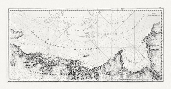 PEI: North East Coast of Nova Scotia and Northumberland Strait, Des Barres auth., 1755, on cotton canvas, 50 x 70 cm or 20x25" approx.
$41.36
PEI: North East Coast of Nova Scotia and Northumberland Strait, Des Barres auth., 1755, on cotton canvas, 50 x 70 cm or 20x25" approx.
$41.36
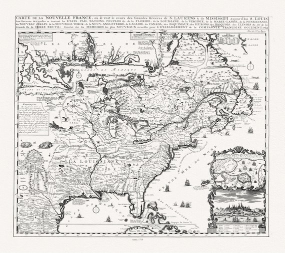 Henri Chatelain, Carte de la Nouvelle France, ou se voit le cours des grandes rivieres de S. Laurens & de Mississipi, 1719 ,canvas, 22x27"
$41.36
Henri Chatelain, Carte de la Nouvelle France, ou se voit le cours des grandes rivieres de S. Laurens & de Mississipi, 1719 ,canvas, 22x27"
$41.36
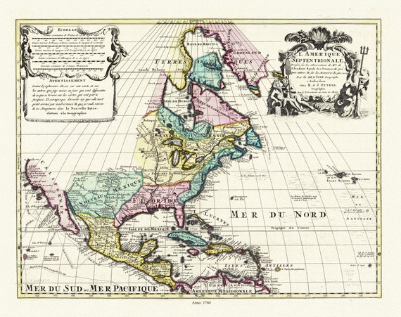 L'Amérique septentrionale. Dressée sur les observations de mrs. de l'Academie royale des sciences. & quelques autres, 1760, on canvas,22x27"
$41.36
L'Amérique septentrionale. Dressée sur les observations de mrs. de l'Academie royale des sciences. & quelques autres, 1760, on canvas,22x27"
$41.36
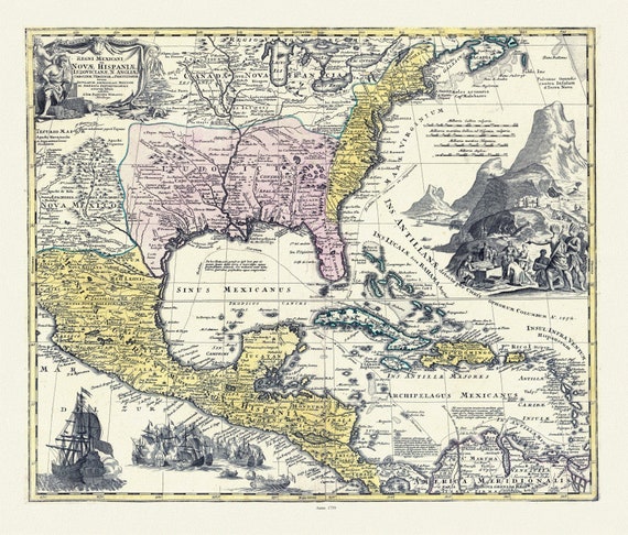 Regni Mexicani seu Novæ Hispaniæ, Ludovicianæ, N. Angliæ, Carolinæ, Virginæ et Pensylvaniæ in America Septentrionali, 1759 canvas 22x27"
$41.36
Regni Mexicani seu Novæ Hispaniæ, Ludovicianæ, N. Angliæ, Carolinæ, Virginæ et Pensylvaniæ in America Septentrionali, 1759 canvas 22x27"
$41.36
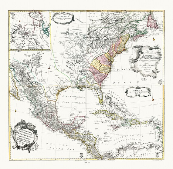 Euler, Sauerbrey et Rhode, Composite map Mappa geographica Americae Septentrionalis pars I-IV, 1753 , on heavy cotton canvas, 22x27" approx.
$41.36
Euler, Sauerbrey et Rhode, Composite map Mappa geographica Americae Septentrionalis pars I-IV, 1753 , on heavy cotton canvas, 22x27" approx.
$41.36
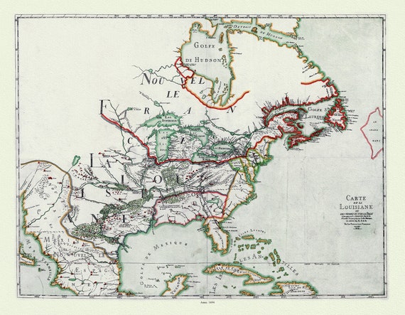 Franquelin (1850), Carte de la Louisiane ou des voyages du Sr. De La Salle, 1684 Ver. 1 , map on heavy cotton canvas, 22x27" approx.
$41.36
Franquelin (1850), Carte de la Louisiane ou des voyages du Sr. De La Salle, 1684 Ver. 1 , map on heavy cotton canvas, 22x27" approx.
$41.36
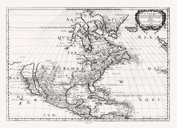 Mariette et Sanson, Amérique septentrionale, 1650 , map on heavy cotton canvas, 22x27" approx
$41.36
Mariette et Sanson, Amérique septentrionale, 1650 , map on heavy cotton canvas, 22x27" approx
$41.36
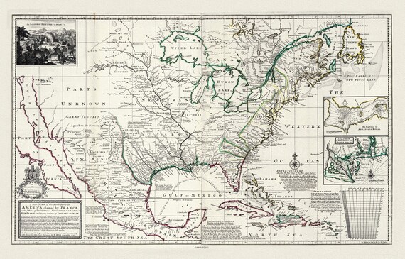 Moll, Parts of America Claimed by France, 1720, map on heavy cotton canvas, 22x27" approx.
$41.36
Moll, Parts of America Claimed by France, 1720, map on heavy cotton canvas, 22x27" approx.
$41.36