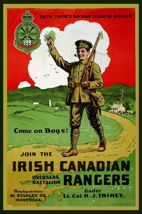
 Canada WW I Poster, Join the Irish Canadian Rangers Overseas Battalion, 1914, vintage war poster on canvas, 50 x 70 cm, 20 x 25" approx.
$41.36
Canada WW I Poster, Join the Irish Canadian Rangers Overseas Battalion, 1914, vintage war poster on canvas, 50 x 70 cm, 20 x 25" approx.
$41.36
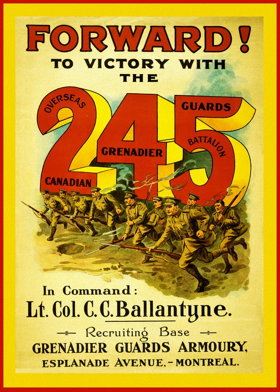 Canada WW I Poster, Forward! To Victory with the 245 Overseas Canadian Grenadier Guards Battalion, 1914, vintage war poster
$41.36
Canada WW I Poster, Forward! To Victory with the 245 Overseas Canadian Grenadier Guards Battalion, 1914, vintage war poster
$41.36
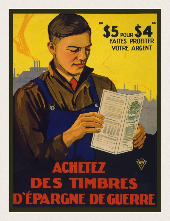 Achetez des timbres d'épargne de guerre, 1915, vintage war poster on durable cotton canvas, 50 x 70 cm, 20 x 25" approx.
$41.36
Achetez des timbres d'épargne de guerre, 1915, vintage war poster on durable cotton canvas, 50 x 70 cm, 20 x 25" approx.
$41.36
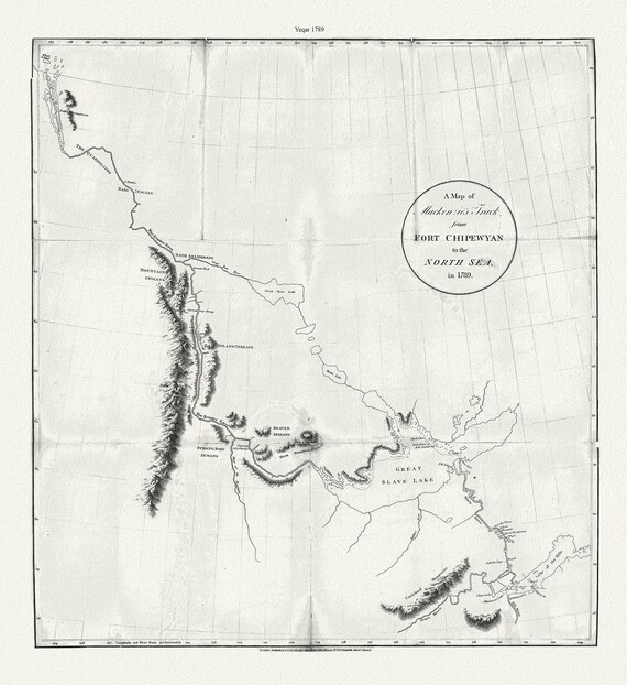 A map of Mackenzie's track from Fort Chipewyan to the north sea in 1789, canvas, 50 x 70 cm or 20x25" approx.
$41.36
A map of Mackenzie's track from Fort Chipewyan to the north sea in 1789, canvas, 50 x 70 cm or 20x25" approx.
$41.36
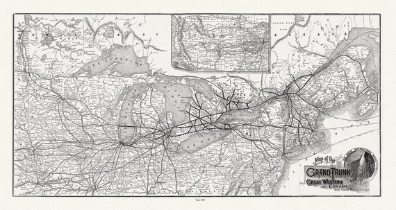 Grand Trunk Railway Company of Canada, 1885, map on heavy cotton canvas, 22x27" approx.
$41.36
Grand Trunk Railway Company of Canada, 1885, map on heavy cotton canvas, 22x27" approx.
$41.36
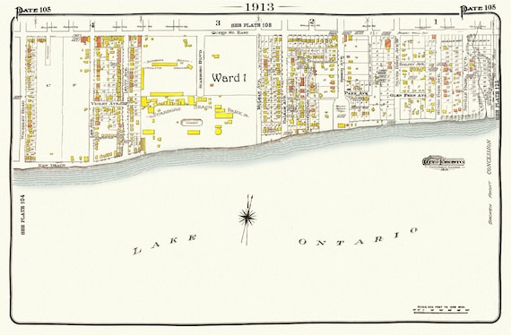 Plate 105, Toronto East, The Beach, Scarboro Beach, 1913, map on heavy cotton canvas, 20 x 30" or 50 x 75cm. approx.
$41.36
Plate 105, Toronto East, The Beach, Scarboro Beach, 1913, map on heavy cotton canvas, 20 x 30" or 50 x 75cm. approx.
$41.36
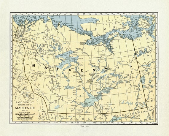 Mackenzie, 1924, Rand McNally & Company, Commercial Atlas, , map on durable cotton canvas, 50 x 70 cm, 20 x 25" approx.
$41.36
Mackenzie, 1924, Rand McNally & Company, Commercial Atlas, , map on durable cotton canvas, 50 x 70 cm, 20 x 25" approx.
$41.36
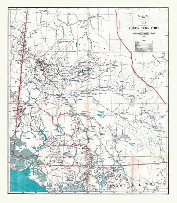 Map of the Yukon Territory, 1919, map on durable cotton canvas, 50 x 70 cm, 20 x 25" approx.
$41.36
Map of the Yukon Territory, 1919, map on durable cotton canvas, 50 x 70 cm, 20 x 25" approx.
$41.36
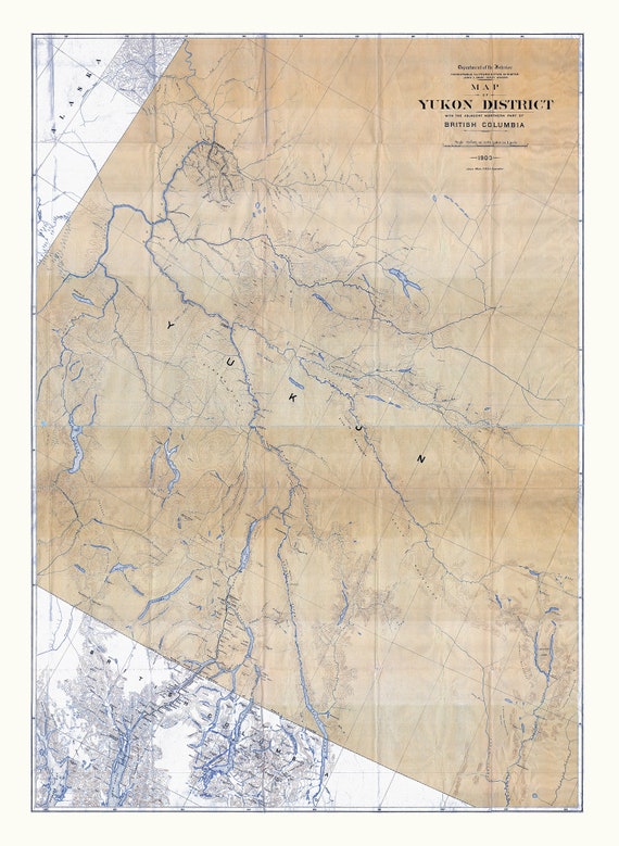 Map of Yukon District with the adjacent northern part of British Columbia, 1903, map on durable cotton canvas, 50 x 70 cm, 20 x 25" approx.
$41.36
Map of Yukon District with the adjacent northern part of British Columbia, 1903, map on durable cotton canvas, 50 x 70 cm, 20 x 25" approx.
$41.36
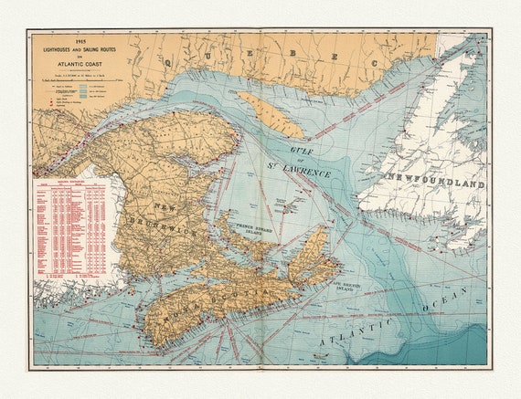 Canada Department of the Interior: Lighthouses and sailing routes on Atlantic coast, 1915 , map on heavy cotton canvas, 20 x 25" approx.
$41.36
Canada Department of the Interior: Lighthouses and sailing routes on Atlantic coast, 1915 , map on heavy cotton canvas, 20 x 25" approx.
$41.36
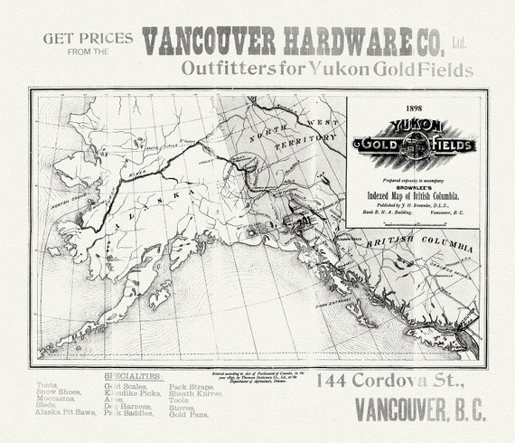 Yukon Gold Fields, 1898
$41.36
Yukon Gold Fields, 1898
$41.36
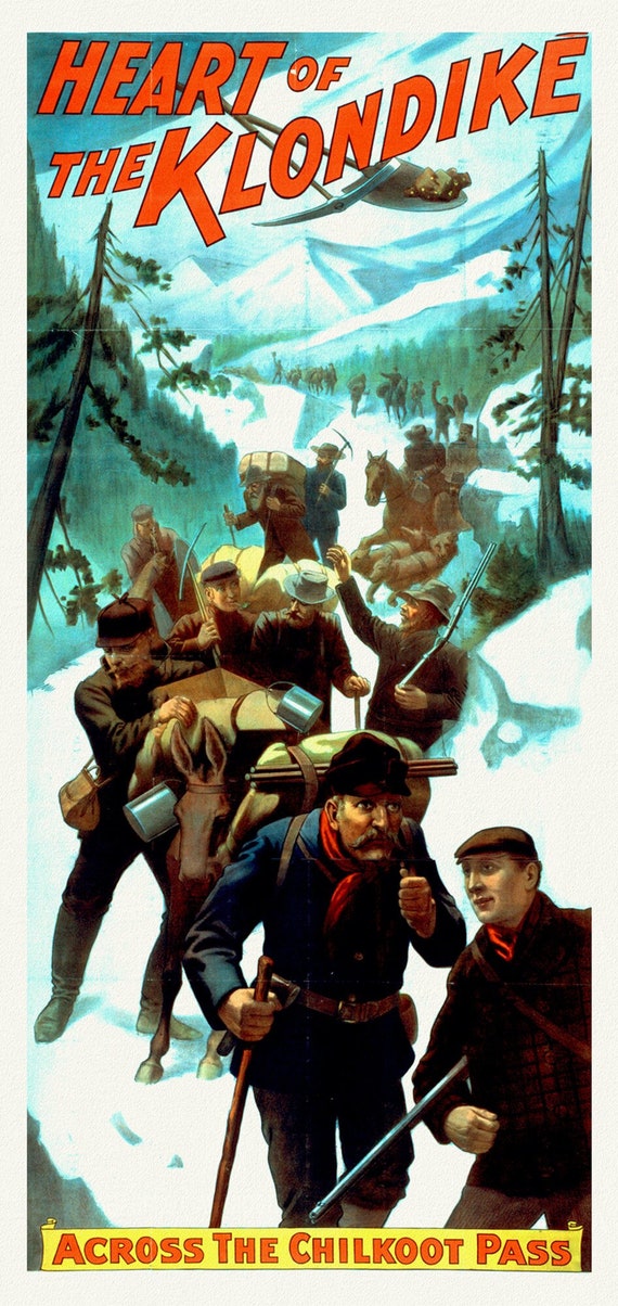
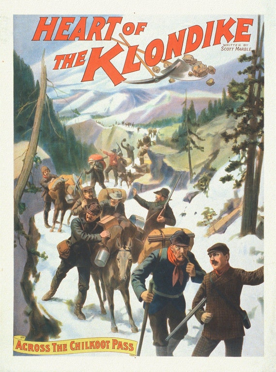 The Heart of the Klondike,Across the Chilkoot Pass, A Book, vintage print on canvas, 50 x 70 cm, 20 x 25" approx.
$41.36
The Heart of the Klondike,Across the Chilkoot Pass, A Book, vintage print on canvas, 50 x 70 cm, 20 x 25" approx.
$41.36
 The Heart of the Klondike, Across the Chilkoot Pass, A Book Ver. II, vintage print on canvas, 50 x 70 cm, 20 x 25" approx.
$41.36
The Heart of the Klondike, Across the Chilkoot Pass, A Book Ver. II, vintage print on canvas, 50 x 70 cm, 20 x 25" approx.
$41.36
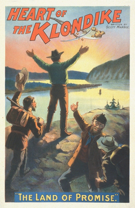 The Heart of the Klondike, The Land of Promise, A Book, vintage print on canvas, 50 x 70 cm, 20 x 25" approx.
$41.36
The Heart of the Klondike, The Land of Promise, A Book, vintage print on canvas, 50 x 70 cm, 20 x 25" approx.
$41.36
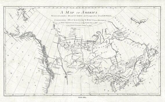 Map of America showing MacKenzie's Route from Montreal to Ft. Chepewyan in 1793, map on durable cotton canvas, 50 x 70 cm, 20 x 25" approx.
$41.36
Map of America showing MacKenzie's Route from Montreal to Ft. Chepewyan in 1793, map on durable cotton canvas, 50 x 70 cm, 20 x 25" approx.
$41.36
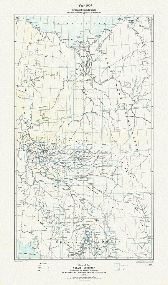 Map of the Yukon Territory to illustrate the summary reports of R.G. McConnell, Keele and Camsell, 1907, map on canvas, 20 x 25" approx.
$41.36
Map of the Yukon Territory to illustrate the summary reports of R.G. McConnell, Keele and Camsell, 1907, map on canvas, 20 x 25" approx.
$41.36
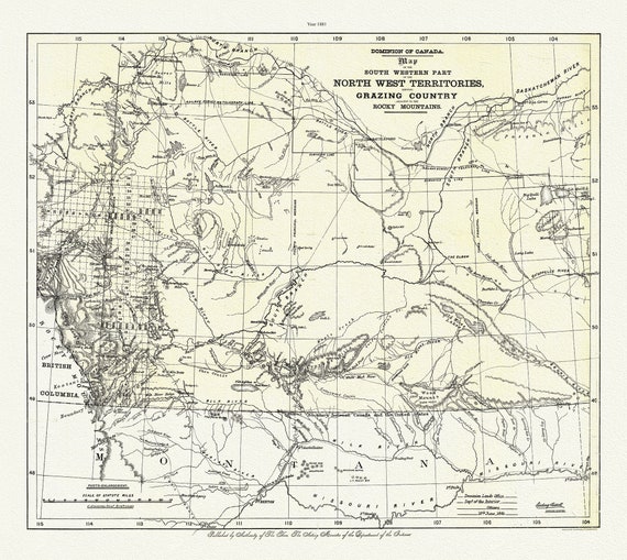 Map of South Western Part of the North West Territories shewing grazing country adjacent to the Rocky Mountains,1881, canvas, 20 x 25"
$41.36
Map of South Western Part of the North West Territories shewing grazing country adjacent to the Rocky Mountains,1881, canvas, 20 x 25"
$41.36
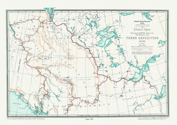 Index Map Shewing the Routes Followed by the Members of the Yukon Expedition, 1887-1888,(1891), map on canvas, 50 x 70 cm, 20 x 25" approx.
$41.36
Index Map Shewing the Routes Followed by the Members of the Yukon Expedition, 1887-1888,(1891), map on canvas, 50 x 70 cm, 20 x 25" approx.
$41.36
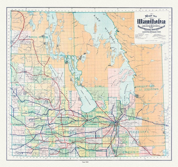 Manitoba, 1903, map on durable cotton canvas, 50 x 70 cm, 20 x 25" approx.
$41.36
Manitoba, 1903, map on durable cotton canvas, 50 x 70 cm, 20 x 25" approx.
$41.36
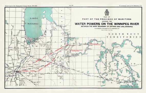 Plan of part of the province of Manitoba showing the water powers on the Winnipeg River, 1908 , map on canvas, 50 x 70 cm, 20 x 25" approx.
$41.36
Plan of part of the province of Manitoba showing the water powers on the Winnipeg River, 1908 , map on canvas, 50 x 70 cm, 20 x 25" approx.
$41.36