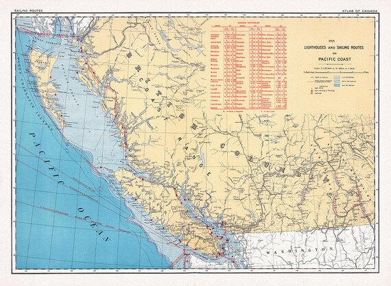
 Canada Department of the Interior, Lighthouses and sailing routes on Pacific Coast, 1915, map on heavy cotton canvas, 22x27" approx.
$34.32
Canada Department of the Interior, Lighthouses and sailing routes on Pacific Coast, 1915, map on heavy cotton canvas, 22x27" approx.
$34.32
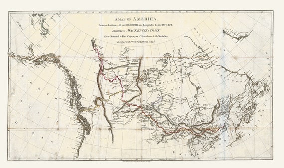 Mackenzie's Track from Montreal to Fort Chipewyan, 1793, map on heavy cotton canvas, 22x27" approx.
$34.32
Mackenzie's Track from Montreal to Fort Chipewyan, 1793, map on heavy cotton canvas, 22x27" approx.
$34.32
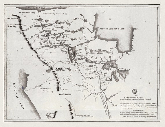 A map shewing the communication of the lakes and the rivers between Lake Superior and Slave Lake in North America, 1785 on canvas, 22x27"
$34.32
A map shewing the communication of the lakes and the rivers between Lake Superior and Slave Lake in North America, 1785 on canvas, 22x27"
$34.32
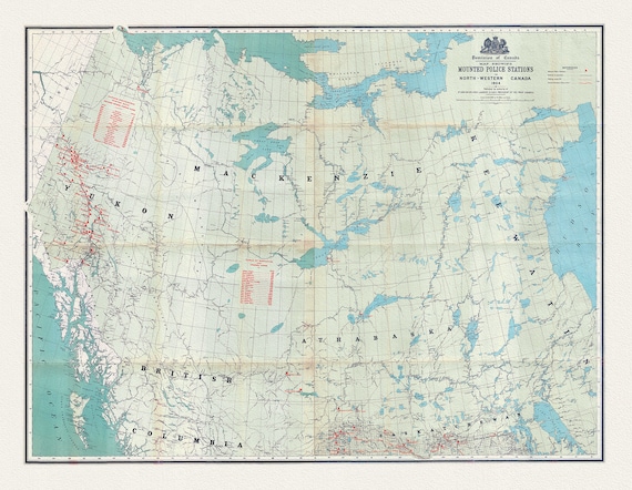 Map showing Mounted Police stations in North-Western Canada, 1904 , map on heavy cotton canvas, 22x27" approx.
$34.32
Map showing Mounted Police stations in North-Western Canada, 1904 , map on heavy cotton canvas, 22x27" approx.
$34.32
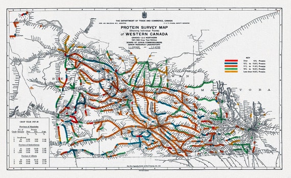 Map of Western Canada showing the protein content of red spring wheat, 1928, map on heavy cotton canvas, 22x27" approx.
$34.32
Map of Western Canada showing the protein content of red spring wheat, 1928, map on heavy cotton canvas, 22x27" approx.
$34.32
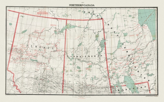 Northern Canada, 1907, map on heavy cotton canvas, 22x27" approx.
$34.32
Northern Canada, 1907, map on heavy cotton canvas, 22x27" approx.
$34.32
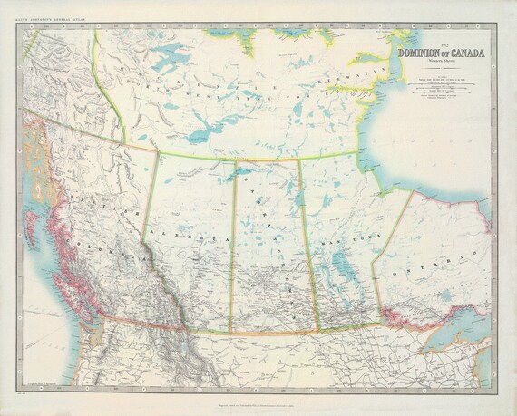
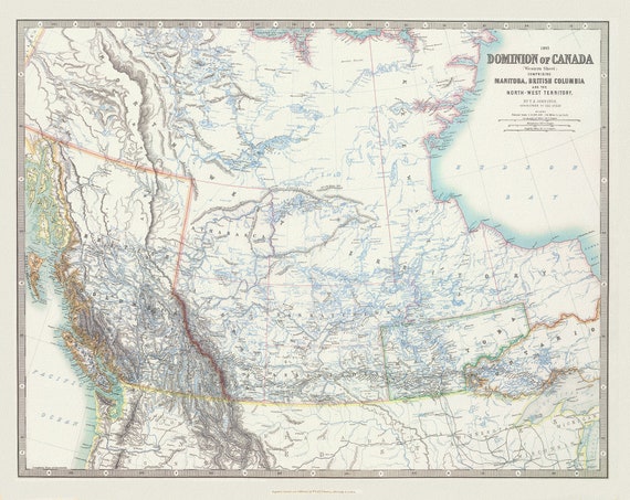 Johnston, Western Canada, 1893, map on heavy cotton canvas, 22x27" approx.
$34.32
Johnston, Western Canada, 1893, map on heavy cotton canvas, 22x27" approx.
$34.32
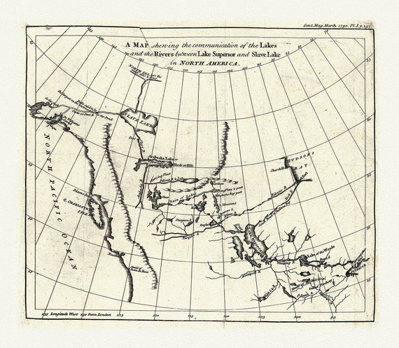 A map shewing the communication of the lakes and rivers between Lake Superior and Slave Lake in N. America, 1790, on canvas, 22x27" approx.
$34.32
A map shewing the communication of the lakes and rivers between Lake Superior and Slave Lake in N. America, 1790, on canvas, 22x27" approx.
$34.32
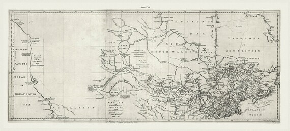 Jefferys, A map of Canada and the north part of Louisiana with the adjacent countrys, 1768 Ver. 2, on heavy cotton canvas, 22x27" approx.
$34.32
Jefferys, A map of Canada and the north part of Louisiana with the adjacent countrys, 1768 Ver. 2, on heavy cotton canvas, 22x27" approx.
$34.32
 Johnson, Western Canada, 1912 , map on heavy cotton canvas, 22x27" approx.
$34.32
Johnson, Western Canada, 1912 , map on heavy cotton canvas, 22x27" approx.
$34.32
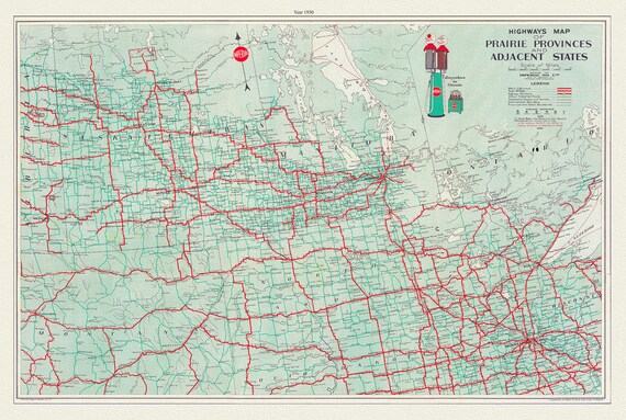 Highways Map of Prairie Provinces and Adjacent States, 1930, map on heavy cotton canvas, 22x27" approx.
$34.32
Highways Map of Prairie Provinces and Adjacent States, 1930, map on heavy cotton canvas, 22x27" approx.
$34.32
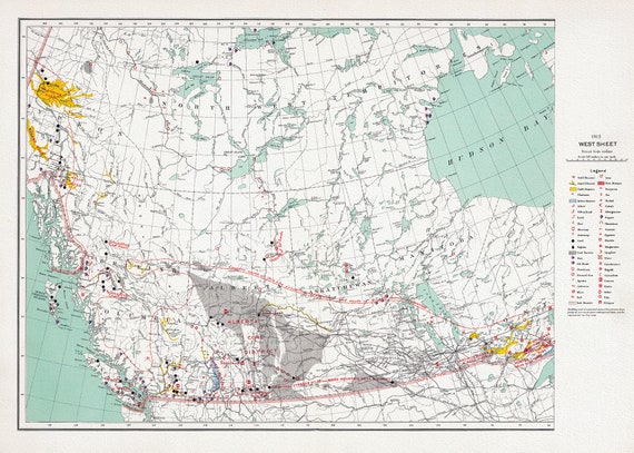
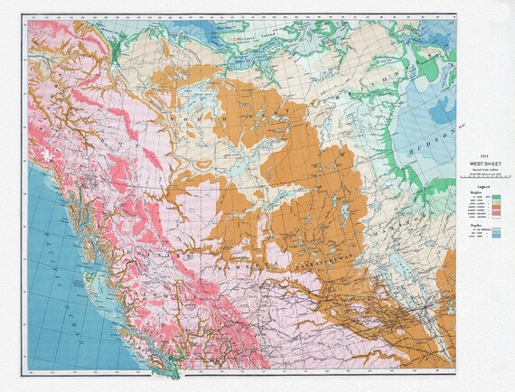 Canada Department of the Interior, West sheet, Physical map of the Dominion of Canada, 1915 , map on heavy cotton canvas, 22x27" approx.
$34.32
Canada Department of the Interior, West sheet, Physical map of the Dominion of Canada, 1915 , map on heavy cotton canvas, 22x27" approx.
$34.32
 Canada Department of the Interior, West sheet. Mineral map of the Dominion of Canada, 1915, map on heavy cotton canvas, 22x27" approx.
$34.32
Canada Department of the Interior, West sheet. Mineral map of the Dominion of Canada, 1915, map on heavy cotton canvas, 22x27" approx.
$34.32
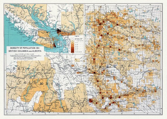 Canada Department of the Interior, Density of population 1911, British Columbia and Alberta, 1915, on heavy cotton canvas, 22x27" approx.
$34.32
Canada Department of the Interior, Density of population 1911, British Columbia and Alberta, 1915, on heavy cotton canvas, 22x27" approx.
$34.32
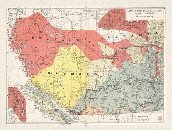 Canada Department of the Interior, Alberta, British Columbia and Yukon Railway Territories, 1915, on heavy cotton canvas, 22x27" approx.
$34.32
Canada Department of the Interior, Alberta, British Columbia and Yukon Railway Territories, 1915, on heavy cotton canvas, 22x27" approx.
$34.32
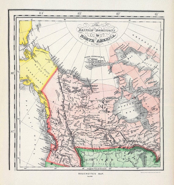 Bouchette's British Dominions in North America (portion), 1831
$34.32
Bouchette's British Dominions in North America (portion), 1831
$34.32
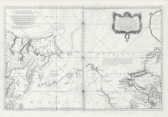 Bellin, L'hydrographie françoise, Pacific NorthWest, 1766, map on heavy cotton canvas, 22x27" approx.
$34.32
Bellin, L'hydrographie françoise, Pacific NorthWest, 1766, map on heavy cotton canvas, 22x27" approx.
$34.32
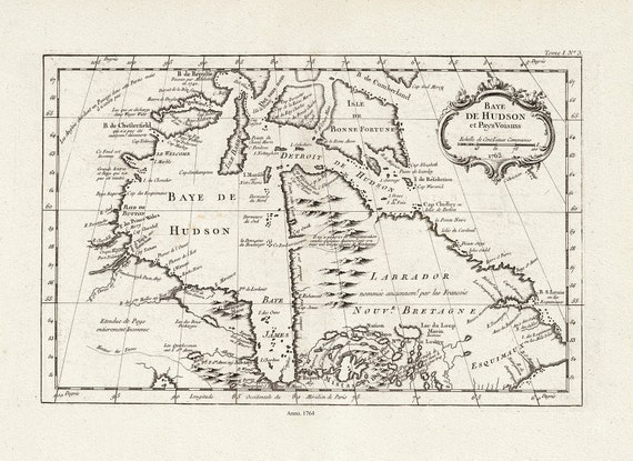 Bellin, Baye De Hudson et Pays Voisins, 1764 , map on heavy cotton canvas, 22x27" approx.
$34.32
Bellin, Baye De Hudson et Pays Voisins, 1764 , map on heavy cotton canvas, 22x27" approx.
$34.32
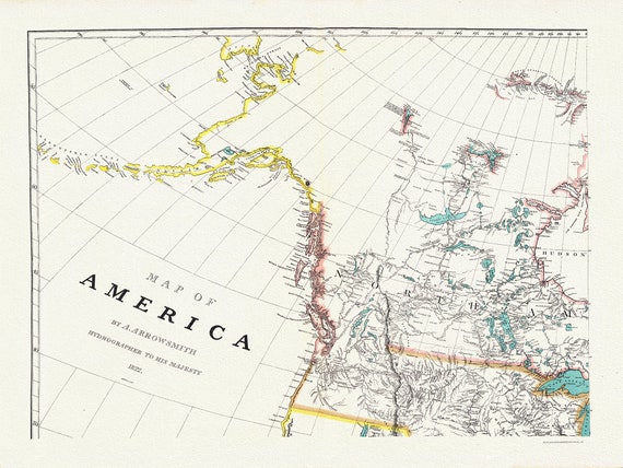 Arrowsmith's America (North West portion), 1824 , map on heavy cotton canvas, 22x27" approx.
$34.32
Arrowsmith's America (North West portion), 1824 , map on heavy cotton canvas, 22x27" approx.
$34.32
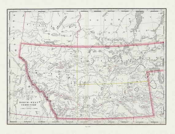 Cram, George Franklin, The North-West Territory, 1889, map on heavy cotton canvas, 22x27" approx.
$34.32
Cram, George Franklin, The North-West Territory, 1889, map on heavy cotton canvas, 22x27" approx.
$34.32